
Berlin Wall less than 18 months after it was built.

Berlin.
sold
This is a 1962 JRO-Sonderkarte pictorial city map of Berlin, Germany, boldly illustrating the 18-month-old Berlin Wall and the strangling confinement of West Berlin. (more details)
Architectural wonder of a generation.

Bird's-Eye View of the Great Suspension Bridge, connecting the cities of New York and Brooklyn - From New York looking South-East.
sold
- Digital Map Information
- Suitable for large format printing
- File Size: 59.2 MB
- File Type: ZIP / TIFF
- ICC color profile embedded
- Delivered instantly via download link
A dramatic 1883 chromolithograph bird's-eye view capturing the opening day festivities on the Brooklyn Bridge, New York City, issued by Franklin Square Lithographic. (more details)
Upending the Sino-Centric Order.

中外方輿全圖 / [Complete Map of China and Neighboring Countries].
sold
- Digital Map Information
- Suitable for large format printing
- File Size: 248.43 MB
- File Type: ZIP / TIFF
- ICC color profile embedded
- Delivered instantly via download link
A remarkable find, this scarce, huge map of China and East Asia was prepared in 1894 by Kishida Ginkō at the start of the First Sino-Japanese War (1894 - 1895). This was the largest and most detailed map of China, and East Asia in general, available during the war - a transformative moment in East Asian history that upended the traditional Sino-centric order and established Japan as a world power. Its influence on both the First Sino-Japanese War and its aftermath cannot be understated. (more details)
Blaeu's Europe in Original Color.
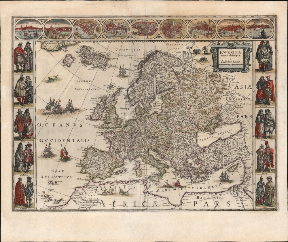
Europa recens descripta à Guilielmo Blaeuw.
sold
- Digital Map Information
- Suitable for large format printing
- Full resolution TIFF file
- ICC color profile embedded
- Delivered instantly via download link
This is a beautiful example of Willem Blaeu's 1617 map of Europe, in its 1634 atlas issue, produced at the height of the Golden Age of Dutch Mapmaking. This beautifully engraved work was one of Blaeu's four continental cartes à figures and is a classic of the form. The map displays a selection of Europe's most famous cities in the top border and noble denizens of various countries in their characteristic styles in the left and right borders. The map is embellished with sailing ships, sea battles, and sea monsters. (more details)
Contrasting the paradise of Florida with the horrors of WWI trench warfare.

Florida Must Give $1,00,000 to help keep the Y.M.C.A. with the Boys Over There - United War Work Campaign November 11th to 18th.
sold
- Digital Map Information
- Suitable for large format printing
- File Size: 74.91 MB
- File Type: ZIP / TIFF
- ICC color profile embedded
- Delivered instantly via download link
A rare 1918 World War I poster features a pictorial bird's-eye view map of Florida, printed in St. Augustine. The poster was issued as part of a national collaborative fundraising effort to provide social welfare and recreational services to American soldiers and navy men on the European front. This poster embodies earnest initiative, indicative of the era's approach to social responsibility and support for the military. (more details)
Highlighting Brazilian Transgressions in the Banda Oriental.

Carta Geografica que Comprehende los Rios de la Plata, Paranà, Uruguay, y Grande y los Terrenos adyacentes conforme a' los Comisionados de la Linea de limites 1820.
sold
- Digital Map Information
- Suitable for large format printing
- File Size: 15.73 MB
- File Type: ZIP / TIFF
- ICC color profile embedded
- Delivered instantly via download link
This is an 1825 map of the lands comprising present-day Uruguay, produced anonymously by Argentinian diplomat Ignacio Núñez to garner European support for the United Provinces of the Río de la Plata in the Cisplatine war against the Empire of Brazil. While the mapmakers are unnamed, the map draws on the work of Spanish border commissioners and engineers Félix de Azara, Jose Maria Cabrer, and others. It presented to a European audience the frontier agreed upon in the 1777 Treaty of Ildefonso between the Spanish and Portuguese Empires in South America - thus emphasizing that Brazil's invasion occupation of Montevideo was a breach of treaty. (more details)
The First Earth Day.

Environmental Action April 22.
sold
This is a 1970 poster by Bill Garner promoting the first Earth Day, April 22, 1970. (more details)
Tokyo transforming into a modern metropolis.

市郡變稱東亰全圖 / [Complete Map of Tokyo with Municipal Name Changes].
sold
- Digital Map Information
- Suitable for large format printing
- Full resolution TIFF file
- ICC color profile embedded
- Delivered instantly via download link
This is a rare 1895 Sagano Hikotarō map of Tokyo at the height of the Meiji Era. It was produced soon after a bewildering series of administrative reforms and was designed as a guide for the perplexed, showing Tokyo neighborhoods under the new system. The map and the changes it represents are a snapshot of Tokyo in a period of dramatic transformation. (more details)
Published shortly after the Adirondack Park was created.

Map of the Adirondack Wilderness.
sold
- Digital Map Information
- Suitable for large format printing
- File Size: 45.34 MB
- File Type: ZIP / TIFF
- ICC color profile embedded
- Delivered instantly via download link
This is an 1903 Seneca Ray Stoddard map of the Adirondacks, New York, highlighting the Adirondack State Park. This one of the earliest obtainable commercial maps of the Adirondack Wilderness, published not long after the park's founding, at the height of the Naturalist Movement and the Adirondack Gilded Age. (more details)
Race to the South Pole.

Antartide continente del giorno.
sold
This is a strikingly colorful 1956 Editrice La Scuola celebration of Antarctic Exploration. With compelling imagery, the map honors the achievements of Roald Amundsen and Robert Falcon Scott, the first expeditions to reach the South Pole. Herein, are illustrated by the happy achievement of Amundsen and the harrowing defeat of Scott. (more details)
'Oh, Brighton! Brighton! What a place thou art for love, liberty, and salt water.' - Jane Austen

Bacon's New Ordnance Plan of Brighton.
sold
- Digital Map Information
- Suitable for large format printing
- Full resolution TIFF file
- ICC color profile embedded
- Delivered instantly via download link
This is George Bacon's c. 1890 city plan or map of Brighton, England, at the height of its 19th-century tourism boom. (more details)
The North Pole in Texas?

Official Texas Brags Map of North America.
sold
- Digital Map Information
- Suitable for large format printing
- Full resolution TIFF file
- ICC color profile embedded
- Delivered instantly via download link
This is a 1948 John Randolph and Mark Storm pictorial map of Texas as a Texan sees it - including its original shipping envelope. An outsized Texas engulfs from the Pacific Ocean north of the Baja Peninsula to most of the Gulf Coast and from almost the Yucatan Peninsula to north of the actual U.S.-Canada border. (more details)
Deterring 'secession fever'.

Camp Washburn, 10th Maine Regiment, Col. George L. Beal. Patterson Park, Baltimore, MD.
sold
- Digital Map Information
- Suitable for large format printing
- File Size: 12.18 MB
- File Type: ZIP / TIFF
- ICC color profile embedded
- Delivered instantly via download link
This is an 1861 Edward Sachse view of Camp Washburn, Baltimore, Maryland, and the 10th Maine Infantry Regiment. This view captures the arrival of the 10th Maine in Maryland, where they established themselves at Camp Washburn as a deterrent to 'secession fever.' This view was issued shortly after the regiment's arrival, making it as close to real-time reporting as possible during the Civil War. (more details)
Israel's Ellis Island.

חיפה / [Haifa].
sold
An impressive, large-format Hebrew-language survey map of Haifa, produced in 1957 by the Survey of Israel. (more details)
Infographically dense map combing Japanese aesthetics with technical printing mastery.

最新實測 大阪市街地圖 : 近畿名勝遊覽 / [Latest Survey Osaka Street Map : Tour of Famous Sites in the Kinki Region].
sold
- Digital Map Information
- Suitable for large format printing
- Full resolution TIFF file
- ICC color profile embedded
- Delivered instantly via download link
This is a densely graphic city map or plan of Osaka was prepared by Hayashi Keizo in 1919. It is notable above all for its colorful design and many illustrated vignettes. This map is emblematic of the cartographic style of the Taisho period, where color lithography was leveraged to create infographically dense maps that combined traditonal Japanese cartographic elements, western mapping models, and technical printing mastery. (more details)
Portland and Casco Bay.
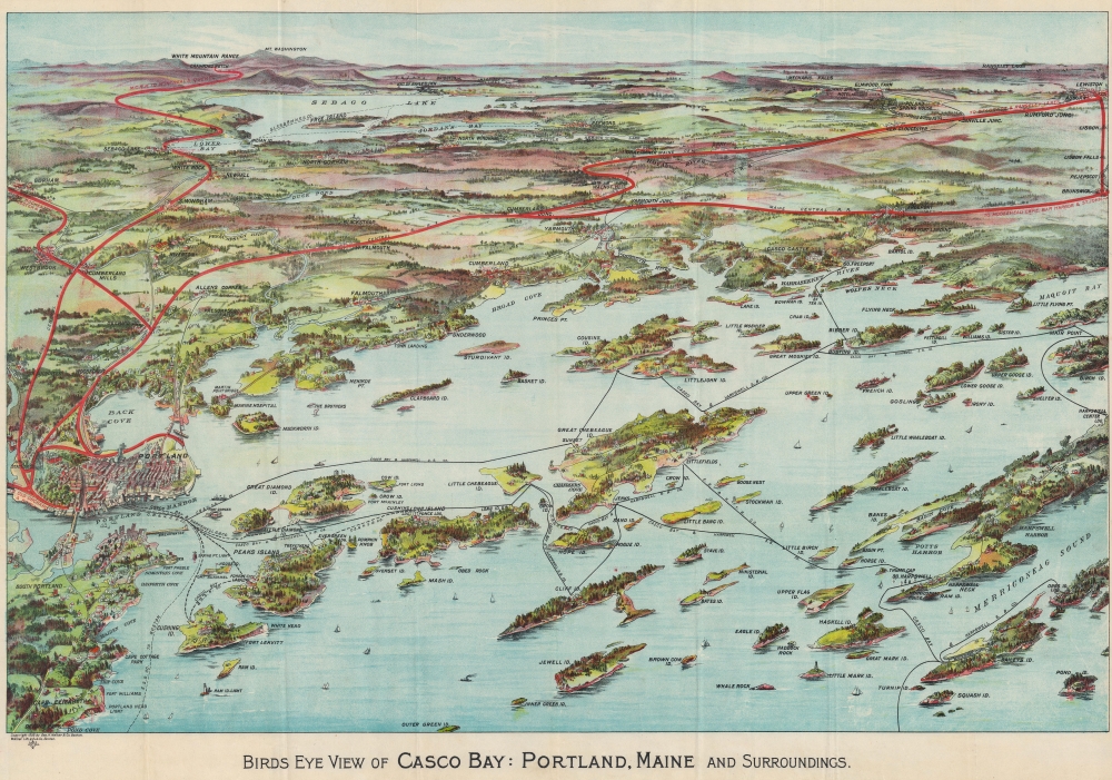
Birds Eye View of Casco Bay: Portland, Maine and Surroundings.
sold
- Digital Map Information
- Suitable for large format printing
- Full resolution TIFF file
- ICC color profile embedded
- Delivered instantly via download link
This is a beautiful 1906 George Walker chromolithograph bird's-eye view map of Casco Bay, Portland, Maine. Such views were made for sale at newsstands in stations and onboard ferry lines. (more details)
Flood Relief and Levee Breaches.

Relief of Flood Sufferers Ohio and Mississippi Valleys April - June 1912 Map Showing Relief Districts.
sold
- Digital Map Information
- Suitable for large format printing
- File Size: 22.73 MB
- File Type: ZIP / TIFF
- ICC color profile embedded
- Delivered instantly via download link
This is a 1913 Norris Peters map of relief zones created to help rebuild after the 1912 Mississippi River Flood. One of the worst Mississippi River floods in recorded history, the flood caused nearly $100 million in damage and lasted 83 days. The 1912 flood was also the first Mississippi River flood to be photographed. (more details)
Discovery Era World Map.
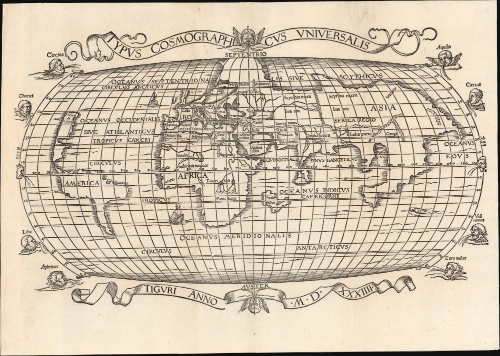
Typus Cosmographicus Universalis.
sold
- Digital Map Information
- Suitable for large format printing
- Full resolution TIFF file
- ICC color profile embedded
- Delivered instantly via download link
This is Joachim Vadian's rare 1534 woodcut map of the world, combining a largely Ptolemaic formulation of Europe and Asia with what was a modern depiction of Africa and the New World. It is one of the earliest maps to name America. While largely derived from the map Sebastian Münster prepared for Simon Grynaeus in 1532, it is in many ways a better representation of Münster's source, the 1507 map of Martin Waldseemüller. (more details)
One of the most desirable printed maps of any part of the world.

Islandia.
sold
- Digital Map Information
- Suitable for large format printing
- Full resolution TIFF file
- ICC color profile embedded
- Delivered instantly via download link
This is an attractive example of Abraham Ortelius' 1587 map of Iceland. Ortelius' Islandia is arguably the most famous decorative map, being the 'monster map' par excellence, presenting a menagerie of the sea monsters typically found on early maps. The map is geographically important as well. Beyond strongly evoking Iceland's astonishing terrain with its vigorously engraved mountains, it is remarkably accurate since it is the first map of Iceland derived from the contemporaneous work of an Icelander, Gudbrandur Thorlaksson (Guðbrandur Þorláksson; c. 1542 - 1627). (more details)
Piedmontese Easter - a Massacre of Waldensians in the Europe Wars of Religion.

Topografica descrittione d'Alcune singolari Città in pian, e Valliprincipali nelle Alpi, per le quali come Porte del Italia dal Piemonte sipassa in Provenza, Delinato, Savioa, e Vallei, nelle quali resiedono la Missioni de PP. Capuccini.
sold
- Digital Map Information
- Suitable for large format printing
- File Size: 28.98 MB
- File Type: ZIP / TIFF
- ICC color profile embedded
- Delivered instantly via download link
This exceptional piece is the 1659 Paulus a Lotharinga map of the Italian Alps issued to illustrate ongoing efforts to suppress the Waldensians (Valdesi) sect in the wake of the 1655 'Piedmontese Easter' or the 'Massacre of the Waldensians' - one of the darkest episodes in the European Wars of Religion. It is known in academic circles as the Carta dei Cappuccini or 'Capuchin Map'. (more details)