
One of the first tourst maps of Lake Champlain.
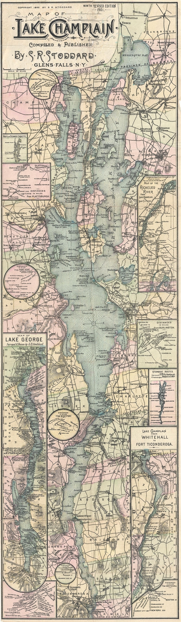
Map of Lake Champlain. Compiled & Published by S. R. Stoddard. Glens Falss, NY.
sold
- Digital Map Information
- Suitable for large format printing
- File Size: 11.61 MB
- File Type: ZIP / TIFF
- ICC color profile embedded
- Delivered instantly via download link
A rare map of Lake Champlain issued by Seneca Ray Stoddard of Glens Falls, New York, in 1901. Issued in an unusual elongated format, this map covers the entirety of Lake Champlain, and the adjacent parts of Vermont and New York, from Missisquoi Bay and Rouse's ... (more details)
Uncommon map illustrating all of Manhattan in 1866.
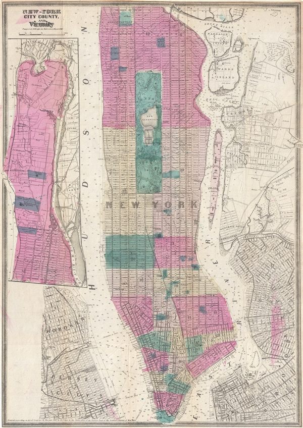
New-York City County, and Vicinity.
sold
- Digital Map Information
- Suitable for large format printing
- File Size: 10.87 MB
- File Type: ZIP / TIFF
- ICC color profile embedded
- Delivered instantly via download link
This is an uncommon large format 1866 map of New York City by Matthew Dripps. The map covers the entire island of Manhattan as well as parts of Brooklyn, Queens, Hoboken and Jersey City. The whole is rendered in considerable detail with all streets and even some ... (more details)
Plan of Paris illustrating the early development of the Paris Metro.

Plan de Paris.
sold
- Digital Map Information
- Suitable for large format printing
- File Size: 35.03 MB
- File Type: ZIP / TIFF
- ICC color profile embedded
- Delivered instantly via download link
An attractive map of Paris, France issued around 1910 by Hachette and Company. The map covers the old walled city of Paris from the Bois de Boulogne in the west to the Bois de Vincennes in the east. All streets are labeled as are various gardens, rail lines, ... (more details)
Plan of Pallavaram, suburb of the city of Chennai, India.
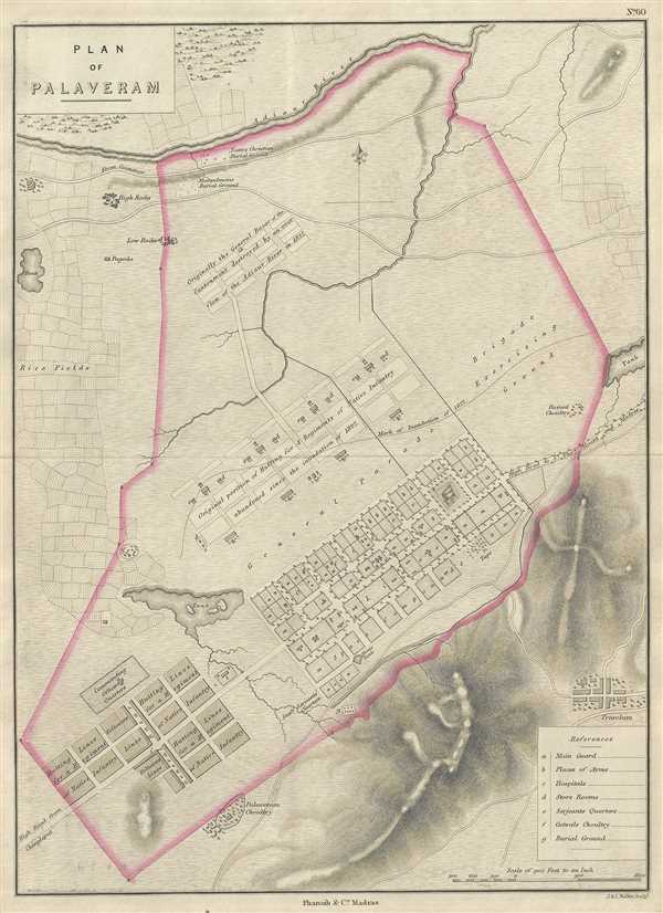
Plan of Palaveram.
sold
- Digital Map Information
- Suitable for large format printing
- DPI: 300
- File Size: 6.22 MB
- File Type: ZIP / TIFF
- ICC color profile embedded
- Delivered instantly via download link
This is an uncommon 1854 Pharoah and Company map of the town of Pallavaram in the Indian state of Tamil Nadu. Today a suburb of the city of Chennai (Madras), the town was a military station during British Rule. The map covers the cantonment and hills and ... (more details)
Plan of the town of Ramnad a town near the important Hindu and Muslim pilgrimage centers in southern India.
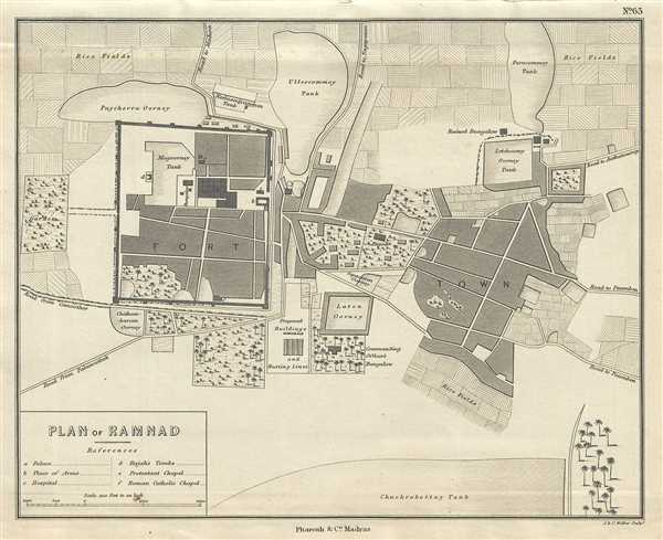
Plan of Ramnad.
sold
- Digital Map Information
- Suitable for large format printing
- DPI: 300
- File Size: 2.84 MB
- File Type: ZIP / TIFF
- ICC color profile embedded
- Delivered instantly via download link
This is a lovely 1854 Pharoah and Company map of the town of Ramnad or Ramanathapuram in the Indian state of Tamil Nadu. Beautifully rendered, the map notes the fort, tanks, rice fields, official buildings, ruins, and other important landmarks from the ... (more details)
Early map of Sitabuldi in Nagpur, India - site of the 1817 battle of Sitabuldi.
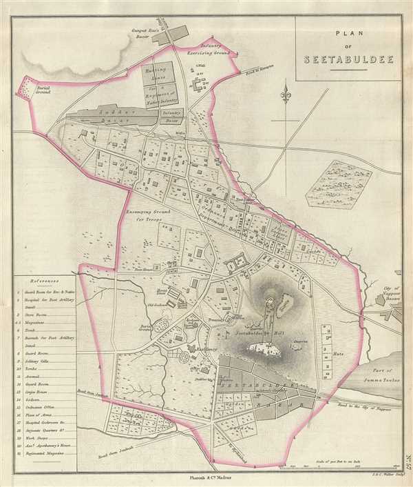
Plan of Seetabuldee.
sold
- Digital Map Information
- Suitable for large format printing
- DPI: 300
- File Size: 4.05 MB
- File Type: ZIP / TIFF
- ICC color profile embedded
- Delivered instantly via download link
This is a good example of the 1854 Pharoah and Company map of Sitabuldi in the city of Nagpur, India. The map covers the Sitabuldi hill and fort along with its surrounding areas in beautiful detail. Important roads, fields, tombs, gardens, bazaars, ... (more details)
Early map of the geographical center of India.
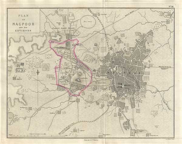
Plan of Nagpoor and its Environs.
sold
- Digital Map Information
- Suitable for large format printing
- DPI: 300
- File Size: 5.16 MB
- File Type: ZIP / TIFF
- ICC color profile embedded
- Delivered instantly via download link
This is a lovely 1854 example of the Pharoah and Company map of the city of Nagpur located in the Indian state of Maharashtra. The map covers the city and its environs and extends from the Ambazari Lake to Vanjari and notes lakes, streets, ... (more details)
19th century map of Madikery in Coorg, India.

Plan of Merkara.
sold
- Digital Map Information
- Suitable for large format printing
- DPI: 300
- File Size: 6.09 MB
- File Type: ZIP / TIFF
- ICC color profile embedded
- Delivered instantly via download link
This is a nice example of the 1854 Pharoah and Company map of Madikeri or Mercara in Coorg, located in the Indian state of Karnataka. The map is beautifully rendered showing detail to the level of street and individual buildings. ... (more details)
Pharoah map of Secunderabad, the twin city of Hyderabad.
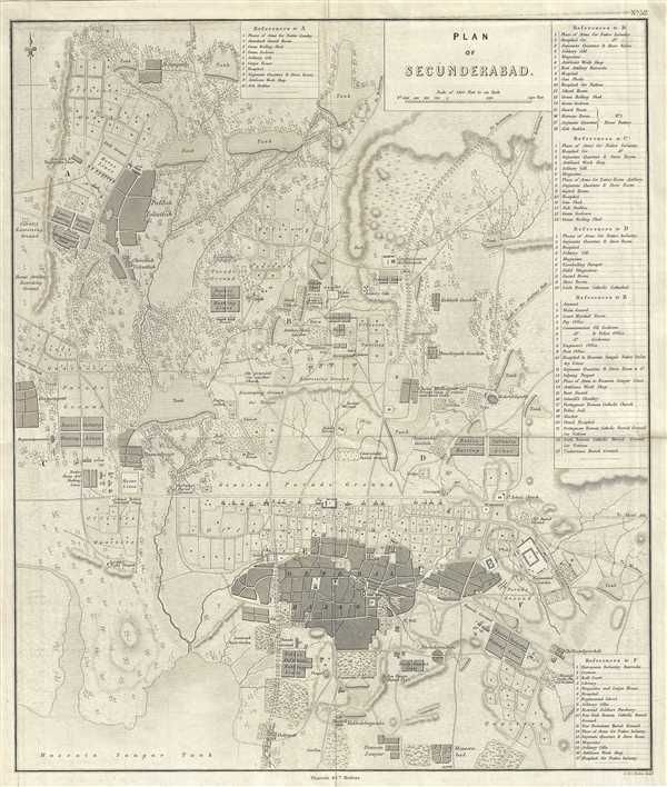
Plan of Secunderabad.
sold
- Digital Map Information
- Suitable for large format printing
- DPI: 300
- File Size: 11.19 MB
- File Type: ZIP / TIFF
- ICC color profile embedded
- Delivered instantly via download link
This is a beautiful 1854 map or plan of Secunderabad located in the Indian state of Telangana. It covers the British cantonment in beautiful detail, noting streets, bazaar, military grounds, tanks, fields, streams, and ... (more details)
Johnson's map of the world in hemispheres.

Johnson's Western Hemisphere. / Johnson's Eastern Hemisphere.
sold
- Digital Map Information
- Suitable for large format printing
- File Size: 17.94 MB
- File Type: ZIP / TIFF
- ICC color profile embedded
- Delivered instantly via download link
This is A. J. Johnson's fine 1866 map of the world on a hemispherical projection. Offers a fascinating snapshot of the world during a period of rapid globalization and discovery. This is one of the first appearances of ... (more details)
Pharoah and company map of Hyderabad, India's City of Pearls.
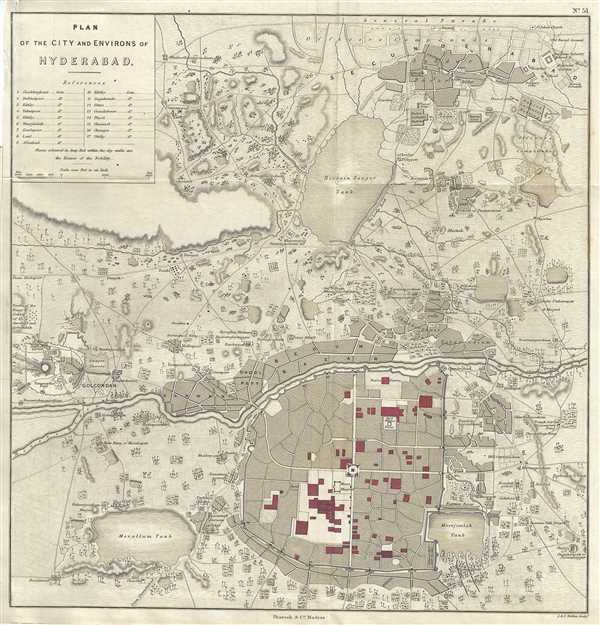
Plan of the City and Environs of Hyderabad.
sold
- Digital Map Information
- Suitable for large format printing
- DPI: 300
- File Size: 8.45 MB
- File Type: ZIP / TIFF
- ICC color profile embedded
- Delivered instantly via download link
This is a lovely 1854 Pharoah and Company map of the city of Hyderabad, in the Indian state of Telangana. It covers the old city of Hyderabad, built on the banks of the Musi River, and its vicinity in beautiful detail ... (more details)
Johnson's chart showing the flags of various countries.

Johnson's New Chart of National Emblems.
sold
- Digital Map Information
- Suitable for large format printing
- File Size: 15.85 MB
- File Type: ZIP / TIFF
- ICC color profile embedded
- Delivered instantly via download link
This is a beautiful example of Johnson and Ward's highly decorative 1864 chart of the world's flags and national emblems. Johnson first introduced this chart in 1863 edition of his atlas. Though common in European, ... (more details)
Johnson and Ward's beautiful map of Michigan and Wisconsin.

Johnson's Michigan and Wisconsin.
sold
- Digital Map Information
- Suitable for large format printing
- File Size: 20.63 MB
- File Type: ZIP / TIFF
- ICC color profile embedded
- Delivered instantly via download link
A beautiful example of Johnson's 1831 map of Michigan and Wisconsin. This rare map offers a fascinating snapshot of these two states shortly following the outbreak of the American Civil War. Map shows both states ... (more details)
Map of North Carolina and South Carolina with engraved views.

Johnson's North and South Carolina.
sold
- Digital Map Information
- Suitable for large format printing
- File Size: 4.14 MB
- File Type: ZIP / TIFF
- ICC color profile embedded
- Delivered instantly via download link
This is a beautiful example of A. J. Johnson and Ward's 1863 map of North Carolina and South Carolina. It offers a fascinating snapshot of these states during the American Civil War. Map shows both states in ... (more details)
Johnson's large folio map of New York State.

Johnson's New York.
sold
- Digital Map Information
- Suitable for large format printing
- File Size: 19.99 MB
- File Type: ZIP / TIFF
- ICC color profile embedded
- Delivered instantly via download link
This is Johnson and Ward's beautifully hand colored 1863 map of New York State. This rare map offers a fascinating snapshot of New York during the American Civil War. It covers New York in full with bold ... (more details)
Johnson's overview of North America after the outbreak of the American Civil War.

Johnson's North America.
sold
- Digital Map Information
- Suitable for large format printing
- File Size: 17.08 MB
- File Type: ZIP / TIFF
- ICC color profile embedded
- Delivered instantly via download link
A beautiful example of Johnson and Ward's 1863 map of North America. It offers a fascinating snapshot of North America, particularly the United States, Canada and Mexico, just after the outbreak of the ... (more details)
Johnson's early map of the World with exploration routes.

Johnson's Map of the World on Mercator's Projection.
sold
- Digital Map Information
- Suitable for large format printing
- File Size: 17.57 MB
- File Type: ZIP / TIFF
- ICC color profile embedded
- Delivered instantly via download link
This is A. J. Johnson's fine 1861 map of the world on Mercator's Projection. It depicts the entire world centered on the Americas. Offering a fascinating snapshot of the world during a period of rapid ... (more details)
Map detailing Galveston Bay in Texas.

(I No. 2) Preliminary Sketch of Galveston Bay.
sold
- Digital Map Information
- Suitable for large format printing
- Full resolution TIFF file
- ICC color profile embedded
- Delivered instantly via download link
An uncommon 1851 U.S. Coast Survey nautical chart or maritime map of Galveston Bay, Texas. The map covers from Turtle Bay to the entrance to Galveston Bay, including the City of Galveston, Galveston ... (more details)
Colton's representation of Palestine or Israel.

Palestine.
sold
- Digital Map Information
- Suitable for large format printing
- File Size: 8.26 MB
- File Type: ZIP / TIFF
- ICC color profile embedded
- Delivered instantly via download link
A beautiful 1856 example of Colton's map of Palestine, Israel or the Holy Land. Includes the modern day nations of Israel, Palestine and Lebanon with parts of adjacent Syria and Jordan. Notes both ... (more details)
Beautiful map of Cuba from the mid-19th century.
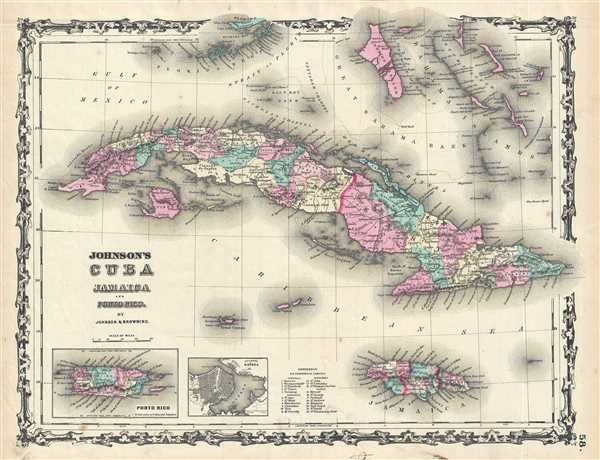
Johnson's Cuba Jamaica and Porto Rico.
sold
- Digital Map Information
- Suitable for large format printing
- File Size: 8.44 MB
- File Type: ZIP / TIFF
- ICC color profile embedded
- Delivered instantly via download link
This is a beautiful example of Johnson and Ward's 1863 map of Cuba, Jamaica, the Bahamas and Puerto Rico. Also shows part of the Florida Keys. The map offers superb detail of the entire region ... (more details)