

Part of South Australia.
sold
- Digital Map Information
- Suitable for large format printing
- Full resolution TIFF file
- ICC color profile embedded
- Delivered instantly via download link
This is a beautiful example of John Tallis and John Rapkin's 1851 map of South Australia, Australia. Centered on the Spencer Gulf, it covers the southeastern part of the state of South Australia from Lake Torrens to Kangaroo Island and Bonny Wells. This map ... (more details)
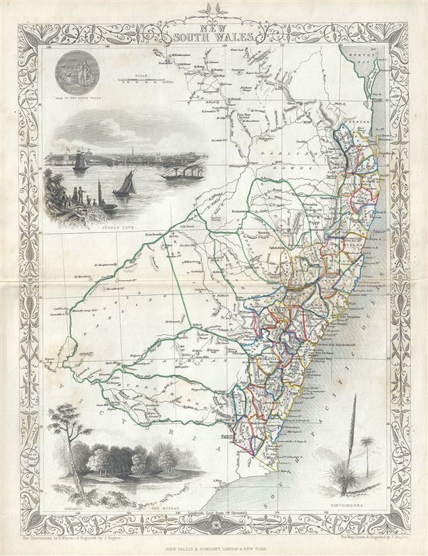
New South Wales.
sold
- Digital Map Information
- Suitable for large format printing
- Full resolution TIFF file
- ICC color profile embedded
- Delivered instantly via download link
This is a fine 1851 John Tallis map of New South Wales, Australia. The map covers eastern Australia from the Great Sandy Island south past Sydney to Cape Howe. It also extends a considerable distance inland despite the region being only tenuously mapped. ... (more details)
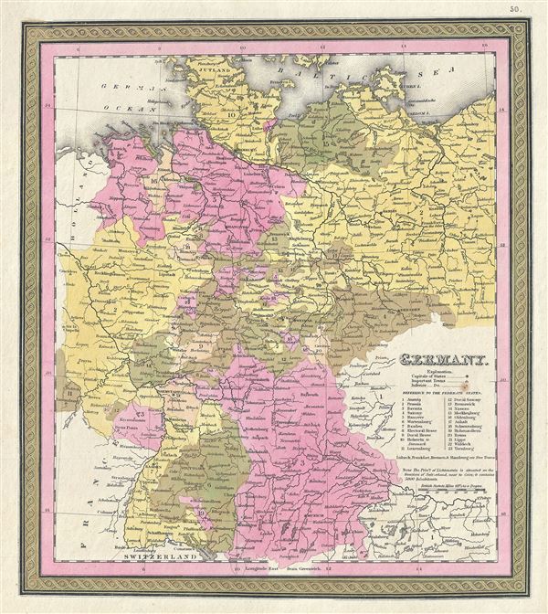
Germany.
sold
- Digital Map Information
- Suitable for large format printing
- DPI: 300
- File Size: 4.55 MB
- File Type: ZIP / TIFF
- ICC color profile embedded
- Delivered instantly via download link
This is a fine example of S. A. Mitchell's 1846 map of Germany. The whole is engraved in Mitchell's distinctive style with green border work and vivid pastels. Political and topographical features are noted and color coded with elevation rendered by ... (more details)
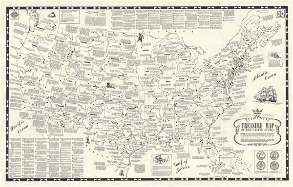
Treasure Map of the United States.
sold
- Digital Map Information
- Suitable for large format printing
- Full resolution TIFF file
- ICC color profile embedded
- Delivered instantly via download link
This is a fascinating 1957 treasure map of the United States published by Walker Drake and Sons. Covering the entire country, this map notes numerous sites of buried and hidden treasure from the Rio Grande River to Puget Sound in Washington and from ... (more details)
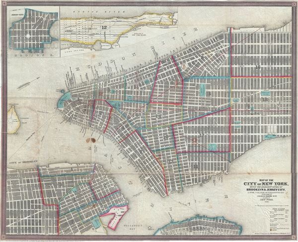
Map of the City of New York, with the Adjacent Cities of Brooklyn and Jersey City, and the Village of Williamsburg.
sold
- Digital Map Information
- Suitable for large format printing
- Full resolution TIFF file
- ICC color profile embedded
- Delivered instantly via download link
This is a scarce and beautiful 1850 pocket map of New York City published by Ensign, Thayer and Co. It covers Manhattan from 32nd Street south to the Battery and Brooklyn from Navy Yard to Sackett Street as well as part of Williamsburg. A large ... (more details)
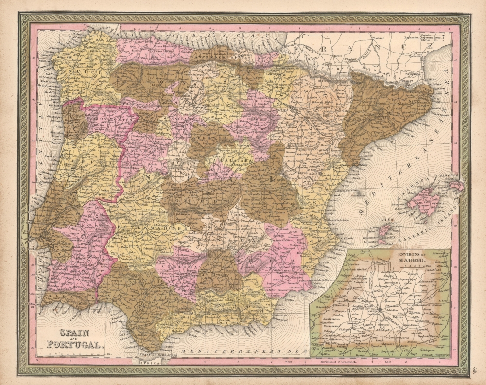
Spain and Portugal.
sold
- Digital Map Information
- Suitable for large format printing
- File Size: 15.4 MB
- File Type: ZIP / TIFF
- ICC color profile embedded
- Delivered instantly via download link
This is a fine example of Thomas Cowperthwait and S. A. Mitchell's 1849 map of Spain and Portugal. The whole is engraved and colored in Mitchell's distinctive style with green border work and vivid pastels. Political and topographical features ... (more details)
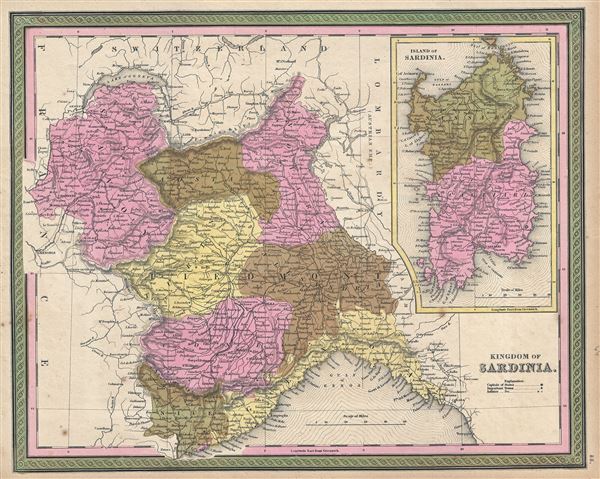
Kingdom of Sardinia.
sold
- Digital Map Information
- Suitable for large format printing
- Full resolution TIFF file
- ICC color profile embedded
- Delivered instantly via download link
This is a fine example of Thomas Cowperthwait and S. A. Mitchell's 1849 map of Kingdom of Sardinia. Centered in Piedmont, this map covers the Kingdom of Sardinia's claims both on the Island of Sardinia and the mainland provinces of Piedmont, ... (more details)

Italy, North Part.
sold
- Digital Map Information
- Suitable for large format printing
- Full resolution TIFF file
- ICC color profile embedded
- Delivered instantly via download link
This is a fine example of Thomas Cowperthwait and S. A. Mitchell's 1849 map of the north part of Italy. Centered on Tuscany, this map covers from Lombardy to the Papal States (Including Rome), and the Venetian Republic. The whole is ... (more details)
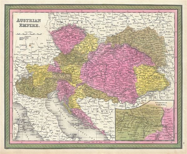
Austrian Empire.
sold
- Digital Map Information
- Suitable for large format printing
- DPI: 300
- File Size: 7.54 MB
- File Type: ZIP / TIFF
- ICC color profile embedded
- Delivered instantly via download link
This is a fine example of Thomas Cowperthwait and S. A. Mitchell's 1846 map of the Austrian Empire. Covers the territories claimed by the once vast Austro-Hungarian Empire, including in whole or part the modern day nations of ... (more details)
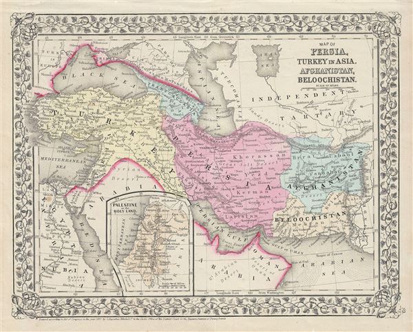
Map of Persia, Turkey in Asia, Afghanistan, Beloochistan.
sold
- Digital Map Information
- Suitable for large format printing
- Full resolution TIFF file
- ICC color profile embedded
- Delivered instantly via download link
This is a beautiful example of the American map publisher Samuel Augustus Mitchell Jr.'s 1867 map of Turkey, Persia, Beloochistan and Afghanistan. It covers the modern day nations of Turkey, Iran, Iraq, Syria, Jordan and ... (more details)

Map of Canada East in Counties.
sold
- Digital Map Information
- Suitable for large format printing
- Full resolution TIFF file
- ICC color profile embedded
- Delivered instantly via download link
This is a beautiful example of the legendary American map publisher Samuel Augustus Mitchell Jr.'s 1868 map of the Canadian province of Quebec, or Canada East. Centered on the St. Lawrence River Valley, this map covers ... (more details)
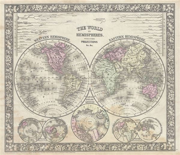
The World in Hemispheres. With Other Projections etc. etc.
sold
- Digital Map Information
- Suitable for large format printing
- Full resolution TIFF file
- ICC color profile embedded
- Delivered instantly via download link
This is a beautiful example of S. A. Mitchell Jr.'s 1866 decorative double hemisphere map of the world. Depicts the world on a hemisphere projection. The upper part of the map shows the rivers in relative proximity ... (more details)
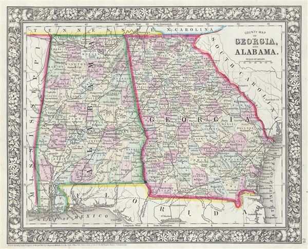
County Map of Georgia and Alabama.
sold
- Digital Map Information
- Suitable for large format printing
- Full resolution TIFF file
- ICC color profile embedded
- Delivered instantly via download link
This is a beautiful example of S. A. Mitchell Jr.'s 1866 map of Georgia and Alabama. Detailed to the county level with special attention both political and geographic elements, the map notes important river systems, ... (more details)

County Map of Florida. County Map of North Carolina. Map of South Carolina.
sold
- Digital Map Information
- Suitable for large format printing
- Full resolution TIFF file
- ICC color profile embedded
- Delivered instantly via download link
This is a beautiful example of S. A. Mitchell Jr.'s 1866 map of North Carolina, South Carolina and Florida. Detailed to the county level with special attention both political and geographic elements, the map notes ... (more details)
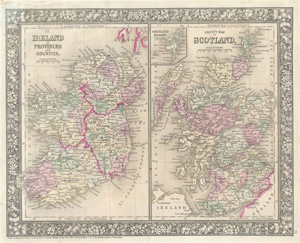
Ireland in Provinces and Counties. County Map of Scotland.
sold
- Digital Map Information
- Suitable for large format printing
- Full resolution TIFF file
- ICC color profile embedded
- Delivered instantly via download link
This is a beautiful example of the American map publisher Samuel Augustus Mitchell Jr.'s 1866 map of Scotland and Ireland. Essentially two maps on a single sheet, this map details all of Ireland and Scotland with ... (more details)
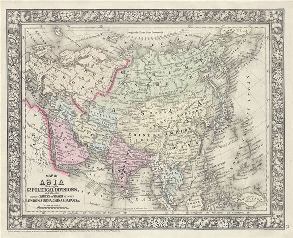
Map of Asia Showing its Gt. Political Divisions, and, also, the various Routes of Travel, between London and India, China and Japan etc.
sold
- Digital Map Information
- Suitable for large format printing
- Full resolution TIFF file
- ICC color profile embedded
- Delivered instantly via download link
This is a beautiful example of the legendary American map publisher Samuel Augustus Mitchell Jr.'s 1866 map of Asia. This map covers from the Arabian Peninsula and Turkey eastward as far as Kamchatka, Japan, the ... (more details)

Map of Africa, Showing its most Recent Discoveries.
sold
- Digital Map Information
- Suitable for large format printing
- Full resolution TIFF file
- ICC color profile embedded
- Delivered instantly via download link
This is a beautiful example of S. A. Mitchell Jr.'s 1866 map of Africa and St. Helena. It covers the continent in considerable detail considering the level to which it was explored at the time. One of the early ... (more details)
Highly decorative pictorial map of the United States.
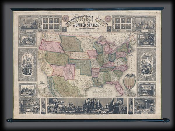
Pictorial Map of the United States.
sold
- Digital Map Information
- Suitable for large format printing
- DPI: 300
- File Size: 12.11 MB
- File Type: ZIP / TIFF
- ICC color profile embedded
- Delivered instantly via download link
An appealing and highly decorative 1854 wall map of the United States. Issued by Ensign, Bridgman and Fanning, this map was drawn and engraved by J.M. Atwood and covers the entire United States from Atlantic to ... (more details)
An highly influential and often underappreciated map. First American commercial map published as a foreign National Map. Map that led to the bankruptcy of the Colton firm and contributed to the rise of the Johnson firm.
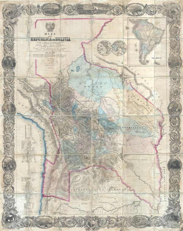
Mapa de la Republica de Bolivia mandado publicar pr el Gobierno de la Nacion en la Administracion del Presidente Doctor José Maria Linares... Levantado y organindo en los años de 1842 à 1859 Por el Teniente Coronel Juan Ondarza, Commandante Juan Mariano Mujia y Mayor Lucio Camacho.
sold
- Digital Map Information
- Suitable for large format printing
- File Size: 24.31 MB
- File Type: ZIP / TIFF
- ICC color profile embedded
- Delivered instantly via download link
A magnificent and important map of extreme and often underappreciated multilevel significance; this is J. H. Colton and Juan Ondarza's great map of Bolivia. This map is highly significant and influential on a ... (more details)
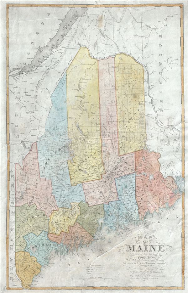
Map of Maine Constructed from the most Correct Surveys With Sectional Distances and Elevations or Level, of the St. Croix River from Calais Bridge.
sold
- Digital Map Information
- Suitable for large format printing
- Full resolution TIFF file
- ICC color profile embedded
- Delivered instantly via download link
This is a rare and beautiful 1843 first edition map of Maine by W. Anson. The northern boundary of Maine is depicted according to the Treaty of 1842, making it one of the first maps published following the ... (more details)