
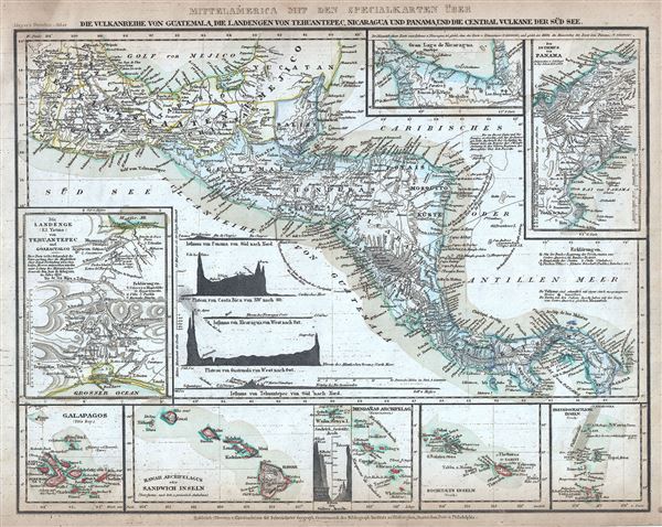
Mittelamerica Mit Den Specialkarten Uber Die Vulkanreihe Von Guatemala, Die Landengen Von Tehuantepec, Nicaragua Und Panama, Und Die Central-Vulkane Der Sud-See.
sold
- Digital Map Information
- Suitable for large format printing
- Full resolution TIFF file
- ICC color profile embedded
- Delivered instantly via download link
This is an attractive 1852 map of Central America by Joseph Meyer. It covers from the Yucatan and the Gulf of Mexico south as far as Panama. It includes nine insets maps. In a clockwise fashion from the top center, these detail the Great Lake of Nicaragua, The ... (more details)
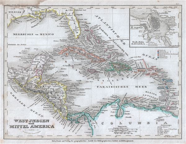
West Jndien und Mittel America
sold
- Digital Map Information
- Suitable for large format printing
- Full resolution TIFF file
- ICC color profile embedded
- Delivered instantly via download link
This is a beautiful 1852 map of the West Indies and Central America by Joseph Meyer. Centered on Haiti or San Domingo (Hispaniola), the map covers the Caribbean from Florida to Venezuela and from Yucatan to the Lesser Antilles. It includes the Bahamas, Cuba, ... (more details)

(Columbia) Neu Granada, Ecuador und Venezuela.
sold
- Digital Map Information
- Suitable for large format printing
- Full resolution TIFF file
- ICC color profile embedded
- Delivered instantly via download link
This is an appealing 1849 map of Venezuela, New Granada (Colombia) and Ecuador. It covers from the Pacific to Guyana and from Peru to the Caribbean, including Panama. The lower right quadrant of the map features an elevation profile of the Andes. Simon ... (more details)
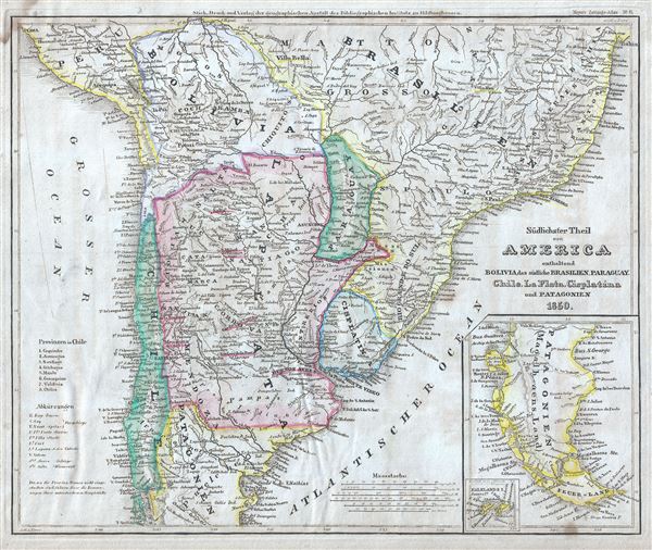
Sudlichster Theil von America enthaltend Bolivia, das sudliche Brasilien, Paraguay, Chile, La Plata, Cisplatina und Patagonien.
sold
- Digital Map Information
- Suitable for large format printing
- Full resolution TIFF file
- ICC color profile embedded
- Delivered instantly via download link
This is a fine 1850 map by Joseph Meyer depicting Chile, Argentina (La Plata, including parts of Patagonia), Paraguay, Uruguay (Cisplatin), Bolivia and parts of Peru, and Brazil. Bolivia's claims to the Atacama Desert and Peru's claims to Moquegua - ... (more details)
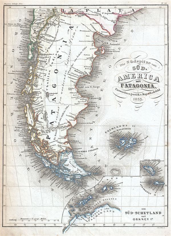
Die Sudspitze von Sud America mit Patagonia.
sold
- Digital Map Information
- Suitable for large format printing
- Full resolution TIFF file
- ICC color profile embedded
- Delivered instantly via download link
This is a fine 1853 map of Patagonia by Joseph Meyer. It includes Patagonia (part of modern day Argentina and Chile) as well as the Falkland Islands. An inset in the lower right quadrant features the South Orkney Island, the South Shetland Islands ... (more details)

Brasilien.
sold
- Digital Map Information
- Suitable for large format printing
- Full resolution TIFF file
- ICC color profile embedded
- Delivered instantly via download link
This is a fine 1852 map of Brazil by Joseph Meyer. It covers from Venezuela to Uruguay and from the Amazon basin to the Atlantic. Includes Brazil, Uruguay, Paraguay, Bolivia and parts of Argentina, Chile, and Peru. Bolivia's claims to the Atacama ... (more details)

Asiatische Archipel und Neu Holland.
sold
- Digital Map Information
- Suitable for large format printing
- Full resolution TIFF file
- ICC color profile embedded
- Delivered instantly via download link
This is a fine example of Joseph Meyer's 1849 map of Australia and the East India Islands. It covers from the Malay Peninsula to New Caledonia, including Australia, Malaysia, Indonesia, Philippines, Papua New Guinea and Melanesia. An interesting ... (more details)
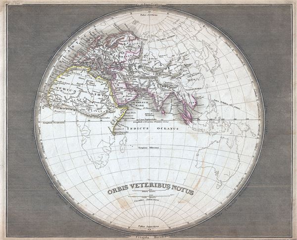
Orbis Veteribus Notus.
sold
- Digital Map Information
- Suitable for large format printing
- Full resolution TIFF file
- ICC color profile embedded
- Delivered instantly via download link
This is an uncommon and attractive 1852 map of the Ancient World, including Asia, Europe and Africa. By Joseph Meyer. The map shows the Ancient World during the time of the Ancient Roman Empire from the Atlantic Ocean to Siam in Asia and from the ... (more details)

Welt-Charte in Mercators Projection.
sold
- Digital Map Information
- Suitable for large format printing
- Full resolution TIFF file
- ICC color profile embedded
- Delivered instantly via download link
This is an excellent example of the 1849 map of the world on Mercator's projection by Joseph Meyer. Meyer offers a fascinating snapshot of the world during a period of rapid globalization and discovery. This map depicts the entire world centered ... (more details)

Verbreitung Bezirke der wichtigsten Kulturgewachse Nebst Andeutungen uber den lauf der Isotheren und Isochimenen.
sold
- Digital Map Information
- Suitable for large format printing
- Full resolution TIFF file
- ICC color profile embedded
- Delivered instantly via download link
This is a fine example of the 1852 map or chart showing the distribution of the most important cultivated plants around the world by Joseph Meyer. It depicts the distribution and limits of cultivation of the principal plants useful to mankind. ... (more details)
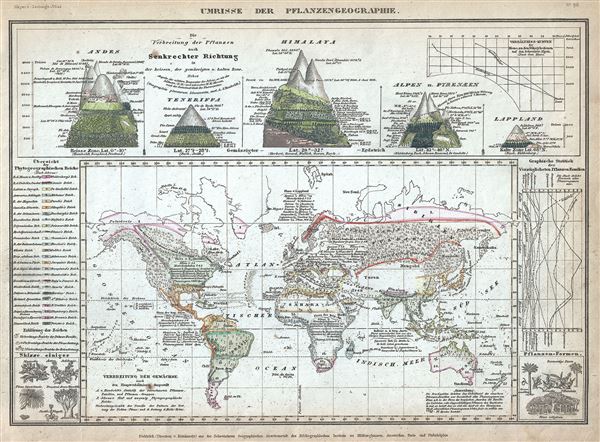
Umrisse der Pflanzengeographie.
sold
- Digital Map Information
- Suitable for large format printing
- Full resolution TIFF file
- ICC color profile embedded
- Delivered instantly via download link
This is a scarce 1852 map or chart by Joseph Meyer depicting plant geography. It shows the distribution of vegetation throughout the world. Above the map proper, Meyer includes five illustrations showing the vegetation in various regions, ... (more details)

Hyetographische Karte der Erde.
sold
- Digital Map Information
- Suitable for large format printing
- Full resolution TIFF file
- ICC color profile embedded
- Delivered instantly via download link
This is a scarce 1852 hydrology map or chart of the world by Joseph Meyer. It depicts the precipitation throughout the world with darker areas are regions that receive more rainfall while lighter areas are deserts. Additional data ... (more details)

Europa.
sold
- Digital Map Information
- Suitable for large format printing
- Full resolution TIFF file
- ICC color profile embedded
- Delivered instantly via download link
This is a fine example of the 1852 map of Europe by Joseph Meyer. It covers the continent in its entirety from the Atlantic to the Caspian Sea and from the Arctic Ocean to the Mediterranean Sea. It also details Iceland (Island) ... (more details)
Fine pre-Revolution map of Paris.

Nouveau Plan Routier de la Ville et Faubourg de Paris.
sold
- Digital Map Information
- Suitable for large format printing
- DPI: 300
- File Size: 31.11 MB
- File Type: ZIP / TIFF
- ICC color profile embedded
- Delivered instantly via download link
A fine 1782 dissected pocket map of Paris issued by Esnauts and Rapilly. Centered on the Seine, this map depicts Pre-Revolutionary Paris. As this map was being drawn Benjamin Franklin was the toast of the town, visiting to ... (more details)
Republic of Texas represented at its fullest extant.
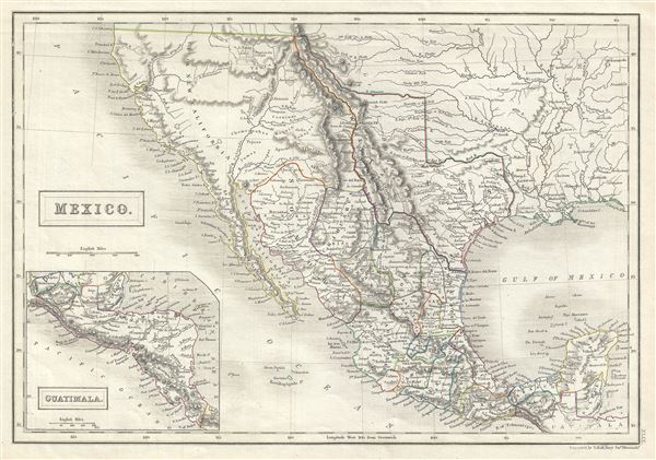
Mexico.
sold
- Digital Map Information
- Suitable for large format printing
- DPI: 300
- File Size: 5.14 MB
- File Type: ZIP / TIFF
- ICC color profile embedded
- Delivered instantly via download link
This is a fine example of the 1844 Black Map of Mexico, California and the Republic of Texas (fullest extent). The map covers from the southern border of Oregon as far south as Guatemala including New Mexico (with modern ... (more details)
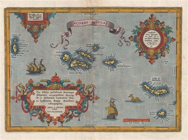
Acores Insulae.
sold
- Digital Map Information
- Suitable for large format printing
- DPI: 300
- File Size: 11.89 MB
- File Type: ZIP / TIFF
- ICC color profile embedded
- Delivered instantly via download link
A highly decorative 1603 map of the Azores by Abraham Ortelius. The map covers the Azores in considerable detail with numerous ships decorating the seas and a large sea serpent just west of St. Michael. The detail and ... (more details)

G. Woolworth Colton's New Map of New York City, Brooklyn, Jersey City, Hoboken, Etc.
sold
- Digital Map Information
- Suitable for large format printing
- File Size: 17.98 MB
- File Type: ZIP / TIFF
- ICC color profile embedded
- Delivered instantly via download link
An extremely rare example of G. Woolworth Colton's 1867 vertical pocket map of New York. This important map, first issued in 1865, marks a significant rethinking of the standard Manhattan map. Previous maps of New York ... (more details)
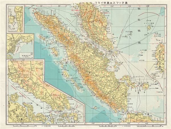
Malay and Sumatra.
sold
- Digital Map Information
- Suitable for large format printing
- Full resolution TIFF file
- ICC color profile embedded
- Delivered instantly via download link
This is a scarce 1943 Japanese map of the Malay Peninsula (Malaysia) including Singapore and Sumatra, Indonesia, from the Great East Asia Atlas issued during World War II. The map covers the Malay Peninsula including ... (more details)
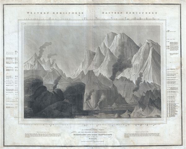
A Comparative View of the Heights of the Principal Mountains and other Elevations in the World.
sold
- Digital Map Information
- Suitable for large format printing
- DPI: 300
- File Size: 19.86 MB
- File Type: ZIP / TIFF
- ICC color profile embedded
- Delivered instantly via download link
This is one of the earliest and most interesting takes on the comparative heights of principal mountains theme by John Thomson. Comparative mountains charts first appeared in the late 18th and early 19th century. ... (more details)

Boston and Surroundings.
sold
- Digital Map Information
- Suitable for large format printing
- Full resolution TIFF file
- ICC color profile embedded
- Delivered instantly via download link
This is a beautiful c.1910 map or plan of the city of Boston, Massachusetts and its surroundings by the Walker Lith. and Publishing Company. It covers the city and suburbs from Blue Hills Reservations and Milton ... (more details)