
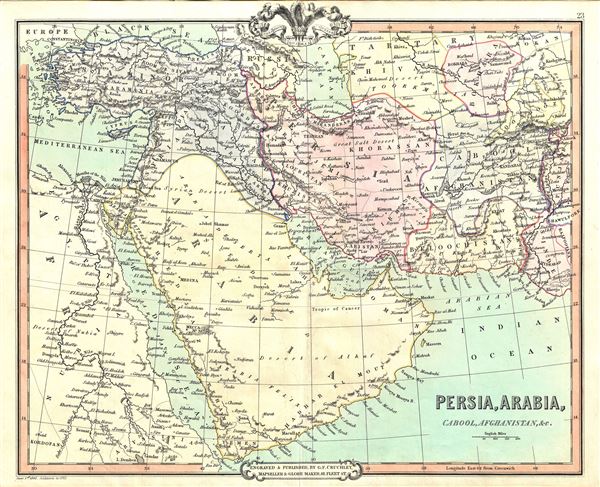
Persia, Arabia, Cabool, Afghanistan, etc.
sold
- Digital Map Information
- Suitable for large format printing
- DPI: 300
- File Size: 8.73 MB
- File Type: ZIP / TIFF
- ICC color profile embedded
- Delivered instantly via download link
A fine example of the 1853 map of Persia, Arabia and Afghanistan by G. F. Cruchley. Centered on the Persian Gulf, this map covers from the Mediterranean and Red Sea eastward as far as India, including all of modern day Turkey, Saudi Arabia, Israel, Jordan, Syria, ... (more details)

The World.
sold
- Digital Map Information
- Suitable for large format printing
- DPI: 300
- File Size: 9.03 MB
- File Type: ZIP / TIFF
- ICC color profile embedded
- Delivered instantly via download link
This is a fine example of G.F. Cruchley's 1852 map of the World. An interesting map issued just as most of the Earth's non-polar shores had been explored. Cruchley depicts the world showing the six known continents as well as traces of Antarctica. Vast ... (more details)

America.
sold
- Digital Map Information
- Suitable for large format printing
- DPI: 300
- File Size: 8.93 MB
- File Type: ZIP / TIFF
- ICC color profile embedded
- Delivered instantly via download link
This is an attractive 1852 map of North and South America by George Frederick Cruchley. The map covers all of North America as well as South America from the Arctic to Cape Horn. In North America, Russian and British territories in Alaska and Canada are ... (more details)
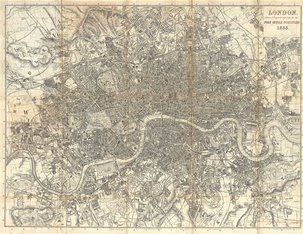
London. Drawn and Engraved expressly for the Post Office Directory 1885.
sold
- Digital Map Information
- Suitable for large format printing
- File Size: 51.2 MB
- File Type: ZIP / TIFF
- ICC color profile embedded
- Delivered instantly via download link
A large 1885 dissected folding map of London by Kelly and Company. Issued for the Kelly and Co. Post Office Directory , this large map covers from Highgate to Plaistow and from Dulwich to Chiswick. The map offers stupendous detail throughout identifying ... (more details)
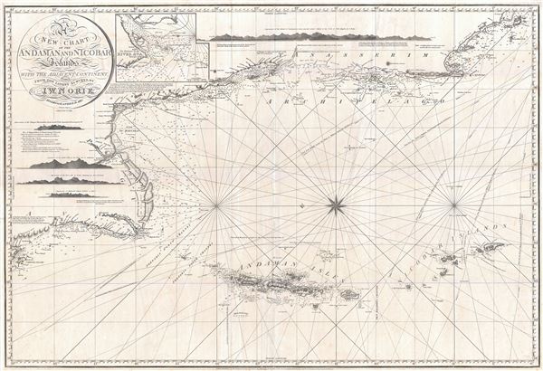
A New Chart of the Andaman and Nicobar Islands with the Adjacent Continent, Drawn from the latest Surveys, by J. W. Norie, Hydrographer.
sold
- Digital Map Information
- Suitable for large format printing
- DPI: 300
- File Size: 26.48 MB
- File Type: ZIP / TIFF
- ICC color profile embedded
- Delivered instantly via download link
An extremely scarce 1831 nautical chart or maritime map by J. W. Noire depicting the Andaman Islands and Nicobar Islands as well as parts of modern-day Burma (Pegu) and Thailand (Tanasserim). Oriented to the East, Norie's map covers from Ramree Island and Sandoway (today a popular resort known as Nagapali Beach, Myanmar), then south east around Pegu and past Rangoon (Yangon), then along the Myanmar and Thai coastline as far south as Ko Tarutao (Trotto), in modern day south Thailand. The map includes the large Thai coastal city of and island of Phuket, then known as Junkseylon Island. (more details)

A New Chart of the Straits of Malacca and Sincapore Drawn from the Latest Surveys, with Additions and Improvemetns, by J. W. Norie.
sold
- Digital Map Information
- Suitable for large format printing
- DPI: 300
- File Size: 37.68 MB
- File Type: ZIP / TIFF
- ICC color profile embedded
- Delivered instantly via download link
An extremely scarce 1815 map of the Strait of Malacca and Singapore (Sincapore) by John William Norie. This map covers from Aceh in northwestern Sumatra (Acheen) to Singapore Island and Pulu Bintang. This map first appeared in 1803 when it was issued by ... (more details)

East India Archipelago (Western Route to China Chart no. 2)
sold
- Digital Map Information
- Suitable for large format printing
- File Size: 52.8 MB
- File Type: ZIP / TIFF
- ICC color profile embedded
- Delivered instantly via download link
A large and impressive 1872 nautical chart by James Imray covering eastern Malaya (Malaysia), Singapore, and parts of Borneo and Sumatra. (more details)
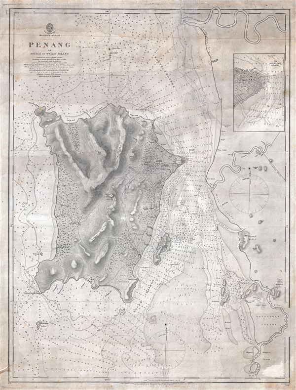
Malacca Strait Penang or Prince of Wales Island.
sold
- Digital Map Information
- Suitable for large format printing
- File Size: 21.44 MB
- File Type: ZIP / TIFF
- ICC color profile embedded
- Delivered instantly via download link
A scarce 1874 British Admiralty Hydrographic Office map of the island of Penang. Located in the Straits of Malacca just off the coast of Malaysia, this island became a British East India Company trading center when it was occupied by Captain Francis ... (more details)
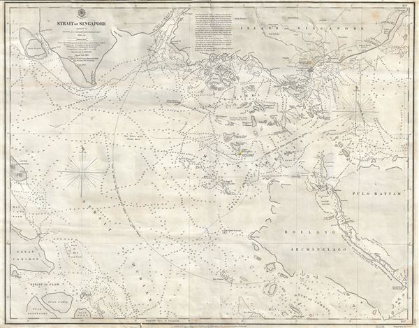
Strait of Singapore Sheet 2.
sold
- Digital Map Information
- Suitable for large format printing
- File Size: 16.62 MB
- File Type: ZIP / TIFF
- ICC color profile embedded
- Delivered instantly via download link
A scarce 1861 British Admiralty nautical chart or maritime map of the Strait of Singapore. The map covers from Singapore Island to Pulu Paril and from Great Carimon to Pulo Battam, focusing thus specifically on the waters just south of Singapore. ... (more details)
Scarce Klondike Gold Rush and Alaska Gold Rush Map.

The White Pass and Yukon Route Scenic Railway of the World.
sold
- Digital Map Information
- Suitable for large format printing
- File Size: 18.33 MB
- File Type: ZIP / TIFF
- ICC color profile embedded
- Delivered instantly via download link
A scarce 1919 Klondike Gold Rush map illustrating the just completed White Pass and Yukon Railway. Covering portions of Alaska, British Columbia, and Yukon Territories, this is essentially three maps on a single sheet. The leftmost map focuses ... (more details)

Clason's Map of California.
sold
- Digital Map Information
- Suitable for large format printing
- File Size: 36.31 MB
- File Type: ZIP / TIFF
- ICC color profile embedded
- Delivered instantly via download link
A large and highly detailed c. 1920 pocket format map of California by the Clason Map Company. This map covers the entire stain of California with green highlighting to distinguish county borders and national forest lands. Inset submaps in the upper right and lower left quadrants focus on the San Francisco Bay area and the vicinity of Los Angeles, respectively. An index set along the map's left-hand border offers population statistics and a key to various cities throughout the state. (more details)
Scarce nautical chart detailing the China Coast between Taiwan, Hong Kong, and the Philippines.
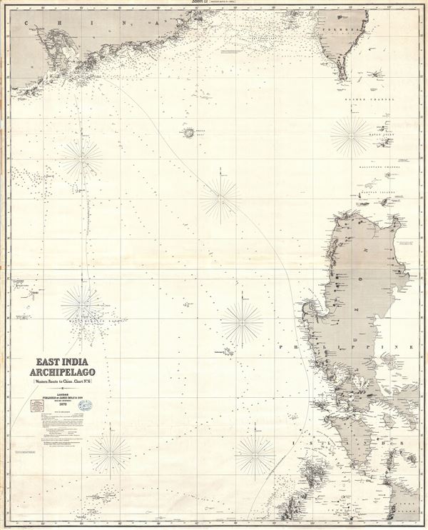
East India Archipelago (Western Route to China Chart no. 6)
sold
- Digital Map Information
- Suitable for large format printing
- File Size: 44.42 MB
- File Type: ZIP / TIFF
- ICC color profile embedded
- Delivered instantly via download link
A large and impressive 1872 nautical chart by James Imray covering southeastern China in the vicinity of Hong Kong and Guangdong Province, southern Taiwan, and the northern Philippines (Luzon and Mindanao). Two trade routes are identified including the 'Usual route to and from Hong Kong in fair Monsoon' and the 'course to Hong Kong in the Northeast Monsoon.' The chart achieves its greatest detail and accuracy in the vicinity of Hong Kong and Macao as well as in the seas around the Pescadores Islands between Taiwan and the China coast. Manila Bay, in the Philippines, is also well mapped. (more details)
Important Gold Rush map detailing the California Gold Region and showing Texas at its largest.
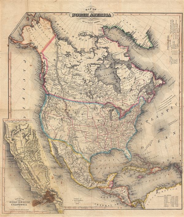
Map of North America by J. Calvin Smith.
sold
- Digital Map Information
- Suitable for large format printing
- DPI: 300
- File Size: 22.62 MB
- File Type: ZIP / TIFF
- ICC color profile embedded
- Delivered instantly via download link
An extremely scarce 1850 map of North America by J. Calvin Smith. Published to capitalize on the mass westward migrations associated with the 1849 California Gold Rush, this map covers all of North American and Central America from Panama to the ... (more details)
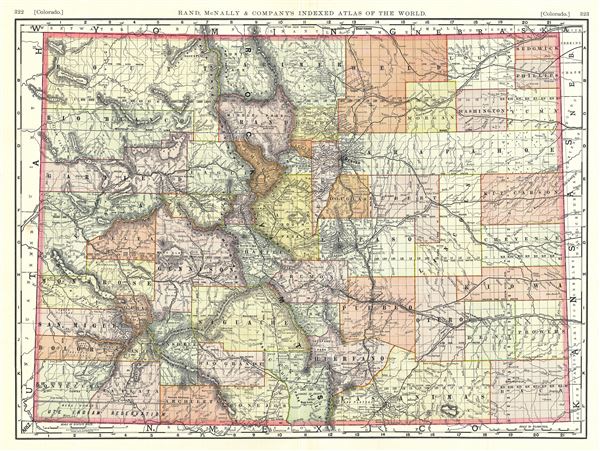
Colorado.
sold
- Digital Map Information
- Suitable for large format printing
- File Size: 20.96 MB
- File Type: ZIP / TIFF
- ICC color profile embedded
- Delivered instantly via download link
An appealing 1890 Rand McNally and Company map of Colorado. It covers the state in extensive detail, naming major towns, cities, rivers, mountains, railroads and other topographical features. The map also delineates survey grids and plats ... (more details)

Arkansas.
sold
- Digital Map Information
- Suitable for large format printing
- File Size: 17.88 MB
- File Type: ZIP / TIFF
- ICC color profile embedded
- Delivered instantly via download link
A fine 1890 map of Arkansas issued by Rand McNally and Company. It covers the state of Arkansas, naming major cities, towns, rivers, railroads, and a host of other topographical features. Color coded according to counties, it also ... (more details)
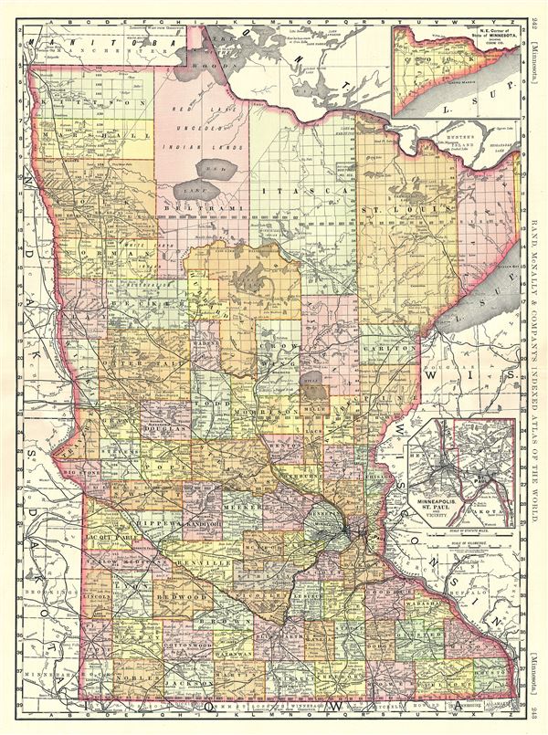
Minnesota.
sold
- Digital Map Information
- Suitable for large format printing
- File Size: 20.1 MB
- File Type: ZIP / TIFF
- ICC color profile embedded
- Delivered instantly via download link
This is an appealing 1889 example of Rand McNally and Company's map of Minnesota. The map covers the entire state, with the north east corner of the state features in an inset in the upper right quadrant. Another inset of ... (more details)

Louisiana.
sold
- Digital Map Information
- Suitable for large format printing
- File Size: 8.98 MB
- File Type: ZIP / TIFF
- ICC color profile embedded
- Delivered instantly via download link
This is an attractive 1888 map of Louisiana issued by Rand McNally and Company. It covers the state of Louisiana in its entirety and includes parts of neighboring states. Major cities, railroads, rivers, marshes, towns, ... (more details)
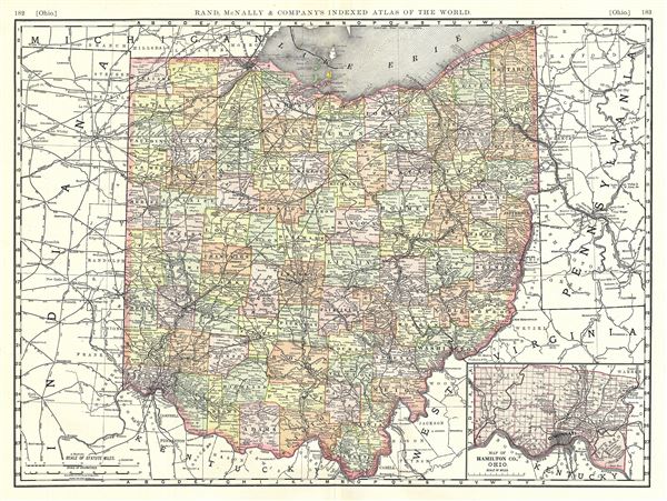
Ohio.
sold
- Digital Map Information
- Suitable for large format printing
- File Size: 18.8 MB
- File Type: ZIP / TIFF
- ICC color profile embedded
- Delivered instantly via download link
An appealing 1888 Rand McNally and Company map of Ohio. It covers the state of Ohio in extensive detail, showing major cities, towns, rivers, and other topographical details. Parts of neighboring Pennsylvania, West ... (more details)

Virginia.
sold
- Digital Map Information
- Suitable for large format printing
- File Size: 20.13 MB
- File Type: ZIP / TIFF
- ICC color profile embedded
- Delivered instantly via download link
A fine example of Rand McNally and Company's 1889 map of Virginia. It covers the entire state in great detail with the western portion of Virginia featured in an inset in the upper left quadrant. Parts of West ... (more details)
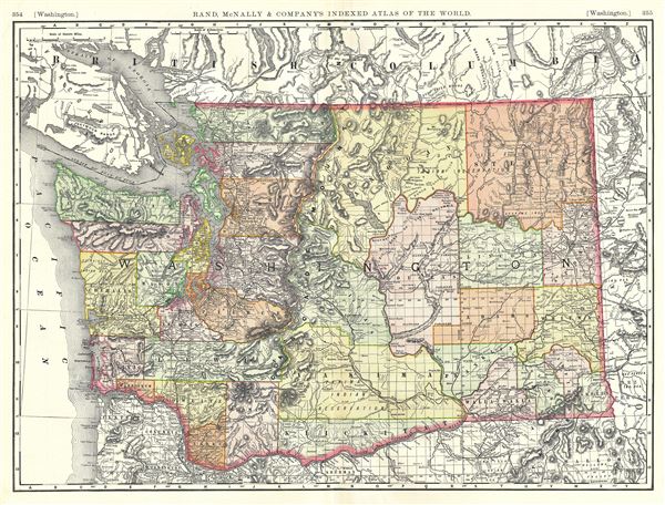
Washington.
sold
- Digital Map Information
- Suitable for large format printing
- File Size: 21.62 MB
- File Type: ZIP / TIFF
- ICC color profile embedded
- Delivered instantly via download link
This is a beautiful 1892 Rand McNally and Company map of Washington. Covers the state in its entirety including parts of neighboring Oregon, Idaho and Canada. The map also delineates survey grids and plats ... (more details)