

Alabama.
sold
- Digital Map Information
- Suitable for large format printing
- File Size: 18.62 MB
- File Type: ZIP / TIFF
- ICC color profile embedded
- Delivered instantly via download link
An attractive 1892 map of Alabama issued by Rand McNally and Company. Centered on Birmingham, the map covers the entire state in great detail. An inset map of the environs of Birmingham in included in the lower right quadrant. Major cities, towns, rivers, ... (more details)

Mississippi.
sold
- Digital Map Information
- Suitable for large format printing
- File Size: 15.77 MB
- File Type: ZIP / TIFF
- ICC color profile embedded
- Delivered instantly via download link
A lovely 1892 map of Mississippi by Rand McNally and Company. It covers the entire state east of the Mississippi River south as far as the Gulf of Mexico. This detailed map notes major cities, towns, railways, rivers and a host of important topographical ... (more details)
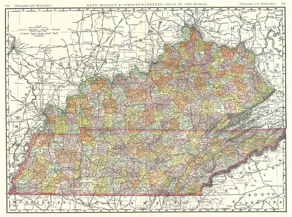
Tennessee and Kentucky.
sold
- Digital Map Information
- Suitable for large format printing
- File Size: 19.88 MB
- File Type: ZIP / TIFF
- ICC color profile embedded
- Delivered instantly via download link
This is a fine example of Rand McNally and Company's 1889 map of Tennessee and Kentucky. It covers both states in detail and notes numerous towns, cities, railways, rivers, and other topographical details. The map is color coded according to counties and ... (more details)
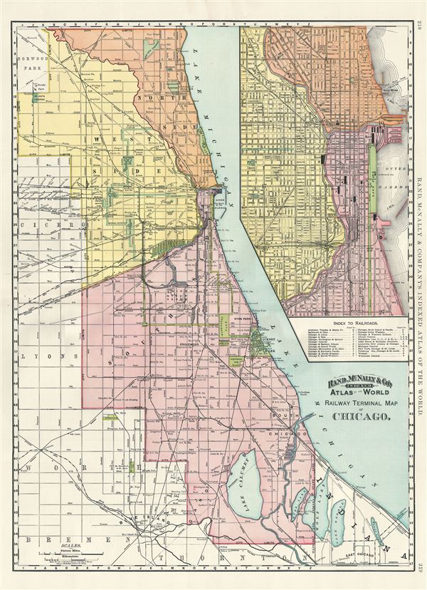
Railway Terminal Map of Chicago.
sold
- Digital Map Information
- Suitable for large format printing
- File Size: 20.92 MB
- File Type: ZIP / TIFF
- ICC color profile embedded
- Delivered instantly via download link
An attractive railway map of Chicago issued in 1892 by Rand McNally and Company. It covers Chicago from Norwood Park to the suburb of Thornton in the south and east as far as Lake Michigan. An inset map of the central city in included in the upper right ... (more details)

Pictorial Map of Dione.
sold
A beautiful 1992 example of the U.S. Geological Survey pictorial map of Dione, moon of the planet Saturn. This map, based on the images from Voyager 1 and 2, shows the Saturn-facing hemisphere, North Polar Region and South Polar Region of the fifteenth ... (more details)

The Southern Hemispheres of Umbriel, Titania, and Oberon.
sold
This is an impressive 1988 U.S. Geological Survey map of the southern hemispheres of Umbriel, Titania and Oberon, three of the Uranus' moons. The map contains three pairs of images. The first pair in the top section of the map depicts a photomosaic ... (more details)
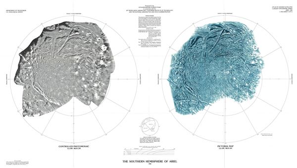
The Southern Hemisphere of Miranda.
sold
This is a fine example of the U.S. Geological Survey's 1988 map of the southern hemisphere of Ariel, the fourth largest moon of the planet Uranus. The map contains two images, a controlled photomosaic on the left and a pictorial map on the right. ... (more details)

The Southern Hemisphere of Miranda.
sold
This is a beautiful example of the U.S. Geological Survey's 1988 map of the southern hemispheres of Miranda, the smallest moon of the planet Uranus. The map contains two images, the left being a controlled photomosaic and the right a pictorial ... (more details)

Controlled Photomosaic of Io.
sold
This is a beautiful 1987 U.S. Geological Survey map or photomosaic of Io, the innermost moon of the planet Jupiter. It depicts the many active volcanoes, plateaus and mountains on the most geologically active object in the Solar System. The ... (more details)
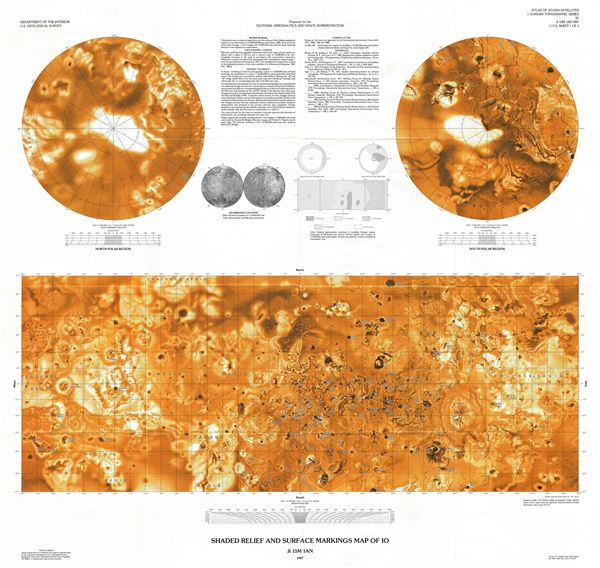
Shaded Relief and Surface Markings Map of Io.
sold
This is a beautiful 1987 map of Jupiter's innermost moon, Io, issued by the U.S. Geological Survey. This relief and surface markings map depicts the many active volcanoes, plateaus and mountains on the most geologically active object in the ... (more details)

High Resolution Controlled Photomosaics of Io.
sold
This is an impressive 1983 pictorial map or photomosaic of Jupiter's innermost moon, Io, issued by the U.S. Geological Survey. These photomosaics are compiled from images from the Voyager 1 and 2 missions. Divided into three sections, it ... (more details)

Preliminary Pictorial Map of Ganymede.
sold
This is a fascinating 1979 U.S. Geological Survey's pictorial map of Ganymede, the largest moon of the planet Jupiter and of the Solar System. This map was compiled from the images from Voyager 1 and 2. Centered on the Nicholson Region, ... (more details)
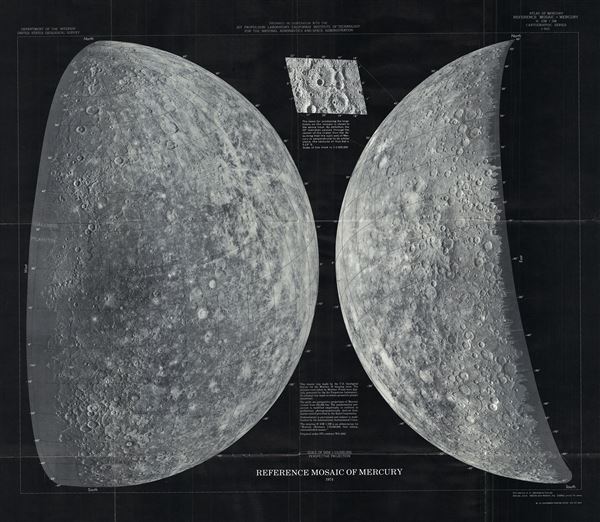
Reference Mosaic of Mercury.
sold
- Digital Map Information
- Suitable for large format printing
- File Size: 26.11 MB
- File Type: ZIP / TIFF
- ICC color profile embedded
- Delivered instantly via download link
This is a stunning 1974 mosaic of the planet Mercury by the U. S. Geological Survey for the Mariner 10 imaging team. This map represents the surface of Mercury as photographed by Mariner 10 and digitally processed by NASA's Jet ... (more details)
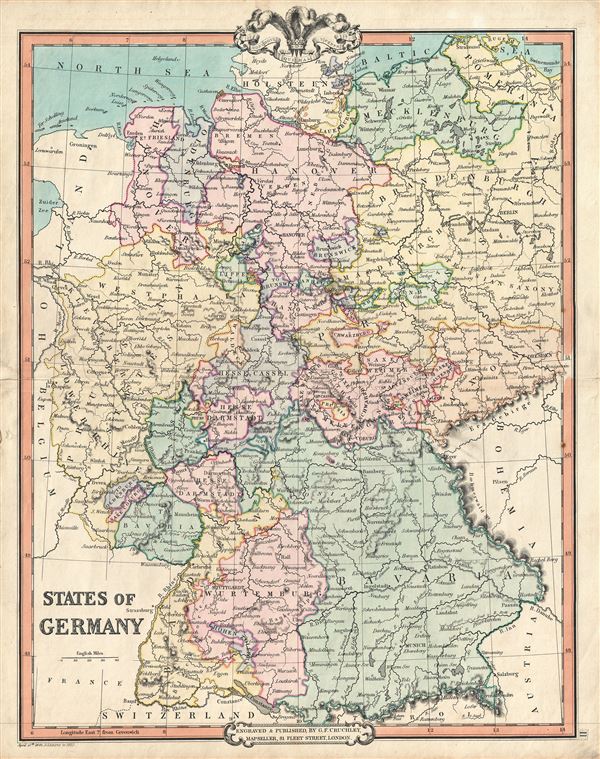
States of Germany.
sold
- Digital Map Information
- Suitable for large format printing
- DPI: 300
- File Size: 9.95 MB
- File Type: ZIP / TIFF
- ICC color profile embedded
- Delivered instantly via download link
A fine example of G. F. Cruchley's 1850 map of Germany. Cities, towns, rivers, mountains and other topographical features are noted, with relief shown by hachures. The map is color coded according to Germanic states. This map ... (more details)
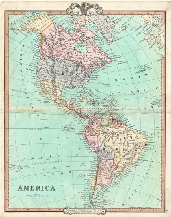
America.
sold
- Digital Map Information
- Suitable for large format printing
- DPI: 300
- File Size: 8.39 MB
- File Type: ZIP / TIFF
- ICC color profile embedded
- Delivered instantly via download link
An attractive 1850 map of North and South America by George Frederick Cruchley. The map covers all of North America as well as South America from the Arctic to Cape Horn. In North America, Russian and British territories in ... (more details)
A scarce separately issued example.
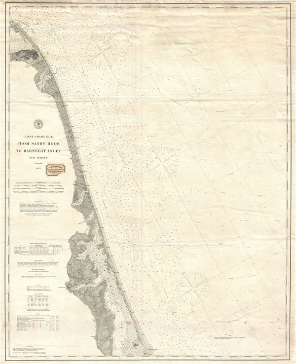
Coast Chart No. 21 From Sandy Hook to Barnegat Inlet New Jersey.
sold
- Digital Map Information
- Suitable for large format printing
- File Size: 6.5 MB
- File Type: ZIP / TIFF
- ICC color profile embedded
- Delivered instantly via download link
An uncommon 1879 nautical chart or maritime map of the New Jersey coastline between Barnegat Inlet and Sandy Hook. The chart offers countless depth soundings and a wealth of practical information for the mariner as well as ... (more details)
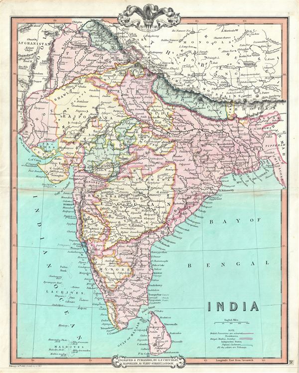
India.
sold
- Digital Map Information
- Suitable for large format printing
- DPI: 300
- File Size: 8.43 MB
- File Type: ZIP / TIFF
- ICC color profile embedded
- Delivered instantly via download link
This is an attractive 1850 map of India by George Frederick Cruchley. It covers the Indian subcontinent from Kashmir to the Indian Ocean and includes Ceylon or Sri Lanka as well as parts of Afghanistan and Tibet. The map ... (more details)
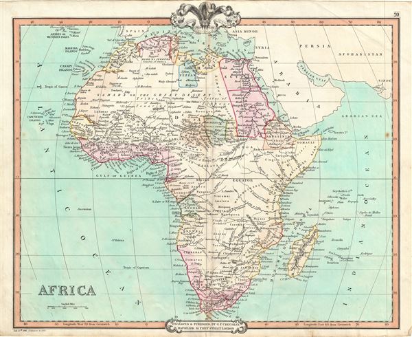
Africa.
sold
- Digital Map Information
- Suitable for large format printing
- DPI: 300
- File Size: 7.53 MB
- File Type: ZIP / TIFF
- ICC color profile embedded
- Delivered instantly via download link
This is a beautiful 1850 map of Africa issued by George Frederick Cruchley. It details the continent of Africa, including Madagascar, on the cusp of the great exploratory expeditions of the mid-19th century undertaken by ... (more details)
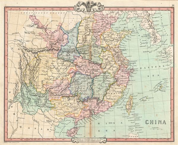
China.
sold
- Digital Map Information
- Suitable for large format printing
- DPI: 300
- File Size: 8.25 MB
- File Type: ZIP / TIFF
- ICC color profile embedded
- Delivered instantly via download link
A lovely 1850 map of China by George Frederick Cruchley. It covers the traditional provinces of mainland China, as well as adjacent Corea (Korea) and Formosa (Taiwan). Hong Kong Island and Macao are identified. The ... (more details)

Persia, Arabia, Cabool, Afghanistan, etc.
sold
- Digital Map Information
- Suitable for large format printing
- DPI: 300
- File Size: 9.17 MB
- File Type: ZIP / TIFF
- ICC color profile embedded
- Delivered instantly via download link
A fine example of the 1850 map of Persia, Arabia and Afghanistan by G. F. Cruchley. Centered on the Persian Gulf, this map covers from the Mediterranean and Red Sea eastward as far as India, including all of modern ... (more details)