

Georgia.
sold
- Digital Map Information
- Suitable for large format printing
- File Size: 12.02 MB
- File Type: ZIP / TIFF
- ICC color profile embedded
- Delivered instantly via download link
This is a nice example of the 1888 Rand McNally and Company map of Georgia, United States. Centered on the city of Macon, the map covers the entire state of Georgia along with parts of its neighboring states. Several towns, cities, rivers and railroads are noted ... (more details)

New Hampshire.
sold
- Digital Map Information
- Suitable for large format printing
- File Size: 12.38 MB
- File Type: ZIP / TIFF
- ICC color profile embedded
- Delivered instantly via download link
A beautiful Rand McNally and Company 1888 map of New Hampshire, United States. Centered on the Connecticut River, which forms the border between Vermont and New Hampshire, this map covers the State of New Hampshire and part of neighboring Vermont in extensive ... (more details)

Vermont.
sold
- Digital Map Information
- Suitable for large format printing
- File Size: 12.29 MB
- File Type: ZIP / TIFF
- ICC color profile embedded
- Delivered instantly via download link
This is an attractive 1888 Rand McNally and Company map of Vermont, United States. Centered on the Connecticut River, which forms the border between Vermont and New Hampshire, this map covers the state of Vermont and part of neighboring New Hampshire in ... (more details)

New Jersey.
sold
- Digital Map Information
- Suitable for large format printing
- File Size: 11.2 MB
- File Type: ZIP / TIFF
- ICC color profile embedded
- Delivered instantly via download link
This is a beautiful example of Rand McNally and Company's 1893 map of New Jersey, United States. The map covers the state of New Jersey in its entirety, including parts of neighboring states. Color coded according to counties, the map notes several ... (more details)
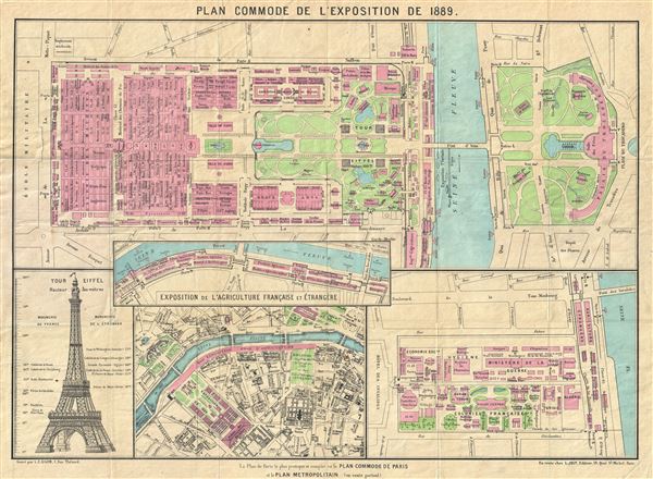
Plan Commode de L'Exposition de 1889.
sold
- Digital Map Information
- Suitable for large format printing
- File Size: 10.9 MB
- File Type: ZIP / TIFF
- ICC color profile embedded
- Delivered instantly via download link
An uncommon map of Paris issued for the 1889 Paris World's Fair, or Exposition Universelle. Essentially four maps on a single sheet including a general map of the Champs de Mars, where the exposition was held, the Quai d'Orsay on the Left Bank of ... (more details)
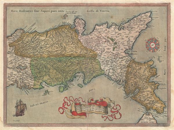
Regni Neapolitani Verissima Secundum Antiquorum et Recentiorum Traditionem Descriptio, Pyrrho Ligorio Acut.
sold
- Digital Map Information
- Suitable for large format printing
- DPI: 300
- File Size: 14.7 MB
- File Type: ZIP / TIFF
- ICC color profile embedded
- Delivered instantly via download link
A very beautiful old color example of Abraham Ortelius's 1580 map of southern Italy. Oriented to the east, this map covers Italy from central Italy to northern Sicily, and from the Adriatic Sea to the Tyrrhenian Sea. The map identifies countless ... (more details)
First state first edition of an iconic map of Quebec City.
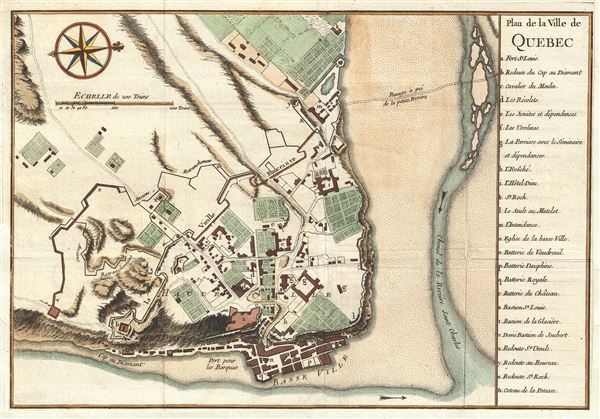
Plan de la Ville de Quebec.
sold
- Digital Map Information
- Suitable for large format printing
- DPI: 300
- File Size: 3.68 MB
- File Type: ZIP / TIFF
- ICC color profile embedded
- Delivered instantly via download link
A scarce 1744 first state first edition of Bellin's important map of Quebec City, Canada. Oriented to the west, Bellin's map covers the fortified center of Quebec City at the conjunction of the St. Laurence River and the St. Charles estuary. The ... (more details)
Bellin's illustration of 18th century French claims to the American Southeast.

Carte des Costes de la Floride Francoise Suivant les premieres decouvertes.
sold
- Digital Map Information
- Suitable for large format printing
- DPI: 300
- File Size: 1.74 MB
- File Type: ZIP / TIFF
- ICC color profile embedded
- Delivered instantly via download link
A beautiful example of Bellin's unusual an interesting 1744 map of the American Southeast. The map covers the southeastern coast of the modern day United States roughly from St. Augustine, Florida to Cape Fear, North Carolina. As the title ... (more details)
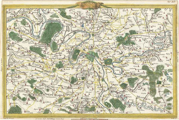
Les Environs De Paris assujettis a 18 lieues de l'Est a l'Ouest sur 12 du Sud au Nord.
sold
- Digital Map Information
- Suitable for large format printing
- DPI: 300
- File Size: 8.53 MB
- File Type: ZIP / TIFF
- ICC color profile embedded
- Delivered instantly via download link
A beautiful hand colored 1770 map of Paris and its environs by Etienne Andre Philippe de Pretot. Centered over the city of Paris, it covers the Seine valley from Juziers to Guignes. The map offers extraordinary detail throughout showing ... (more details)
A unusual Anglocentric perspective illustrating the vast potential of British colonial expansionism in North America.
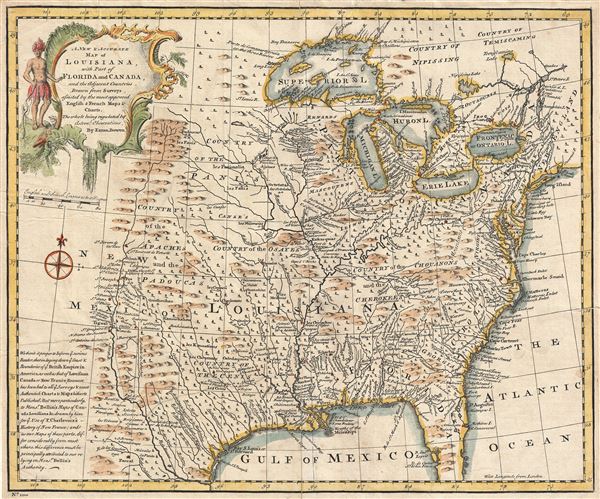
A new & accurate map of Louisiana, with part of Florida and Canada, and the adjacent countries.
sold
- Digital Map Information
- Suitable for large format printing
- Full resolution TIFF file
- ICC color profile embedded
- Delivered instantly via download link
A fascinating 1747 map of North America drawn by the British cartographer Emanuel Bowen shortly before the outbreak of the French and Indian War. Bowen's map covers most of the modern day United States from the Rio Grande to the Pacific ... (more details)
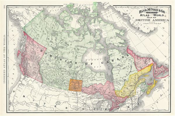
Map of British America.
sold
- Digital Map Information
- Suitable for large format printing
- File Size: 11.02 MB
- File Type: ZIP / TIFF
- ICC color profile embedded
- Delivered instantly via download link
A beautiful example of Rand McNally and Company's 1893 map of British America or Canada. The map covers the entire region from Victoria Island to Lake Erie and from the Pacific Ocean and Queen Charlotte Islands (Haida Gwaii) to ... (more details)
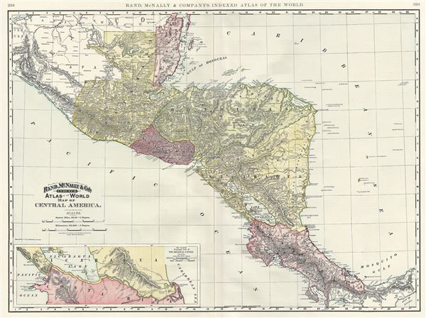
Map of Central America.
sold
- Digital Map Information
- Suitable for large format printing
- File Size: 17.02 MB
- File Type: ZIP / TIFF
- ICC color profile embedded
- Delivered instantly via download link
An attractive example of Rand McNally and Company's 1892 map of Central America. The map covers Central America from British Honduras to Costa Rica including Belize, Guatemala, El Salvador, Honduras, Nicaragua and Costa Rica. ... (more details)
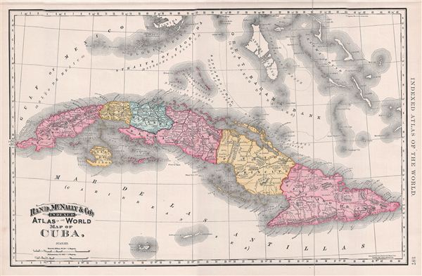
Map of Cuba.
sold
- Digital Map Information
- Suitable for large format printing
- File Size: 9.67 MB
- File Type: ZIP / TIFF
- ICC color profile embedded
- Delivered instantly via download link
A beautiful example of Rand McNally and Company's 1892 map of Cuba. The map covers the entire island of Cuba including the Salt Sea Banks and the Isla de la Juventud or the Isla de Pinos (Isle of Pines) as it was until 1978. ... (more details)
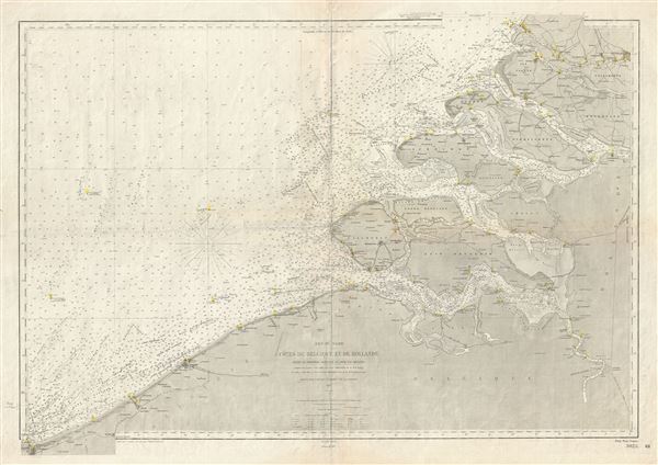
Mer du Nord Cotes de Belgique et de Hollande (Entre la Frontiere Francaise et Hoek van Holland).
sold
- Digital Map Information
- Suitable for large format printing
- File Size: 36.24 MB
- File Type: ZIP / TIFF
- ICC color profile embedded
- Delivered instantly via download link
This is a rare and beautiful nautical chart or map of Holland and Belgium issued in 1887 by the Depot de la Marine. It covers the coast of Holland and Belgium from Dunkirk on the French border to Hoek van Holland. The chart ... (more details)
Unusual map of the Great Lakes region at the start of the American Revolutionary War.
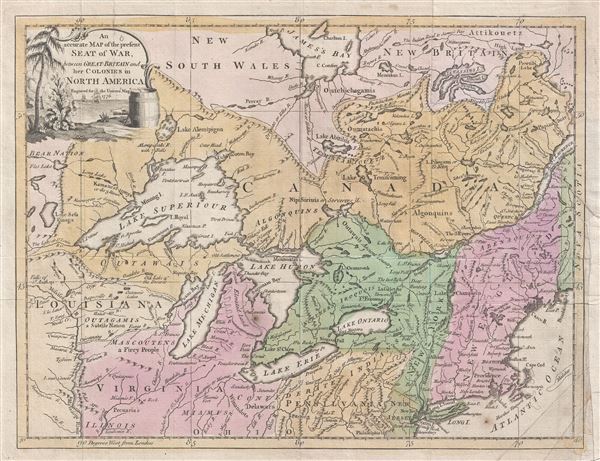
An accurate Map of the present Seat of War, between Great-Britain and her Colonies in North America.
sold
- Digital Map Information
- Suitable for large format printing
- DPI: 300
- File Size: 6.69 MB
- File Type: ZIP / TIFF
- ICC color profile embedded
- Delivered instantly via download link
An uncommon and attractive 1776 map of the northern British Colonies (the United States and Canada) at the start of the American Revolutionary War. Published by John Hinton for his Universal Magazine , this map centers on ... (more details)
A British perspective on America at the close of the American Revolutionary War.
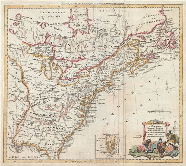
A New Map of the British Empire in Nth. America.
sold
- Digital Map Information
- Suitable for large format printing
- DPI: 300
- File Size: 9.32 MB
- File Type: ZIP / TIFF
- ICC color profile embedded
- Delivered instantly via download link
An uncommon and attractive 1776 map of the northern British Colonies (the United States and Canada) at the start of the American Revolutionary War. Published by John Hinton for his Universal Magazine , this map centers on ... (more details)
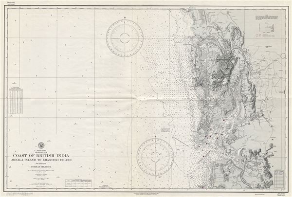
Indian Ocean Arabian Sea Coast of British India Arnala Island to Khanderi Island including Bombay Harbor.
sold
- Digital Map Information
- Suitable for large format printing
- File Size: 32.22 MB
- File Type: ZIP / TIFF
- ICC color profile embedded
- Delivered instantly via download link
This is a scarce World War II (WWII) era 1945 map of Bombay (Mumbai) harbor and vicinity issued by the U. S. Navy Hydrographic Office. It covers the western coast of what was then British India, from Arnala Island to ... (more details)
The United States just after the American Revolutionary War.
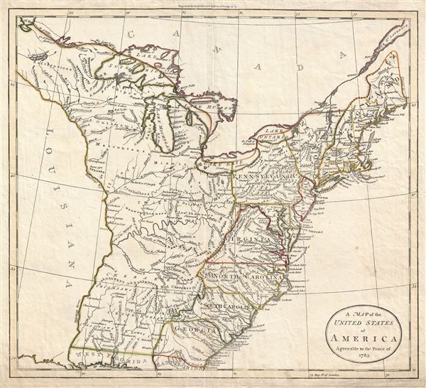
A Map of the United States of America Agreeable to the Peace of 1783.
sold
- Digital Map Information
- Suitable for large format printing
- DPI: 300
- File Size: 7.77 MB
- File Type: ZIP / TIFF
- ICC color profile embedded
- Delivered instantly via download link
An unusual c. 1783 John Russell map of the United States issued shortly after the American Revolutionary War. The map depicts the United States according to the 1783 Treaty of Paris that formally ended the War. ... (more details)

Preliminary Chart of Portland Harbor Maine.
sold
- Digital Map Information
- Suitable for large format printing
- File Size: 16.4 MB
- File Type: ZIP / TIFF
- ICC color profile embedded
- Delivered instantly via download link
This is a beautiful example of the U.S. Coast Survey's 1859 nautical chart or maritime map of Portland Harbor, Maine. Centered on the city of Portland, this map covers from Westbrook to Long Island and from the ... (more details)

Preliminary Chart of Kennebec River Main from Entrance to Bath.
sold
- Digital Map Information
- Suitable for large format printing
- File Size: 12.12 MB
- File Type: ZIP / TIFF
- ICC color profile embedded
- Delivered instantly via download link
This is a beautiful example of the U.S. Coast Survey nautical chart or maritime map of the Kennebec River, Maine. It covers the Kennebec River from its entrance to the town of Bath. This extraordinarily ... (more details)