
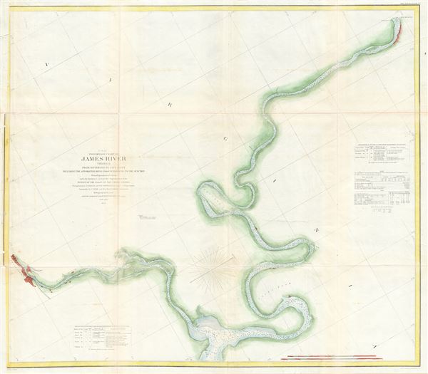
(C No. 4) Preliminary Chart of James River Virginia from Richmond to City Point Including the Appomattox River from Petersburg to the Junction.
sold
- Digital Map Information
- Suitable for large format printing
- File Size: 14.42 MB
- File Type: ZIP / TIFF
- ICC color profile embedded
- Delivered instantly via download link
This is an attractive 1855 U.S. Coast Survey nautical chart or map of the James River, Virginia. It covers the James River from Richmond to City Point, including part of the Appomattox River from Petersburg to the junction. The map offers excellent detail noting ... (more details)

(A No. 2) Preliminary Sketch Showing the positions of Davis's South Shoal and Other Dangers recently Discovered by the Coast Survey and the sounding on the Old South Shoal, Bass Rip, Old Man, Pochuck Rip, &c.
sold
- Digital Map Information
- Suitable for large format printing
- File Size: 12.61 MB
- File Type: ZIP / TIFF
- ICC color profile embedded
- Delivered instantly via download link
This beautiful and important 1852 sea chart or maritime map depicts the waters immediately surrounding the island of Nantucket, Massachusetts, including Davis' Shoal, Old South Shoal, and others. The chart contains a wealth of practical information for the ... (more details)

Boston Harbor Massachusetts.
sold
- Digital Map Information
- Suitable for large format printing
- File Size: 33.92 MB
- File Type: ZIP / TIFF
- ICC color profile embedded
- Delivered instantly via download link
A stunning 1857 U.S. Coast Survey nautical chart or maritime map of Boston Bay, Boston Harbor, and environs. The map covers the Massachusetts coastline from Cape Ann southward past Gloucester, Marblehead, Lynn, Boston and Cohasset to Green Harbor River. It ... (more details)
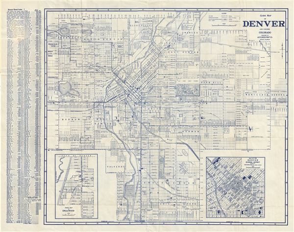
Guide Map of Denver and Suburbs Colorado.
sold
- Digital Map Information
- Suitable for large format printing
- File Size: 16.5 MB
- File Type: ZIP / TIFF
- ICC color profile embedded
- Delivered instantly via download link
This is a beautiful example of the Hotchkiss Map Co.'s 1947 map or plan of Denver, Colorado and its suburbs. Centered on Capitol Hill, this map covers all of Denver from Lakeside Lake to Aurora and from 54th Avenue to Englewood. An inset map of Englewood ... (more details)
The first world map to show any significant portion of the Antarctic Coast.

Chart of the World Shewing the tracks of the U.S. Exploring Expedition in 1838, 39, 40, 41 & 42.
sold
- Digital Map Information
- Suitable for large format printing
- DPI: 300
- File Size: 24.35 MB
- File Type: ZIP / TIFF
- ICC color profile embedded
- Delivered instantly via download link
This important and extraordinary production is Commodore Wilkes's 1840 U.S. exploring expedition map of the World. Presented on a Mercator Projection, this chart covers the globe from the high arctic to the Antarctic Coast. The map is color coded to represent isothermal lines, with variances in shading representing 5 degrees of temperature difference. In addition, Wilkes also shows currents and winds. Wilkes intended this map to present a general overview of the accomplishments of the U.S. Exploring Expedition (1838 - 1842). (more details)

Tybee Roads Savannah River and Wassaw Sound Georgia.
sold
- Digital Map Information
- Suitable for large format printing
- File Size: 23.02 MB
- File Type: ZIP / TIFF
- ICC color profile embedded
- Delivered instantly via download link
This is a rarely seen nautical chart of Savanna Georgia, the Savanna River, and environs. Depicts from Savannah eastward to Hilton Head Island and southward as far as the entrance to the Vernon River. Shows Wassaw Sound, Skiddaway Island, Wassaw Island, ... (more details)

Nouveau Plan de Paris.
sold
- Digital Map Information
- Suitable for large format printing
- File Size: 21.85 MB
- File Type: ZIP / TIFF
- ICC color profile embedded
- Delivered instantly via download link
This is an extremely attractive c.1908 tourist pocket map of Paris, France. Published by Garnier Freres, the map centers on the Seine River, and covers the embastilled heart of Paris. Although ostensibly designed as a subway map, this map offers much ... (more details)
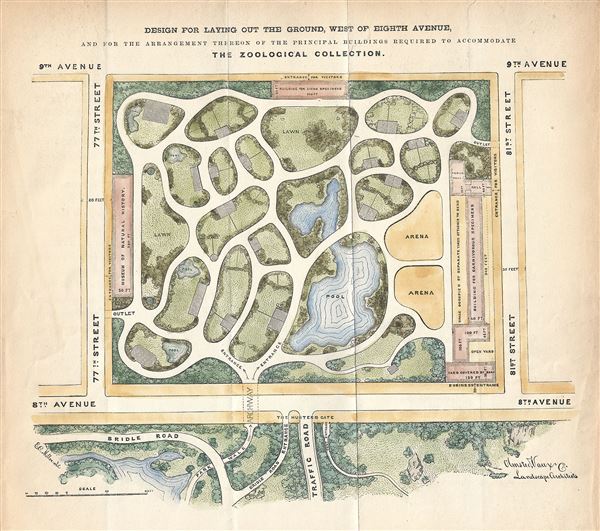
Design for laying out The ground, West of Eight Avenue, and for the arrangement thereon of the principal buildings required to accommodate The Zoological Collection.
sold
- Digital Map Information
- Suitable for large format printing
- File Size: 2.43 MB
- File Type: ZIP / TIFF
- ICC color profile embedded
- Delivered instantly via download link
This is an extraordinary 1867 hand colored map or plan of the grounds that today house the American Museum of Natural History in New York City. It depicts from 77th Street north to the intersection of 81st Street and 8th Avenue (Central Park West), ... (more details)
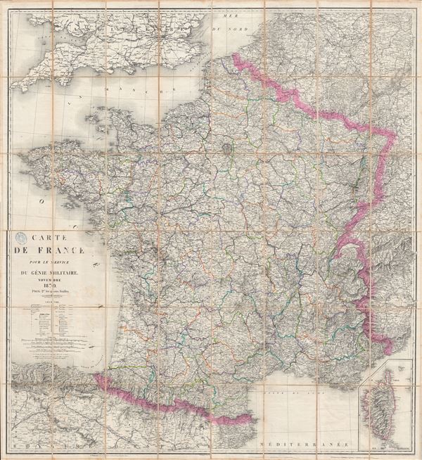
Carte de France Pour le Service Du Genie Militaire.
sold
- Digital Map Information
- Suitable for large format printing
- File Size: 116.11 MB
- File Type: ZIP / TIFF
- ICC color profile embedded
- Delivered instantly via download link
An enormous 1870 folding wall map of France drawn, as the title suggests, for 'genie militaire' or 'military intelligence.' Prepared for publication by Dumaine, this map covers from the North Sea to the Mediterranean and from the Atlantic to Italy, ... (more details)

Central Park. Plan showing the new arrangement of Park Entrance at the corner of 59th Street and 5th Avenue.
sold
- Digital Map Information
- Suitable for large format printing
- File Size: 1.27 MB
- File Type: ZIP / TIFF
- ICC color profile embedded
- Delivered instantly via download link
This is a beautiful and unusual little map of the southeastern corner of New York City's Central Park prepared and printed for inclusion in the 1867 Tenth Annual Report of the Board of Commissioners of the Central Park. It depicts from 61st Street ... (more details)
Important early map illustrating the explorations of La Verendrye and the River of the West.
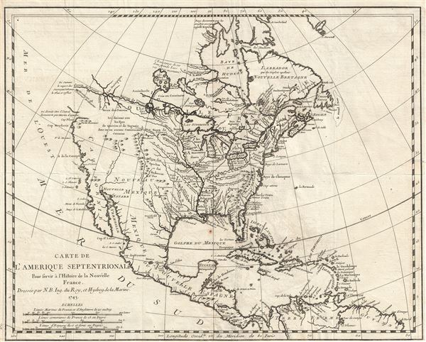
Carte de L'Amerique Septentrionale Pour servir a L'Histoire de la Nouvelle France.
sold
- Digital Map Information
- Suitable for large format printing
- DPI: 300
- File Size: 5.1 MB
- File Type: ZIP / TIFF
- ICC color profile embedded
- Delivered instantly via download link
An important and influential first edition first state 1743 map of the North America by the French cartographer Jacques-Nicholas Bellin. Bellin's map covers all of North America from the Arctic to the Spanish Main, including modern day Canada, the ... (more details)

Central Park Guide.
sold
- Digital Map Information
- Suitable for large format printing
- File Size: 2.2 MB
- File Type: ZIP / TIFF
- ICC color profile embedded
- Delivered instantly via download link
An altogether extraordinary 1867 hand colored map of New York City's Central Park prepared and printed for inclusion in the Tenth Annual Report of the Board of Commissioners of the Central Park. This is an extremely rare variant on the map of ... (more details)

Caarte van de Rivier van Bourdeaux en de haven van Arcachon.
sold
- Digital Map Information
- Suitable for large format printing
- DPI: 300
- File Size: 5.56 MB
- File Type: ZIP / TIFF
- ICC color profile embedded
- Delivered instantly via download link
This is a beautiful c.1643 Johannes Blaeu map or nautical chart of the Bordeaux River in France. This maritime map covers part of the coastal department of Gironde from the Port of Arcachon to Royan (Roian) and the city of Bordeaux. It ... (more details)
The first accurate map of the Fiji Islands.
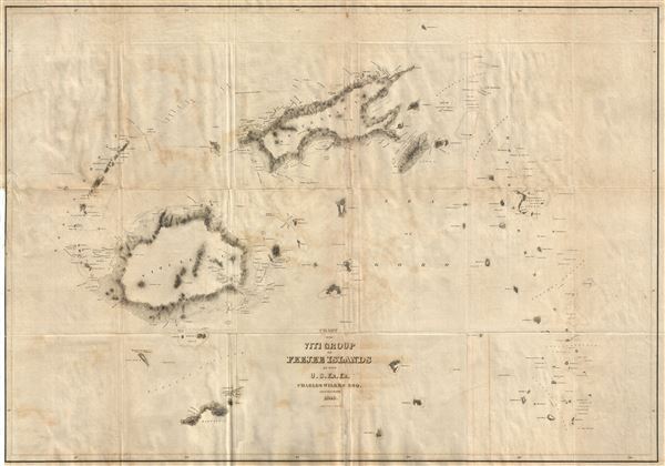
Chart of the Viti Group or Feejee Islands by the U.S. Ex. Ex.
sold
- Digital Map Information
- Suitable for large format printing
- Full resolution TIFF file
- ICC color profile embedded
- Delivered instantly via download link
A beautiful example of Wilkes' 1840 map of the Fiji Islands. Considered to be the first accurate map of the Fiji Islands, this map includes three main islands, Vanua Levu, Viti Levu, and Taveuni as well as the Yasawa Group and countless ... (more details)
Identifies the Sea of Korea.
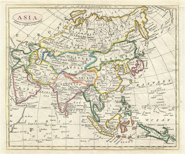
Asia.
sold
- Digital Map Information
- Suitable for large format printing
- DPI: 300
- File Size: 2.45 MB
- File Type: ZIP / TIFF
- ICC color profile embedded
- Delivered instantly via download link
This is a beautiful example of the 1821 map of Asia published by James V. Seaman. It covers the entire continent from the Mediterranean Sea and Arabia eastward as far as Bristol Bay and New Guinea. The map centers on the vast stretch ... (more details)
Identifies the Sea of Korea.

Carte d'Asie Divisee en ses Princpaux Etats Assujettie Observations Astronomiques.
sold
- Digital Map Information
- Suitable for large format printing
- Full resolution TIFF file
- ICC color profile embedded
- Delivered instantly via download link
This is a beautiful example of C. Bertholon's 1799 map of Asia. It covers the continent from the Red Sea (Mer Rouge) east as far as New Guinea. This map is most interesting in its rendering of the largely unexplored extreme northwest ... (more details)
Identifies the Sea of Korea.
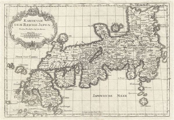
Karte Von Dem Reiche Japon.
sold
- Digital Map Information
- Suitable for large format printing
- DPI: 300
- File Size: 4.79 MB
- File Type: ZIP / TIFF
- ICC color profile embedded
- Delivered instantly via download link
This is a beautiful 1752 Bellin map of the Empire of Japan. Centered on the Bay of Osaka, this map covers from Hirado (here identified as I. Firando) and Nagasaki to Akita (Aquita), to include most of Tokugawa (Edo) Era Japan. The ... (more details)
The first geometrically constructed map of any significant portion of Hawaii. - Fitzpatrick

Map of Part of the Island of Hawaii Sandwich Islands Shewing the Craters and Eruption of May and June 1840.
sold
- Digital Map Information
- Suitable for large format printing
- DPI: 300
- File Size: 16.9 MB
- File Type: ZIP / TIFF
- ICC color profile embedded
- Delivered instantly via download link
This extraordinary production is Commodore Wilkes' 1841 U.S. Exploring Expedition map of the island of Hawaii. An incredibly important work, this is, according to Fitzpatrick, the 'first geometrically constructed map of any ... (more details)

East India Islands.
sold
- Digital Map Information
- Suitable for large format printing
- DPI: 300
- File Size: 12.67 MB
- File Type: ZIP / TIFF
- ICC color profile embedded
- Delivered instantly via download link
This is a beautiful map of the East Indies from Sidney Hall's extremely scarce 1850 New General Atlas. It covers from Burma (Myanmar) south as far as Australia and from the Andaman Islands eastward as far as the Philippines ... (more details)
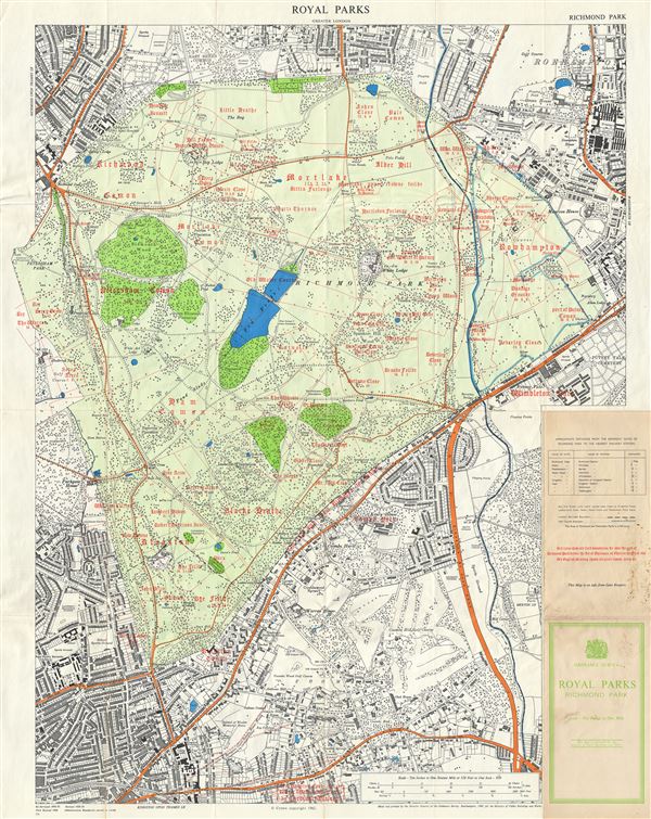
Royal Parks Greater London. Richmond Park.
sold
- Digital Map Information
- Suitable for large format printing
- File Size: 36.63 MB
- File Type: ZIP / TIFF
- ICC color profile embedded
- Delivered instantly via download link
This is a beautiful example of the 1968 Ordnance Survey map of Richmond Park, one of the Royal Parks of London, England. It covers all of Richmond Park and its vicinity. The map is highly detailed with the parks ... (more details)