
Since antiquity Ceylon's Trincomalee has been renowned the finest harbor on the Indian Ocean.
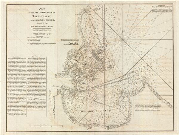
Plan of the Bay and Harbour of Trincomalay, on the Island of Ceylon.
sold
- Digital Map Information
- Suitable for large format printing
- DPI: 300
- File Size: 24.44 MB
- File Type: ZIP / TIFF
- ICC color profile embedded
- Delivered instantly via download link
This is a fine example of Laurie and Whittle's 1794 nautical chart or maritime map of the Bay and Harbor of Trincomalee, Sri Lanka. Trincomalee is the largest and safest natural port in the Indian Ocean, accessible to all crafts in any weather condition. It has ... (more details)
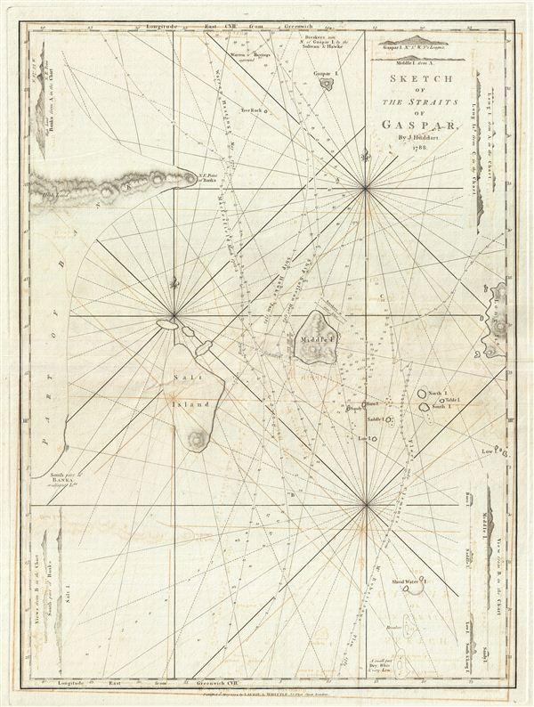
Sketch of the Straits of Gaspar.
sold
- Digital Map Information
- Suitable for large format printing
- DPI: 300
- File Size: 15.38 MB
- File Type: ZIP / TIFF
- ICC color profile embedded
- Delivered instantly via download link
This is a fine example of Laurie and Whittle's 1794 nautical chart or maritime map of the Gaspar Strait, Indonesia. The map covers the strait between Belitung and Bangka Islands connecting the Java Sea to the South China Sea. By the end of the 18th century the ... (more details)
Prominently shows the volcanic island of Krakatoa, which famously exploded killing nearly 35,0000 people in 1883 - and which may explode again with even more disastrous results.
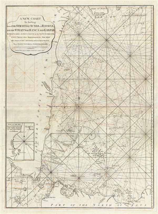
A New Chart for Sailing between the Straits of Sunda or Batavia and the Strairs of Banca and Gaspar.
sold
- Digital Map Information
- Suitable for large format printing
- DPI: 300
- File Size: 19.95 MB
- File Type: ZIP / TIFF
- ICC color profile embedded
- Delivered instantly via download link
This is a fine example of Laurie and Whittle's 1794 nautical chart or maritime map of northwestern Java and eastern Sumatra, including the Straits of Sunda and the Strait of Banca. The map covers from the Strait of Banca southwards to Krakatoa (Cracatoa), the ... (more details)
The earliest obtainable example of the first map to introduce four fictional islands in Lake Superior. Islands later used to draw post-Revolutionary War US-Canada border.

Carte des Lacs du Canada Dresse sur les Manuscrits du Depost des Carts, Plans et Journaux de la Marine et sur le Journal de RP. De Charlevoix.
sold
- Digital Map Information
- Suitable for large format printing
- Full resolution TIFF file
- ICC color profile embedded
- Delivered instantly via download link
An iconic and historically influential 1744 map of the Great Lakes by Jacques-Nicholas Bellin. Possibly Bellin's most important production, this is the earliest obtainable map, preceded only by a 1742 proof noted by Kershaw, to depict the four fictive islands ... (more details)
Important East India nautical chart issued shortly after the 1794 Battle of the Straits of Sunda.
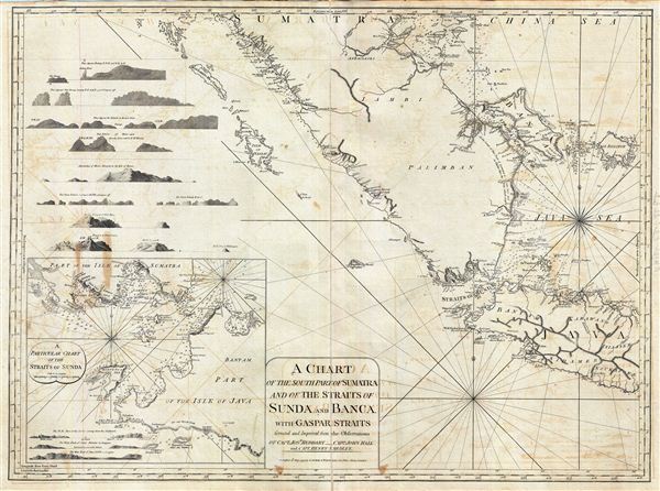
A Chart of the South Part of Sumatra and of the Straits of Sunda and Banca with Gaspar Straits.
sold
- Digital Map Information
- Suitable for large format printing
- DPI: 300
- File Size: 35.58 MB
- File Type: ZIP / TIFF
- ICC color profile embedded
- Delivered instantly via download link
This is a fine example of Laurie and Whittle's 1794 nautical chart or maritime map of Southern Sumatra, Western Java, and the Straits of Sunda and Banca, and the Gaspar Strait. An inset in the lower left offers a more detailed presentation of the Strait of ... (more details)
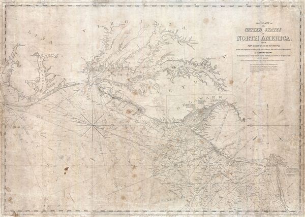
The Coast of the United States of North America, from New York to St. Augustine drawn and regulated according to the best Surveys and Astronomical Observations by Enmund Blunt.
sold
- Digital Map Information
- Suitable for large format printing
- Full resolution TIFF file
- ICC color profile embedded
- Delivered instantly via download link
An interesting 1851 Edmund Blunt maritime chart or nautical map of the coast of the United States between New York City and the Pamlico Sound. Centered on the Chesapeake Bay, which is rendered in full, this map offers a fine pre-U.S. Coast Survey analysis ... (more details)

Plan de Paris Superieur et Complet.
sold
- Digital Map Information
- Suitable for large format printing
- File Size: 45.84 MB
- File Type: ZIP / TIFF
- ICC color profile embedded
- Delivered instantly via download link
An uncommon 1904 map of Paris from the French publishing house Bernardine-Bechet. The map covers the embastilled center of Paris with each of the ring forts identified. All streets, bridges, monuments, and parks noted. Presents a post Haussmann vision ... (more details)
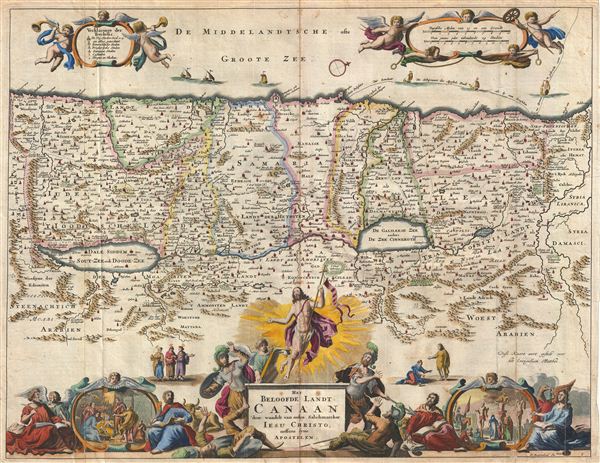
Het Beloofde Landt Canaan door wandelt van onsen Salichmaecker Iesu Christo nessens syne Apostelen.
sold
- Digital Map Information
- Suitable for large format printing
- DPI: 300
- File Size: 10.65 MB
- File Type: ZIP / TIFF
- ICC color profile embedded
- Delivered instantly via download link
This is a splendid early example of Bastiaan Stoopendaal and Jacob Keur's c. 1702 map of Canaan (Israel or Palestine). Oriented to the west, this map covers the Holy Land from the Mediteranean to just beyond the Jordan River. This map purports to ... (more details)
Magnificent decorative map of the Holy Land showing the Exodus.

Perigrinatie ofte Veertich-Iarige Reyse der Kinderen Israels.
sold
- Digital Map Information
- Suitable for large format printing
- DPI: 300
- File Size: 11.33 MB
- File Type: ZIP / TIFF
- ICC color profile embedded
- Delivered instantly via download link
An absolutely stunning 1702 map of the Holy Land, Israel, or Palestine by N. Visscher and D. Stoopendaal. This map, from Keur's important Dutch Bible of 1702, is oriented to west and covers from the Nile Delta, Cairo and Memphis, Egypt, across ... (more details)
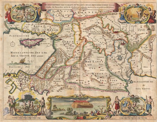
De Gelegentheyt van 't Paradys ende 't Land Canaan mitsgaders de eerste bewoonde landen Der Patriarchen, uyt de H. schrifture en verscheyden Auctoren bij een gestelt door
sold
- Digital Map Information
- Suitable for large format printing
- DPI: 300
- File Size: 10.54 MB
- File Type: ZIP / TIFF
- ICC color profile embedded
- Delivered instantly via download link
This is a splendid early example of Daniel Stoopendaal and Jacob Keur's 1702 map of the Holy Land, or as it is titled (in rough translation) 'Paradise, or the Garden of Eden, with the countries adjacent as inhabited by the Patriarchs.' Covers ... (more details)
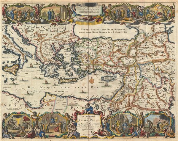
De Beschryvingh van de Reysen Pauli, en van de Andere Apostelen.
sold
- Digital Map Information
- Suitable for large format printing
- DPI: 300
- File Size: 11.32 MB
- File Type: ZIP / TIFF
- ICC color profile embedded
- Delivered instantly via download link
This is a splendid early example of Daniel Stoopendaal and Jacob Keur's 1702 map of the travels of the Apostle Paul. The map covers the eastern Mediterranean from Sicily to the Holy Land and inland as far as the Persian Gulf and the Caspian ... (more details)
An fascinating fictional plan of Jerusalem.
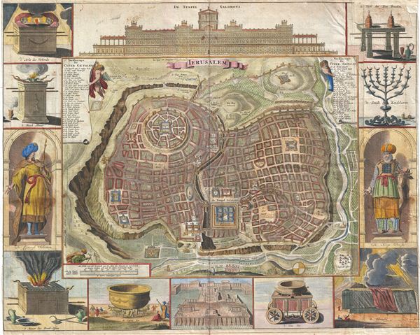
Ierusalem.
sold
- Digital Map Information
- Suitable for large format printing
- Full resolution TIFF file
- ICC color profile embedded
- Delivered instantly via download link
A remarkable imaginary 1702 plan of Jerusalem drawn by Daniel Stoopendaal but based upon an early work by Juan Bautista Villalpando. Villalpando's popular fictive view of Jerusalem first appeared in a 1604 commentary on Ezekiel co-written ... (more details)
Early 18th century world map with decorative borders showing an insular California.

Orbis Terrarum Tabula Recens Emendata et in Lucem Edita.
sold
- Digital Map Information
- Suitable for large format printing
- DPI: 300
- File Size: 11.78 MB
- File Type: ZIP / TIFF
- ICC color profile embedded
- Delivered instantly via download link
A fine 1702 world map was drawn by Daniel Stoopendaal for publication in the Keur Bible. Based on Visscher's very similar map of 1663, this map depicts the world on a hemisphere projection surrounded by stunning allegorical cartouche ... (more details)
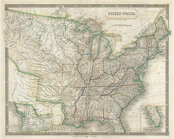
United States.
sold
- Digital Map Information
- Suitable for large format printing
- DPI: 300
- File Size: 15.12 MB
- File Type: ZIP / TIFF
- ICC color profile embedded
- Delivered instantly via download link
A beautiful example of Sidney Hall's 1835 map of the United States. Hall's map covers the United States from the Atlantic seaboard westward as far as Oregon and the Pacific and from the Great Lakes southwards to southern Florida. ... (more details)
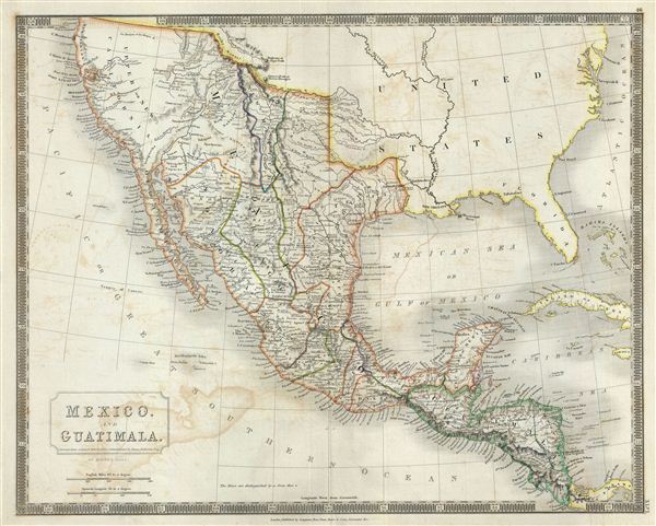
Mexico and Guatimala.
sold
- Digital Map Information
- Suitable for large format printing
- DPI: 300
- File Size: 13.69 MB
- File Type: ZIP / TIFF
- ICC color profile embedded
- Delivered instantly via download link
This is a beautiful map of Mexico and Guatemala from Sidney Hall's extremely scarce 1835 New General Atlas . It covers from Upper California and New Albion south to Guatemala, including the modern day regions of California, New ... (more details)
One of the eariest maps to accurately show the true Northwest Passage.

British North America.
sold
- Digital Map Information
- Suitable for large format printing
- DPI: 300
- File Size: 14.55 MB
- File Type: ZIP / TIFF
- ICC color profile embedded
- Delivered instantly via download link
This is a fascinating map of British North America or Canada from Sidney Hall's extremely scarce 1835 New General Atlas . It covers from the North Georgian Islands to the United States including Greenland, Iceland and Russian ... (more details)

West Indies.
sold
- Digital Map Information
- Suitable for large format printing
- DPI: 300
- File Size: 16.09 MB
- File Type: ZIP / TIFF
- ICC color profile embedded
- Delivered instantly via download link
This is a beautiful map of the West Indies from Sidney Hall's extremely scarce 1835 New General Atlas . Centered on the island of Hispaniola (Santo Domingo), it covers the Caribbean from southern Florida, south as far as the ... (more details)

Canada, New Brunswick and Nova Scotia.
sold
- Digital Map Information
- Suitable for large format printing
- DPI: 300
- File Size: 14.06 MB
- File Type: ZIP / TIFF
- ICC color profile embedded
- Delivered instantly via download link
This is a beautiful map of Canada and the Great Lakes from Sidney Hall's extremely scarce 1835 New General Atlas . It covers Upper Canada (Ontario), Lower Canada (Quebec), Nova Scotia, New Brunswick and Prince Edward Island ... (more details)
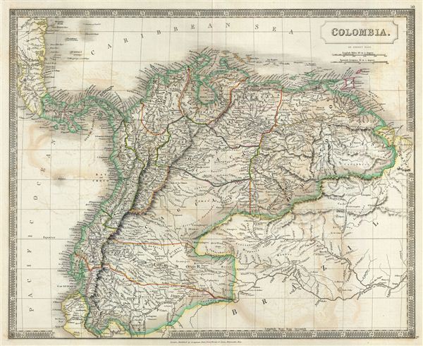
Colombia.
sold
- Digital Map Information
- Suitable for large format printing
- DPI: 300
- File Size: 15.29 MB
- File Type: ZIP / TIFF
- ICC color profile embedded
- Delivered instantly via download link
This is a beautiful map of Colombia, or Gran Colombia, from Sidney Hall's extremely scarce 1835 New General Atlas . This map covers Gran Colombia or Great Colombia, which included territories of modern day Colombia, ... (more details)
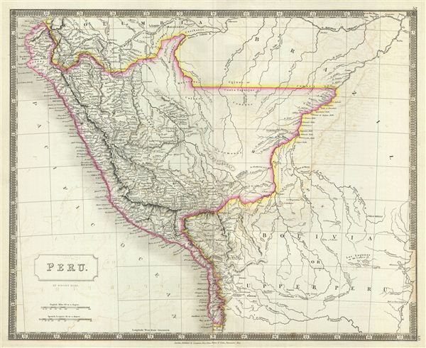
Peru.
sold
- Digital Map Information
- Suitable for large format printing
- DPI: 300
- File Size: 13.18 MB
- File Type: ZIP / TIFF
- ICC color profile embedded
- Delivered instantly via download link
This is a beautiful map of the Peru from Sidney Hall's extremely scarce 1835 New General Atlas . It covers all of Peru as well as significant portions of modern day Brazil and Bolivia. Peru's claim to the Tarapaca ... (more details)