
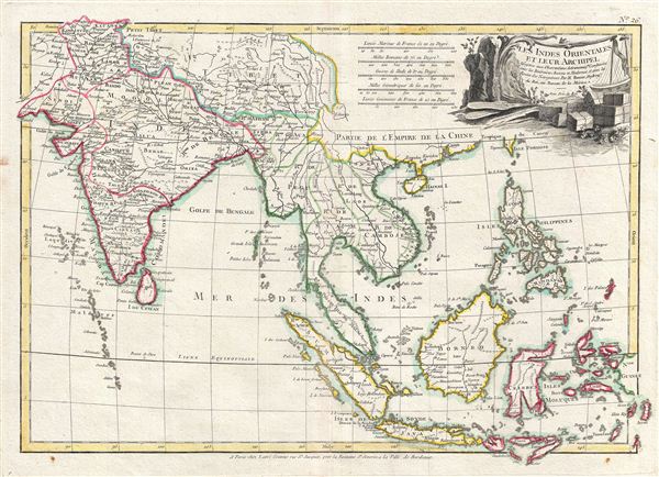
Les Indes Orientales et leur archipel. Assujettie aux observations astronomiq(u)es combinees avec les itineraires anciens et modernes, et avec les routes des navigateurs.
sold
- Digital Map Information
- Suitable for large format printing
- DPI: 300
- File Size: 8.94 MB
- File Type: ZIP / TIFF
- ICC color profile embedded
- Delivered instantly via download link
A beautiful example of Rigobert Bonne's 1783 map of India, Southeast Asia and the east Indies. The map covers from Kandahar and the Maldives eastward to include all of India, Southeast Asia (modern Burma, Thailand or Siam, Malaysia, Cambodia, Vietnam, Laos), the ... (more details)
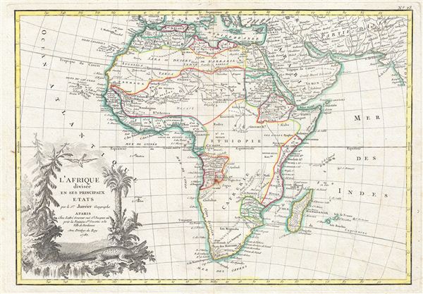
L'Afrique divisee en ses Principaux Etats.
sold
- Digital Map Information
- Suitable for large format printing
- Full resolution TIFF file
- ICC color profile embedded
- Delivered instantly via download link
A fine example of Jean Janvier's 1782 map of Africa. Janvier's map covers the entire continent of Africa as well as the island of Madagascar and adjacent parts of europe, Arabia, and Persia. Like most 18th century maps of Africa, the present example is rife ... (more details)
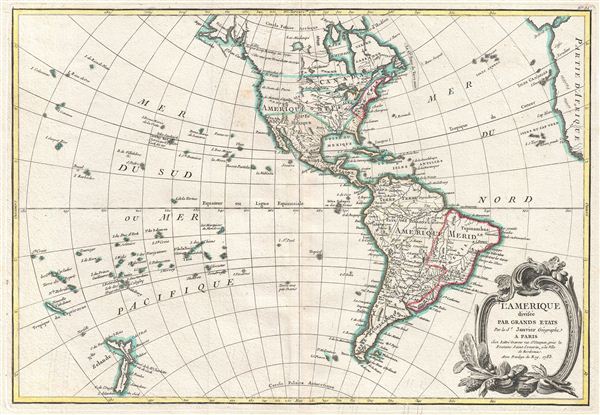
L'Amerique divisee Par Grands Etats.
sold
- Digital Map Information
- Suitable for large format printing
- DPI: 300
- File Size: 7.65 MB
- File Type: ZIP / TIFF
- ICC color profile embedded
- Delivered instantly via download link
An altogether fascinating map of North America and South America by Jean Janvier dating to 1883. Covers both continents from the Antarctic Circle to the Arctic Circle, extends westward to New Zealand and eastward as far as Africa and Spain. The 'Sea of the ... (more details)
The Sea of the West at its highest expression.
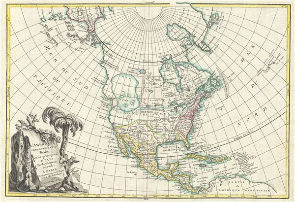
L'Amerique Septentrionale Divisee en ses Principaux Etats.
sold
- Digital Map Information
- Suitable for large format printing
- DPI: 300
- File Size: 8.63 MB
- File Type: ZIP / TIFF
- ICC color profile embedded
- Delivered instantly via download link
An altogether fascinating first edition example of Jean Janvier 1762 map of North America, including one of the most ambitions depictions of the Sea of the West in any map. The map covers the continent from Panama to the Arctic Circle, extends westward to include parts of Asia and eastward as far as Iceland. This map, which is heavily influenced by the theoretical mappings of Guillaume de l'Isle and Philippe Buache, went through several states of which this is the first and possibly the most interesting. Javier divides the continent according to the three colonial powers that controlled it, with England controlling the colonies along the east coast, France occupying Canada and Louisiana, and Spain dominating Mexico, Florida, Cuba and Central America. (more details)

Carte geo-hydrographique du Golfe du Mexique et de ses isles. Construit d'apres les memoires les plus recens, et assujeties, pour l'emplacement de ces principales positions aux latitudes et longitudes, determinées par observation.
sold
- Digital Map Information
- Suitable for large format printing
- DPI: 300
- File Size: 9.21 MB
- File Type: ZIP / TIFF
- ICC color profile embedded
- Delivered instantly via download link
A beautiful example of Zannoni's 1762 map of the West Indies, Florida and Central America. Covers from the Gulf of Mexico to the Lesser Antilles including all of the West Indies, Florida and Central America, with parts of Louisiana, Mexico and northern ... (more details)
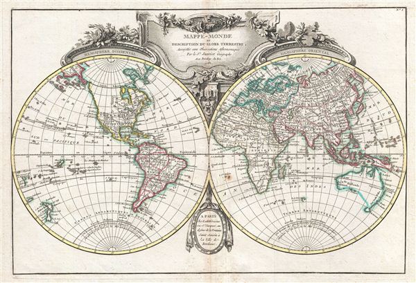
Mappe-Monde ou Description du Globe Terrestre, Assujettie aux Observations Astronomiques.
sold
- Digital Map Information
- Suitable for large format printing
- Full resolution TIFF file
- ICC color profile embedded
- Delivered instantly via download link
A beautiful and impressive map of the world drawn by Jean Janvier in 1782. Depicts the entire world on a double hemisphere projection. North America appears with a fair approximation of accuracy though the western and northwestern regions remain either ... (more details)
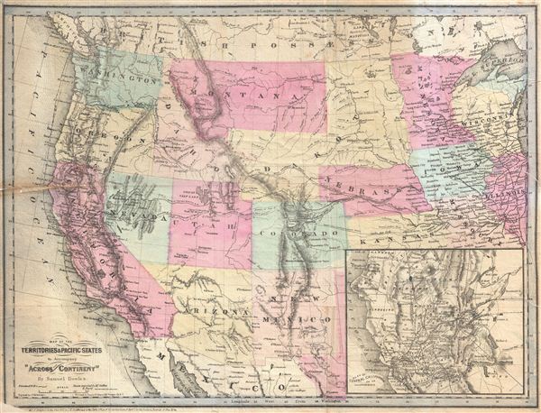
Map of the Territories & Pacific States to Accompany 'Across the Continent' by Samuel Bowles.
sold
- Digital Map Information
- Suitable for large format printing
- File Size: 8.6 MB
- File Type: ZIP / TIFF
- ICC color profile embedded
- Delivered instantly via download link
A highly appealing 1865 map of the western parts of the United States drawn to illustrate Samuel Bowles' Across the Continent . The map covers from the Pacific Ocean to Illinois and the Great Lakes. It is notable for its detailed inclusion of ... (more details)
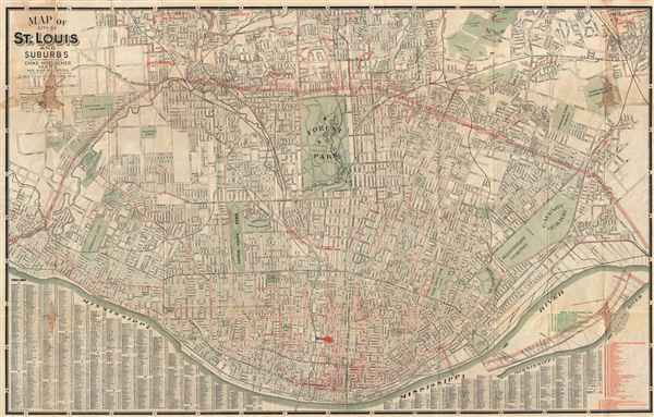
Map of City of St. Louis and Suburbs.
sold
- Digital Map Information
- Suitable for large format printing
- File Size: 45.48 MB
- File Type: ZIP / TIFF
- ICC color profile embedded
- Delivered instantly via download link
An impressive 1929 large format pocket map of St. Louis, Missouri, and its suburbs. This map was drawn by H. W. Gross and published by Chas Hoelscher Maps of 203 Pine Street, St. Louis, Missouri. Centered on Forest Park, this map covers all of ... (more details)
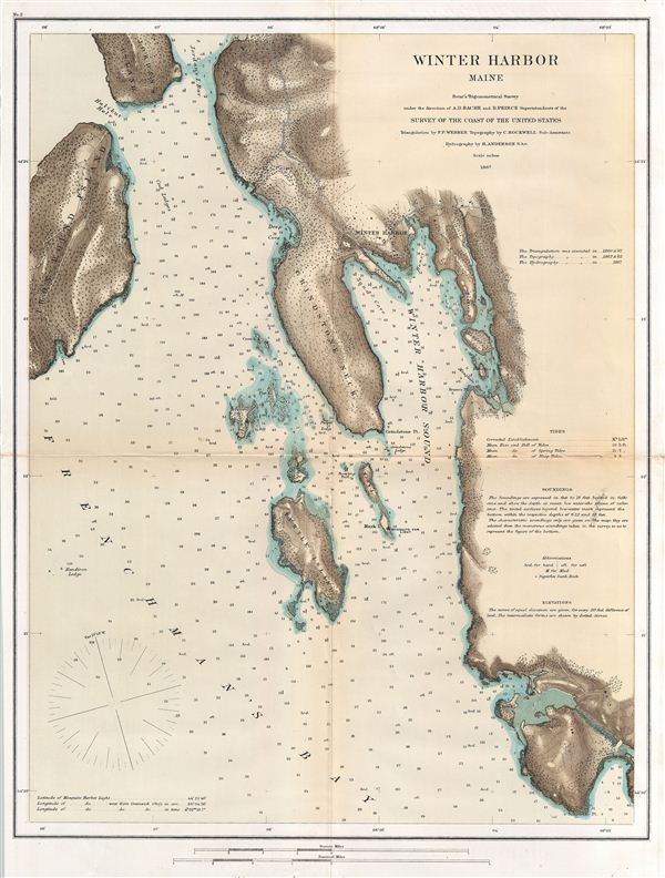
Winter Harbor Maine.
sold
- Digital Map Information
- Suitable for large format printing
- File Size: 8.03 MB
- File Type: ZIP / TIFF
- ICC color profile embedded
- Delivered instantly via download link
An uncommon U.S. Coast Survey map of Winter Harbor Maine. The map covers the eastern shore of Frenchman's Bay and Winter Harbor Sound from Jordan's Island, Halibut Hole, and Iron Bound Island eastward as far as Mosquito Harbor and south to ... (more details)

[Sacramento Valley]
sold
- Digital Map Information
- Suitable for large format printing
- File Size: 19.54 MB
- File Type: ZIP / TIFF
- ICC color profile embedded
- Delivered instantly via download link
A curious and attractive 1939 Newton Pratt pictorial map of the Sacramento Valley. This map covers from the Oregon border south as far as San Francisco Bay and eastwards from the Pacific Ocean to Yosemite National Park. Historic sites and ... (more details)

Clason's Guide Map of Wyoming.
sold
- Digital Map Information
- Suitable for large format printing
- File Size: 15.95 MB
- File Type: ZIP / TIFF
- ICC color profile embedded
- Delivered instantly via download link
An uncommon 1920 pocket map of Wyoming by George Clason. The map covers the entire state of Wyoming including Yellowstone National Park, and the surrounding Teton National Forest, Wyoming National Forest, Washakie National Forest, and ... (more details)
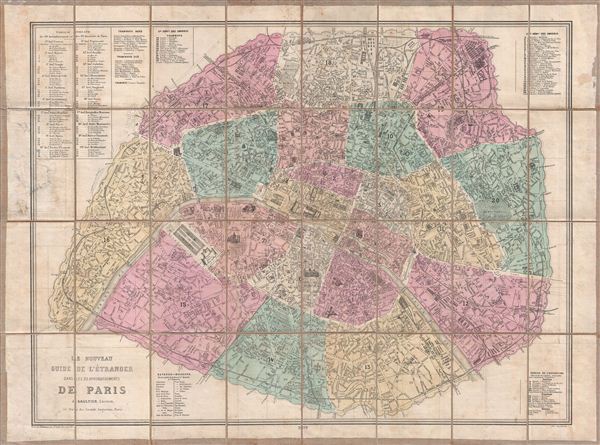
Le Nouveau Guide de l'Etranger Dans les 20 Arrondissements de Paris.
sold
- Digital Map Information
- Suitable for large format printing
- File Size: 29.5 MB
- File Type: ZIP / TIFF
- ICC color profile embedded
- Delivered instantly via download link
A fine 1878 map of Paris designed by J. Gaultier to capitalizes on international tourism associated with the 1878 exposition Universelle . Centered on the Seine River, this map details the embastilled center of Paris from the Pte. ... (more details)
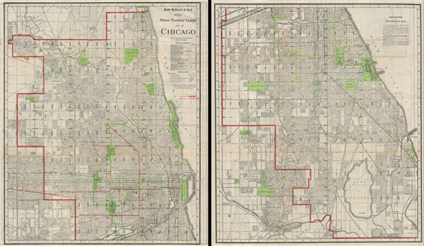
New Street Number Guide Map of Chicago.
sold
- Digital Map Information
- Suitable for large format printing
- File Size: 54.97 MB
- File Type: ZIP / TIFF
- ICC color profile embedded
- Delivered instantly via download link
An uncommon 1910 map of Chicago, Illinois by Rand McNally and Company. The Rand McNally Company issued this enormous pocket map to illustrate their home city in incredible detail. The map is printed on two sides of a single sheet ... (more details)
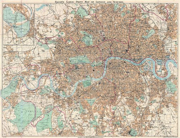
Bacon's Large-Print Map of London and Suburbs.
sold
- Digital Map Information
- Suitable for large format printing
- File Size: 45.27 MB
- File Type: ZIP / TIFF
- ICC color profile embedded
- Delivered instantly via download link
An uncommon 1882 map of London and its immediate suburbs by G. W. Bacon. Centered on the Thames River, the map covers from Old dear Park to Greenwich Park and the east India Dock, as well as from Hampstead Heath in the north to ... (more details)
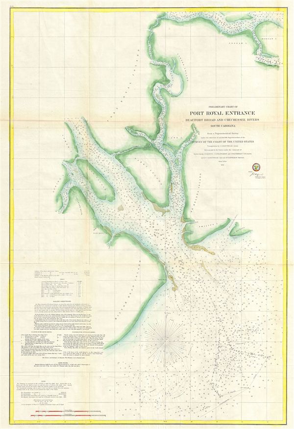
Preliminary Chart of Port Royal Entrance Beaufort Chechessee and Colleton Rivers South Carolina.
sold
- Digital Map Information
- Suitable for large format printing
- File Size: 19.6 MB
- File Type: ZIP / TIFF
- ICC color profile embedded
- Delivered instantly via download link
A fine example of the U.S. Coast Survey nautical chart or maritime map of Port Royal entrance, South Carolina. Port Royal entrances is an inlet from the Atlantic between Savannah, Georgia and Charleston, South Carolina. This ... (more details)
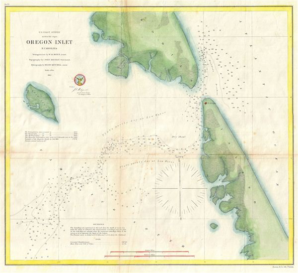
Oregon Inlet, N. Carolina.
sold
- Digital Map Information
- Suitable for large format printing
- File Size: 7.67 MB
- File Type: ZIP / TIFF
- ICC color profile embedded
- Delivered instantly via download link
A fine example of the U.S. Coast survey map of Oregon Inlet, N. Carolina. The map covers the inlet as well as parts of Bodie Island, Pea Island, and Duck Island. This inlet, located on North Carolina's Outer Banks, provides ... (more details)

Johnson's Georgetown and the City of Washington the Capital of the United States of America.
sold
- Digital Map Information
- Suitable for large format printing
- File Size: 9.71 MB
- File Type: ZIP / TIFF
- ICC color profile embedded
- Delivered instantly via download link
A beautiful example of A. J. Johnson's 1864 map of Washington D.C. and Georgetown. Offers a fascinating snapshot of the Union capital in the midst of the American Civil War. Shows the city in considerable detail with color ... (more details)
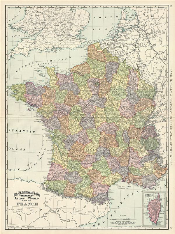
Map of France.
sold
- Digital Map Information
- Suitable for large format printing
- File Size: 23.57 MB
- File Type: ZIP / TIFF
- ICC color profile embedded
- Delivered instantly via download link
This is a beautiful example of Rand McNally and Company's 1892 map of France. It covers all of France subdivided according to its various departments. An inset map on the lower right quadrant details Corsica. The French ... (more details)

Map of Germany (Western Sheet).
sold
- Digital Map Information
- Suitable for large format printing
- File Size: 22.56 MB
- File Type: ZIP / TIFF
- ICC color profile embedded
- Delivered instantly via download link
This is a beautiful example of Rand McNally and Company's 1891 map of western Germany. It covers the western portion of the German empire, mainly focusing on modern day Germany. It includes the modern day nations of ... (more details)

Map of Manitoba.
sold
- Digital Map Information
- Suitable for large format printing
- File Size: 8.94 MB
- File Type: ZIP / TIFF
- ICC color profile embedded
- Delivered instantly via download link
This is a beautiful example of Rand McNally and Company's 1892 map of Manitoba, Canada. It covers only part of modern day Manitoba from the Porcupine Mountains to Provencher. Winipeg, its capital and largest city is ... (more details)