

Map of Ontario.
sold
- Digital Map Information
- Suitable for large format printing
- File Size: 24 MB
- File Type: ZIP / TIFF
- ICC color profile embedded
- Delivered instantly via download link
This is a beautiful example of Rand McNally and Company's 1892 map of Ontario, Canada. Centered on Lake Ontario, the map covers Upper or West Canada from essex to Prescott. Four inset maps in the lower right quadrant detail the western portion of Ontario, River ... (more details)
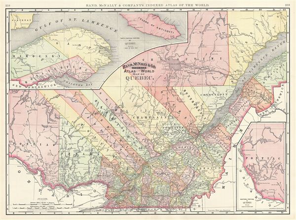
Map of Quebec.
sold
- Digital Map Information
- Suitable for large format printing
- File Size: 20.56 MB
- File Type: ZIP / TIFF
- ICC color profile embedded
- Delivered instantly via download link
This is a beautiful example of Rand McNally and Company's 1892 map of Quebec, Canada. Centered on the St. Lawrence River Valley, this map of the Canadian province Quebec, or Canada east, covers from Pontiac to Saguenay, north as far as Lake Pipmuakan in ... (more details)

Map of Palestine.
sold
- Digital Map Information
- Suitable for large format printing
- File Size: 9.3 MB
- File Type: ZIP / TIFF
- ICC color profile embedded
- Delivered instantly via download link
This is a beautiful example of Rand McNally and Company's 1892 map of Israel, Palestine, or the Holy Land. The map includes the modern day nations of Israel, Palestine and Lebanon with parts of adjacent Syria and Jordan. Both ancient and contemporary ... (more details)
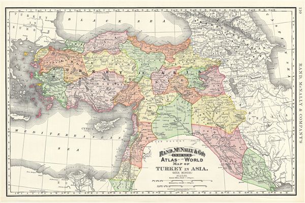
Map of Turkey in Asia. (Asia Minor).
sold
- Digital Map Information
- Suitable for large format printing
- File Size: 4.16 MB
- File Type: ZIP / TIFF
- ICC color profile embedded
- Delivered instantly via download link
This is a beautiful example of Rand McNally and Company's 1892 map of Turkey in Asia or Asia Minor. It covers from the Black Sea to the Mediterranean and from the Aegean Sea east as far as the Caspian Sea. The map essentially covers the late-19th ... (more details)
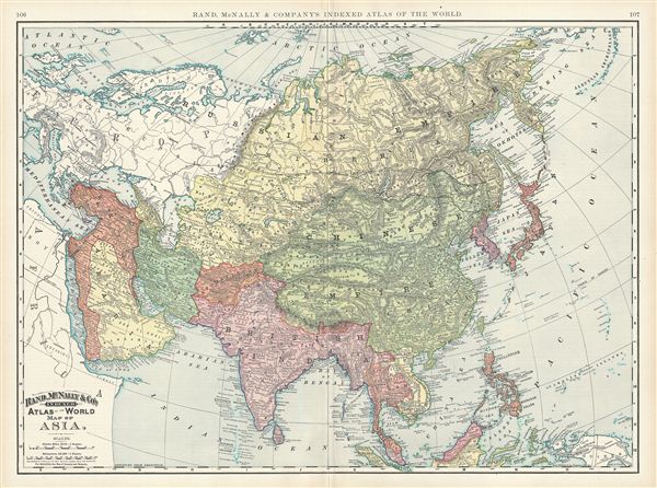
Map of Asia.
sold
- Digital Map Information
- Suitable for large format printing
- File Size: 23.83 MB
- File Type: ZIP / TIFF
- ICC color profile embedded
- Delivered instantly via download link
This is a beautiful example of Rand McNally and Company's 1892 map of Asia. It covers from the Arctic Ocean south as far as Sumatra and from the Arabian Peninsula and Turkey eastward as far as Kamchatka, Japan, the Philippines and New Guinea. It ... (more details)

Map of Russia.
sold
- Digital Map Information
- Suitable for large format printing
- File Size: 19.79 MB
- File Type: ZIP / TIFF
- ICC color profile embedded
- Delivered instantly via download link
This is a beautiful example of Rand McNally and Company's 1892 map of european Russia. It covers from Nova Zembla to Transcaucasia. Russia during this time was under the rule of Alexander III, who, after the assassination of his father Tzar ... (more details)

Map of Sweden and Norway.
sold
- Digital Map Information
- Suitable for large format printing
- File Size: 8.97 MB
- File Type: ZIP / TIFF
- ICC color profile embedded
- Delivered instantly via download link
This is a beautiful example of Rand McNally and Company's 1891 map of Sweden and Norway. It covers from Finmark in Norway to Gothland in Sweden. During the latter half of the 19th century, due to Sweden's predominantly agricultural and ... (more details)
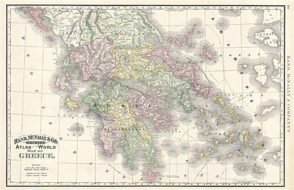
Map of Greece.
sold
- Digital Map Information
- Suitable for large format printing
- File Size: 10.04 MB
- File Type: ZIP / TIFF
- ICC color profile embedded
- Delivered instantly via download link
This is a beautiful example of Rand McNally and Company's 1892 map of Greece. It covers from Corfu to Cythera and includes the Cyclades. Although Greece gained independence from the Ottoman empire in 1832 under the Treaty of ... (more details)
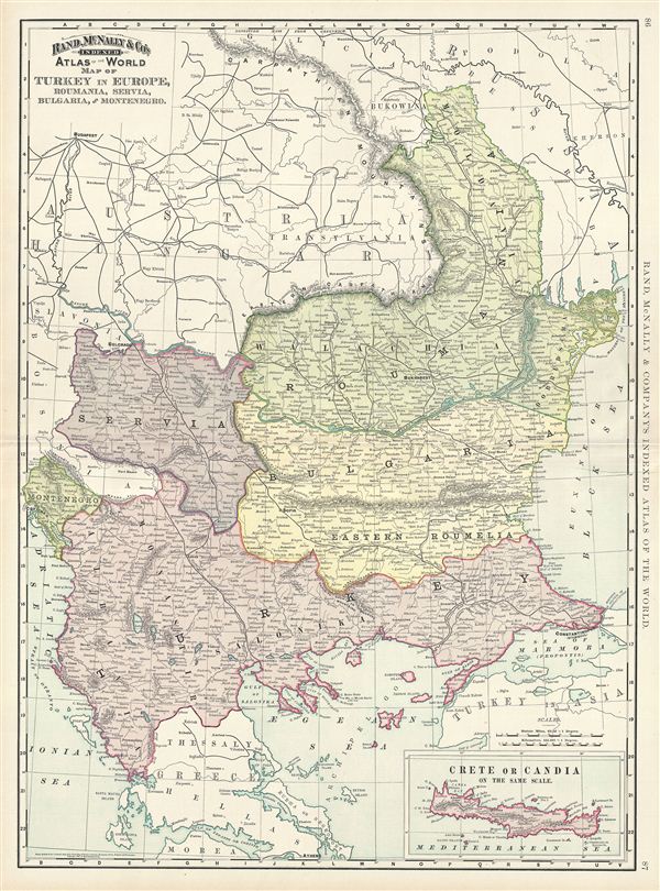
Map of Turkey in Europe, Roumania, Servia, Bulgaria and Montenegro.
sold
- Digital Map Information
- Suitable for large format printing
- File Size: 18.41 MB
- File Type: ZIP / TIFF
- ICC color profile embedded
- Delivered instantly via download link
This is a beautiful example of Rand McNally and Company's 1892 map of european Turkey. It covers Rumelia including modern day Romania, Bulgaria, Serbia, Montenegro, Albania, Macedonia and part of Greece. An inset in the ... (more details)

Map of Austria-Hungary.
sold
- Digital Map Information
- Suitable for large format printing
- File Size: 22.73 MB
- File Type: ZIP / TIFF
- ICC color profile embedded
- Delivered instantly via download link
This is a beautiful example of Rand McNally and Company's 1891 map of Austria-Hungary or the Austro-Hungarian empire. It covers the territories claimed by the once vast Austro-Hungarian empire, including in whole or part ... (more details)
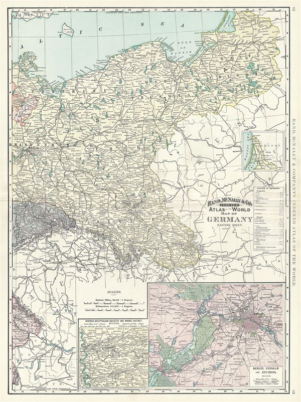
Map of Germany (Eastern Sheet).
sold
- Digital Map Information
- Suitable for large format printing
- File Size: 21.49 MB
- File Type: ZIP / TIFF
- ICC color profile embedded
- Delivered instantly via download link
This is a beautiful example of Rand McNally and Company's 1891 map of eastern Germany. It covers the eastern portion of the then German empire, mainly focusing on the Kingdom of Prussia. It includes the modern day ... (more details)
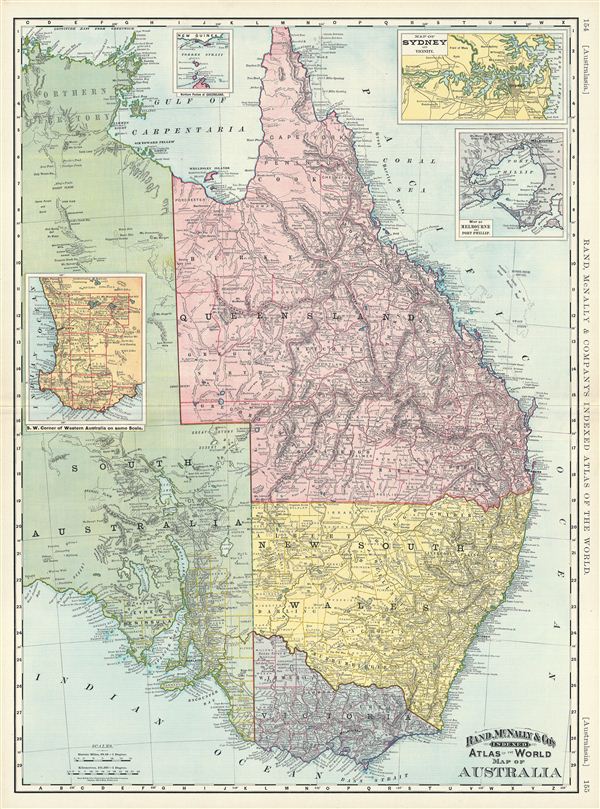
Map of Australia.
sold
- Digital Map Information
- Suitable for large format printing
- File Size: 25.66 MB
- File Type: ZIP / TIFF
- ICC color profile embedded
- Delivered instantly via download link
This is a beautiful example of Rand McNally and Company's 1892 map of eastern Australia. It covers the eastern half of the continent from Crocker Island to the Bass Strait. The provinces of Queensland, New South ... (more details)

Map of New Zealand, Tasmania, and the Fiji Islands.
sold
- Digital Map Information
- Suitable for large format printing
- File Size: 9.84 MB
- File Type: ZIP / TIFF
- ICC color profile embedded
- Delivered instantly via download link
This is a beautiful example of Rand McNally and Company's 1892 map of New Zealand. It covers It covers the entire island country from Cape Reinga (C. Maria Van Diemen) to Stewart Island. An inset map in the ... (more details)
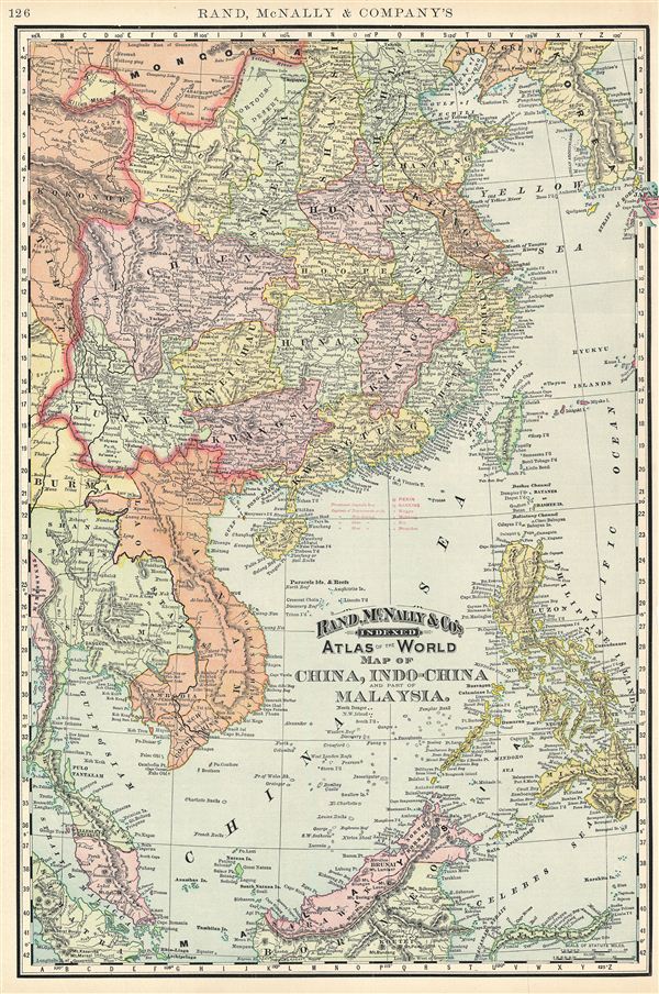
Map of China, Indo-China and part of Malaysia.
sold
- Digital Map Information
- Suitable for large format printing
- File Size: 11.46 MB
- File Type: ZIP / TIFF
- ICC color profile embedded
- Delivered instantly via download link
This is a beautiful example of Rand McNally and Company's 1895 map of China, Southeast Asia, and the Philippines. It covers from Korea south as far as Borneo and from Burma to the western tip of Japan. The ... (more details)
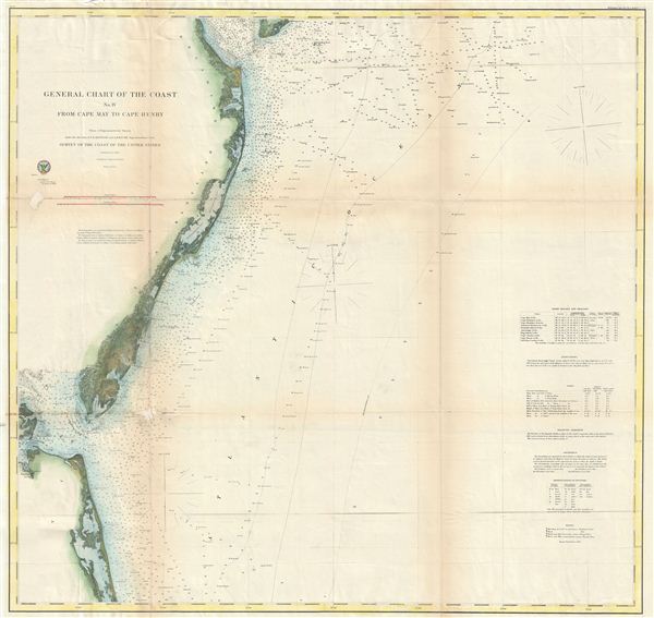
General Chart of the Cost No. IV From Cape May to Cape Henry.
sold
- Digital Map Information
- Suitable for large format printing
- File Size: 22.18 MB
- File Type: ZIP / TIFF
- ICC color profile embedded
- Delivered instantly via download link
An uncommon and highly appealing 1862 U.S. Coast Survey nautical chart or maritime map of Atlantic Coast of Delaware, Maryland, and Virginia. The map covers from the entrance to Delaware Bay (and Cape May) ... (more details)

General Chart of the Coast No. V From Cape Henry to Cape Lookout.
sold
- Digital Map Information
- Suitable for large format printing
- File Size: 23.19 MB
- File Type: ZIP / TIFF
- ICC color profile embedded
- Delivered instantly via download link
A fine example of the 1867 edition of the U. S. Coast Survey's General Chart of the Coast No. V. The chart covers from the entrance to the Chesapeake Bay and Cape Henry southwards as far as Cape Lookout, ... (more details)
Among the most ephemeral of all Johnson Maps, appearing in just one edition of his atlas.
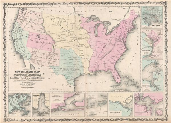
Johnson's New Military Map of the United States showing the Forts, Military Posts & all the Military Divisions with Enlarged Plans of Southern Harbors.
sold
- Digital Map Information
- Suitable for large format printing
- File Size: 13.83 MB
- File Type: ZIP / TIFF
- ICC color profile embedded
- Delivered instantly via download link
A scarce and underappreciated 1861 map by A. J. Johnson showing the military deportment of the United States in 1860, just prior to the outbreak of the American Civil War. The map covers the entire ... (more details)

Plan of Plymouth.
sold
- Digital Map Information
- Suitable for large format printing
- File Size: 6.28 MB
- File Type: ZIP / TIFF
- ICC color profile embedded
- Delivered instantly via download link
An uncommon c. 1930 map of Plymouth, england, by Geographia Ltd. The map covers Plymouth from the Hamoaze and Plymouth Sound to the River Plym and Crown Hill. The map identifies all streets, parks, ... (more details)
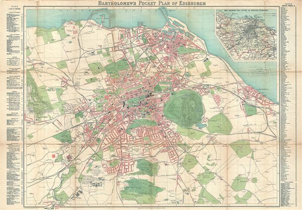
Bartholomew's Pocket Map of Edinburgh.
$300.00
Acquire
- Digital Map Information
- Suitable for large format printing
- File Size: 22.18 MB
- File Type: ZIP / TIFF
- ICC color profile embedded
- Delivered instantly via download link
A scarce c. 1900 map of Edinburgh, Scotland, by John Bartholomew. The map covers Edinburgh from Firth of Forth south as far as Colinton, and from the Ravelston Golf Course eastward as far as ... (more details)

Bacon's Map of Liverpool Corrected to the Present Time.
sold
- Digital Map Information
- Suitable for large format printing
- File Size: 25.86 MB
- File Type: ZIP / TIFF
- ICC color profile embedded
- Delivered instantly via download link
This is Bacon's scarce c. 1885 travellers pocket map of Liverpool, england. Cartographically Bacon derived this map from the Ordinance Survey with embellishments including quarter mile grid ... (more details)