

Plan du Combat de Salamine Pour le Voyage du Jeune Anacharsis.
sold
- Digital Map Information
- Suitable for large format printing
- DPI: 300
- File Size: 7.23 MB
- File Type: ZIP / TIFF
- ICC color profile embedded
- Delivered instantly via download link
This is a fascinating 1785 map of the naval Battle of Salamis fought between the Greeks and the Persians. The map depicts the 480 BC Battle of Salamis, one of the most important conflicts in ancient Greek history. According to the historian Herodotus, the Greek ... (more details)

Carte du Palus Meotide et du Pont Euxin, Pour le Voyage du jeune Anacharsis.
sold
- Digital Map Information
- Suitable for large format printing
- DPI: 300
- File Size: 3.41 MB
- File Type: ZIP / TIFF
- ICC color profile embedded
- Delivered instantly via download link
This is an attractive 1791 map of the Black Sea and the Sea of Azov. Take from an earlier D'Anville map, Barbie de Bocage's map covers the Black Sea (Pont euxin), the Crimea, and the Sea of Azov (Lake Maeotis), identifying various sites along their shores. It ... (more details)
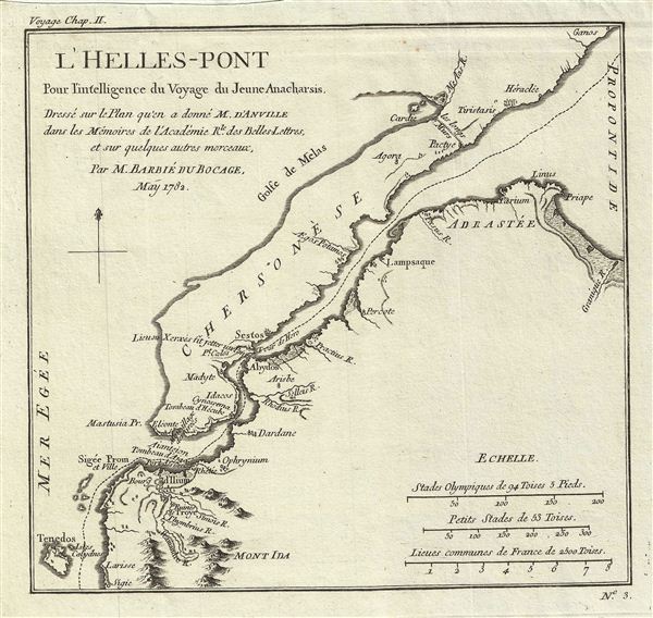
l'Helles-Pont Pour l'intelligence du Voyage du Jeune Anacharsis.
sold
- Digital Map Information
- Suitable for large format printing
- DPI: 300
- File Size: 2.35 MB
- File Type: ZIP / TIFF
- ICC color profile embedded
- Delivered instantly via download link
This is a fascinating 1782 map of the Hellespont (Dardanelles) in antiquity. Cartographically based on an earlier chart by D'Anville, Barbie de Bocage's map covers the narrow strait connecting the Aegean Sea and the Sea of Marmara. Referring to the account of ... (more details)

Plan de l'Academie et de ses Environs Pour le Voyage du Jeune Anacharsis.
sold
- Digital Map Information
- Suitable for large format printing
- DPI: 300
- File Size: 2.58 MB
- File Type: ZIP / TIFF
- ICC color profile embedded
- Delivered instantly via download link
This is a fascinating 1784 plan of Plato's Academy in Athens, ancient Greece. The map covers the vicinity of the Platonic seat of learning in ancient Athens. Founded by the philosopher Plato, the Academy nurtured the genius of Aristotle, among others. ... (more details)
Home to the Great Oracle of Delphi, considered by ancient Greeks to be the center of the world.

Essai sur les Environs de Delhes Pour le Voyage du Jeune Anacharsis.
sold
- Digital Map Information
- Suitable for large format printing
- DPI: 300
- File Size: 2.27 MB
- File Type: ZIP / TIFF
- ICC color profile embedded
- Delivered instantly via download link
This is a fascinating 1787 map or plan of Delphi and its vicinity in Ancient Greece. The map covers the region from the Crissean Gulf to Amfissa. The top portion of the map contains a view of Delphi and the Rocks of Parnassus. Parnassus, in Greek ... (more details)

Les Cyclades Pour le Voyage du Jeune Anacharsis.
sold
- Digital Map Information
- Suitable for large format printing
- DPI: 300
- File Size: 2.2 MB
- File Type: ZIP / TIFF
- ICC color profile embedded
- Delivered instantly via download link
This is a fascinating 1791 map of the Cyclades, the island group in the Aegean Sea, in Ancient Greece. The map covers Andros to Anafe. An inset in the upper right quadrant of the map details the island of Delos. According to Greek mythology the ... (more details)

l'Arcadie, Pour le Voyage du Jeune Anacharsis.
sold
- Digital Map Information
- Suitable for large format printing
- DPI: 300
- File Size: 2.57 MB
- File Type: ZIP / TIFF
- ICC color profile embedded
- Delivered instantly via download link
This is an attractive 1786 map of Arcadia in Ancient Greece by M. Barbie de Bocage. Bocage based this chart on an earlier map by D'Anville. Arcadia, according to Greek mythology was the home of the God Pan. It is surrounded by Achaea in the ... (more details)

La Laconie et l'Isle de Cythere Pour le Voyage du Jeune Anacharchis.
sold
- Digital Map Information
- Suitable for large format printing
- DPI: 300
- File Size: 4.11 MB
- File Type: ZIP / TIFF
- ICC color profile embedded
- Delivered instantly via download link
This is a fascinating 1791 map of the regions of Laconia and the island of Cythera in Ancient Greece. Based on an earlier map by D'Anville, this chart covers the ancient regions from the Gulf of Messinia to the Gulf of Argos and includes the ... (more details)

Plan d'Athenes Pour le Voyage du Jeune Anacharsis.
sold
- Digital Map Information
- Suitable for large format printing
- DPI: 300
- File Size: 4.56 MB
- File Type: ZIP / TIFF
- ICC color profile embedded
- Delivered instantly via download link
This is an attractive 1791 map of ancient Athens, Greece. Covering the walled center of ancient Athens, this map details the ancient city's most important buildings and monuments. Names the Lyceum (Aristotle's famous school of philosophy) ... (more details)
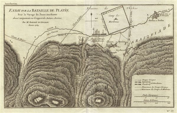
Essai sur la Bataille de platee Pour le Voyage du Jeune Anacharsis dresse uniquement sur le rapport des Auteurs Anciens.
sold
- Digital Map Information
- Suitable for large format printing
- Full resolution TIFF file
- ICC color profile embedded
- Delivered instantly via download link
This is a fascinating 1784 map showing the Battle of Plataea by Barbie du Bocage. The battle of Plataea occurred in 479 BC and was the last battle in the second Persian invasion of Greece. It took place near the city of Plataea in ... (more details)

La Thessalie Pour le Voyage du Jeune Anacharsis.
sold
- Digital Map Information
- Suitable for large format printing
- DPI: 300
- File Size: 4.25 MB
- File Type: ZIP / TIFF
- ICC color profile embedded
- Delivered instantly via download link
This lovely little map of Thessaly, just south of Macedonia in Ancient Greece, was prepared by M. Barbie de Bocage, after D'Anville, for the 1788 Travels of Anacharsis . Thessaly is the legendary seat of Phthiotis, home of Achilles ... (more details)

La Messenie Pour le Voyage du Jeune Anacharsis.
sold
- Digital Map Information
- Suitable for large format printing
- DPI: 300
- File Size: 2.9 MB
- File Type: ZIP / TIFF
- ICC color profile embedded
- Delivered instantly via download link
This lovely little map of Messenia, in the southeast of Ancient Greece, was prepared by M. Barbie de Bocage, after D'Anville, for the 1785 Travels of Anacharsis . This peninsula and gulf just south of Arcadia and west of Laconia, ... (more details)

Essai sur la Topographie de Sparte et de ses Environs Pour le Voyage du Jeune Anacharsis.
sold
- Digital Map Information
- Suitable for large format printing
- DPI: 300
- File Size: 5.07 MB
- File Type: ZIP / TIFF
- ICC color profile embedded
- Delivered instantly via download link
This lovely little map of Sparta, in the west of Ancient Greece, was prepared by M. Barbie de Bocage, after D'Anville, for the 1785 Travels of Anacharsis . Unlike its rival city Athens, Sparta left very little in terms of ... (more details)

Plan du Bosphore de Thrace Pour le Voyage du Jeune Anacharsis.
sold
- Digital Map Information
- Suitable for large format printing
- DPI: 300
- File Size: 4.41 MB
- File Type: ZIP / TIFF
- ICC color profile embedded
- Delivered instantly via download link
This lovely map, depicting the Bosphorus and the city of Byzantium (modern day Istanbul), was prepared by M. Barbie de Bocage, after D'Anville, for the 1785 Travels of Anacharsis . The map shows the narrow naval passage ... (more details)

Plan des Environs d'Athenes Pour le Voyage du Jeune Anacharsis.
sold
- Digital Map Information
- Suitable for large format printing
- DPI: 300
- File Size: 2.16 MB
- File Type: ZIP / TIFF
- ICC color profile embedded
- Delivered instantly via download link
This lovely little map or city plan of Athens and environs in Ancient Greece was prepared by M. Barbie de Bocage, after D'Anville, for the 1785 Travels of Anacharsis . Athens, capital of the Athenian empire, was the ... (more details)

Colton's New Railroad & County Map of the United States the Canadas.
sold
- Digital Map Information
- Suitable for large format printing
- File Size: 64.42 MB
- File Type: ZIP / TIFF
- ICC color profile embedded
- Delivered instantly via download link
An uncommon pocket map of the United States issued in 1875 by J. H Colton. This large map covers the most inhabited parts of the United States from Texas, Kansas, Nebraska and Dakota eastward to the Atlantic. ... (more details)
Scarce early pocket map of Pennsylvania, New Jersey, and Delaware.
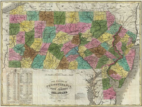
The States of Pennsylvania New Jersey and Delaware From the Latest Authorities.
sold
- Digital Map Information
- Suitable for large format printing
- DPI: 300
- File Size: 13.95 MB
- File Type: ZIP / TIFF
- ICC color profile embedded
- Delivered instantly via download link
This is a beautiful example of the Henry Benton's extremely scarce 1833 pocket map of Pennsylvania, New Jersey and Delaware. Benton's map covers Pennsylvania from Lake erie eastward to Delaware and New Jersey, ... (more details)
Shows Haussmann's renovations in manuscript.
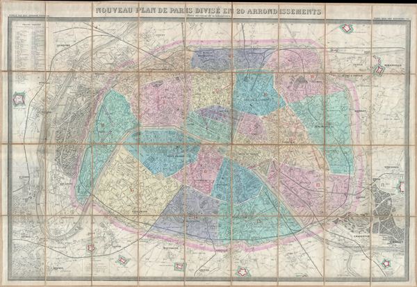
Nouveau Plan de Paris Divise en 20 Arrondissements Dans un rayon de 10 kilometres.
sold
- Digital Map Information
- Suitable for large format printing
- File Size: 49.81 MB
- File Type: ZIP / TIFF
- ICC color profile embedded
- Delivered instantly via download link
This is a large 1869 pocket map of Paris by A. Logerot. It covers the walled center of Paris as well as its immediate vicinity, including the Bois de Boulogne and Bois de Vincennes. Fine detail is present ... (more details)

Clason's Guide Map of Idaho.
sold
- Digital Map Information
- Suitable for large format printing
- File Size: 14.64 MB
- File Type: ZIP / TIFF
- ICC color profile embedded
- Delivered instantly via download link
This is an attractive example of G. S. Clason's c. 1920 Guide Map of Idaho. Issued to accompany Clason's Idaho Green Guide , this folding map covers the entire state of Idaho. An index on the upper right ... (more details)
Monumental map of Paris in nine panels.
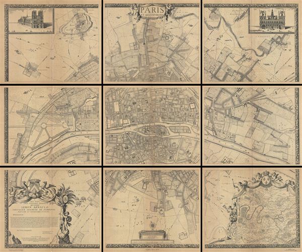
Paris et ses Environs.
sold
- Digital Map Information
- Suitable for large format printing
- File Size: 178.49 MB
- File Type: ZIP / TIFF
- ICC color profile embedded
- Delivered instantly via download link
A rare example of the c. 1900 reissue of Albert Jouvin de Rochefort's monumental 1675 nine panel map of Paris. Rochefort's plan of Paris was influential due to its illustration of the rapidly expanding ... (more details)