

Johnson's Kentucky and Tennessee.
sold
- Digital Map Information
- Suitable for large format printing
- File Size: 22.44 MB
- File Type: ZIP / TIFF
- ICC color profile embedded
- Delivered instantly via download link
A beautiful example of A. J. Johnson's 1861 map of Kentucky and Tennessee. Probably the most decorative of Johnson's Kentucky-Tennessee series, this rare map offers a fascinating snapshot of these secessionist states shortly following the outbreak of the American ... (more details)
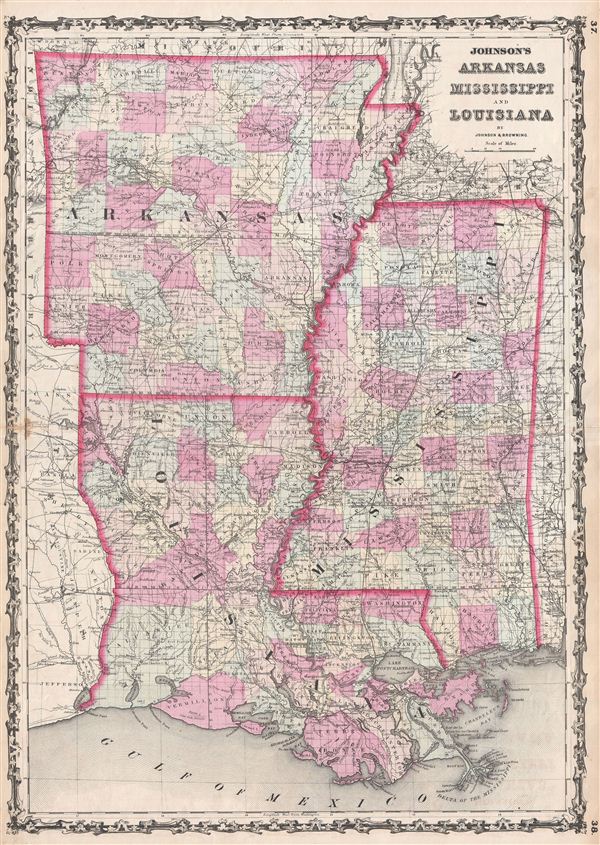
Johnson's Arkansas Mississippi and Louisiana.
sold
- Digital Map Information
- Suitable for large format printing
- File Size: 18.28 MB
- File Type: ZIP / TIFF
- ICC color profile embedded
- Delivered instantly via download link
A beautiful example of A. J. Johnson's 1862 map of Arkansas, Louisiana, and Mississippi. This rare map offers a fascinating snapshot of these secessionist states shortly following the outbreak of the American Civil War. Map shows all three states in full with ... (more details)
One of the earliest specific printed maps of Golden Gate Parrk.

Golden Gate Park San Francisco
sold
- Digital Map Information
- Suitable for large format printing
- File Size: 9.29 MB
- File Type: ZIP / TIFF
- ICC color profile embedded
- Delivered instantly via download link
An extremely rare map and one of the earliest specific illustrations of San Francisco's Golden Gate Park. The map, issued in 1874, covers the eastern half of Golden Gate Park from 19th Avenue to Buena Vista Park and Broderick Street. San Franciscans began to ... (more details)

Sketch I Showing the progress of the Survery in Section No. 9 1848 to 55.
sold
- Digital Map Information
- Suitable for large format printing
- File Size: 4.61 MB
- File Type: ZIP / TIFF
- ICC color profile embedded
- Delivered instantly via download link
An attractive example of the U.S. Coast Survey's 1855 triangulation chart of the Texas coastline from Lavaca and Matagorda Bay eastwards past Galveston Bay as far as Smith Sabine Lake and Pass. Shows the primary triangulation points used in setting up the ... (more details)

Preliminary Chart of Albemarle Sound North Carolina.
sold
- Digital Map Information
- Suitable for large format printing
- File Size: 9.74 MB
- File Type: ZIP / TIFF
- ICC color profile embedded
- Delivered instantly via download link
An uncommon 1855 nautical chart or maritime map Albemarle Sounds, North Carolina. Centered on Albemarle Sound, this map covers from edenton, North Carolina to the Atlantic Ocean. Offers beautiful detail throughout inclusive of countless depth soundings ... (more details)
One of the earliest maps to specifically name Miami.
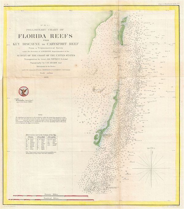
Preliminary Chart of Florida Reefs from Key Biscayne to Carysfort Reef from a Trigonometrical Survey.
sold
- Digital Map Information
- Suitable for large format printing
- File Size: 4.54 MB
- File Type: ZIP / TIFF
- ICC color profile embedded
- Delivered instantly via download link
An uncommon 1855 nautical chart or maritime map Key Biscayne, near Miami, Florida. This map covers from Virginia Key south as far as elliott's Key and Old Rhodes Key, inclusive of Key Biscayne. Miami appears at the very top of the chart – making ... (more details)
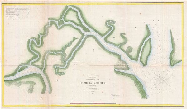
Reconnaissance of Romerly Marshes Georgia.
sold
- Digital Map Information
- Suitable for large format printing
- File Size: 13.2 MB
- File Type: ZIP / TIFF
- ICC color profile embedded
- Delivered instantly via download link
An uncommon 1855 nautical chart or maritime map of the Romerly Marshes, Georgia. Romerly Marsh is a popular hunting and fishing area just south of Savannah, Georgia. In the 1850s Romerly Marsh was particularly difficult to navigate due to its ... (more details)
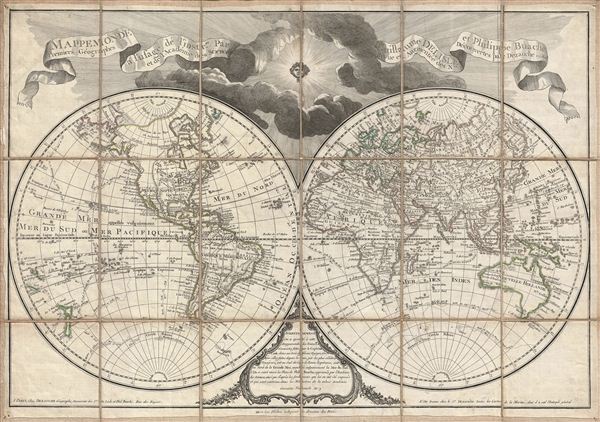
Mappemonde a l'usage de l'Instr.on par Guillaume Delisle et Philippe Buache Premiers Geographes et de l'Academie des Sciences. Revue e Augmentee des Nles. Decouvertes par Dezauche en 1808.
sold
- Digital Map Information
- Suitable for large format printing
- DPI: 300
- File Size: 23.46 MB
- File Type: ZIP / TIFF
- ICC color profile embedded
- Delivered instantly via download link
An uncommon and appealing 1808 pocket map of the world in two hemispheres by Dezauche. This is a later revision, by Dezauche, of Guillaume de Lisle and Phillipe Buache's map of 1785. This popular map, which underwent numerous revisions and ... (more details)
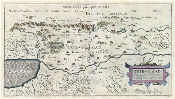
Tribus Gad nempe, ca Terrae Sancte pars, quae obtigit in partitione regionis tribui Gad.
sold
- Digital Map Information
- Suitable for large format printing
- Full resolution TIFF file
- ICC color profile embedded
- Delivered instantly via download link
A fine example of Christian van Adrichem's rare 1590 map of the lands granted to the Tribe of Gad at the time of Joshua's division of the Twelve Tribes. The map is oriented to the east and covers from the Sea of Galilee and the River ... (more details)
The first published large format specific map of Oahu, Hawaii.
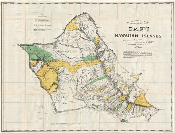
Oahu, Hawaiian Islands.
sold
- Digital Map Information
- Suitable for large format printing
- File Size: 33.88 MB
- File Type: ZIP / TIFF
- ICC color profile embedded
- Delivered instantly via download link
This very large, rare, and extraordinary 1902 map of the island of Oahu, Hawaii, was prepared for the 1906 Report of the Governor of the Territory of Hawaii to the Secretary of the Interior . Honolulu, Pearl Harbor, Diamond Head, Koko ... (more details)
The first published large format specific map of Kauai, Hawaii.

Kauai, Hawaiian Islands.
sold
- Digital Map Information
- Suitable for large format printing
- File Size: 26.62 MB
- File Type: ZIP / TIFF
- ICC color profile embedded
- Delivered instantly via download link
This very large, rare, and extraordinary 1902 map of the island of Kauai, Hawaii, was prepared for the 1906 Report of the Governor of the Territory of Hawaii to the Secretary of the Interior . Kauai is the fourth largest Hawaiian ... (more details)

Sippican Harbor Massachusetts.
sold
- Digital Map Information
- Suitable for large format printing
- File Size: 9.18 MB
- File Type: ZIP / TIFF
- ICC color profile embedded
- Delivered instantly via download link
An uncommon 1855 map of Marion or Sippican Harbor, Massachusetts. Located on the western side of Buzzards Bay, Sippican or Marion is a small bay historically known for its many resident sailors and sea captains. Today it is a ... (more details)
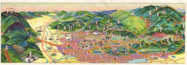
Nara.
sold
- Digital Map Information
- Suitable for large format printing
- File Size: 7.73 MB
- File Type: ZIP / TIFF
- ICC color profile embedded
- Delivered instantly via download link
An uncommon Showa 8 or 1933 map and view of Nara Japan. This is one of the Japanese issue bi-lingual maps of any Japanese city to be issued before World War II. Shows city blocks, historic buildings, and rail lines. Nara ... (more details)
Shows Mt. Fuji in the distance.
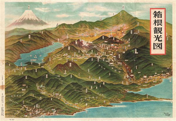
Hakone.
sold
- Digital Map Information
- Suitable for large format printing
- File Size: 27.63 MB
- File Type: ZIP / TIFF
- ICC color profile embedded
- Delivered instantly via download link
A rare panoramic view of Hakone, Japan, dating to the 1950s. This map was drawn by Tomiteru Takaoa. Shows railways and roads well as topography. Mt. Fuji rises in the distance. This uncommon type of map evolved from ... (more details)

Lake Biwa.
sold
- Digital Map Information
- Suitable for large format printing
- File Size: 6.11 MB
- File Type: ZIP / TIFF
- ICC color profile embedded
- Delivered instantly via download link
An appealing Japanese c. 1930 panoramic view map of Lake Biwa, Shiga Prefecture, Honshu, Japan. L ake Biwa (Biwa-ko, literally ‘Biwa Lake') is the largest freshwater lake in Japan and is situated northeast of the ... (more details)
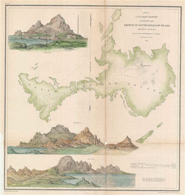
(J. No. 5) Sketch of South Farallon Island Pacific Ocean.
sold
- Digital Map Information
- Suitable for large format printing
- File Size: 5.66 MB
- File Type: ZIP / TIFF
- ICC color profile embedded
- Delivered instantly via download link
An uncommon 1855 map of South Farallon Island, California. The Farallon Islands are a group of islands and sea stacks in the Gulf of the Farallones, off the coast of San Francisco, California, USA. They lie 27 ... (more details)

(J No. 6) Preliminary Survey of Point Reyes and Drake's Bay California.
sold
- Digital Map Information
- Suitable for large format printing
- File Size: 3.25 MB
- File Type: ZIP / TIFF
- ICC color profile embedded
- Delivered instantly via download link
An uncommon 1855 map of Drakes Bay or Puerto de Los Reyes, California. Located approximately 30 miles northwest of San Francisco, Drakes Bay has long been considered the most likely landing site of the ... (more details)
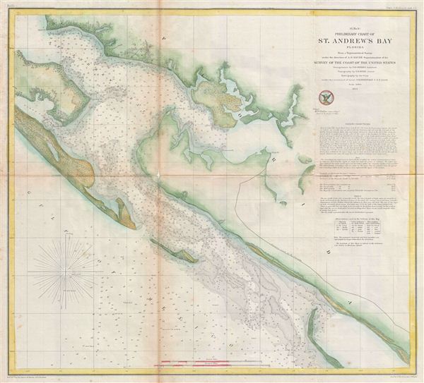
(G No. 4) Preliminary Chart of St. Andrew's Bay Florida.
sold
- Digital Map Information
- Suitable for large format printing
- File Size: 11.6 MB
- File Type: ZIP / TIFF
- ICC color profile embedded
- Delivered instantly via download link
An uncommon 1855 U.S. Coast Survey map or nautical chart of St. Andrews Bay, Florida. The map identifies St. Andrews City, which would soon evolve into Panama City, the seat of Bay County, Florida. ... (more details)
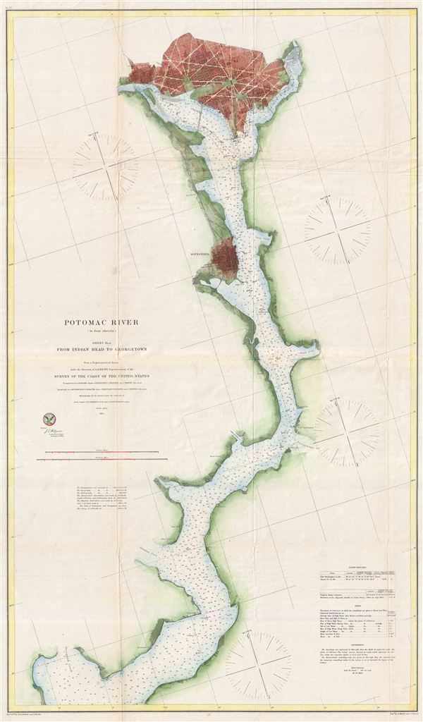
Potomac River (in four sheets) Sheet No. 4.
sold
- Digital Map Information
- Suitable for large format printing
- File Size: 20.82 MB
- File Type: ZIP / TIFF
- ICC color profile embedded
- Delivered instantly via download link
A rare and appealing three section map of Washington D.C., Alexandria, and the Potomac River issued by the U.S. Coast survey in 1864. The map covers the course of the Potomac River from Indian ... (more details)

Potomac River (in four sheets) Sheet No. 1 from Entrance to Piney Point. Potomac River (in four sheets) Sheet No. 2 from Piney Point to Lower Cedar Point. Potomac River (in four sheets) heet No. 3 from Lower Cedar Point to Indian Head.
sold
- Digital Map Information
- Suitable for large format printing
- File Size: 53.11 MB
- File Type: ZIP / TIFF
- ICC color profile embedded
- Delivered instantly via download link
A rare and appealing three section map of the Potomac River issued by the U.S. Coast survey in 1862. The map covers from entrance of the Potomac at the Chesapeake Bay to Indian Point. It ... (more details)