
Dezauche, Jean-Claude

Jean-Claude Dezauche (1745 - 1824) was a French map publisher active in Paris during the first half of the 19th century. He established his own engraving firm around 1770 after having engraved music since 1762. Dezauche bought the archives of Phillipe Buache and Guillaume de L'Isle from Jean Nicholas Buache, Buache's heir, in 1780. Dezauche soon obtained a monopoly on selling the charts produced by the Dépôt de la Marine. Jean-Claude Dezuache passed his business to his son, Jean André Dezauche, upon his death, who took over selling the Dépôt de la Marine charts.
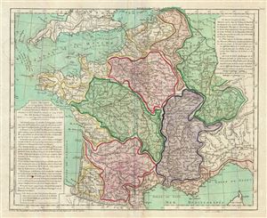
Carte Physique de ou Geographie Naturelle de la France, divisee par Chaines de Montagnes et aussi par Terreins de Fleuves et Rivieres.
$300.00
Acquire
- Digital Map Information
- Suitable for large format printing
- DPI: 300
- File Size: 13.6 MB
- File Type: ZIP / TIFF
- ICC color profile embedded
- Delivered instantly via download link
A scarce 1770 physical map of France by Philippe Buache. The map covers all of France highlighting the various river basins, including Rhine, Rhone, Meuse, Seine, Loire, Garonne, and its coastal basins. Various rivers, mountain ranges, gulfs, lakes, plateaus and ... (more details)
Golden Age of Caribbean piracy.
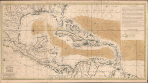
Carte du Golphe du Mexique et des Isles Antilles.
$2,000.00
Acquire
- Digital Map Information
- Suitable for large format printing
- Full resolution TIFF file
- ICC color profile embedded
- Delivered instantly via download link
A fine example of the 1780 Dezauche edition of Buache's important nautical map of the Caribbean, Gulf of Mexico, Florida, and West Indies at the end of the Golden Age of Caribbean Piracy. (more details)
Pioneering Effort in Oceanic geography.
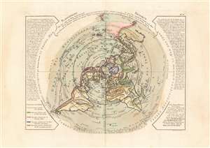
Planisphere Physique.
$1,200.00
Acquire
- Digital Map Information
- Suitable for large format printing
- DPI: 600
- File Size: 53.17 MB
- File Type: ZIP / TIFF
- ICC color profile embedded
- Delivered instantly via download link
A fascinating and beautiful c. 1781 Philippe Buache map of the world, presented on an unusual north polar projection. This is the first work to attempt to map the ocean floor - a revolutionary work connecting undersea with surface geography. Although Buache's submarine geography was speculative at best, the work is a landmark achievement in its attempt to illustrate and scientifically assess the unknowable oceanic depths. (more details)
Pioneering Effort in Oceanic geography.
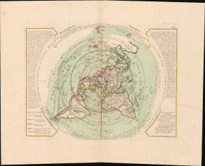
Planisphere Physique.
$1,200.00
Acquire
- Digital Map Information
- Suitable for large format printing
- File Size: 42.7 MB
- File Type: ZIP / TIFF
- ICC color profile embedded
- Delivered instantly via download link
A fascinating and beautiful 1781 Philippe Buache map of the world, presented on an unusual polar projection rendered from the North Pole. This is the first work to attempt to map the ocean floor - a revolutionary work connecting submarine with surface geography. Although Buache's geography was speculative at best, the work is a landmark achievement in its attempt to illustrate and scientifically assess the unknowable oceanic depths. (more details)
First of this series to recognize the United States.
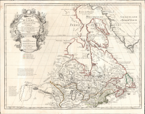
Carte du Canada Qui Comprend la Partie Septentrionale des Etats Unis D'Amerique.
$1,200.00
Acquire
- Digital Map Information
- Suitable for large format printing
- File Size: 30.38 MB
- File Type: ZIP / TIFF
- ICC color profile embedded
- Delivered instantly via download link
This is the 1783 Dezauche issue of Guillaume de l'Isle's map of Canada and the Northern United States. Published after the close of the American Revolutionary War (1775 - 1783), this is one of the first French maps to formally recognize the United States. (more details)
Challenges of mapmaking during the French Revolution.
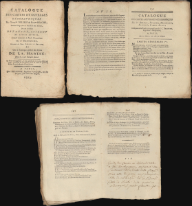
Catalogue des Cartes et Ouvrages Géographique de Guillme Delisle et Philpe Buache, Premier Géographes de l'Académie des Science, De ceux des Sieurs Dezauche, Jaillot et Autres Auteurs, Lesquels composent les Fonds Géographique du Sr. Dezauche, Successeur des Sieurs Delisle et Buache, Ainsi Que le Catalogue général des Cartes de la Marine Dont il a seul l'entrepôt général.
$4,000.00
Acquire
This is a 1793 Jean-Claude Dezauche catalog of maps published at the height of the French Revolution. The 44-page catalog advertises the cartographic work of the Dezauche firm while lamenting the difficulties of producing such work in the midst of that period of intense social and political turmoil. The catalog thus offers a unique insight into the world of cartography during one of Europe's most turbulent periods. (more details)
Revised to Increase Accuracy and Avoid Beheading.
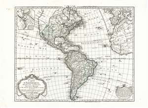
Carte D'Amerique Dressée Pour L'Instruction, Par Guil. Delisle Et Phil. Buache, Premiere Geographe de l'Academie des Sciences. Nouvellement Revue, Augmentée et Assujetie aux N.les Observations Astronomiques et Mrs. de l'Academie des Sciences. Par Dezauche Géographe, Successeur des Sr. Delisle et Phil. Buache. A Paris chez l'Auteur Rue des Noyers. Garantie Nationale An 9. 1800.
$750.00
Acquire
- Digital Map Information
- Suitable for large format printing
- Full resolution TIFF file
- ICC color profile embedded
- Delivered instantly via download link
This is Jean-Claude Dezauche's 1785 map of the Western Hemisphere, here in a superb example of its 1800 revision. While the map has its basis in the similarly titled map first printed in 1722 by De l'Isle, Dezauche did not use the plate inherited from De l'Isle's heir Buache. The map was re-drawn and re-engraved for its 1785 issue, and would be further amended in subsequent printings. (more details)
New England during the War of 1812.
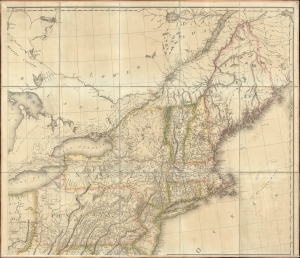
[New England].
$1,000.00
Acquire
- Digital Map Information
- Suitable for large format printing
- File Size: 36.52 MB
- File Type: ZIP / TIFF
- ICC color profile embedded
- Delivered instantly via download link
The northeastern sheet of Pierre Francois Tardieu's 1812 four-sheet map of the United States of America, based on Aaron Arrowsmith's seminal 1796 map of the same. Its publication coincided with the outbreak of the War of 1812 (1812 - 1815). Aside from its aesthetic qualities and level of detail, the map is notable for demonstrating the territorial evolution of the new republic. (more details)