

Atlas Classique Ancienne et Moderne de Eugene Belin.
sold
- Digital Map Information
- Suitable for large format printing
- File Size: 5.63 MB
- File Type: ZIP / TIFF
- ICC color profile embedded
- Delivered instantly via download link
A fine c. 1914 cosmographic chart by Abbe Drioux and Charles Leroy. This chart offers a wealth of information on the solar system, planetary alignment, the seasons, celestial projections, lunar features, and orbital paths. Published as part of eugene's Belin's ... (more details)

A View of Paris in 1867.
sold
- Digital Map Information
- Suitable for large format printing
- File Size: 5.38 MB
- File Type: ZIP / TIFF
- ICC color profile embedded
- Delivered instantly via download link
A pleasing view of Paris in 1867 with important buildings numbered and named. This map centered on the longer extant Palace of the International exhibition, which was once situated on the site of the eiffel Tower. The view stretches to Montmartre and Sacre ... (more details)
Buache's fantastic speculative mapping of the undiscovered Antarctic continent.
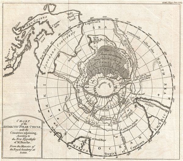
Chart of the Antarctic Polar Circle, with the Countries Adjoining, According to the New Hypothesis of M. Buache. From the Memoirs of the Royal Academy at Paris.
sold
- Digital Map Information
- Suitable for large format printing
- Full resolution TIFF file
- ICC color profile embedded
- Delivered instantly via download link
This is an unusual and highly speculative map of the southern Polar Regions (Antarctic) drawn in 1763 by the scientific geographer M. Buache. A subtle and unusual map that yields more fascinating discoveries the longer one studies it, this chart centers on ... (more details)
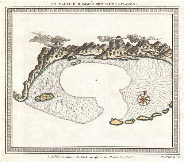
Ile Maurice Nommee Depuis Ile De France.
sold
- Digital Map Information
- Suitable for large format printing
- Full resolution TIFF file
- ICC color profile embedded
- Delivered instantly via download link
Bellin's interesting hand-colored, combined chart and view (replete with wispy clouds) of the harbor of the Ile Maurice , or Mauritius, from Prevost's influential Histoire Des Voyages , 1750. essentially a nautical view, this map details Mauritius ... (more details)
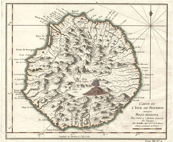
Carte de L'Isle de Bourbon autrefois Mascareigne Pour Servir a l'Histoire Generale des Voyages Par M. Bellin.
sold
- Digital Map Information
- Suitable for large format printing
- Full resolution TIFF file
- ICC color profile embedded
- Delivered instantly via download link
Bellin's hand-colored map of L'Isle De Bourbon (Reunion Island today) featuring and active 'Volcan.' Reunion or ‘Bourbon' was a colony of the French east India Company since 1665. The name was changed to ‘Reunion' with the French Revolution ... (more details)

Wallabout Improvement.
sold
- Digital Map Information
- Suitable for large format printing
- File Size: 1.29 MB
- File Type: ZIP / TIFF
- ICC color profile embedded
- Delivered instantly via download link
An uncommon 1868 map of the newly improved Wallabout Bay, home to the U.S. Navy Yard in Brooklyn, New York (also pictured, along with the Marine Hospital). Today the Brooklyn Navy Yard hosts an assortment of film studios and art spaces. This map ... (more details)
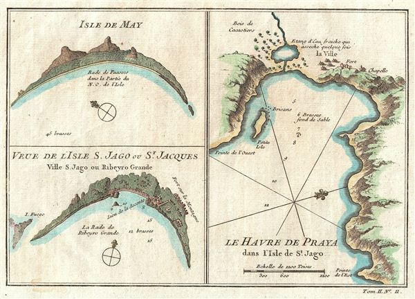
Isle De May, Veue De L'Isle S. Jago ou St. Jacques, Le Havre de Praya dans l'Isle de St. Jago.
sold
- Digital Map Information
- Suitable for large format printing
- Full resolution TIFF file
- ICC color profile embedded
- Delivered instantly via download link
Bellin's uniquely drawn half-view, half-maps of the Portuguese held Cape Verde Islands, from Prevost's influential Histoire Des Voyages , 1750. essentially three coastal views on a single sheet. The upper left view details the Isle of May (Maio ... (more details)

Plan de Ninh-Binh.
sold
- Digital Map Information
- Suitable for large format printing
- File Size: 0.79 MB
- File Type: ZIP / TIFF
- ICC color profile embedded
- Delivered instantly via download link
A charming hand colored, steel engraved French map of the strategically important Vietnamese citadel and town of Ninh Binh. The letters on the building indicate: A) House of Strangers, B) Temple of the Spirit of the King, C) Governor's House, ... (more details)

A Map of Old Boston in the Commonwealth of Massachusetts. Presented by The Boston Five Cents Savings Bank 30 School Street Boston.
sold
- Digital Map Information
- Suitable for large format printing
- File Size: 16.56 MB
- File Type: ZIP / TIFF
- ICC color profile embedded
- Delivered instantly via download link
A quaint and charming pictorial map of the tourist sites of downtown Boston in 1929. This map was drawn by Charles R. Capon for the Boston Five Cents Savings Bank – which is located at the center of the map. The map depicts important ... (more details)

Florida Highway Pictorial Plesurmap.
sold
- Digital Map Information
- Suitable for large format printing
- File Size: 25.76 MB
- File Type: ZIP / TIFF
- ICC color profile embedded
- Delivered instantly via download link
While the idea of ‘Plesurmaps' never caught on, this charming 1945 map of Florida is indeed a pleasure. The typeface and strategic use of red, as well as the fascinating black and white photos that ring the map, make the map of a ... (more details)

New Reference Map & Guide to New York City. Executed by Brooks Bank Note Co. Boston, and Springfield, Mass. Embodying a Brief History of New York.
sold
- Digital Map Information
- Suitable for large format printing
- File Size: 10.28 MB
- File Type: ZIP / TIFF
- ICC color profile embedded
- Delivered instantly via download link
An absolutely charming 1900 guide map of New York City, showing 'From the Latest Surveys showing all the Ferries and Steamship Docks, elevated, electric and Cross Town Car Lines,' as well as 'Grand Central Depot.' On verso are ... (more details)

Colton's Map of Maine.
sold
- Digital Map Information
- Suitable for large format printing
- File Size: 9.78 MB
- File Type: ZIP / TIFF
- ICC color profile embedded
- Delivered instantly via download link
Colton's exquisite hand colored and highly detailed 1872 pocket map of Maine. This map is based on Colton's atlas map of 1855 but has been updates to reflect the 1872 county and township structure. Colton identifies various ... (more details)
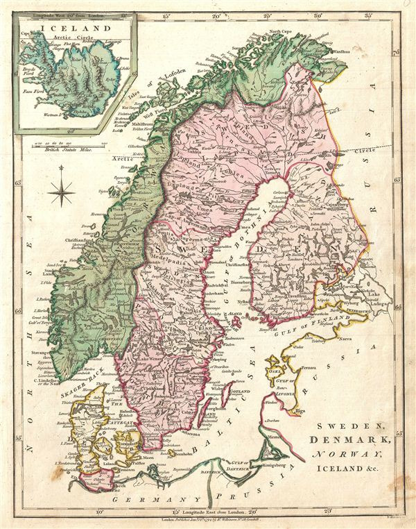
Sweden, Denmark, Norway, Iceland &c.
sold
- Digital Map Information
- Suitable for large format printing
- Full resolution TIFF file
- ICC color profile embedded
- Delivered instantly via download link
A finely detailed first edition 1794 map of Scandinavia, by Robert Wilkinson, with Iceland as an inset. Includes Norway, Denmark, Sweden and Finland (then part of Sweden). Beautifully rendered mountains and fjords and ... (more details)

A New Map of Prussia from the Best Authorities.
sold
- Digital Map Information
- Suitable for large format printing
- DPI: 300
- File Size: 3.13 MB
- File Type: ZIP / TIFF
- ICC color profile embedded
- Delivered instantly via download link
A finely detailed first edition 1794 map of Prussia, by Robert Wilkinson. Shows Holy Roman empire Circles, the Palatinate of Culm, Pomeralia, and Polish Prussia. engraved by Thomas Conder for the 1794 first edition ... (more details)

Poland with its Dismembered Provinces, Drawn from the Best Authorities.
sold
- Digital Map Information
- Suitable for large format printing
- DPI: 300
- File Size: 3.46 MB
- File Type: ZIP / TIFF
- ICC color profile embedded
- Delivered instantly via download link
Robert Wilkinson's finely detailed first edition 1794 map of Poland. Covers Poland, Polish Prussia, Lithuania, and Ukraine. This map follows the Polish boundaries as set by the Second Partition, 1790. Shortly ... (more details)

Russia in Europe, Divided into Governments, Drawn from the Latest Authorities.
sold
- Digital Map Information
- Suitable for large format printing
- DPI: 300
- File Size: 3.49 MB
- File Type: ZIP / TIFF
- ICC color profile embedded
- Delivered instantly via download link
Robert Wilkinson's finely detailed first edition 1794 map of european Russia. Russia, at the time under Catherine II (the Great) was enjoying a golden age of territorial and cultural expansion known as the ... (more details)

Switzerland with its Subjects and Allies Drawn from the Best Authorities.
sold
- Digital Map Information
- Suitable for large format printing
- DPI: 300
- File Size: 4.11 MB
- File Type: ZIP / TIFF
- ICC color profile embedded
- Delivered instantly via download link
Robert Wilkinson's gorgeous first edition 1794 map of Switzerland on the eve of Napoleonic invasion of 1798. The French tried to centralize authority of Switzerland by forming the Helvetic Republic ... (more details)

A Map of Spain and Portugal Drawn from the Best Authorities.
sold
- Digital Map Information
- Suitable for large format printing
- DPI: 300
- File Size: 3.53 MB
- File Type: ZIP / TIFF
- ICC color profile embedded
- Delivered instantly via download link
A finely detailed first edition 1794 map of Spain and Portugal, by Robert Wilkinson. engraved by Thomas Conder for the 1794 first edition of Robert Wilkinson's General Atlas ... (more details)

France, Divided into Departments, etc. agreeable to the Decrees of the National Assembly.
sold
- Digital Map Information
- Suitable for large format printing
- Full resolution TIFF file
- ICC color profile embedded
- Delivered instantly via download link
Robert Wilkinson's finely detailed first edition 1794 map of France divided into departments. This map was issued in the second year of the French Revolutionary or ... (more details)
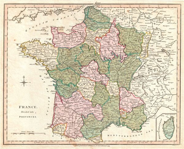
France, Divided into Provinces.
sold
- Digital Map Information
- Suitable for large format printing
- DPI: 300
- File Size: 3.84 MB
- File Type: ZIP / TIFF
- ICC color profile embedded
- Delivered instantly via download link
Robert Wilkinson's finely detailed first edition 1794 map of France divided into provinces, in the second year of the French Revolutionary or Napoleonic Wars, which ... (more details)