
One of the first detailed maps of the Taiwan / Formosa interior.
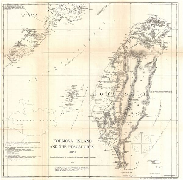
Formosa Island and the Pescadores China.
sold
- Digital Map Information
- Suitable for large format printing
- File Size: 8.82 MB
- File Type: ZIP / TIFF
- ICC color profile embedded
- Delivered instantly via download link
An extremely interesting, important, and uncommon map of Taiwan or Formosa issued in 1870 by the American Consul at Amoy, Charles W. Le Gendre. Focusing on the island of Formosa, this map covers from Fu-Kyen (Fukien), China to the Botel Tobago. Includes the ... (more details)
Impressive early nautical chart of San Francisco.
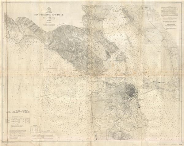
San Francisco Entrance California.
sold
- Digital Map Information
- Suitable for large format printing
- File Size: 44.14 MB
- File Type: ZIP / TIFF
- ICC color profile embedded
- Delivered instantly via download link
This is an extraordinary highly detailed 1897 U.S. Coast and Geodetic Survey maritime map or nautical chart of the entrance to San Francisco Bay and San Francisco itself. First issued in 1884, this updated 1897 chart covers from Duxbury Point south along the ... (more details)
One of the finest maps of Brooklyn to appear in the second half of the 19th century.
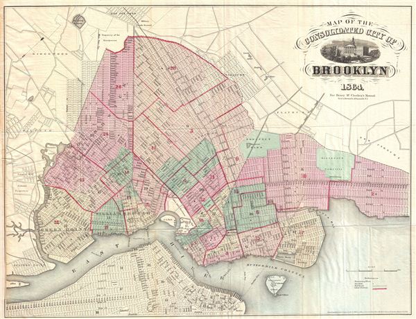
Map of the Consolidated City of Brooklyn.
sold
- Digital Map Information
- Suitable for large format printing
- File Size: 13.86 MB
- File Type: ZIP / TIFF
- ICC color profile embedded
- Delivered instantly via download link
An extremely example of Henry McCloskey's 1864 pocket map of the city of Brooklyn, New York. In the mid-19th century, fueled by the advent of the steam ferry, which made crossing the east River practical, Kings County experienced a massive population burst. ... (more details)
An extremely scarce stunning wall map of England and Ireland.
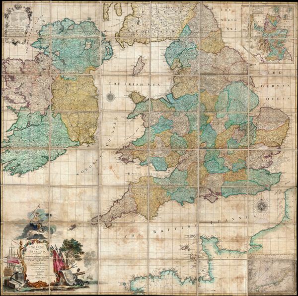
England and Ireland, Containing all the Cities, Boroughs, Market-Towns, & principal Villages, with the Coast of France from Calais to Brest.
sold
- Digital Map Information
- Suitable for large format printing
- Full resolution TIFF file
- ICC color profile embedded
- Delivered instantly via download link
An impressive and extremely scarce folding c. 1760 wall map of england and Ireland by Richard W. Seale. Covers all of england and about 98% of Ireland excepting only a small part of western Kerry and western Connaught. Part of the adjacent French coast is ... (more details)
One of the most decorative maps of Brooklyn to appear in the 19th century.

Map of the City of Brooklyn.
sold
- Digital Map Information
- Suitable for large format printing
- File Size: 17.18 MB
- File Type: ZIP / TIFF
- ICC color profile embedded
- Delivered instantly via download link
An extremely example of William Bishop's 1871 pocket map of the city of Brooklyn, New York. In the mid-19th century, fueled by the advent of the steam ferry, which made crossing the east River practical, Kings County experienced a massive population burst. ... (more details)
Early Land Office map showing important gold and silver deposits.
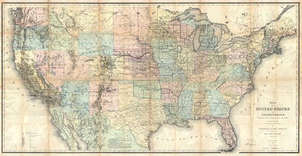
Map of the United States and Territories, Showing the extent of Public Surveys and other details, constructed from the Plats and official sources of the General Land Offices, Under the direction of Hon. Jos. S. Wilson, Commissioner by Joseph Gorlinsi, Draughtsman, 1868.
sold
- Digital Map Information
- Suitable for large format printing
- File Size: 58.9 MB
- File Type: ZIP / TIFF
- ICC color profile embedded
- Delivered instantly via download link
This is an extremely interesting 1868 U.S. Land Office map of the United States. Covering the entire country on a rectangular projection, this map is intended to illustrate the extant of the Land Survey as it worked its way westward. In this map the ... (more details)
Unusually detailed mapping of the Straits of Malaca.

Carte de L'Isle de Sumatra.
sold
- Digital Map Information
- Suitable for large format printing
- DPI: 300
- File Size: 4.62 MB
- File Type: ZIP / TIFF
- ICC color profile embedded
- Delivered instantly via download link
This is J. N. Bellin's 1749 map of Sumatra and the southern portion of the Malay Peninsula. This is an unusually detailed map of the area, showing many coastal features, shoals, banks and small islands. The Straits of Malacca and the Detroit de ... (more details)

Map of the State of New York compiled from the Latest Authorities.
sold
- Digital Map Information
- Suitable for large format printing
- DPI: 300
- File Size: 18.06 MB
- File Type: ZIP / TIFF
- ICC color profile embedded
- Delivered instantly via download link
A fine example of Thomas Cowperthwait and S. A. Mitchell's 1854 map of New York State. That fact that this is one of only two double page maps in Mitchell's New Universal Atlas testifies to the importance of New York in the mid-19th century. ... (more details)

Lengths of the Principal Rivers in the World. / Heights of the Principal Mountains in the World.
sold
- Digital Map Information
- Suitable for large format printing
- DPI: 300
- File Size: 8.07 MB
- File Type: ZIP / TIFF
- ICC color profile embedded
- Delivered instantly via download link
An attractive example of Mitchells 1854 Comparative Mountains and Rivers Charts. Mitchell based his Mountains and Rivers Chart on a nearly identical map first prepared by the American engraver H. S. Tanner in 1836.. This stunning center ... (more details)

Italy.
sold
- Digital Map Information
- Suitable for large format printing
- DPI: 300
- File Size: 5.09 MB
- File Type: ZIP / TIFF
- ICC color profile embedded
- Delivered instantly via download link
A fine example of Thomas Cowperthwait and S. A. Mitchell's 1854 map of the north part of Italy. Centered on Tuscany, this map covers from Lombardy to the Papal States (Including Rome), and the Venetian Republic. The whole is engraved in ... (more details)

Kingdom of Sardinia.
sold
- Digital Map Information
- Suitable for large format printing
- DPI: 300
- File Size: 8.28 MB
- File Type: ZIP / TIFF
- ICC color profile embedded
- Delivered instantly via download link
A fine example of Thomas Cowperthwait and S. A. Mitchell's 1854 map of Kingdom of Sardinia. Centered in Piedmont, this map covers the Kingdom of Sardinia's claims both on the Island of Sardinia and the mainland provinces of Piedmont, ... (more details)

Kingdom of Naples or The Two Sicilies.
sold
- Digital Map Information
- Suitable for large format printing
- DPI: 300
- File Size: 7.19 MB
- File Type: ZIP / TIFF
- ICC color profile embedded
- Delivered instantly via download link
A fine example of Thomas Cowperthwait and S. A. Mitchell's 1854 map of Kingdom of Naples of the Two Sicilies. Covers the southern parts of modern Italy from Rome to Sicily. An inset detailing the environs of Naples is included in the ... (more details)

Russia in Asia and Tartary.
sold
- Digital Map Information
- Suitable for large format printing
- DPI: 300
- File Size: 7.57 MB
- File Type: ZIP / TIFF
- ICC color profile embedded
- Delivered instantly via download link
A fine example of Thomas Cowperthwait and S. A. Mitchell's 1854 map of Russia in Asia and Independent Tartary. Also includes parts of the adjacent Chinese empire, Korea, and Japan. Identifies the disputed sea between Japan and ... (more details)

Asia.
sold
- Digital Map Information
- Suitable for large format printing
- DPI: 300
- File Size: 9.27 MB
- File Type: ZIP / TIFF
- ICC color profile embedded
- Delivered instantly via download link
A fine example of Thomas Cowperthwait and S. A. Mitchell's 1854 map of Asia. Covers the entire continent of Asia from the Ural Mountains to Kamchatka and from the Arctic to Malay. The east Indies and Australia are also included ... (more details)

Greece.
sold
- Digital Map Information
- Suitable for large format printing
- DPI: 300
- File Size: 7.67 MB
- File Type: ZIP / TIFF
- ICC color profile embedded
- Delivered instantly via download link
A fine example of Thomas Cowperthwait and S. A. Mitchell's 1854 map of Greece. Covers the southern part of modern Greece including the Peloponnese (Morea), the Negroponte, and Karalla, as well as the Ionian Republic and the ... (more details)

Map of Turkey in Europe with Ionian Islands.
sold
- Digital Map Information
- Suitable for large format printing
- DPI: 300
- File Size: 5.03 MB
- File Type: ZIP / TIFF
- ICC color profile embedded
- Delivered instantly via download link
A fine example of Thomas Cowperthwait and S. A. Mitchell's 1854 map of Greece and the Balkans under the Ottoman empire. Centered on the Aegean Sea, this map covers from Moldova to Crete and from the Adriatic to the Black ... (more details)

Hindoostan.
sold
- Digital Map Information
- Suitable for large format printing
- DPI: 300
- File Size: 8.8 MB
- File Type: ZIP / TIFF
- ICC color profile embedded
- Delivered instantly via download link
A fine example of Thomas Cowperthwait and S. A. Mitchell's 1854 map of India. Covers the Subcontinent from the Chinese Tartary in the north to Ceylon in the south, and from the Indus River valley in the west to Bengal in ... (more details)

Persia Arabia & c.
sold
- Digital Map Information
- Suitable for large format printing
- DPI: 300
- File Size: 6.72 MB
- File Type: ZIP / TIFF
- ICC color profile embedded
- Delivered instantly via download link
A fine example of Thomas Cowperthwait and S. A. Mitchell's 1854 map of Persia, Afghanistan, and Arabia. Centered on the Persian Gulf, this map covers from the Mediterranean and Red Sea eastward as far as India, ... (more details)
A strategic guide to privateering in South America and an illustration of the world's first stock bubble.

A new & exact map of the coast, countries and islands within the limits of ye South Sea Company, from ye River Aranoca to Tierra del Fuego, and from there through ye South Sea to ye north port of California, &c. with a view of general and coasting trade-winds and particular draughts of the most important bays, ports, &c., according to ye newest observations, by Herman Moll Geographer.
sold
- Digital Map Information
- Suitable for large format printing
- DPI: 300
- File Size: 20.16 MB
- File Type: ZIP / TIFF
- ICC color profile embedded
- Delivered instantly via download link
One of Herman Moll's most interesting and influential maps. Issued c. 1719 – 1720, at the height of the South Sea Bubble, this is Moll's map illustrating the limits and goals of the South Sea Company. ... (more details)
One of the most beautiful, important, and enduring maps of Manhattan ever published.
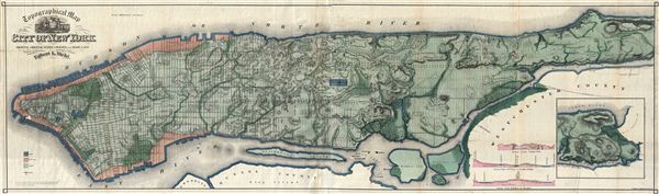
Topographical Map of the City of New York Showing Original Water Courses and Made Land.
sold
- Digital Map Information
- Suitable for large format printing
- File Size: 47.88 MB
- File Type: ZIP / TIFF
- ICC color profile embedded
- Delivered instantly via download link
This is Egbert L. Viele's 1865 topography and waterways map of Manhattan, one of the scarcest, most important and most enduring maps of New York City ever published. Covering the entirety of Manhattan ... (more details)