
Pre Civil War map of South Carolina.
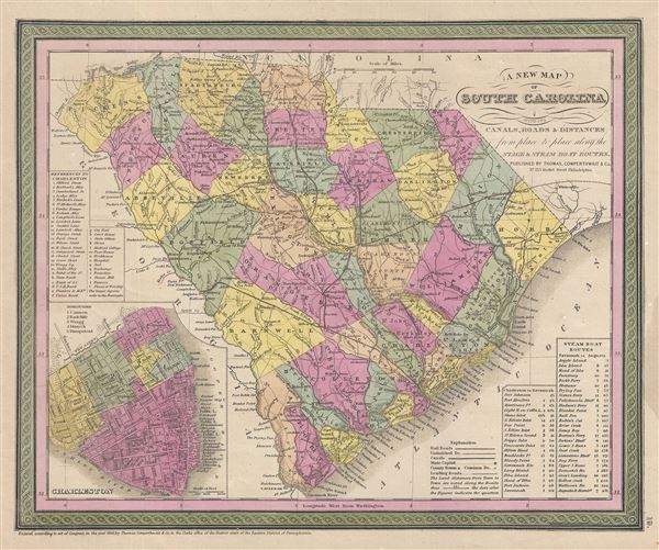
A New Map of South Carolina with its Canals, Roads & Distances from place to place along the stage & steam boat routes.
sold
- Digital Map Information
- Suitable for large format printing
- DPI: 300
- File Size: 6.74 MB
- File Type: ZIP / TIFF
- ICC color profile embedded
- Delivered instantly via download link
A fine example of Samuel Augustus Mitchell's important 1850 map of South Carolina. This map shows cities, topographical features, railways, ferries and roads with color coding at the county level. In addition to cartographic information this map is full of ... (more details)
Shows the site of the nation's first Gold Rush.

A New Map of Nth. Carolina with its Canals, Roads & Distances from Place to Place, along the Stage & Steam Boat Routes.
sold
- Digital Map Information
- Suitable for large format printing
- DPI: 300
- File Size: 6.49 MB
- File Type: ZIP / TIFF
- ICC color profile embedded
- Delivered instantly via download link
A fine example of Samuel Augustus Mitchell's important 1854 map of North Carolina. This map shows cities, topographical features, railways, ferries and roads with color coding at the county level. In addition to cartographic information this map is full of ... (more details)

A New Map of Virginia with its Canals, Roads & Distances from place to place, along the Stage & Steam Boat Routes.
sold
- Digital Map Information
- Suitable for large format printing
- DPI: 300
- File Size: 6.97 MB
- File Type: ZIP / TIFF
- ICC color profile embedded
- Delivered instantly via download link
This is a fine example of S. A. Mitchell's 1854 map of Virginia. This map predates the 1862 separation of Virginia and West Virginia, and so contains both modern states in full as well as parts of adjacent Kentucky, Ohio, Maryland, and North Carolina. The ... (more details)
A remarkable combination of actual and proposed urban cartography.

City of Washington.
sold
- Digital Map Information
- Suitable for large format printing
- DPI: 300
- File Size: 7.85 MB
- File Type: ZIP / TIFF
- ICC color profile embedded
- Delivered instantly via download link
A fine example of S. A. Mitchell and Thomas Cowperthwait's 1854 map or plan of Washington D.C. Given that most of Washington D.C. was under construction when this map was drawn, Mitchell's plan is a remarkable combination of existing of existing ... (more details)
A fine map of the United States showing the California Gold Region.
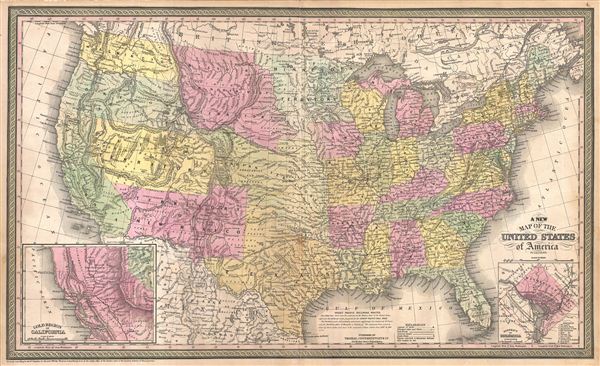
A New Map of the United States of America.
sold
- Digital Map Information
- Suitable for large format printing
- DPI: 300
- File Size: 18.48 MB
- File Type: ZIP / TIFF
- ICC color profile embedded
- Delivered instantly via download link
This is a fine example of S. A. Mitchell's 1854 map of the United States. Issued shortly following the California Gold rush, this map covers the United States from coast to coast, extending as far north as the Canadian border and as far south as ... (more details)
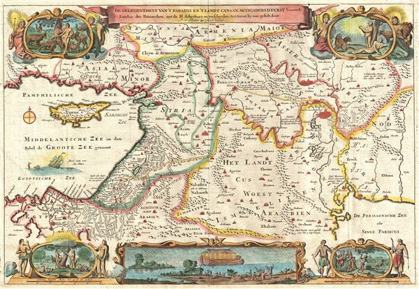
De Gelegentheyt van 't Paradys ende 't Land Canaan mitsgaders de eerste bewoonde landen Der Patriarchen, uyt de H. schrifture en verscheyden Auctoren bij een gestelt door
sold
- Digital Map Information
- Suitable for large format printing
- DPI: 300
- File Size: 8.96 MB
- File Type: ZIP / TIFF
- ICC color profile embedded
- Delivered instantly via download link
This is a splendid early example of Daniel Stoopendaal and Jacob Keur's c. 1730 map of the Holy Land, or as it is titled (in rough translation) 'Paradise, or the Garden of Eden, with the countries adjacent as inhabited by the Patriarchs.' Covers ... (more details)
An fascinating fictional plan of Jerusalem.

Ierusalem.
sold
- Digital Map Information
- Suitable for large format printing
- DPI: 300
- File Size: 11.21 MB
- File Type: ZIP / TIFF
- ICC color profile embedded
- Delivered instantly via download link
A remarkable imaginary c. 1730 plan of Jerusalem drawn by Daniel Stoopendaal but based upon an early work by Juan Bautista Villalpando. Villalpando's popular fictive view of Jerusalem first appeared in a 1604 commentary on Ezekiel co-written by ... (more details)
An important 18th century mapping of the California - Arizona region.

Kaart van het Westelyk Gedeelte van Nieuw Mexico en van California Volgens de Laatste Ontdekkingen der Jesuiten en Anderen.
sold
- Digital Map Information
- Suitable for large format printing
- DPI: 300
- File Size: 5.76 MB
- File Type: ZIP / TIFF
- ICC color profile embedded
- Delivered instantly via download link
A scarce and important 1765 map detailing the Spanish/Mexican borderlands in the California-New Mexico (including modern day Arizona) region. Despite its title, this map does not cover New Mexico, instead, it focuses on the Gulf of California, ... (more details)
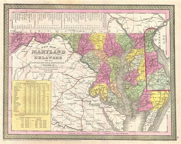
A New Map of Maryland and Delaware.
sold
- Digital Map Information
- Suitable for large format printing
- DPI: 300
- File Size: 7.03 MB
- File Type: ZIP / TIFF
- ICC color profile embedded
- Delivered instantly via download link
This is a fine example of S. A. Mitchell's 1854 map of Maryland and Delaware. Centered on Washington D.C., this map extends eastward from Maryland to New Jersey and the Delaware Bay. The Chesapeake Bay is rendered in full. In the upper left ... (more details)
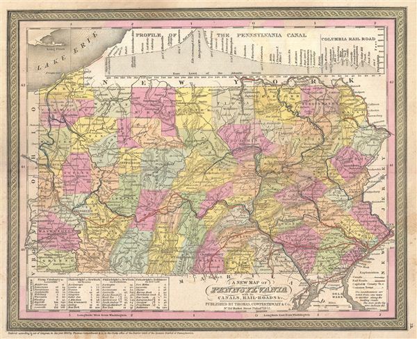
Map of Pennsylvania.
sold
- Digital Map Information
- Suitable for large format printing
- DPI: 300
- File Size: 7.73 MB
- File Type: ZIP / TIFF
- ICC color profile embedded
- Delivered instantly via download link
This carefully defined piece of S. A. Mitchell's 1854 map of Pennsylvania features the state's cities, towns, roads, canals, and railroads in great detail. This map covers from Lake Erie eastward to Delaware and New Jersey. An elevation ... (more details)

Map of New Jersey.
sold
- Digital Map Information
- Suitable for large format printing
- Full resolution TIFF file
- ICC color profile embedded
- Delivered instantly via download link
This is a beautifully detailed version of S. A. Mitchell's 1854 map of New Jersey. Extending vertically northward from Delaware Bay and Cape Bay, it depicts railroads, canals, rivers, State Parks, and bays to reach Pennsylvania on its ... (more details)

Canada West formerly Upper Canada.
sold
- Digital Map Information
- Suitable for large format printing
- DPI: 300
- File Size: 8.38 MB
- File Type: ZIP / TIFF
- ICC color profile embedded
- Delivered instantly via download link
An extremely attractive example of S. A. Mitchell's 1854 map of Upper Canada or Ontario, Canada. Centered on Lake Ontario, this map covers from Lake Erie eastward from Detroit, Michigan and Lake Huron at the northwest, as far as ... (more details)
An important map issued just after the California Gold Rush.

A New Map of the State of California, the Territories of Oregon, Washington, Utah & New Mexico.
sold
- Digital Map Information
- Suitable for large format printing
- DPI: 300
- File Size: 8.01 MB
- File Type: ZIP / TIFF
- ICC color profile embedded
- Delivered instantly via download link
A fine example of S. A. Mitchell and J. H. Young's important 1854 map of California and the western territories of Washington, Oregon, Utah, and New Mexico. Based upon Mitchell's seminal pocket map of 1846, this map covers from ... (more details)
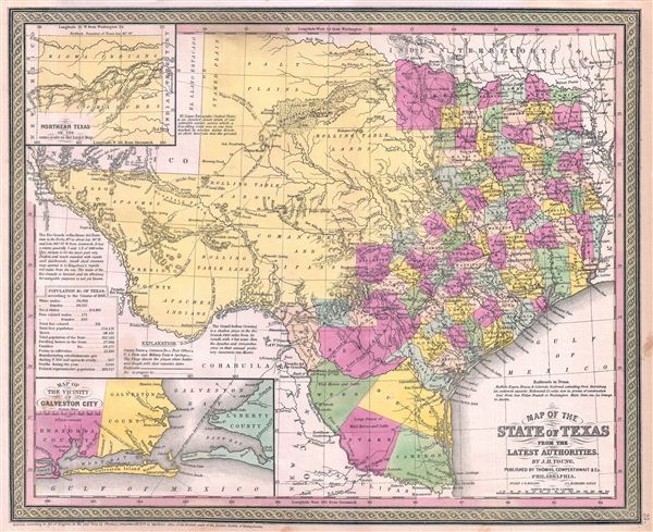
Map of the State of Texas from the Latest Authorities.
sold
- Digital Map Information
- Suitable for large format printing
- DPI: 300
- File Size: 8.01 MB
- File Type: ZIP / TIFF
- ICC color profile embedded
- Delivered instantly via download link
A fine example of S. A. Mitchell and J. H. Young's important 1854 map of Texas. Mitchell's map covers the entire state of Texas from the Red River Valley to the Rio Grande, and from El Paso to the Louisiana border. Texas's ... (more details)
Issued shortly after the Black Hawk War which opened southern Minnesota to settlement.

Map of Minnesota Territory.
sold
- Digital Map Information
- Suitable for large format printing
- DPI: 300
- File Size: 8.14 MB
- File Type: ZIP / TIFF
- ICC color profile embedded
- Delivered instantly via download link
A fine example of S. A. Mitchell and J. H. Young's important 1854 map of Minnesota Territory. Mitchell's map covers the Minnesota Territory as it existed in 1854, extending from the Missouri River to Lake Superior and the ... (more details)
The first map to depict Manhattan as an Island and depict a beaver.
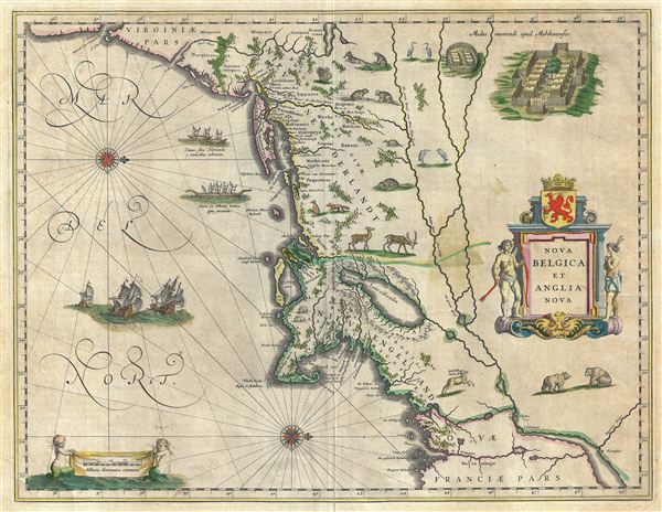
Nova Belgica et Anglia Nova.
sold
- Digital Map Information
- Suitable for large format printing
- DPI: 300
- File Size: 12.88 MB
- File Type: ZIP / TIFF
- ICC color profile embedded
- Delivered instantly via download link
A beautiful old color example of one of the most important maps in the history of America, Blaeu's 1638 Nova Belgica et Anglia Nova . Oriented to the west, this map covers the American coast from Virginia, past New York ... (more details)
One of the earliest accurate maps of Alaska and Bering Strait.
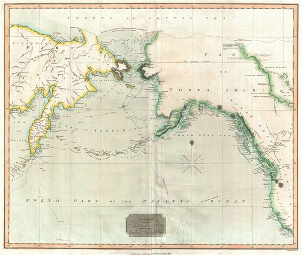
Chart of the Northern Passage Between Asia & America.
sold
- Digital Map Information
- Suitable for large format printing
- DPI: 300
- File Size: 12.51 MB
- File Type: ZIP / TIFF
- ICC color profile embedded
- Delivered instantly via download link
This is an exceptionally fine example of John Thomson's 1814 map of the Bearing Strait. Centered on the Bearing Strait, Thomson's map covers from the coast of California to Alaska and the Arctic Sea, and the coast of ... (more details)
Shows the partitions of Poland following the Napoleonic Wars.
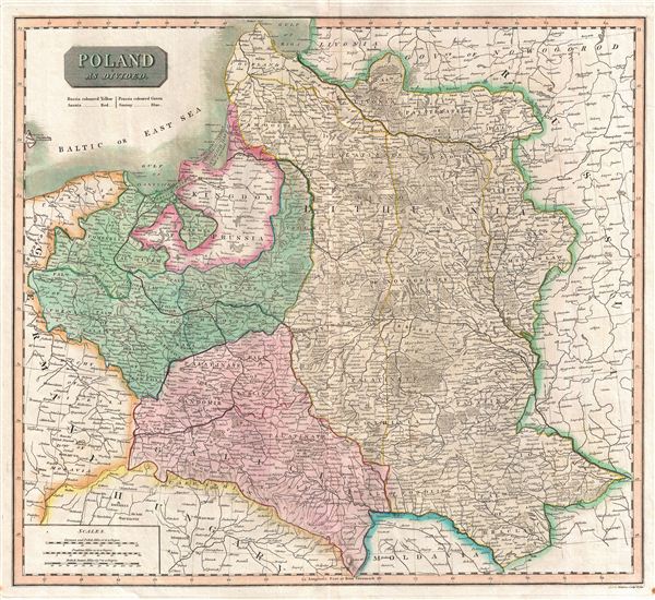
Poland As Divided.
sold
- Digital Map Information
- Suitable for large format printing
- DPI: 300
- File Size: 12.92 MB
- File Type: ZIP / TIFF
- ICC color profile embedded
- Delivered instantly via download link
This is an exceptionally fine example of John Thomson's 1817 map of Poland. Thomson's map of Italy covers Poland following the 1795 Third Partition of Poland between Austria, Germany, and Russia. Color coding ... (more details)
Italy on the cusp of its national solidarity movement.
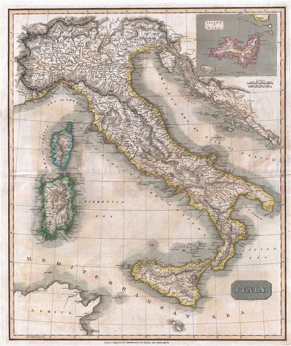
Italy.
sold
- Digital Map Information
- Suitable for large format printing
- DPI: 300
- File Size: 21.04 MB
- File Type: ZIP / TIFF
- ICC color profile embedded
- Delivered instantly via download link
This is an exceptionally fine example of John Thomson's 1814 map of Italy. Thomson's map of Italy covers peninsular Italy from the Alps to Calabria as well as the adjacent islands of Sicily, Sardinia, and ... (more details)
A finely engraved topographical plan of 19th century Rome showing the monuments.
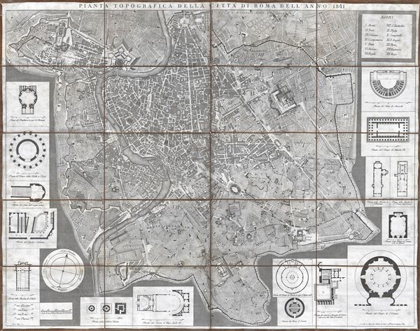
Pianta Topografica della Citta di Roma dell'Anno 1841.
sold
- Digital Map Information
- Suitable for large format printing
- DPI: 300
- File Size: 38.81 MB
- File Type: ZIP / TIFF
- ICC color profile embedded
- Delivered instantly via download link
This is a fine 1841 topographical map or plan of Rome, Italy drawn by Pietro Ruga. Covers the walled center of Rome in incredible detail, reveling individual streets, buildings, parks, piazzas, temples, ... (more details)