
French and Indian War
Unobtainable first state of one of the most influential maps of New England ever made.
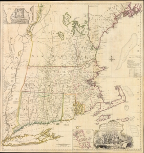
A MAP of the most INHABITED part of NEW ENGLAND, containing the PROVINCES of MASSACHUSETS BAY and NEW HAMPSHIRE, with the COLONIES of KONEKTIKUT AND RHODE ISLAND. Divided into Counties and Townships: The whole composed of Actual Surveys and its situation adjusted by ASTRONOMICAL OBSERVATIONS.
$55,000.00
Acquire
- Digital Map Information
- Suitable for large format printing
- File Size: 35.46 MB
- File Type: ZIP / TIFF
- ICC color profile embedded
- Delivered instantly via download link
This is the rare 1755 first state of Braddock Mead's French and Indian War Era map of New England - one of the most significant and iconic American maps ever produced. It is one of the first large-format regional maps of any part of North America and was the most comprehensively researched and detailed map of contemporary New England. (more details)
Best neutral-perspective map of the French and Indian War.
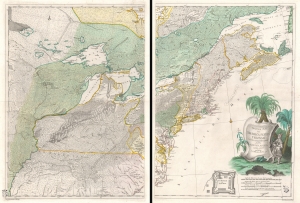
Theatrum belli in America Septentrionali. II. foliis comprehensum jussu Acad. Reg. Scient. et Eleg. Litt. exhibet I. C. Rhode Ac: Geogr. Berger, sculpsit berol.
$14,000.00
Acquire
- Digital Map Information
- Suitable for large format printing
- Full resolution TIFF file
- ICC color profile embedded
- Delivered instantly via download link
An important separately issued c. 1761 Johann Christoph Rhode map of eastern North America published in Berlin is considered the most important neutral perspective map of the French and Indian War (1754 - 1763). Rhode's map is little known and often overlooked by collectors, surprising as it is unquestionably the most exceptional map of the Theater of the French and Indian War published in any country other than the belligerent nations. (more details)
Seminal view of Quebec shortly after the French and Indian War.
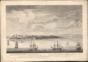
A View of the City of Quebec, the capital of Canada, taken partly from the Pointe des Peres, and partly on Board the Vanguard Man of War. / Vue de la Ville de Québec, capitale du Canada, prise en partie de la Pointe des Peres, et en partie abord de l'Avantgarde Vaisseau de Guerre.
$5,500.00
Acquire
- Digital Map Information
- Suitable for large format printing
- File Size: 25.18 MB
- File Type: ZIP / TIFF
- ICC color profile embedded
- Delivered instantly via download link
This is the rare 1868 Hervey Smyth view of Quebec City, published in 1768. It is one of the earliest obtainable views of Quebec City, offering a look at the city shortly after the French and Indian War (1754 - 1763). The view was published for the Scenographia Americana, one of the most influential and monumental pre-Revolutionary graphic works on North America. (more details)
Unique French perspective on the French and Indian War.
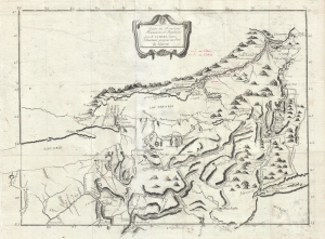
Carte des Frontieres Francoises, et Angloises dens le Canada depuis Montreal jusques au Fort du Quesne.
$2,900.00
Acquire
- Digital Map Information
- Suitable for large format printing
- DPI: 300
- File Size: 7.05 MB
- File Type: ZIP / TIFF
- ICC color profile embedded
- Delivered instantly via download link
A remarkable 1758/1781 idiosyncratically engraved map offering a uniquely French perspective on the French and Indian War (1754 - 1763). It is based on the first-hand experiences of French engineer Pierre Pouchot de Maupas. (more details)
French Territorial Claims in North America.
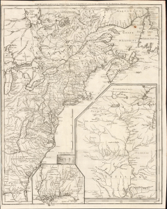
Carte d'une partie de l'Amérique Septentrionale, pour servir à l'histoire de la dernière guerre.
$1,500.00
Acquire
- Digital Map Information
- Suitable for large format printing
- File Size: 26.55 MB
- File Type: ZIP / TIFF
- ICC color profile embedded
- Delivered instantly via download link
This is Louis Le Rouge's 1755/1787 map of the British Colonies in North America, surrounded by French territorial claims as they stood at the beginning of the French and Indian War (1754 - 1763). While the present state was published just after the American Revolutionary War (1775 - 1783), it was composed and first printed in 1755, and was edited in 1777 to provide a record of the earlier conflict. Hence, its focus is on the battles of the earlier conflict and the extensive inclusion of Native American tribes and settlements. (more details)
An important map illustrating the Mississippi Valley during the French and Indian War.
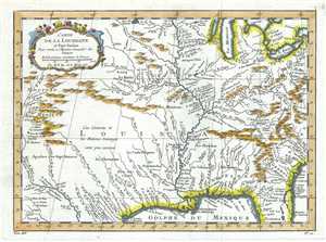
Carte de la Louisiane et Pays Voisins.
$650.00
Acquire
- Digital Map Information
- Suitable for large format printing
- DPI: 300
- File Size: 4.44 MB
- File Type: ZIP / TIFF
- ICC color profile embedded
- Delivered instantly via download link
This is an important 1757 map of the United States by the French cartographer Jacques-Nicholas Bellin. Centered on the Mississippi Valley, Bellin's map covers from the Riviere de Nord (Rio Grande) eastward to Lake Ontario and from Lake Huron to the Gulf of Mexico ... (more details)