
French and Indian War (sold)
Setting the Stage for the French and Indian War.
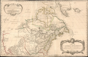
Carte De L’ Amerique Septentrionale Depuis le 28 Degré de Latitude jusquau 72.
sold
- Digital Map Information
- Suitable for large format printing
- File Size: 37.56 MB
- File Type: ZIP / TIFF
- ICC color profile embedded
- Delivered instantly via download link
This grand map of 1755 J. N. Bellin map of North America presents one of the clearest statements of France's boldly aggressive territorial claims in North America at the dawn of the French and Indian War (1754 - 1763). (more details)
Important French and Indian War issue of Bellin's influential Map of the Great Lakes. Probably the most decorative of the series.
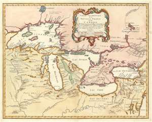
Partie Occidentale de la Nouvelle France ou du Canada.
sold
- Digital Map Information
- Suitable for large format printing
- DPI: 600
- File Size: 22.1 MB
- File Type: ZIP / TIFF
- ICC color profile embedded
- Delivered instantly via download link
A rare and extremely influential 1755 map of the Great Lakes drawn by Jacques Nicholas Bellin. This map, which appeared in the 1755 issue of the Homann Heirs Atlas Major , depicts all five of the Great Lakes as well as the adjacent Indian lands and the English ... (more details)
Important French and Indian War issue of Bellin's influential Map of the Great Lakes. Probably the most decorative of the series.
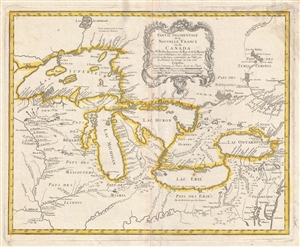
Partie Occidentale de la Nouvelle France ou du Canada.
sold
- Digital Map Information
- Suitable for large format printing
- DPI: 300
- File Size: 11.3 MB
- File Type: ZIP / TIFF
- ICC color profile embedded
- Delivered instantly via download link
A rare and extremely influential 1755 map of the Great Lakes drawn by Jacques Nicholas Bellin. This map, which appeared in the 1755 issue of the Homann Heirs Atlas Major , depicts all five of the Great Lakes as well as the adjacent Indian lands and the English ... (more details)
French perspective map of the French and Indian War.
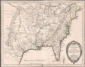
Carte de La Louisiane et des Pays Voisins.
sold
- Digital Map Information
- Suitable for large format printing
- Full resolution TIFF file
- ICC color profile embedded
- Delivered instantly via download link
An unusual and scarce 1755 map of North America by Jacques-Nicolas Bellin issued at the outbreak of the French and Indian War (1754 - 1763). Centered on the vast Mississippi Valley, the map covers from the Rio Grande to the Atlantic Seaboard and from Lake Superior to the Florida Keys. While first issued in 1750, the present map has been updated considerably to represent French, English, and Spanish claims at the outbreak of the French and Indian War. Most of the most important battle sites are forts are noted, including Fort Duquesne, Fort Necessity, Fr. Le Boeuf, Fort Presqu'Isle, and Fort St. Frederic, among others. (more details)
Sublimely-executed manuscript study of West's famous painting.
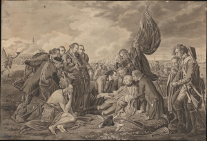
The Death of General Wolfe.
sold
- Digital Map Information
- Suitable for large format printing
- File Size: 6.55 MB
- File Type: ZIP / TIFF
- ICC color profile embedded
- Delivered instantly via download link
This is a sublimely-executed 19th-century painting of Benjamin West's The Death of General Wolfe by an unidentified artist. West's work dramatizes General James Wolfe's death during the 1759 Battle of Quebec during the Seven Years' War (1756 - 1763) just after learning of the British victory. The present study is in a fine, if unknown, hand and rendered so precisely that the brush can only have been a single hair. (more details)
The Northeast Coast of America during the French and Indian War.
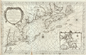
Carte reduite des costes orientales de l'Amerique septentrionale : 1re. feuille contenant L'Isle Royale, L'Accadie, La Baye Françoise, La Nouvelle Angleterre et La Nouvelle Yorc.
sold
- Digital Map Information
- Suitable for large format printing
- Full resolution TIFF file
- ICC color profile embedded
- Delivered instantly via download link
This is a large, scarce, beautifully engraved 1757 French and Indian War Era Jacques Nicolas Bellin nautical map of New York, New England, and the Canadian Maritimes, including Nova Scotia and Isle Royale. This chart, along with many others, was issued on the order of the French Crown for anticipated naval action during the French and Indian War (1754 - 1763). The chart is superbly engraved, with dramatic pictorial mountains, elaborate river systems, and particular attention to approaches from Newfoundland to Boston Harbor, with depth soundings in profusion. The map extends from Isle Royale to the west shore of the Hudson (including the Mohawk River, Saratoga Lake, noting the portages to points north of the Hudson's shallows.) (more details)
Important map issued at the outset of the French and Indian War.
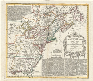
America Septentrionalis a domino d'Anville in Galiis edita nunc in Anglia coloniis in interiorem Virginiam deductis nec non fluvii Ohio cursu aucta notisq geographicis et historicis illustrata.
sold
- Digital Map Information
- Suitable for large format printing
- DPI: 300
- File Size: 14.65 MB
- File Type: ZIP / TIFF
- ICC color profile embedded
- Delivered instantly via download link
A fine example of the 1756 first edition of the Homann Heirs map of the English Colonies in North America near the outset of the French and Indian War. The map covers much of the eastern part of the modern day United States from just west of the Mississippi ... (more details)
Issued on the eve of the French and Indian War or Seven Years' War.
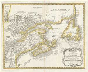
Partie Orientale de la Nouvelle France ou du Canada.
sold
- Digital Map Information
- Suitable for large format printing
- DPI: 300
- File Size: 16.4 MB
- File Type: ZIP / TIFF
- ICC color profile embedded
- Delivered instantly via download link
This is a beautiful 1755 map of eastern Canada and New England by Homann Heirs. Extends from Lake Ontario, St. Lawrence River and Cape Cod north to Newfoundland, Cap Rond and the Hudson Bay. The map renders the entire region in extraordinary detail offering ... (more details)
State-of-the-art mapping of Lake Champlain at the outbreak of the French and Indian War.
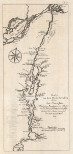
Karte von dem Fluße Richeliue und dem See Champlain Nach den Manuscripten des Schatzes von Karten Grüdrißen und Tagebüchern der Marine.
sold
- Digital Map Information
- Suitable for large format printing
- File Size: 3.14 MB
- File Type: ZIP / TIFF
- ICC color profile embedded
- Delivered instantly via download link
This is the 1756 German edition of the 1744 Bellin map of Lake Champlain and the St. Lawrence River. Bellin composed this map from French surveys conducted in the 1740s, making it one of the earliest accurate maps of Lake Champlain. This map was the state-of-the-art of Lake Champlain cartography and was the best available map of Lake Champlain at the outbreak of the French and Indian War (1754 - 1763) and the American Revolutionary War (1775 - 1783). Bellin's work was only supplanted when the British published Brassier's map in 1776. (more details)
Britain's Prize in America following the French and Indian War.
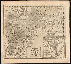
An Accurate Map of the British Empire in Nth. America as settled by the Preliminaries in 1762.
sold
- Digital Map Information
- Suitable for large format printing
- DPI: 600
- File Size: 12.76 MB
- File Type: ZIP / TIFF
- ICC color profile embedded
- Delivered instantly via download link
This scarce, fascinating map of North America east of the Mississippi appeared in the 1762 end-of-year supplement of the Gentleman's Magazine. It revealed, to that magazine's readership, the vast prize of American land that Great Britain stood to gain at the expense of the French in the treaty negotiations then bringing the French and Indian War (1754 - 1763) to a close. (more details)
Stunning map of several important Canadian cities during the French and Indian War.
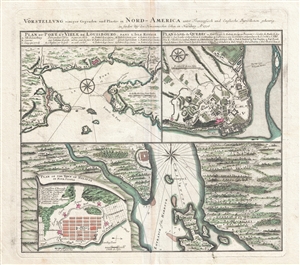
Vorstellung einiger Gegenden und Plaetze in Nord-America unter Franzoesisch und Englische Jurisdiction gehoerig.
sold
- Digital Map Information
- Suitable for large format printing
- DPI: 300
- File Size: 15.08 MB
- File Type: ZIP / TIFF
- ICC color profile embedded
- Delivered instantly via download link
An attractive 1756 Homann Heirs map of the Canadian cities of Halifax (Nova Scotia), Louisbourg (Nova Scotia) and Quebec City (Quebec) at the outset of the French and Indian War (1756 – 1763). Essentially four maps on one sheet. Homann no doubt issued ... (more details)
French map issued in the second year of the French and Indian War.
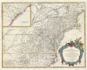
Partie de l'Amerique Septentrionale, qui comprend le Cours de l'Ohio, la Nlle. Angleterre, la Nlle. York, le New Jersey, la Pensylvanie, le Maryland, la Virginie, la Caroline.
sold
- Digital Map Information
- Suitable for large format printing
- DPI: 300
- File Size: 17.72 MB
- File Type: ZIP / TIFF
- ICC color profile embedded
- Delivered instantly via download link
An uncommon first edition first state example of Robert de Vaugondy's 1755 map of the Ohio River Valley and eastern seaboard from Maine to Carolina. The map coves from Lake Huron to Brunswick North Carolina and from the Mississippi River to the Atlantic ... (more details)
An important map illustrating the Mississippi Valley during the French and Indian War.
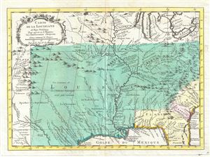
Carte de la Louisiane et Pays Voisins Pour servir a l'Histoire des Etablissemens Europeens.
sold
- Digital Map Information
- Suitable for large format printing
- DPI: 300
- File Size: 3.85 MB
- File Type: ZIP / TIFF
- ICC color profile embedded
- Delivered instantly via download link
This is an important 1760 map of the United States by the French cartographer Jacques-Nicholas Bellin. Centered on the Mississippi Valley, Bellin's map covers from the Riviere de Nord (Rio Grande) eastward to Lake Ontario and from Lake Huron to the Gulf ... (more details)
Frontier of the French and Indian War.
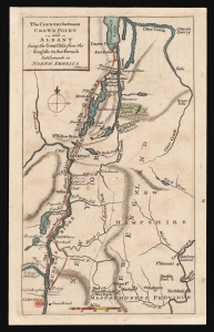
The Country between Crown Point and Albany being the Great Pass from the English to the French Settlements in North America.
sold
- Digital Map Information
- Suitable for large format printing
- DPI: 600
- File Size: 4.83 MB
- File Type: ZIP / TIFF
- ICC color profile embedded
- Delivered instantly via download link
This is a rare 1858 map of a key theatre of the French and Indian War, engraved by Thomas Phinn in Edinburgh to satisfy readers hungry for news. Although of broader scope, it is remarkable in pre-dating the famous Brasier map of Lakes Champlain and George, the earliest separate map specifically of those lakes. The Brasier surveys began after the publication of the present map. (more details)
An important map illustrating the Mississippi Valley during the French and Indian War.
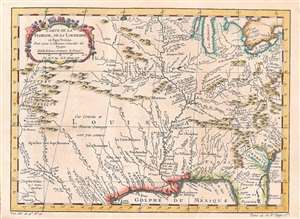
Carte de la Floride, de la Louisiane, et Pays Voisins.
sold
- Digital Map Information
- Suitable for large format printing
- DPI: 600
- File Size: 6.42 MB
- File Type: ZIP / TIFF
- ICC color profile embedded
- Delivered instantly via download link
This is an attractively engraved and detailed 1757 map of the United States by the French cartographer Jacques-Nicholas Bellin. Centered on the Mississippi Valley, Bellin's map covers from the Riviere de Nord (Rio Grande) eastward to Lake Ontario and from Lake Huron to the Gulf of Mexico and Florida. This map is extremely rich in detail illustrating and naming countless American Indian settlements and villages. Bellin offers a wealth of new material throughout marking this map as a unique and meticulously researched production. (more details)
Scarce French and Indian War Era Map showing Fort Dequesne.
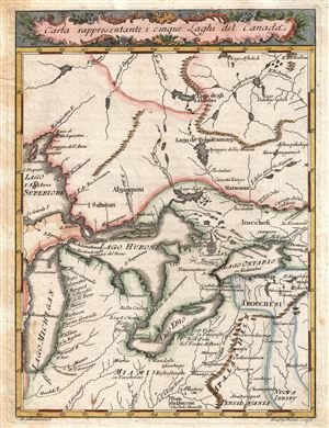
Carta Rappresentante i Cinque Laghi del Canada.
sold
- Digital Map Information
- Suitable for large format printing
- DPI: 300
- File Size: 2.66 MB
- File Type: ZIP / TIFF
- ICC color profile embedded
- Delivered instantly via download link
This is an uncommon and detailed 1763 Italian issue map of the Great Lakes and adjacent territories. The map covers all five of the Great Lakes although Lake Superior is only partially represented. It extends northwards well beyond Lake Superior, ... (more details)
French map issued in the fourth year of the French and Indian War.
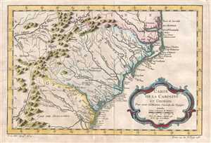
Carte de la Caroline et Georgie.
sold
- Digital Map Information
- Suitable for large format printing
- DPI: 300
- File Size: 2.35 MB
- File Type: ZIP / TIFF
- ICC color profile embedded
- Delivered instantly via download link
This is French cartographer Jacques-Nicolas Bellin’s 1757 map of the Carolinas and Georgia. It depicts modern day North Carolina, South Carolina, and Georgia, along with parts of Virginia and eastern Tennessee, extending from just north of the ... (more details)
French map issued in the fourth year of the French and Indian War.
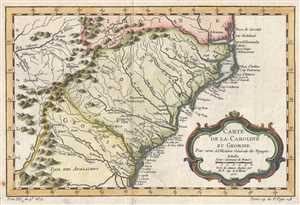
Carte de la Caroline et Georgie.
sold
- Digital Map Information
- Suitable for large format printing
- DPI: 300
- File Size: 2.51 MB
- File Type: ZIP / TIFF
- ICC color profile embedded
- Delivered instantly via download link
This is French cartographer Jacques-Nicholas Bellin’s 1757 map of the Carolinas and Georgia. It depicts modern day North Carolina, South Carolina, and Georgia, along with parts of Virginia and eastern Tennessee, extending from just north of ... (more details)
French map issued in the fourth year of the French and Indian War.
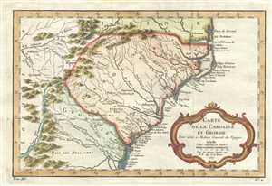
Carte de la Caroline et Georgie.
sold
- Digital Map Information
- Suitable for large format printing
- DPI: 300
- File Size: 3.01 MB
- File Type: ZIP / TIFF
- ICC color profile embedded
- Delivered instantly via download link
This is French cartographer Jacques-Nicholas Bellin’s 1757 map of the Carolinas and Georgia. It covers modern day North Carolina, South Carolina and Georgia, and parts of Virginia and eastern Tennessee, extending from just north of the ... (more details)
1763 Gazzettiere Americano Map of the British Colonies: New York, Pennsylvania, New Jersey, Masssach
Scarce French and Indian War Era Map showing French settlements in Pennsylvania.
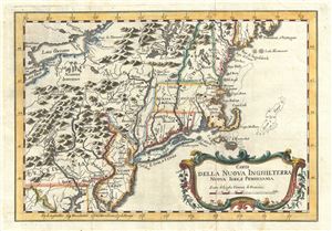
Carta Della Nuova Inghilterra Nuova Iork, e Pennsilvania.
sold
- Digital Map Information
- Suitable for large format printing
- DPI: 300
- File Size: 3.56 MB
- File Type: ZIP / TIFF
- ICC color profile embedded
- Delivered instantly via download link
An uncommon 1763 Italian edition of Jacques Nicholas Bellin's 1763 map of the English Colonies from Pennsylvania to Maine. The map covers from Lake Erie and Lake Ontario south to the Potomac River and eastward to the Atlantic seaboard. ... (more details)
Map of New England during the French and Indian War.
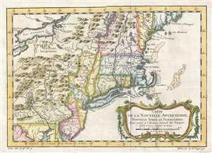
Carte de la Nouvelle Angleterre Nouvelle Yorck et Pensilvanie.
sold
- Digital Map Information
- Suitable for large format printing
- DPI: 300
- File Size: 2.84 MB
- File Type: ZIP / TIFF
- ICC color profile embedded
- Delivered instantly via download link
This is a Jacques-Nicolas Bellin map of New England. The map depicts the region from Lake Erie to the Atlantic Ocean and from Lake Champlain to the extreme northern portion of the Chesapeake Bay, including some or all of the states of New York, Massachusetts, Pennsylvania, New Jersey, Connecticut, Rhode Island, Vermont, New Hampshire, and Maine. Numerous cities and towns are labeled throughout, including New York, Boston, Cambridge, Philadelphia, New Haven, and Salem. American Indian tribes and settlements are also identified, including the Five Iroquois Nations, while others are referred to simply as villages sauvages. Several rivers, lakes, and mountain ranges are also illustrated. (more details)
Map of New England during the French and Indian War.
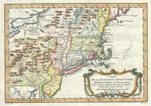
Carte de la Nouvelle Angleterre Nouvelle Yorck et Pensilvanie.
sold
- Digital Map Information
- Suitable for large format printing
- DPI: 300
- File Size: 4.23 MB
- File Type: ZIP / TIFF
- ICC color profile embedded
- Delivered instantly via download link
This beautiful 1757 hand colored map by French cartographer Jacques-Nicolas Bellin features New England, New York and Pennsylvania. The map covers the northeast showing New York, New Jersey, Connecticut, Massachusetts, New Hampshire, ... (more details)
Also known as the Battle of the Plains of Abraham, this battle was a key British victory in the French and Indian War.
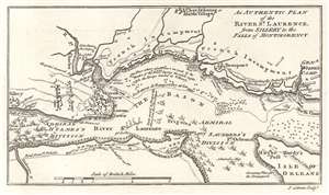
An Authentic Plan of the River St. Laurence, from Sillery to the Falls of Montmorency.
sold
- Digital Map Information
- Suitable for large format printing
- DPI: 600
- File Size: 2.03 MB
- File Type: ZIP / TIFF
- ICC color profile embedded
- Delivered instantly via download link
This is a 1759 John Gibson map of the Battle of Quebec during the French and Indian War, the name for the North American theater during the 7 Years' War between Britain and France. Also known as the Battle of the Plains of Abraham, the map depicts the region from the sillery to Montmorency Falls and from Charlebourg to the Isle of Orleans (Isle d'Orléans). The blockading British fleet is illustrated in the St. Lawrence, while French encampments are labeled all along the river from Quebec City to the Montmorency Falls. The battle, which took place to the west of Quebec City, is illustrated by French and British battle lines. (more details)
Also known as the Battle of the Plains of Abraham, this battle was a key British victory in the French and Indian War.
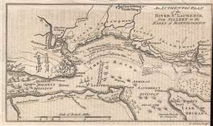
An Authentic Plan of the River St. Laurence, from Sillery to the Falls of Montmorency.
sold
- Digital Map Information
- Suitable for large format printing
- DPI: 300
- File Size: 1.1 MB
- File Type: ZIP / TIFF
- ICC color profile embedded
- Delivered instantly via download link
This is a 1759 John Gibson map of the Battle of Quebec during the French and Indian War, the name for the North American theater during the 7 Years' War between Britain and France. Also known as the Battle of the Plains of Abraham, the map depicts the region from the sillery to Montmorency Falls and from Charlebourg to the Isle of Orleans (Isle d'Orléans). The blockading British fleet is illustrated in the St. Lawrence, while French encampments are labeled all along the river from Quebec City to the Montmorency Falls. The battle, which took place to the west of Quebec City, is illustrated by French and British battle lines. (more details)