
Ottoman Maps
Battle for the Fate of the Levant.
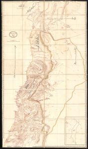
ردشمنلوا میسرت كنویامه هیرب هناخسدنهم هطیرح وبشا [This map was drawn by the Imperial Engineering Office].
$20,000.00
Acquire
- Digital Map Information
- Suitable for large format printing
- Full resolution TIFF file
- ICC color profile embedded
- Delivered instantly via download link
An extraordinary, one-of-a-kind large-format manuscript folding map of Ottoman Syria produced by the sultan's Imperial Engineering Office c. 1832. It was made in the context of the First Egyptian Ottoman War (1831 - 1833), which saw the region temporarily come under Egyptian rule. (more details)
Most Detailed Ottoman Map of Montenegro Ever Produced.
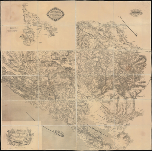
... ١٨٦٩ سنه سی اوستريا دولتی جغرافيا جمعيت عسكريه سی واسطه سيله تنظيم قلنان قره طاغ وجوارينك خريطه سی اولوب / [This is a map of Montenegro and its Surroundings, prepared by means of the Austrian Militärgeographisches Institut in the year 1869...].
$6,000.00
Acquire
- Digital Map Information
- Suitable for large format printing
- Full resolution TIFF file
- ICC color profile embedded
- Delivered instantly via download link
This is a rare 1875 Ottoman Turkish large-format folding map of Montenegro produced by the Erkân-ı Harbiye Dairesi, the General Staff Department of the Ottoman military, based on an earlier 1869 Austrian map prepared by the Militärgeographisches Institut. Combining Austrian and Ottoman cartographic knowledge, largely gained during the Ottoman-Montenegrin War (1861 - 1862), it is the most detailed Ottoman map of Montenegro produced before the kingdom's independence. (more details)
Celebrating the Hejaz Railway from Damascus to Medina.
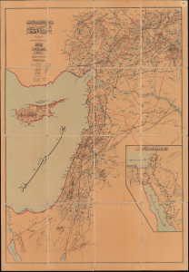
سوریه قطعهسی / [The Region of Syria].
$3,750.00
Acquire
- Digital Map Information
- Suitable for large format printing
- Full resolution TIFF file
- ICC color profile embedded
- Delivered instantly via download link
This exceptionally rare c. 1912 Ottoman folding map of the Levant highlights the Hejaz Railway. Across scorching deserts, waterless expanses, and some of the most unforgiving terrain on earth, the Ottoman Empire forged one of the Islamic world's great engineering achievements: the Hejaz Railway. Financed without European loans through contributions from Muslims around the globe and constructed increasingly by Ottoman engineers and Muslim workers, the line reached more than 1,300 kilometers from Damascus to Medina (المدينة) by 1908. (more details)
Baghdad in Transition from Ottoman to British Rule.
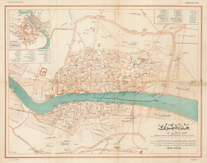
بغداد شهری / [City of Baghdad].
$3,500.00
Acquire
- Digital Map Information
- Suitable for large format printing
- File Size: 18.69 MB
- File Type: ZIP / TIFF
- ICC color profile embedded
- Delivered instantly via download link
This is a rare c. 1925 Ottoman Turkish map of Baghdad, originally prepared by Rashid (Reşid) Bey and updated by the Erkân-ı Harbiye-i Umûmiye Matbaasından, the Printing House of the General Staff of the Turkish military. Although published after the city's capture by British forces, the map presents the city at the end of the Ottoman period, with references to its earlier history. (more details)
Ottoman Preparations for the 'Last Stand' in the Levant.

يلديرم اردولر غروپى نزد مؤسسه مؤسسات صحيه و حيوانيهسى مشروحدور / [The medical and veterinary institutions and establishments attached to the Yıldırım Army Group are detailed here].
$3,000.00
Acquire
- Digital Map Information
- Suitable for large format printing
- Full resolution TIFF file
- ICC color profile embedded
- Delivered instantly via download link
This is a rare and likely unique c. 1918 large-format Ottoman military resource map of the Levant prepared by the Yıldırım Orduları Grubu (Lightning Armies Group), the elite field command established to halt the advancing British Empire and its Arab allies during the final stages of World War I (1914-1918). Combining printed cartography with handstamps and manuscript annotations, the map inventories the region's strategic infrastructure, emphasizing hospitals, medical depots, supply centers, transportation networks, and other critical military resources essential to sustaining Ottoman operations. Intended for high-level logistical planning rather than tactical battlefield use, such a comprehensive assessment of military assets would have been among the Ottoman Empire's most closely guarded wartime documents, offering an extraordinary glimpse into the administrative and logistical foundations of the Palestine Campaign. (more details)
Ottoman Irredentism in Africa.

مفصل افريقا خريطة / [Detailed Map of Africa].
$2,000.00
Acquire
- Digital Map Information
- Suitable for large format printing
- Full resolution TIFF file
- ICC color profile embedded
- Delivered instantly via download link
This is a rare, large-format Ottoman Turkish wall map of Africa, produced c. 1908 by the empire's Ministry of Public Education. It reflects the efforts of Ottoman reformers to disseminate geographic knowledge through the education system while also reinforcing pride in the empire through irredentism and maximalist territorial claims. (more details)
Ottoman Empire's Turkish-speaking Orthodox Minority.
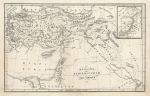
ΜΕΜΑΛΙΚΙ ΟΣΜΑΝΙΓΕΝΙΝ ΑΣΙΑ ΚΗΤΑΣΗ. / [Territories of the Ottoman Empire - Asian Possessions.]
$950.00
Acquire
- Digital Map Information
- Suitable for large format printing
- File Size: 5.46 MB
- File Type: ZIP / TIFF
- ICC color profile embedded
- Delivered instantly via download link
This is a fascinating c. 1880 map of the Asian portion of the Ottoman Empire in the Karamanli Turkish type. The map reflects the complex and contradictory trends of the late Ottoman period, in which the empire's remarkable cosmopolitanism collided with 19th-century nationalism. (more details)
Walls of the Sea.
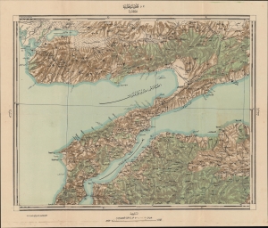
قلعه سلطانيه / [Sultaniye Castle].
$950.00
Acquire
- Digital Map Information
- Suitable for large format printing
- Full resolution TIFF file
- ICC color profile embedded
- Delivered instantly via download link
This is a 1922 Ottoman Turkish military and topographic map of the Dardanelles, produced by the Erkan-ı Harbiye-i Umumiye Matbaası. It highlights fortifications, lines of communication, and other essential military information constructed just before and during World War I (1914 - 1918), preparations that would pay off during the Gallipoli Campaign in 1915. (more details)
Dying Days of the Ottoman Empire.
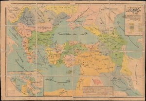
عثمانلي وطن / [Ottoman Homeland].
$950.00
Acquire
- Digital Map Information
- Suitable for large format printing
- File Size: 73.13 MB
- File Type: ZIP / TIFF
- ICC color profile embedded
- Delivered instantly via download link
A scarce, large-format folding map of the Ottoman Empire, produced c. 1917 by the Ministry of Public Education (Maarif-i Umumiye Nezareti) to demonstrate the empire's historical territorial changes. Produced at a time of drastic transition, the map harkens to the Ottomans' glorious history as well as their precarious contemporary situation, as a modern, territorial sense of nationhood was supplanting an older system of suzerainty and adaptive rule over diverse, multiethnic populations. (more details)
One of the Only Acquirable Turkish Maps of Üsküdar
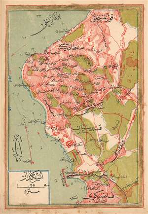
(Turkish Plan of Üsküdar)
$350.00
Acquire
- Digital Map Information
- Suitable for large format printing
- File Size: 1.41 MB
- File Type: ZIP / TIFF
- ICC color profile embedded
- Delivered instantly via download link
This is a 1909 Turkish plan of Üsküdar, produced by the Turkish educator and publisher Mehmet Eşref. It is one of the earliest, if not the only early Turkish printed plan of this part of Istanbul available to the collector. All titles and descriptive text are in Ottoman Turkish. The plan encompasses the neighborhoods of Harem, Doğancılar, Nakkaştepe and İcadiye, and indicates significant green space beyond these limits. Depth soundings are noted in the Bosphorus, and the famous 'Maiden's Tower,' or Kiz Kulesi, is marked just off the shore. Chromolithograph. (more details)