
Bénard, Robert

Robert Bénard (1734 - c. 1785) was a French engraver. Born in Paris, Bénard is best known for supplying a significant number of plates (at least 1,800) for the Encyclopédie published by Diderot and Alembert. He also is remembered for his work with the Académie des Sciences, most notably the Descriptions des Arts et Métiers
Early maps of features in the western Pacific.
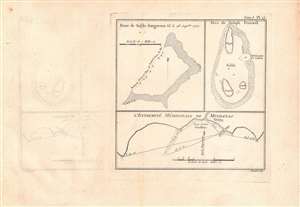
Banc de sable dangereux Vû le 28 Septbre. 1767; Isles de Joseph Freewell; l'extremité méridionale de Mindanao.
$125.00
Acquire
- Digital Map Information
- Suitable for large format printing
- DPI: 600
- File Size: 16.03 MB
- File Type: ZIP / TIFF
- ICC color profile embedded
- Delivered instantly via download link
Three maps on a single sheet. The map detailas geographic features encountered in the western Pacific during a 1766 - 1769 British voyage of circumnavigation captained by Philip Carteret. They were engraved by Robert Benard and published in the 1774 French translation of John Hawkesworth's An Account of the Voyages…, a very popular work which helped publicize British discoveries in the Pacific. (more details)
Named for Selkirk, inspiration for Robinson Crusoe.
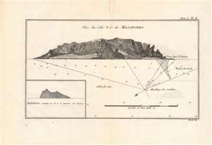
Vue du Côté N.O. de Masafuero.
$150.00
Acquire
- Digital Map Information
- Suitable for large format printing
- DPI: 600
- File Size: 14.84 MB
- File Type: ZIP / TIFF
- ICC color profile embedded
- Delivered instantly via download link
This 1774 view and chart details Más Afuera Island (now Alejandro Selkirk Island), encountered on a 1766 - 1769 British voyage of circumnavigation captained by Philip Carteret. It was engraved by Robert Benard and published in the 1774 French translation of John Hawkesworth's An Account of the Voyages…, a very popular work which helped publicize British discoveries in the Pacific. (more details)
Volcanoes and violence in the Solomons.
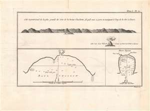
Cote Septentrional de la plus grande des Isles de la Reine Charlotte / Baye Swallow / Havre Byron.
$100.00
Acquire
- Digital Map Information
- Suitable for large format printing
- DPI: 600
- File Size: 15.46 MB
- File Type: ZIP / TIFF
- ICC color profile embedded
- Delivered instantly via download link
This is a nice example of Philip Carteret's 1774 view and chart of the largest of the Queen Charlotte Islands (Nendö Island) in the Santa Cruz Islands, now part of the Solomon Islands (not to be confused with Queen Charlotte Islands in Southern Alaska, or the Queen Charlotte Island now known as Nukutavake in the Tuamotu Archipelago of French Polynesia). It was published in the French translation of John Hawkesworth's wildly successful An Account of the Voyages…. (more details)
The Solomon Islands, Rediscovered and Renamed by Carteret
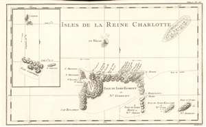
Isles De La Reine Charlotte.
$200.00
Acquire
- Digital Map Information
- Suitable for large format printing
- DPI: 600
- File Size: 5.46 MB
- File Type: ZIP / TIFF
- ICC color profile embedded
- Delivered instantly via download link
This is a 1774 map of the Solomon Islands, renamed by Carteret after his 'rediscovery' of the islands during his calamitous 1767 journey around the world. The map is beautifully engraved, with topography shown pictorially, and showning predominant winds. The map shows the track of HMS Swallow through the islands; there is a volcanic island shown centrally - this is Tinakula island, an island stratovolcano which last erupted in 2012 and whose earliest recorded eruption dates to the Álvaro de Mendaña expediion of 1595 . (more details)
The Charting of a Key English Port of Call in the Age of Cook.
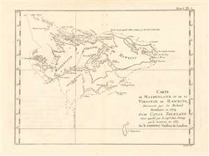
Carte de Maidenland ou de la Virginie de Hawkins, Découvere par Sir Richard Hawkins en 1574 et du Canal Falklanf ainsi appellé par le Cap.ne Jean Stron qui le traversa en 1689 sur le Farewell Vaisseu de Londres.
$250.00
Acquire
- Digital Map Information
- Suitable for large format printing
- DPI: 600
- File Size: 5.89 MB
- File Type: ZIP / TIFF
- ICC color profile embedded
- Delivered instantly via download link
This 1774 Hawkesworth map of the Falkland Islands, or Malvinas shows the charting of the archipelago's waters just as the British were about to withdraw from active possession of the islands in anticipation of the American Revolutionary War. The place name used here, 'Maidenland ou Virginie de Hawkins' refers to the name bestowed on the islands by English commander Richard Hawkins, combining his own name with that of Queen Elizabeth I, the 'Virgin Queen.' (It was later determined that Hawkins had actually sighted only Steeple Jason island, one of the very small islands appearing in the northwest corner of the map.) The archipelago did appear on earlier maps based on the Portuguese, though the attributions of early sightings are uncertain and at odds with one another. (more details)
A Beautifully Engraved Record of Cook's 1769 Passage around Tierra del Fuego.
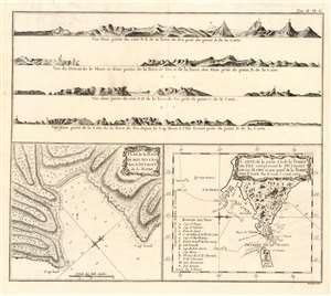
Plan de la Baye Du Bon Succés dans le Détroit de le Maire/ Carte de la partie S. E. de la Terre de Feu comprenant le Détroit de Le Maire et une Partie de la Terre Des Etats. Par le Lieut. J. Cook 1769.
$950.00
Acquire
- Digital Map Information
- Suitable for large format printing
- DPI: 600
- File Size: 9.9 MB
- File Type: ZIP / TIFF
- ICC color profile embedded
- Delivered instantly via download link
This 1774 Hawkesworth map of the Strait of Le Maire details the passage through the strait made by Lieutenant Cook (1728-1779) during his 1769 circumnavigation aboard HMS Endeavor. This, Cook's first Pacific voyage, was undertaken in order to observe the 1769 transit of Venus from Tahiti. The relevant portion of the voyage diverged sharply from its precursors, in that Cook took Endeavor through the Strait of Le Maire, rather than that of Magellan, thereafter sailing south to find evidence of the legendary Terra Australis Incognita. (more details)
Circumnavigators visit Paradise.
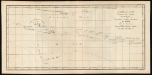
Carte des Isles découvertes aux environs d'Otahiti, dans plusieurs Voyages faits autour du Monde Par les Capitaines Byron, Wallis, Carteret et Cook en 1765, 1767, 1769.
$400.00
Acquire
- Digital Map Information
- Suitable for large format printing
- File Size: 8.64 MB
- File Type: ZIP / TIFF
- ICC color profile embedded
- Delivered instantly via download link
This is a 1774 map showing the explorations of Captains Cook, Byron, Wallis, and Carteret in the vicinity of Tahiti and the Society Islands from 1765 to 1769. The chart extends from the Scilly Islands in the west to Whitsunday Island in the east and from Tepoto Island in the north to Oheiroa in the south. Each of the circumnavigators' tracks is shown as they tacked through the islands. Tahiti, Bora Bora, Otaha, Marma, Ulietea, and other islands are named and shown. These voyages represented the first recorded European contacts with many of these remote places. (more details)
A Grand, Detailed Chart of Cook's Passage Through the Straits
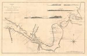
Carte du Detroit de Magellan dans laquelle on a Inseré les observations et de decouvertes du Capne. Byron, du Capne. Wallis, et du Capne. Cateret.
$950.00
Acquire
- Digital Map Information
- Suitable for large format printing
- Full resolution TIFF file
- ICC color profile embedded
- Delivered instantly via download link
This 1774 map of the Straits of Magellan reveals the discoveries made by Captains Samuel Wallis (1728-1795) John Byron (1723-1786) and Captain James Cook (1728-1779) during their respective voyages. In compiling the data of these three explorers, Hawkesworth's chart presented the best knowledge of this important and storied passage. This large and boldly engraved piece shows in detail the treacherous coasts of southern Patagonia and of Tierra del Fuego, replete with soundings, channels, anchorages and small islands. Recognition views are provided for Cabo Virgenes, White Cliffs, Cape Fair Weather at the mouth of the Rio Gallego, and A view of Puerto del Hambre. The coastline is full of detail and colorful place names, such as 'Cape Victory' and 'Piss Pot Bay.' (more details)
A Chart of East Indies Discoveries by Cook and Carteret
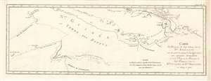
Carte des découvertes du Cap.ne Carteret dans la Nle. Bretagne avec une partie de du passage du Cap.ne Cook à travers les Détroits Endeavour et de la route et des découvertes du Cap.ne Dampierre dans la Nle. Guinée et la Nle. Bretagne en 1699 et 1700.
$350.00
Acquire
- Digital Map Information
- Suitable for large format printing
- DPI: 600
- File Size: 10.58 MB
- File Type: ZIP / TIFF
- ICC color profile embedded
- Delivered instantly via download link
This is a 1774 nautical map of the discoveries of Captain Carteret Captain James Cook in the East Indies, specifically the waters around Papua New Guinea. The earlier track of Captain Dampier (1699 and 1700) is also shown. (more details)
French Edition of the First Harbor Charts of the Endeavour River and Botany Bay.
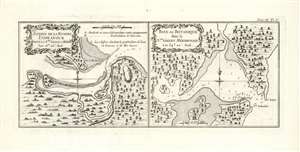
Entreé de la Riviere Endeavour dans la Nle. Galles Meridle./ Baye de Botanique dans la Nle. Galles Meridle.
$450.00
Acquire
- Digital Map Information
- Suitable for large format printing
- DPI: 600
- File Size: 6.1 MB
- File Type: ZIP / TIFF
- ICC color profile embedded
- Delivered instantly via download link
This is the 1774 first French edition of the first printed map of the mouth of the Endeavor River and the harbor of Botany Bay, discovered and named by the legendary navigator James Cook during his first voyage aboard the H.M.S. Endeavor. Both of these harbor charts are oriented to the north; they show depth soundings, the location of fresh water, and sandbars; topography and vegetation is shown pictorially (more details)
The first map of New South Wales Australia!
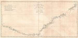
Carte de La Nle. Galles Meridle. Ou de la Cote Orientale de la Nle. Hollande Decouverte et visitee par le Lieutenant J. Cook, Commandant de L'Endeavour, vaisseau de sa Majeste en 1770.
$1,900.00
Acquire
- Digital Map Information
- Suitable for large format printing
- DPI: 600
- File Size: 21.69 MB
- File Type: ZIP / TIFF
- ICC color profile embedded
- Delivered instantly via download link
This is the 1774 first French edition of James Cook's seminal first map of New South Wales, Australia. Oriented to the West, the map extends from Cape York, Prince of Wales Island, and the Endeavour Straits to Point Hicks (Victoria). The map is a product of Cook's search for the often speculated upon southern continent or 'Terra Australis,' which scholars from the 16th century on believed, based upon ancient Greek texts, must exist at the base of the world.
After observing the Transit of Venus on June 3, 1769, Cook sailed westward, planning to return to England via the Cape of Good Hope, as he believed the Endeavour would not survive a second trip around Cape Horn. Instead he sailed west, where he hoped to discover Terra Australis. He sailed around New Zealand and headed for Tasmania, intending to follow up on Abel Tasman's work, when gales forced him northward. On April 19, 1770, his second, Zachary Hicks, signed land, what Cook immediately named Point Hicks. While Cook was most certainly aware he had not discovered 'Terra Australis', he did spend several months, from April 19 to August 22, 1770, mapping long sought east coast of New Holland (Australia), what he came to call New South Wales. He proceeded northwards, navigating the coast with great care, naming notable locations along the way.
It is of note that the coasts between Cape Flattery and Weymouth remains unmapped. This area is so full of small islands and dangerous reefs that Cook aptly named it 'The Labyrinth.' Just as he entered this area, near Cape Tribulation, the Endeavour struck a reef. On our map there is a note reading, 'On this ledge the ship laid 23 hours.' Rather than risk his ship further Cook sailed the Endeavour further out to sea, around the perilous reefs, landing at Cape York to officially name New South Wales and claim the land for England,
After observing the Transit of Venus on June 3, 1769, Cook sailed westward, planning to return to England via the Cape of Good Hope, as he believed the Endeavour would not survive a second trip around Cape Horn. Instead he sailed west, where he hoped to discover Terra Australis. He sailed around New Zealand and headed for Tasmania, intending to follow up on Abel Tasman's work, when gales forced him northward. On April 19, 1770, his second, Zachary Hicks, signed land, what Cook immediately named Point Hicks. While Cook was most certainly aware he had not discovered 'Terra Australis', he did spend several months, from April 19 to August 22, 1770, mapping long sought east coast of New Holland (Australia), what he came to call New South Wales. He proceeded northwards, navigating the coast with great care, naming notable locations along the way.
It is of note that the coasts between Cape Flattery and Weymouth remains unmapped. This area is so full of small islands and dangerous reefs that Cook aptly named it 'The Labyrinth.' Just as he entered this area, near Cape Tribulation, the Endeavour struck a reef. On our map there is a note reading, 'On this ledge the ship laid 23 hours.' Rather than risk his ship further Cook sailed the Endeavour further out to sea, around the perilous reefs, landing at Cape York to officially name New South Wales and claim the land for England,
I now once more hoisted English Coulers and in the Name of His Majesty King George the Third took possession of the whole Eastern Coast from the above Latitude [38] down to this place by the name of New South Wales, together with all the Bays, Harbors, Rivers, and Island s situate upon the said coast. (Cook, J., Journal, August 22, 1770)Until this time it was assumed that Australia, or New Holland as it was known, was a barren wasteland, as the Dutch navigators had explored only a small part of the arid western coast. Cook on the other hand, sailed up the fertile east coast, and was impressed by what he saw. It was Cook who recommended settlement and persuaded Joseph Banks to argue for using the remote continent as a penal colony. This map is significant for Australia collectors as the first definitive mapping of the coasts of New South Wales. Cook's nomenclature largely remains in use today. The map notes both Botany Bay and Port Jackson. (more details)
French Edition of the First Map of New South Wales.
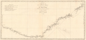
Carte de La Nle. Galles Meridle. Ou de la Cote Orientale de la Nle. Hollande Decouverte et visitee par le Lieutenant J. Cook, Commandant de L'Endeavour, vaisseau de sa Majeste en 1770.
$1,200.00
Acquire
- Digital Map Information
- Suitable for large format printing
- DPI: 600
- File Size: 13.45 MB
- File Type: ZIP / TIFF
- ICC color profile embedded
- Delivered instantly via download link
This is the 1774 first French edition of James Cook's seminal first map of New South Wales, Australia. The map is a product of Cook's search for the often speculated upon southern continent or 'Terra Australis,' which scholars from the 16th century on believed, based upon ancient Greek texts, must exist at the base of the world. This map is significant for Australia collectors as the first definitive mapping of the coasts of New South Wales. (more details)
French Edition of the First Chart of the Great Barrier Reef!
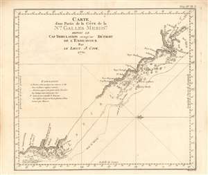
Carte d'une partie de la Côte de la Nle. Galles Meridle. depuis le Cap Tribulation jusqu'au Détroit de l'Endeavour
$400.00
Acquire
- Digital Map Information
- Suitable for large format printing
- DPI: 600
- File Size: 7.05 MB
- File Type: ZIP / TIFF
- ICC color profile embedded
- Delivered instantly via download link
This is the 1774 first French edition of the first chart to detail the Great Barrier Reef, discovered by the legendary navigator James Cook during his first voyage aboard the H.M.S. Endeavor. This west-oriented chart captures the great explorer's difficult journey along the coast of Australia from Cape Tribulation to Cape York, during which he became the first European to navigate - with difficulty, and under duress - the Great Barrier Reef, which he tellingly named 'The Labyrinth.' (more details)
French Edition of the First Chart of New Zealand's Cook Strait.
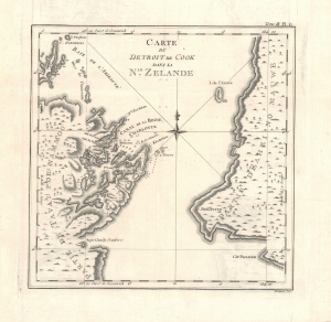
Carte du Detroit de Cook dans la Nle. Zélande.
$350.00
Acquire
- Digital Map Information
- Suitable for large format printing
- Full resolution TIFF file
- ICC color profile embedded
- Delivered instantly via download link
This is the 1774 first French edition of James Cook's landmark chart of Cook Strait, one of the most consequential maps produced from his first voyage to the Pacific (1768 - 1771). When Cook sailed through the passage between New Zealand's North and South Islands in 1770, he resolved a fundamental geographical question left unanswered since Abel Tasman's 1642 encounter with New Zealand: the two great landmasses were separated by a navigable strait. Centered on the passage that would bear Cook's name and the superb natural harbor of Queen Charlotte Sound (Totaranui), this chart records the exploration that transformed European understanding of New Zealand's geography. (more details)
Preparing to witness the transit of Venus.
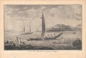
Vue de l'Isle d'Otahiti et de plusieurs Pirogues.
$300.00
Acquire
- Digital Map Information
- Suitable for large format printing
- Full resolution TIFF file
- ICC color profile embedded
- Delivered instantly via download link
An impressive engraving by Robert Benard based on a drawing by Sydney Parkinson, which appeared in the 1774 French translation of the book, An Account of the Voyages…, published the previous year by John Hawkesworth. The view was drawn during the first circumnavigation voyage of Captain James Cook, aboard the H.M.S. Endeavour. (more details)