
Boucher, Lucien (sold)
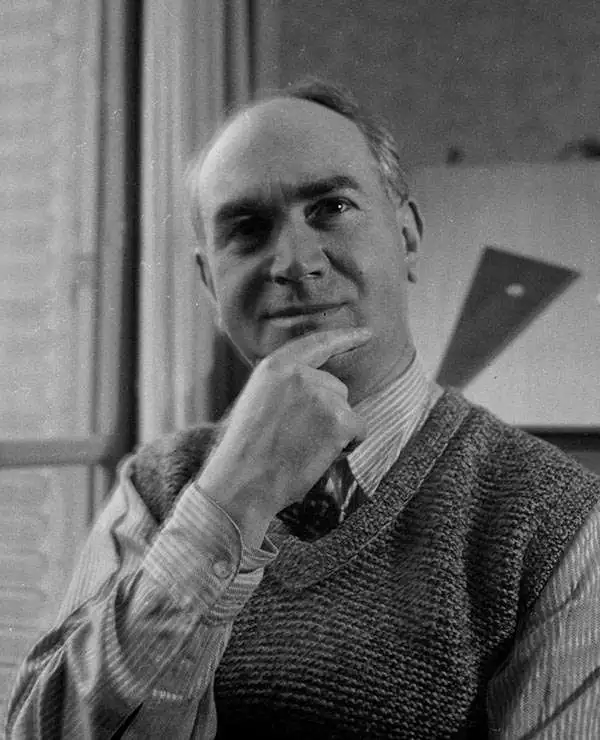
Lucien Boucher (1889 - 1971) was French cartoonist, artist, writer, and illustrator. Boucher was born in Chartres in 1889 and graduated from the École de Céramique de Sèvres. His work as a cartoonist appeared in the humorous weekly Le Rire. Starting in the 1920s he produced numerous pictorial posters inspired by the commercial promise of surrealism. Among them were a series of surrealistic planispheric and celestial maps drawn to illustrate the transportation networks of Air France.
An iconic surrealist embodiment of the golden age of air travel by Lucian Boucher.
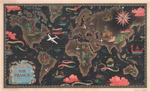
Air France.
sold
- Digital Map Information
- Suitable for large format printing
- File Size: 27.49 MB
- File Type: ZIP / TIFF
- ICC color profile embedded
- Delivered instantly via download link
One of Lucien Boucher's more iconic surrealistic map images, this is a scarce large format edition of his 1947 pictorial map of the world showing the routes of Air France. Boucher started producing maps for Air France as early as 1933. Boucher's work for Air ... (more details)
Surrealism inspired world map showing Air France routes.
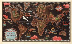
Air France Reseau Aerien Mondial.
sold
- Digital Map Information
- Suitable for large format printing
- File Size: 14.92 MB
- File Type: ZIP / TIFF
- ICC color profile embedded
- Delivered instantly via download link
A remarkable 1947 original Lucien Boucher comic map of the world showing the routes of Air France. Boucher started producing maps for Air France as early as 1933. Most are inspired by the surrealist ethic and feature numerous vignettes. The present example ... (more details)
Lucian Boucher - not just for Air France.
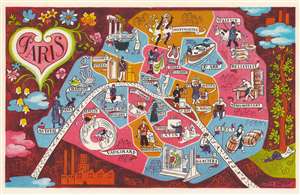
Paris.
sold
- Digital Map Information
- Suitable for large format printing
- File Size: 11.16 MB
- File Type: ZIP / TIFF
- ICC color profile embedded
- Delivered instantly via download link
This is a c. 1949 Lucien Boucher pictorial map of Paris, France. Pictorial vignettes illustrate Paris's most famous neighborhoods, including Saint-Germain-des-Prés, Champs-Elysées, Belleville, Menilmontant, Le Marais, and the Quartier Latin. Moulin Rouge showgirls can-can in Montmartre and a tourist admires the Venus de Milo in the Louvre. A canal boat plies the waters of the Canal Saint Martin and a military officer appears on horseback in Champ-de-Mars-Invalides. The Seine curves through Paris and the city is surrounded by a beautiful pictorial border. (more details)
An iconic surrealist embodiment of the golden age of air travel by Lucien Boucher.
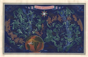
Air France.
sold
- Digital Map Information
- Suitable for large format printing
- File Size: 24.1 MB
- File Type: ZIP / TIFF
- ICC color profile embedded
- Delivered instantly via download link
The finest of Lucien Bucher's iconic comic maps drawn for Air France, here in a scarce large format edition. Boucher's work for Air France is considered an embodiment of the golden age of air travel. This map, presented as a double hemisphere celestial, was ... (more details)
An iconic surrealist embodiment of the golden age of air travel by Lucian Boucher.
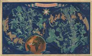
Air France.
sold
- Digital Map Information
- Suitable for large format printing
- File Size: 95.27 MB
- File Type: ZIP / TIFF
- ICC color profile embedded
- Delivered instantly via download link
The finest of Lucien Bucher's iconic comic maps drawn for Air France, here in a scarce large format edition. Boucher's work for Air France is considered an embodiment of the golden age of air travel. This map, presented as a double hemisphere celestial, was ... (more details)
Crédit Lyonnais in North and West Africa.
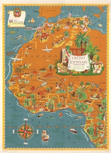
This is a c. 1956 Lucien Boucher art deco pictorial map of the Maghreb and West Africa highlighting Crédit Lyonnais banks. The map reflects the work of one of the greatest pictorial map makers of the mid-20th century. Moreover, it illustrates French Africa at the beginning of its decline as a political power. (more details)
Uses cathedrals and monuments to mark cities.
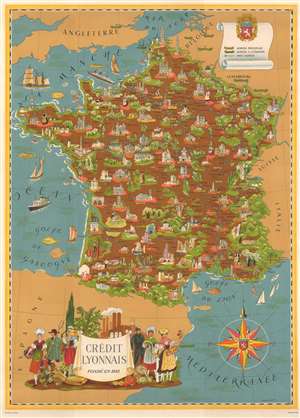
This is a c. 1960 Lucien Boucher art deco pictorial map of France created for the French bank Credit Lyonnais (at the time the largest bank in France). Pictorial vignettes and yellow banners highlight French cities where a main Credit Lyonnais branch operated. Cathedrals mark many of these cities, including Chartres, Amiens, Reims, and Rennes. Other monuments illustrate other cities, including the Eiffel Tower and the Arc de Triomphe in Paris, the arena and the Pont du Gars in Nimes, and several Loire Valley chateaux. Cities and towns with smaller bank branches throughout France are indicated by small white stars. Green banners identify branches in foreign countries, including ones in Brussels (Bruxelles), Anvers, and London. (more details)
The 100th anniversary of the Red Cross.
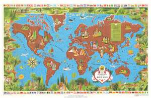
This 1962 Lucien Boucher pictorial map of the world celebrates the 100th anniversary of the Red Cross. Red crosses, red crescents, and a red lion with sun (Iran) symbols incised in white circles mark Red Cross, Red Crescent, and the Red Lion and Sun Societies. Red circles mark 'colonial' Red Cross outposts in Hong Kong, the Caribbean, Indonesia, and Polynesia. Pictorial vignettes highlight world cultures, including New York's skyline, llamas in South America, camels in North Africa, the Giza Pyramids and the Sphinx in Egypt, and kangaroos in Australia. Planes and ships marked with red crosses travel worldwide. A pictorial border surrounds the entire map and is made up of scenes of Red Cross, Red Crescent, and Red Lion and Sun Society workers, volunteers, and vehicles caring for individuals from every corner of the world. Flags of countries with Red Cross chapters line the top and bottom border. (more details)