
Diderot, Denis
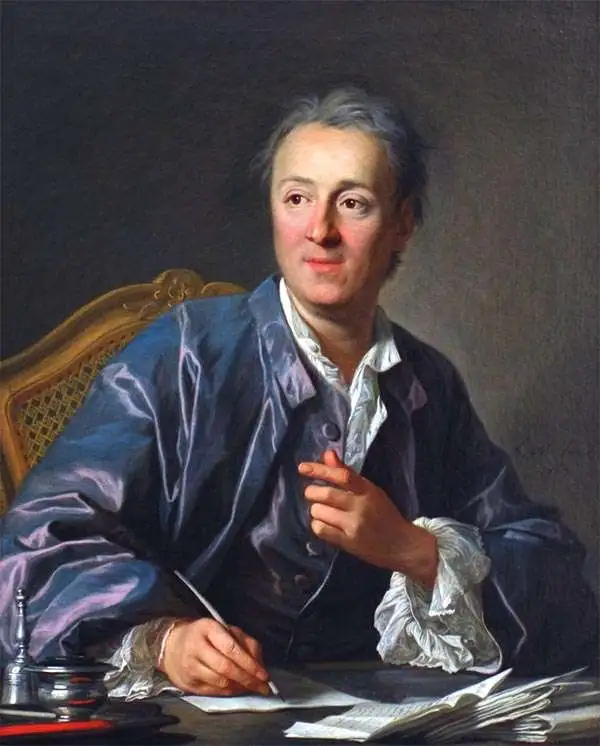
Denis Diderot (October 5, 1713 - July 31, 1784) was a French Enlightenment era philosopher, publisher and writer. Diderot was born in the city of Langres, France and educated at the Lycée Louis le Grand where, in 1732, he earned a master of arts degree in philosophy. Diderot briefly considered careers in the clergy and in law, but in the end chose the more fiscally challenge course of a writer. Though well respected in philosophical circles Diderot was unable to obtain any of the government commissions that commonly supported his set and consequently spent much of his life in deep poverty. He is best known for his role in editing and producing the Encyclopédie . The Encyclopédie was one of the most revolutionary and impressive works of its time. Initially commissioned as a translation of Ephraim Chambers' Cyclopaedia, or Universal Dictionary of Arts and Sciences, Diderot instead turned into a much larger and entirely new work of monumental depth and scope. Diderot's Encyclopédie was intended to lay bare before the common man the intellectual mysteries of science, art and philosophy. This revolutionary mission was strongly opposed by the powers of the time who considered a learned middle class it a threat to their authority. In the course of the Encyclopédie production Diderot was imprisoned twice and the work itself was officially banned. Nonetheless, publication continued in response to a demand exceeding 4000 subscribers. The Encyclopédie was finally published in 1772 in 27 volumes. Following the publication of the Encyclopédie Diderot grew in fame but not in wealth. When the time came to dower his only surviving daughter, Angelique, Diderot could find no recourse save to sell his treasured library. In a move of largess, Catherine the II Russia sent an emissary to purchased the entire library on the condition that Diderot retain it in his possession and act as her "librarian" until she required it. When Diderot died of gastro-intestinal problems 1784, his heirs promptly sent his vast library to Catherine II who had it deposited at the Russian National Library, where it resides to this day.
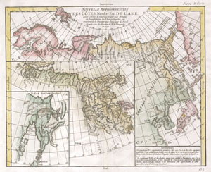
Nouvelle représentation Des Côtes Nord et Est de l'Asie : pour servir d'éclaircissement aux Articles du Supplement de L'Encyclopedie qui concernent le passage aux Indes par le Nord.
$300.00
Acquire
- Digital Map Information
- Suitable for large format printing
- DPI: 300
- File Size: 3.29 MB
- File Type: ZIP / TIFF
- ICC color profile embedded
- Delivered instantly via download link
This is the Vaugondy map of Siberia, Kamchatka and the northeastern extremes of the Asian continent. The map is the third of the ten which Vaugondy supplied for Diderot's Encyclopédie. This seminal map series, exploring the mapping of North America, Asia, and specifically the Northwest and Northeast Passages, was one of the first studies in comparative cartography. As the map's title suggests, this one was intended to clarify the articles in the Encyclopédie that pertained to European efforts to discover a viable northeast passage to the East Indies. The Northeast Passage, much like America's Northwest Passage, was a long sought after sea route through the Arctic that would save European merchantman the expense of rounding Africa in order to access the trade riches of East Asia.
This is a comparative map; the main map shows what was at that time the state of the art cartography of the region, largely derived from J. N. De l'Isle and Philippe Buache. It notes the location of Peking (Beijing) and a relatively accurate depiction of the Korean Peninsula. Japan is shown, with Nagasaki, Osaka and Iedo (Tokyo) labeled. Interesting features include an insular Iesso north of Japan, separated from the mainland by a 'Strait of Tessoy' roughly corresponding to the Strait of Tartary. Thus Iesso here can be understood as an early depiction of Sakahlin Island; the Kuril Islands are marked and named as well. Part of the northwest coast of North America is shown, separated from Asia by a strait in which appears the island of Puchochotski, here spelled Puchochotsks. (more details)
This is a comparative map; the main map shows what was at that time the state of the art cartography of the region, largely derived from J. N. De l'Isle and Philippe Buache. It notes the location of Peking (Beijing) and a relatively accurate depiction of the Korean Peninsula. Japan is shown, with Nagasaki, Osaka and Iedo (Tokyo) labeled. Interesting features include an insular Iesso north of Japan, separated from the mainland by a 'Strait of Tessoy' roughly corresponding to the Strait of Tartary. Thus Iesso here can be understood as an early depiction of Sakahlin Island; the Kuril Islands are marked and named as well. Part of the northwest coast of North America is shown, separated from Asia by a strait in which appears the island of Puchochotski, here spelled Puchochotsks. (more details)
Cartographic game of telephone.
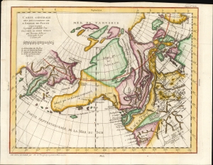
Carte Generale Des Decouvertes de L'Amiral de Fonte representant la grand porbabilite d'un Passage Au Nord Ouest par Thomas Jefferys Geographe du Roi a Londres 1768.
$500.00
Acquire
- Digital Map Information
- Suitable for large format printing
- File Size: 10.24 MB
- File Type: ZIP / TIFF
- ICC color profile embedded
- Delivered instantly via download link
This is Robert de Vaugondy's 1772 map of the northwestern parts of North America and the northeastern extremes of Asia, issued in the supplement to Diderot's groundbreaking Encyclopédie. The map summarizes a blend of new discoveries and wild speculations regarding the coastlines of the North Pacific and the possibilities of a navigable Northwest Passage. (more details)
Confusion over the American and Siberian Arctic.
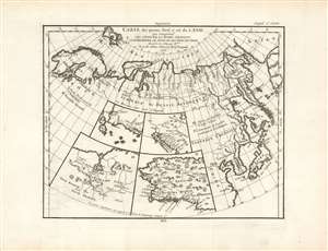
Carte des Parties Nord et Est de l'Asie qui Comprend les Cotes de la Russie Asiatique le Kamschatka, le Iesso, et les Isles du Japon.
$350.00
Acquire
- Digital Map Information
- Suitable for large format printing
- Full resolution TIFF file
- ICC color profile embedded
- Delivered instantly via download link
A map of the Northeast Passage, the northeast coasts of Asia, and the American Northwest. The Northeast Passage, much like America's Northwest Passage, was a long sought after sea route through the Arctic that would save European merchantman the expense of rounding Africa in order to access the trade riches of East Asia. This map deals primarily with Asiatic Russia, detailing the Northeast Passage from Norway and Iceland westward as far as Alaska (Anian), Kamchatka, Hokkaido (Yesso), and Japan. Knowledge of this area was, at the time, speculative at best and this is reflected here in the depictions of many unknown islands, misshapen representations of Kamchatka, Japan, Hokkaido (Yesso), and Alaska. Notes Peking (Beijing), Nanking (Nanjing), Corea (Korea), Jedo (Tokyo), and Nangasaki (Nagasaki). (more details)
A Boldly Presented Northwest Passage.
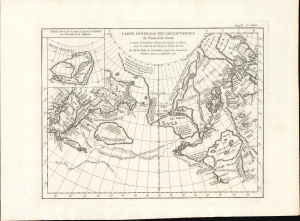
Carte Generale des Decouvertes de l'Amiral de Fonte et Autres Navigateurs Espagnols, Anglois et Russes pour la Recherche du Passage a la Mer du Sud.
$750.00
Acquire
- Digital Map Information
- Suitable for large format printing
- File Size: 12.15 MB
- File Type: ZIP / TIFF
- ICC color profile embedded
- Delivered instantly via download link
This is Robert de Vaugondy's 1772 map of the northern Pacific Ocean, after that of Joseph De l'Isle, combining two of the most elaborate fallacies to be presented on a map: the Sea of the West and the Northwest Passage attributed to the fictitious Admiral de Fonte. Both fictions fueled avid speculation throughout the latter part of the 18th century. When this map was produced for inclusion in Diderot's Encyclopédie, the question of the possible existence of a Northwest Passage was a great cartographic cause célèbre. (more details)
Search for a Northeast Passage.
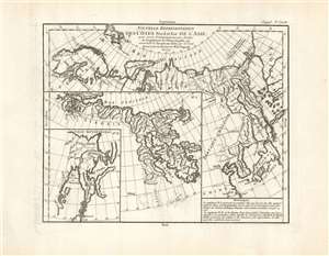
Nouvelle représentation Des Côtes Nord et Est de l'Asie pour servir d'éclaircissement aux Articles du Supplement de L'Encyclopédie qui concernent le passage aux Indes par le Nord.
$400.00
Acquire
- Digital Map Information
- Suitable for large format printing
- Full resolution TIFF file
- ICC color profile embedded
- Delivered instantly via download link
This is the 1772 Robert de Vaugondy map of Siberia, Kamchatka, and the northeastern extremes of Asia. The map is the third of ten maps Robert de Vaugondy supplied for Diderot's Encyclopédie. This seminal map series, exploring the mapping of North America, Asia, and specifically the Northwest and Northeast Passages, was one of the first studies in comparative cartography. As its title suggests, this map was intended to clarify the articles in the Encyclopédie that pertained to European efforts to discover a viable northeast passage to the East Indies. The Northeast Passage, much like America's Northwest Passage, was a long sought after sea route through the Arctic that would save European merchantmen the expense of rounding Africa in order to access the trade riches of East Asia. (more details)