
Goos, Abraham (sold)

Abraham Goos (1590 - 1643) was a Dutch engraver of maps, sea charts, and globes based in Antwerp and Amsterdam. He was born in Haarlem, the sone of diamond cutter Pieter Goos and Margaret van de Keere. Through is mother he was related to engraver Pieter van den Keere (Petrus Kaerius; 1571 - 1646), the brother-in-law of map publisher Jodocus Hondius (1563 - 1612). He was likely trained in engraving by Kaerius, as his first known work is a collaboration on the 1614 terrestrial globe of Petrus Plancius. He went on to engrave for Joannes Jansson, Jocodus Hondius, and John Speed. One of his most significant works is the Holy Land map of Yaacov ben Avraham Aladdin, considered one of the earliest printed maps in Hebrew. Abraham Goos was succeeded by his son Pieter Goos (1616 - 1675), who was in tern succeeded by his son Henrik Goos.
The only known unmounted North American globe gores from an extremely rare 17th century globe.
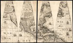
[Four Untitled Globe Gores on Two Sheets]
sold
- Digital Map Information
- Suitable for large format printing
- Full resolution TIFF file
- ICC color profile embedded
- Delivered instantly via download link
A once-in-a-lifetime addition to a collection: the sole known example of this quartet of globe gores, printed in 1623 by Jodocus Hondius II and Jan Jansson for the construction of their 17-inch globe. These four globe gores cover all of North America. The only known copies of these loose gores, they represent a remarkable survival and present unique geographical data. This is the earliest acquirable depiction of North America to show a specific Great Lake based on actual report, and features a unique depiction of the Saint Lawrence River. It contains a remarkable delineation of the American Southwest, with a correct depiction of its rivers not typical for Dutch maps of the period. Such features can be ascribed to the globe being a new work by Jodocus Hondius II and his brother-in-law Jansson, rather than derivative of the elder Hondius, or indeed any other acquirable work of his or their own. (more details)
The Most Decorative 17th Century English Map of Asia
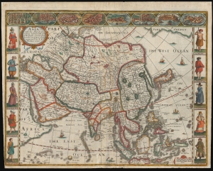
Asia with the Islands adjoyning described...
sold
- Digital Map Information
- Suitable for large format printing
- Full resolution TIFF file
- ICC color profile embedded
- Delivered instantly via download link
This is John Speed's 1626 map of Asia, the first map of the continent printed in English, in its 1676 edition. This beautiful map is one of the most desirable early maps of continent, combining superb engraving, attractive Dutch styling, and entertaining and abundant English text. (more details)
The First English Map of Africa, in its First Edition
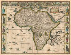
Africae described , the manners of their Habits, and buildings newly done into English by I. S. and published at the charges of G. Humble Ano 1626.
sold
- Digital Map Information
- Suitable for large format printing
- DPI: 600
- File Size: 23.28 MB
- File Type: ZIP / TIFF
- ICC color profile embedded
- Delivered instantly via download link
This is the first state of John Speed's 1626 map of Africa. It is the first English map of the continent, and it is the only edition of this map to be printed during its author's lifetime. This beautiful map is one of the most desirable early maps of Africa, combining superb engraving, attractive Dutch styling, and entertaining and abundant English text. While Speed cannot be accused of innovation as a mapmaker per se, he became an accomplished historian and compiler and his atlases of the British Isles and the World are among the signal cartographic works of the 17th century. The cartography for this mnap is drawn from the maps of Jodocus Hondius (whose student Goos actually engraved the map). Hondius' source was ultimately Willem Blaeu's 1608 wall map of Africa. As is the case with all of these maps, the Speed demonstrates 17th century European geography's detailed knowledge of Africa's coasts wedded to a deep mystification of the interior. The course of the Nile, for example, is shown in substantially the same configuration as was supposed in the second century by Ptolemy. Speed adds descriptive text - for example, noting areas in western and central Africa where gold is said to be found, and indicating areas said to be occupied by Amazons.
Visually, the map shares with Blaeu the decorative elements of key city views along the top border, along with figures to the left and right depicting the denizens of the lands shown. The cities are North African, with the exception of Canaria and Mozambique, and all reflect the coastal limitations of European knowledge of Africa. In addition to the borders, the body of the map as well is richly decorated with sailing ships, sea monsters, flying fish, elephants, ostriches, lions, and a zebra. (more details)
Visually, the map shares with Blaeu the decorative elements of key city views along the top border, along with figures to the left and right depicting the denizens of the lands shown. The cities are North African, with the exception of Canaria and Mozambique, and all reflect the coastal limitations of European knowledge of Africa. In addition to the borders, the body of the map as well is richly decorated with sailing ships, sea monsters, flying fish, elephants, ostriches, lions, and a zebra. (more details)
First printed map to used the Goos Speculation regarding the Pacific Northwest.
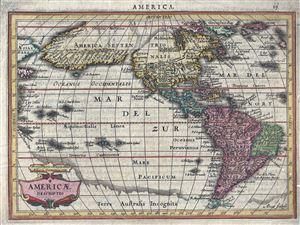
Americae Descriptio.
sold
- Digital Map Information
- Suitable for large format printing
- Full resolution TIFF file
- ICC color profile embedded
- Delivered instantly via download link
A fine first edition first state example of an attractive and important 1628 map of American (North and South) issued by Joannes Jansson and Aberham Goos. Centered on the American continent, this miniature map covers from the Arctic Circle to Tierra del Fuego. ... (more details)
Sicily as known to the Ancients.
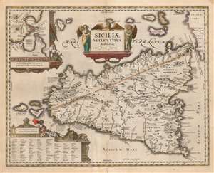
Siciliae Veteris Typus Amstelodami Apud Joannem Janssonium.
sold
- Digital Map Information
- Suitable for large format printing
- DPI: 600
- File Size: 39.08 MB
- File Type: ZIP / TIFF
- ICC color profile embedded
- Delivered instantly via download link
This is Joannes Jansson's map of Sicily in antiquity. In its 1618 edition, it is among the earliest maps to carry Jansson's imprint. This attractive map was first produced for inclusion in an atlas of ancient geography written by Petrus Bertius, and draws upon Ortelius' map of Ancient Sicily published in the Parergon. (more details)
One of the Finest Northeast Charts of the Dutch Period.
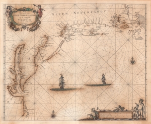
Pas Caerte van Nieu Nederlandt en de Engelsche Virginies van Capo Cod to Cabo Canrick.
sold
- Digital Map Information
- Suitable for large format printing
- Full resolution TIFF file
- ICC color profile embedded
- Delivered instantly via download link
A striking original color 1666 Pieter Goos nautical chart or maritime map of New England, New York, New Jersey, and Virginia. Coverage follows the coast of North America from Boston Harbor to Cape Hatteras, thus embracing one of the more active mid-17th century maritime corridors in North America. At the center of the map, two Dutch ships ply the seas. Finely engraved decorative cartouche work in the upper left and lower right emphasizes the region's rich fur trade and abundant fisheries. (more details)
The first atlas map to show California as an Island.
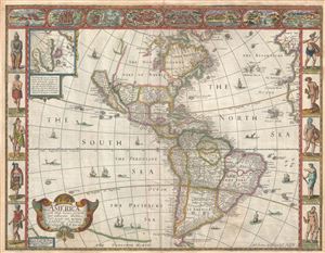
America with those known parts in that unknowne world both people and manner of buildings discribed and inlarged by I.S. Ano 1626.
sold
- Digital Map Information
- Suitable for large format printing
- DPI: 300
- File Size: 10.02 MB
- File Type: ZIP / TIFF
- ICC color profile embedded
- Delivered instantly via download link
A nice example of John Speed's 1626 map of America here in its fourth or 1676 state. One of the most iconic maps of America ever made, this map is surrounded by decorative vignettes illustrating the indigenous peoples and cities of the Americas. This map is both ... (more details)
First English Atlas Map of the World.
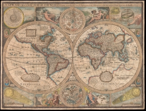
A New and Accurat Map of the World Drawne according to ye truest Descriptions latest Discoveries and best Observations yt have beene made by English or Strangers.
sold
- Digital Map Information
- Suitable for large format printing
- Full resolution TIFF file
- ICC color profile embedded
- Delivered instantly via download link
This is John Speed's 1626 map of the world, in its 1676 Bassett and Chiswell edition. It is the earliest acquirable English world map, and the first world map to appear in an English atlas. It is the earliest acquirable world map to illustrate the California-as-an-island myth. It was also singular in its emphasis on the English colonies in America and is the first world map to mark the settlement of New Plymouth. The map presents the globe in a double-hemisphere format, and is embellished with astronomical diagrams and allegorical representations of the seasons, as well as portraits of famous circumnavigators. (more details)