
Kellogg (sold)

Kellogg (1836 - 1946) refers to a series of partnerships based in Hartford, Connecticut, working under different imprints active from 1836 to 1946. The firm was initially founded by Daniel Wright Kellogg (1807 - 1864), who had studied lithography in Boston. The 'D. W. Kellogg' imprint was active from 1836 - 1841. When Daniel emigrated westward in 1836, the firm was taken over by his younger brothers, Edmund Burke Kellogg (1809 - 1872) and Elijah Chapman Kellogg (1811 - 1881), who changed the imprint to 'E. B. and E. C. Kellogg'. This was the active imprint until 1848, when the brothers partnered with John C. Comstock. In a partnership that lasted until 1850 under the imprint of 'Kellogg and Comstock.' From 1851 to 1854 E. C. Kellogg worked independently under his own 'E.C. Kellogg' imprint. He again partnered with his brother in 1855, reviving the 'E. B. and E. C. Kellogg' imprint, which remained active until 1866. In 1867, Edmund and Elijah sold their share of the company to William H. Bulkeley (1840 - 1902), but a third Kellogg, Elijah's son Charles B. Kellogg, retained an interest in the firm and it continued to operate as 'Kellogg and Bulkeley' until the firm merged with Case, Lockwood and Brainard to from the still active Connecticut Printers Inc. The Kelloggs frequently worked with other printers, including Edward Ensign, Horace Thayer, and Titus H. Darrow.
Rare map of Texas issued just before the Treaty of Guadeloupe Hidalgo.
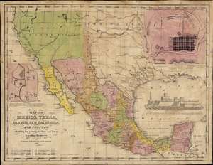
Map of Mexico, Texas, Old and New California, and Yucatan. Showing the principal Cities and Towns, Travelling Routes and c.
sold
- Digital Map Information
- Suitable for large format printing
- Full resolution TIFF file
- ICC color profile embedded
- Delivered instantly via download link
The only known example of the 1848 edition of House and Brown's broadside map of Texas, Mexico, and Upper California, issued at the end of the Mexican-American War (1846 - 1848). The map is centered on Texas, which is presented at its largest, with its western border embracing Albuquerque and Santa Fe, and the stovepipe configuration extending its northern border to 42° N latitude. The map is elaborated by inset maps of Monterey illustrating the Battle of Monterrey (September 21 - 24, 1846) and Veracruz, Mexico. In addition, the Gulf of Mexico is occupied by a large vignette view of the fortress of San Juan de Ulúa, Veracruz. In this edition, Texas is uncolored, emphasizing that it is part of the United States, but Upper California and New Mexico are colored as Mexican intendencias, suggesting this map predates the Treaty of Guadalupe Hidalgo and must therefore have been sent to the presses sometime before February 28, 1848. (more details)
Extremely rare view of New Haven and Yale!
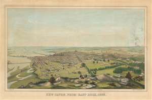
New Haven, From East Rock, 1853.
sold
- Digital Map Information
- Suitable for large format printing
- DPI: 600
- File Size: 27.93 MB
- File Type: ZIP / TIFF
- ICC color profile embedded
- Delivered instantly via download link
This is an extremely rare 1853 lithograph view of New Haven, Connecticut, as seen from East Rock by Titus H. Darrow and the firm of E. C. Kellogg. The view looks south-southwest on New Haven from East Rock, a local high point. The large buildings of Yale University are evident just left of center. The view reviews a bustling port, with numerous ships and a long pier. Several bridges, including an active railroad bridge, exit New Haven to the east. In the foreground, picnickers on East rock observe the town. (more details)
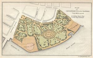
Plan of Improvements of the Battery.
sold
- Digital Map Information
- Suitable for large format printing
- Full resolution TIFF file
- ICC color profile embedded
- Delivered instantly via download link
This is a scarce 1817 map of the Battery Park by Kellogg and Pilat. Located on the southern tip of Manhattan, Capske Hook or the Battery, as it was later called, was where the Dutch began their settlement of New Amsterdam (now New York) in 1625. The Battery was so ... (more details)
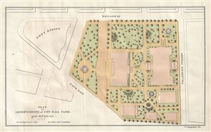
Plan of Improvements of City Hall Park.
sold
- Digital Map Information
- Suitable for large format printing
- Full resolution TIFF file
- ICC color profile embedded
- Delivered instantly via download link
A scarce 1871 map of City Hall Park in New York City by Kellogg and Pilat. The plan covers City Hall Park, the seat of the City government, located in downtown Manhattan. In the late 17th century, the area was a pasture outside city limits known as the Commons, ... (more details)
1871 Kellogg and Pilat Map of the Southeast Corner of Central Park (Grand Army Plaza), New York City
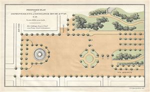
Proposed Plan of Improvements of Entrance 59th St. and Vth Av. C.P.
sold
- Digital Map Information
- Suitable for large format printing
- Full resolution TIFF file
- ICC color profile embedded
- Delivered instantly via download link
This is a beautiful and unusual little map of the southeastern corner of New York City's Central Park by Kellogg and Pilat dating to 1871. It depicts the southeast corner of Central Park from the intersection of 58th street and 5th Avenue north and shows the ... (more details)
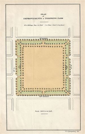
Plan of Improvements of Tompkins Park.
sold
- Digital Map Information
- Suitable for large format printing
- Full resolution TIFF file
- ICC color profile embedded
- Delivered instantly via download link
This is a rare 1871 example of Kellogg and Pilat's plan for the improvements of Tompkins Square Park, New York City. Tompkins Square Parks, located between Avenue A and Avenue B and 7th St. and 10th St. in New York City's Alphabet City, has been witness to ... (more details)
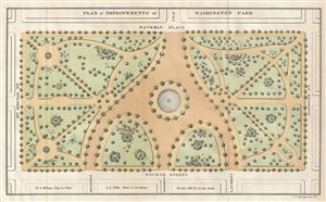
Plan of Improvements of Washington Park.
sold
- Digital Map Information
- Suitable for large format printing
- Full resolution TIFF file
- ICC color profile embedded
- Delivered instantly via download link
This is a rare and beautiful 1871 map of Washington Square Park, New York City by Kellogg and Pilat. Named after George Washington, the area was originally a marsh which was later converted into a Potter's Field, used to bury the cities unknown and poor ... (more details)
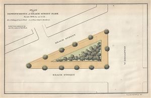
Plan of Improvements of Beach Street Park.
sold
- Digital Map Information
- Suitable for large format printing
- Full resolution TIFF file
- ICC color profile embedded
- Delivered instantly via download link
This is a scarce 1871 map of Tribeca Park or Beach Street Park, New York City by Kellogg and Pilat. It shows the plans of improvements of Beach Street Park, located between Beach Street and West Broadway. The location of trees and shrubbery is noted ... (more details)
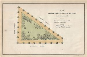
Plan of Improvements of Canal St. Park.
sold
- Digital Map Information
- Suitable for large format printing
- Full resolution TIFF file
- ICC color profile embedded
- Delivered instantly via download link
This is a scarce 1871 map of Canal Park or Canal St. Park, New York City by Kellogg and Pilat. It shows the plan of improvements of Canal Street Park, located between Canal Street and West Street above Holland Tunnel. The map notes the location of ... (more details)
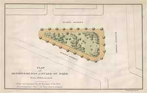
Plan of Improvements of Duane St. Park.
sold
- Digital Map Information
- Suitable for large format printing
- Full resolution TIFF file
- ICC color profile embedded
- Delivered instantly via download link
This is a scarce 1871 map of the Duane St. Park of Duane Park in New York City by Kellogg and Pilat. It shows the plans of improvements to the park located between Duane Street and Hudson St. The location of trees and shrubbery is noted within the ... (more details)
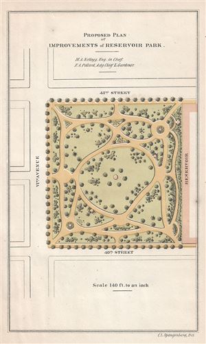
Proposed Plan of Improvements of Reservoir Park.
sold
- Digital Map Information
- Suitable for large format printing
- Full resolution TIFF file
- ICC color profile embedded
- Delivered instantly via download link
This is a rare and beautiful 1871 map or plan of Reservoir Park or Bryant Park by Kellogg and Pollard. The plan covers what is today known as Bryant Park, located in Midtown Manhattan. Before Bryant Park became public property in 1686, it was a ... (more details)
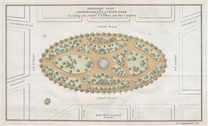
Proposed Plan of Improvements of Union Park.
sold
- Digital Map Information
- Suitable for large format printing
- Full resolution TIFF file
- ICC color profile embedded
- Delivered instantly via download link
This is a rare and important 1871 example of Kellogg and Pollard Map or plan of Union Square, New York City. The Commissioners' Plan of 1811 united Bowery Road (now 4th Avenue) and Bloomingdale St. (now Broadway), and the former potter's field ... (more details)
Unusual spinning wheel chart or map advertisement for Kellogg's cereal with information about each state in the U.S.
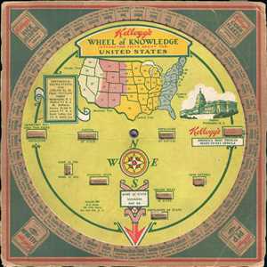
Kellogg's Wheel of Knowledge Interesting Facts about the United States.
sold
- Digital Map Information
- Suitable for large format printing
- File Size: 0.75 MB
- File Type: ZIP / TIFF
- ICC color profile embedded
- Delivered instantly via download link
This is a 1931 Kellogg's Wheel of Knowledge. This map or chart is a spinning wheel attached to some cardboard. Around the rim of the wheel are the names of the 48 states (Alaska and Hawaii were not yet states in 1931). Boxes of Kellogg's cereal ... (more details)