
Laurie, Richard Holmes (sold)

Richard Holmes Laurie (December 2, 1777 - January 19, 1858) was a British map and chart publisher and seller. Born in London to publisher Robert Laurie and his wife Esther Jouret, R. H. Laurie took over his father's share of the Laurie and Whittle publishing firm upon his father's retirement in 1812 and began trading as Whittle and Laurie. After Whittle died in 1818, Laurie continued the business by himself, trading under the imprint R. H. Laurie. During the 1820s and 1830s, Laurie expanded the nautical chart business until he was overtaken by Admiralty charts. Laurie married Susan Ann Coates on February 6, 1814 and later married Mary Ann Dennison on October 15, 1833. He left his business and all his property in trust for his two surviving daughters (both of whom were minors) with his principal engraver, Alexander George Findlay. Findlay continued the business in Laurie's name after acquiring its equity from his daughters.
The most decorative world map of the 19th century.
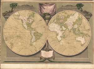
A New Map of the World, with Captain Cook's Tracks, His Discoveries and those of the Other Circumnavigators.
sold
- Digital Map Information
- Suitable for large format printing
- Full resolution TIFF file
- ICC color profile embedded
- Delivered instantly via download link
Possibly the most decorative 19th century double-hemisphere world map, this is Laurie and Whittle's New Map of the World with Captain Cook's Tracks. The map presents the eastern and western hemisphere, set in a striking architectural border with the hemispheres adorned by a pediment identifying the Old and New World. A drape-style title cartouche adorns the top of the map and is surrounded by palms trees, native costumes, and weaponry. On the map itself, the routes of Captain Cook's three voyages, as well as the routes of other circumnavigators are noted. (more details)
Scoping out the Taipa for the EIC during the Napoleonic Wars.
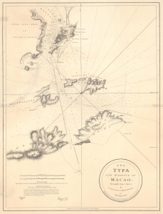
The Typa and Harbour of Macao; Principally from a Survey by Captain P. Heywood, of The Royal Navy.
sold
- Digital Map Information
- Suitable for large format printing
- File Size: 20.15 MB
- File Type: ZIP / TIFF
- ICC color profile embedded
- Delivered instantly via download link
This is the only known example of the 1809 Laurie and Whittle first edition of Peter Heywood's seminal survey of Macau (Macao) and nearby Taipa. This survey, conducted independently while Heywood's ship, the La Dedaigneuse, was being refitted in Macau, is the most important mapping of Macau since the 1778-79 survey of Heywood's erstwhile hydrography instructor, captain, and lifelong nemesis, Captain William Bligh of Bounty infamy. The survey appeared in the context of the Napoleonic Wars, when Franco-Spanish fleets were plaguing East India Company (EIC) fleets, and the British were keen to establish a foothold in the Pearl River Delta. Taipa, being a long-established EIC mooring point, was the prime target. (more details)
A beautifully engraved map of Corsica.
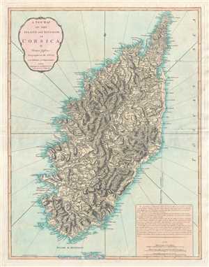
A New Map of the Island and Kingdom of Corsica.
sold
- Digital Map Information
- Suitable for large format printing
- DPI: 300
- File Size: 14.74 MB
- File Type: ZIP / TIFF
- ICC color profile embedded
- Delivered instantly via download link
This is an 1823 Thomas Jefferys and Richard Holmes Laurie map of Corsica. Beautifully engraved, the map depicts the entire island in considerable detail along with the extreme northern region of Sardinia. Myriad cities, towns, and villages are labeled, along with ... (more details)
'Hail Fredonia!'
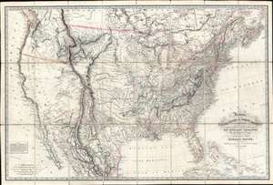
Fredonia, or the United States of North America; including also Cabotia, or the Canadian Provinces; the Western Territory to the Pacific Ocean; and the Northern Part of the Mexican States.
sold
- Digital Map Information
- Suitable for large format printing
- Full resolution TIFF file
- ICC color profile embedded
- Delivered instantly via download link
A fine example of the rare 1830 first obtainable edition of the famous Richard Holmes Laurie 'Fredonia' map of the United States. The map is best known for its advocation of a new name for the United States - Fredonia, which it is argued would build national pride and solidarity, as well as better distinguish it from Canada (Cabotia) and Mexico. Aside from the map's 'Fredish' qualities, this is considered one of the best early 'Manifest Destiny' maps issued in the wake of Lewis and Clark (1804 - 1806), thus illustrating the United States spreading coast-to-coast. It is derived from the most up-to-date sources and includes much of interest throughout. In Florida, it is one of the earliest maps to note the Cape Florida Settlement, a squatter community that was the precursor of modern-day Miami. (more details)
Unrecorded chart of Florida and the Greater Antilles.
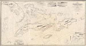
A New Chart of the Windward Passages and Bahama Islands, With the Islands of Hayti, Jamaica, Cuba, etc.
sold
- Digital Map Information
- Suitable for large format printing
- DPI: 600
- File Size: 81.76 MB
- File Type: ZIP / TIFF
- ICC color profile embedded
- Delivered instantly via download link
A rare and unusual 1848 John Purdy / Richard Holmes Laurie Blueback nautical chart or maritime map of Florida, the Bahamas, and the Greater Antilles - here in its only known surviving example. Oriented sharply to the northeast, the chart offers expansive coverage, embracing all of peninsular Florida, Cuba, the Bahamas, Hispaniola (Santo Domingo / Haiti), Jamaica, and Puerto Rico. The map exhibits some manuscript nautical annotations regarding lighthouses in the Bahamas and Cuba, but it is faded and unreadable. Insets detail important ports, including Havana, New Providence (Nassau), Matanzas, Guantanamo, the Morant Kays, and Kingston (Jamaica). (more details)
Beautiful and rare, an essential lighthouse guide for the British mariner.
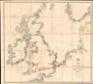
A Chart Exhibiting the Lighthouses and Light Vessels on the Coasts of Great Britain and Ireland and also those on the N.W. Coasts of Europe between Ushant and Bergen. Published by order of the Honble the Corporation of Trinity House, constructed by A. G Findlay.
sold
- Digital Map Information
- Suitable for large format printing
- Full resolution TIFF file
- ICC color profile embedded
- Delivered instantly via download link
An extraordinary 1863 chart and map exhibiting in great detail the lighthouses of Great Britain, including England, Ireland, Wales, and Scotland, and around the North Sea as far as Norway, Holland, France, and Denmark. The chart provides essential information for the mariner with regard to understanding and identifying the region's many lighthouses and what they communicate. In addition, the map illustrates the major regional railroads and their connections to major ports. The whole is impressively presented in a handsome presentation case with gilt stamped cover and brass closures. (more details)
The height of the China Trade on one chart! Belcher's Hong Kong! Collinson's survey!
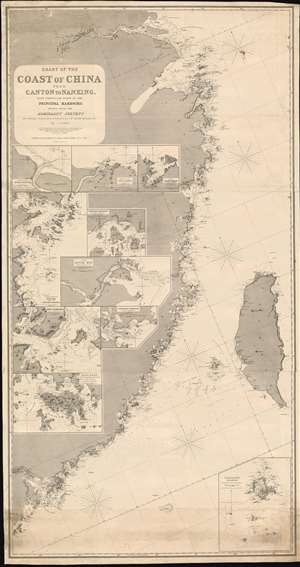
Chart of the Coast of China from Canton to Nanking, with particular plans of the principal Harbors, Drawn from the Admiralty Surveys by Captains R. Collinson, H. Kellett and Sir Edwad Belcher, R. N.
sold
- Digital Map Information
- Suitable for large format printing
- Full resolution TIFF file
- ICC color profile embedded
- Delivered instantly via download link
An exceptionally rare and important 1865 nautical chart or maritime map of the coast of China compiled by John Purdy from the surveys of Sir Edward Belcher (Hong Kong), Richard Collinson (China Coast), and Henry Kellett (China Coast) - probably the best general map of the China coast then obtainable. The map's coverage extends from mouth of the Yangtse River (Nanjing and Shanghai) south as far as Hong Kong and Macao, and east to include Taiwan (Formosa). The chart includes nine insets, among them a large representation Collinson's update of Belcher's First Opium War Hong Kong survey of 1841. This map, made after the second opium war, represents the high point of the China Trade when cities like Shanghai and Hong Kong were transforming into global centers of trade and commerce, largely at the expense of an increasing angry and frustrated Chinese populace (more details)
Microscopic View of Trade along the Thames.
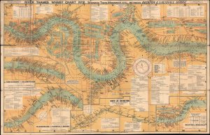
River Thames Wharf Chart No. 2 showing Tiers, Moorings Etc. between Becton and Vauxhall Bridge.
sold
- Digital Map Information
- Suitable for large format printing
- File Size: 75.94 MB
- File Type: ZIP / TIFF
- ICC color profile embedded
- Delivered instantly via download link
This is a large-format folding map and nautical chart of the River Thames in London and environs, published by Imray, Laurie, Norie, and Wilson. Cataloging individual wharves and their owners in great detail, it provides a comprehensive overview of London's bustling commercial activity in the later days of British global hegemony. (more details)