
Laurie and Whittle (sold)
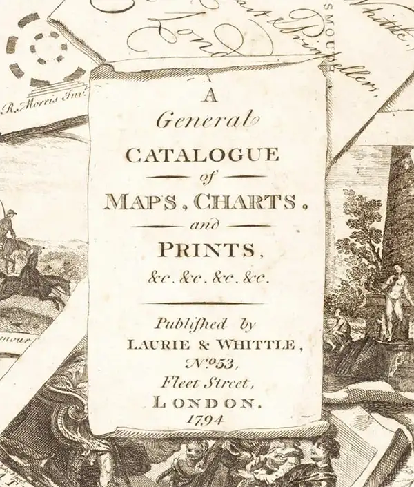
Laurie and Whittle (fl. 1794 - 1858) were London, England, based map and atlas publishers active in the late 18th and early 19th century. Generally considered to be the successors to the Robert Sayer firm, Laurie and Whittle was founded by Robert Laurie (c. 1755 - 1836) and James Whittle (1757-1818). Robert Laurie was a skilled mezzotint engraver and is known to have worked with Robert Sayer on numerous projects. James Whittle was a well-known London socialite and print seller whose Fleet Street shop was a popular haunt for intellectual luminaries. The partnership began taking over the general management of Sayer's firm around 1787; however, they did not alter the Sayer imprint until after Sayer's death in 1794. Apparently Laurie did most of the work in managing the firm and hence his name appeared first in the "Laurie and Whittle" imprint. Together Laurie and Whittle published numerous maps and atlases, often bringing in other important cartographers of the day, including Kitchin, Faden, Jefferys and others to update and modify their existing Sayer plates. Robert Laurie retired in 1812, leaving the day to day management of the firm to his son, Richard Holmes Laurie (1777 - 1858). Under R. H. Laurie and James Whittle, the firm renamed itself "Whittle and Laurie". Whittle himself died six years later in 1818, and thereafter the firm continued under the imprint of "R. H. Laurie". After R. H. Laurie's death the publishing house and its printing stock came under control of Alexander George Findlay, who had long been associated with Laurie and Whittle. Since, Laurie and Whittle has passed through numerous permeations, with part of the firm still extant as an English publisher of maritime or nautical charts, 'Imray, Laurie, Norie and Wilson Ltd.' The firm remains the oldest surviving chart publisher in Europe.
Staggering wall map of India.
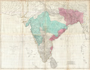
The East Indies, with the Roads.
sold
- Digital Map Information
- Suitable for large format printing
- DPI: 300
- File Size: 71.28 MB
- File Type: ZIP / TIFF
- ICC color profile embedded
- Delivered instantly via download link
This is a staggering wall size map of India and Ceylon issued in 1768 by Thomas Jeffreys. Covers the Indian subcontinent from Mekran in the west to Assam and Aracan in the east, and from Bhutan in the north, south to Ceylon and the Maldives. Offers extraordinary ... (more details)
Sea of Korea and the Pratas Islands.
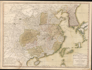
The Empire of China, with its Principal Divisions; Drawn from the Surveys mad by the Jesuits: with Improvements and Additions, from the Maps of Monsr. D'Anville.
sold
- Digital Map Information
- Suitable for large format printing
- Full resolution TIFF file
- ICC color profile embedded
- Delivered instantly via download link
This is a large, elegant 1823 map of China and Korea, produced by Robert Laurie. Initially published in 1775, the map features updates executed over the course of the subsequent decades. Among its notable features is the naming of the body of water between Korea and Japan as the 'Corean Sea'. (more details)
18th century nautical chart of the coast of Taiwan or Formosa.
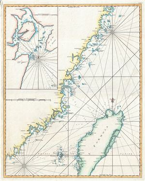
Carte de la coste orientale de la Chine depuis Amoy, jusqu'a Chusan avec une partie de l'Isle Formose. [untitled]
sold
- Digital Map Information
- Suitable for large format printing
- Full resolution TIFF file
- ICC color profile embedded
- Delivered instantly via download link
A scarce c.1780 British edition of D'Apres de Mannevillette's nautical chart or map of Taiwan (Formosa) and the mainland Fujian Coast, China. The map offers rich detail including countless depth soundings, notes on the seafloor, commentary on reefs, rhumb lines, ... (more details)
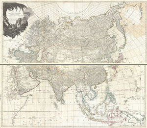
Asia and its Islands According to d'Anville; Divided into Empires, Kingdoms, States, Regions, &ca. with the European possessions and settlements in the East Indies and an exact delineation of all the discoveries made in the eastern parts by the English under Captn. Cook.
sold
- Digital Map Information
- Suitable for large format printing
- DPI: 300
- File Size: 67.68 MB
- File Type: ZIP / TIFF
- ICC color profile embedded
- Delivered instantly via download link
An absolutely stunning and monumental two panel 1794 wall map of Asia by J. B. B. D'Anville. Covers the entire continent of Asia, including Arabia, the Indian subcontinent, and the East Indies. Names countless cities, caravan routes, and geographical features ... (more details)
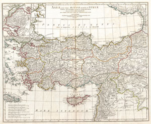
Asiae, quae vulgo Minor dicitur, et Syriae tabula geographica quantum per subsidia licuit elaborata, opere, si quod aliud in antiqua geographia, arduo. Quam tabulam Clariss. Dom. Comes de Caylus in aere incidi curavit.
sold
- Digital Map Information
- Suitable for large format printing
- DPI: 300
- File Size: 17.59 MB
- File Type: ZIP / TIFF
- ICC color profile embedded
- Delivered instantly via download link
A large and dramatic J. B. B. D'Anville map of Asia Minor in antiquity. Covers from Greece (Graecia) and the Aegean Sea eastward to include all of Asia Minor as far as Armenia. Extends south as far as the ancient city of Sidon in modern day Lebanon. ... (more details)
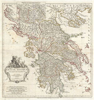
Graeciae Antiquae Specimen Geographicum.
sold
- Digital Map Information
- Suitable for large format printing
- Full resolution TIFF file
- ICC color profile embedded
- Delivered instantly via download link
A large and dramatic J. B. B. D'Anville map of Ancient Greece. Covers from Macedonia to the Peloponnesus, inclusive of Euboea and the Ionian Isles. Details mountains, rivers, cities, roadways, and lakes with political divisions highlighted in outline ... (more details)
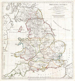
Britanniae Antiquae Tabula Geographica ex. Evi Romani Monumentis…
sold
- Digital Map Information
- Suitable for large format printing
- DPI: 300
- File Size: 14.24 MB
- File Type: ZIP / TIFF
- ICC color profile embedded
- Delivered instantly via download link
A large and dramatic 1794 map of England under Roman Rule. Covers all of England (Province of Britanniae) as well as adjacent parts of Scotland, Ireland (Hibernia), and France (Gallia). Features both ancient and contemporary place names, ie. ... (more details)
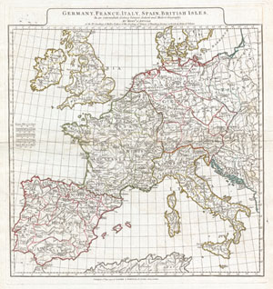
Germany, France, Italy, Spain, British Isles, In an intermediate Century between Ancient and Modern Geography…
sold
- Digital Map Information
- Suitable for large format printing
- DPI: 300
- File Size: 15.24 MB
- File Type: ZIP / TIFF
- ICC color profile embedded
- Delivered instantly via download link
A large and dramatic 1794 J. B. B. D'Anville map of Western Europe. Covers from the British Isles south to Spain and east as far as Hungary, Poland and Dalmatia. This map is intended to represent western Europe following the decline of the ... (more details)
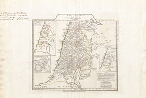
Palaestina.
sold
- Digital Map Information
- Suitable for large format printing
- DPI: 300
- File Size: 15.73 MB
- File Type: ZIP / TIFF
- ICC color profile embedded
- Delivered instantly via download link
A large and dramatic J. B. B. D'Anville map of Palestine, Israel, or the Holy Land. Covers from the ancient city of Sidon in modern day Lebanon south as far the city of Gaza and Egypt. Details mountains, rivers, cities, roadways, and lakes ... (more details)
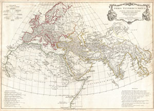
Orbis Vetribus Notus.
sold
- Digital Map Information
- Suitable for large format printing
- DPI: 300
- File Size: 20.96 MB
- File Type: ZIP / TIFF
- ICC color profile embedded
- Delivered instantly via download link
A large and dramatic composite 1794 map of the world as it was known to the ancients, by J. B. B. D'Anville. Covers all of Europe, Asia Minor, Arabia and India, much of Northern Africa, and parts of Southeast Asia. D'Anville compiled ... (more details)
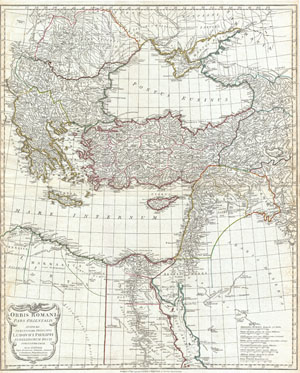
Orbis Romani Pars Orientalis Auspiciis Serenissimi Principis Ludovici Philippi Aurelianorum Ducis Publici juris Facta…
sold
- Digital Map Information
- Suitable for large format printing
- DPI: 300
- File Size: 21.23 MB
- File Type: ZIP / TIFF
- ICC color profile embedded
- Delivered instantly via download link
A large and dramatic J. B. B. D'Anville map of the eastern part of the Roman Empire. Covers from Greece (Graecia) and Dacia east as far as Babylonia, Arabia and Armenia. Extends south as far as Thebes in Upper Egypt. Includes the ... (more details)
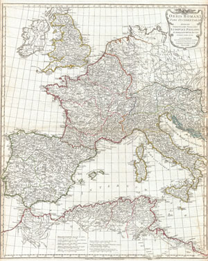
Orbis Romani Pars Occidentalis Auspiciis Serenissimi Principis Ludovici Philippi Aurelianorum Ducis Publici juris Facta…
sold
- Digital Map Information
- Suitable for large format printing
- DPI: 300
- File Size: 21.65 MB
- File Type: ZIP / TIFF
- ICC color profile embedded
- Delivered instantly via download link
A large and dramatic J. B. B. D'Anville map of the western part of the Roman Empire. Covers from England (Brittania) and Ireland (Hibernia), south to Spain (Hispania) and Morocco (Mauretania), and east as far as Italy (Italia) and ... (more details)
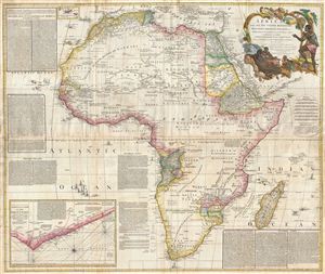
Africa, with all its States, Kingdoms, Republics, Regions, Islands, & cca. Improved and Inlarged form D’Anville’s Map to which has been added A Particular Chart of the Gold Coast wherein are Distinguished all the European Forts, and Factories by S. Boulton and also A Summary Description relative to the Trade adn Natural Produce, Manners and Customs of the African Continent and Islands.
sold
- Digital Map Information
- Suitable for large format printing
- DPI: 300
- File Size: 69.71 MB
- File Type: ZIP / TIFF
- ICC color profile embedded
- Delivered instantly via download link
This is probably the most important map of Africa produced in the 18th century. Largely based upon the earlier D'Anville map, this map has been enlarged and expanded by Samuel Boulton. Depicts the continent in full with insets of ... (more details)
One of the largest and most impressive maps of Scotland to appear in the 18th century.
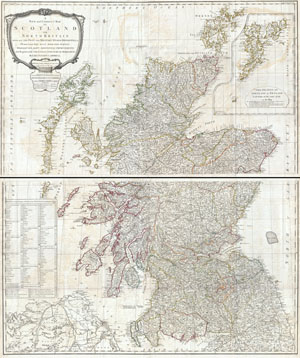
A New and Correct Map of Scotland or North Britain with all the Post and Military Roads, Divisions, and ca.
sold
- Digital Map Information
- Suitable for large format printing
- DPI: 300
- File Size: 70.98 MB
- File Type: ZIP / TIFF
- ICC color profile embedded
- Delivered instantly via download link
An absolutely stunning and monumental 1794 wall map of Scotland by Lieutenant Campbell. Covers Scotland in full with extraordinary detail throughout. Notes every town, hamlet, bishopric, country, forest, castle swam and road. ... (more details)
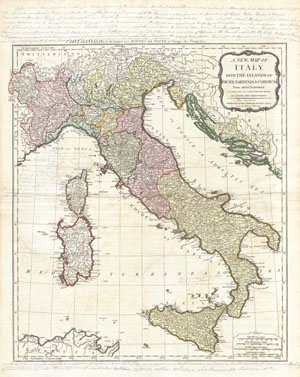
A New Map of Italy with the Islands of Sicily, Sardinia & Corsica. From Monsr. d'Anville: to which have been added the post roads and several other improvements.
sold
- Digital Map Information
- Suitable for large format printing
- DPI: 300
- File Size: 21.22 MB
- File Type: ZIP / TIFF
- ICC color profile embedded
- Delivered instantly via download link
An rare and beautiful 1794 map of Italy by J. B. B. d'Anville. Covers Italy from Switzerland south to Sicily including Corsica, Sardinia, and parts of North Africa and Dalmatia. Italy itself is divided into various states, ... (more details)
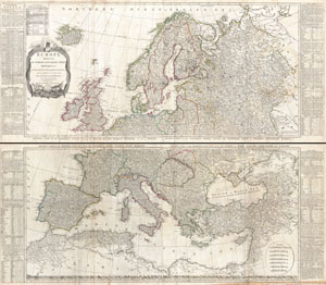
Europe Divided into its Empires, Kingdoms, States Republics, & c.
sold
- Digital Map Information
- Suitable for large format printing
- DPI: 300
- File Size: 78.51 MB
- File Type: ZIP / TIFF
- ICC color profile embedded
- Delivered instantly via download link
A large and dramatic 1794 wall map of Europe on two panels. Published by Laurie and Whittle based the work of the important cartographer J. B. B. D'Anville. Upper sheet covers from Iceland to Russia and from the Arctic to ... (more details)
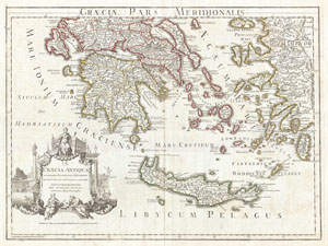
Graeciae Pars Meridionalis.
sold
- Digital Map Information
- Suitable for large format printing
- Full resolution TIFF file
- ICC color profile embedded
- Delivered instantly via download link
A large and dramatic Delisle map of the southern Greece, the Greek Isles, and Crete. Covers from the Ionian Islands to Asia Minor and south as far as Crete. Includes the Peloponnesus, the Cyclades, Rhodes, and numerous ... (more details)
Includes a detailed depiction of the Philippines.
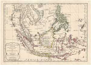
The East India Islands, Comprehending the Isles of Sunda the Maluccas and the Philippine Islands.
sold
- Digital Map Information
- Suitable for large format printing
- DPI: 300
- File Size: 6.24 MB
- File Type: ZIP / TIFF
- ICC color profile embedded
- Delivered instantly via download link
This is a 1794 Samuel Dunn and Laurie and Whittle map of the East Indies and Southeast Asia. The map depicts the region from the Bay of Bengal to Palau and from Hainan to Java, Timor, and the Indian Ocean. Highly ... (more details)
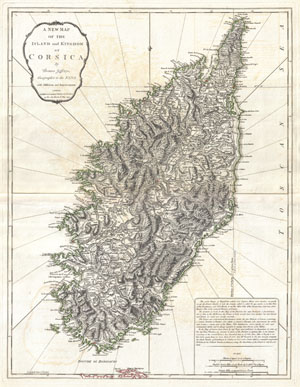
A New Map of the Island and Kingdom of Corsica.
sold
- Digital Map Information
- Suitable for large format printing
- DPI: 300
- File Size: 17.48 MB
- File Type: ZIP / TIFF
- ICC color profile embedded
- Delivered instantly via download link
An extraordinary 1794 map of the Island and Kingdom of Corsica. Covers the entire island in extraordinary detail offering both topographical and political information. With its unique blend of dramatic ... (more details)
Impressive wall map of India.
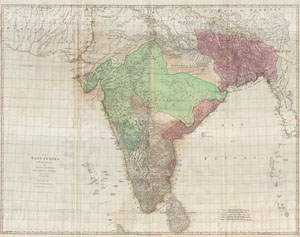
The East Indies, with the Roads.
sold
- Digital Map Information
- Suitable for large format printing
- DPI: 300
- File Size: 90.75 MB
- File Type: ZIP / TIFF
- ICC color profile embedded
- Delivered instantly via download link
This is a staggering wall size map of India and Ceylon originally issued in 1768 by Thomas Jeffreys. Covers the Indian subcontinent from Mekran in the west to Assam and Aracan in the east, and from ... (more details)
Best 18th century map of the Turks Islands.
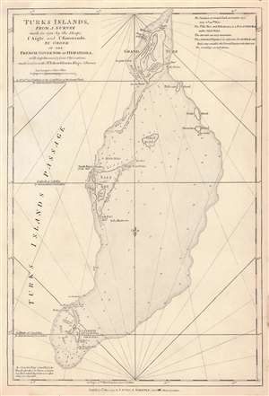
Turks Islands, from a survey made in 1753, by the Sloops l'Aigle and l'Emeraude by order of the French Governor of Hispaniola.
sold
- Digital Map Information
- Suitable for large format printing
- Full resolution TIFF file
- ICC color profile embedded
- Delivered instantly via download link
This is the 1794 Laurie and Whittle edition of Thomas Jeffrys' map of the Turks Islands, among the earliest maps to focus on the islands. The map shows not only Grand Turk, Salt Key, and Sand Key but also the shallows linking these islands, as well as several smaller. As such, the map - with copious depth soundings, anchorages, and notations - is able to emphasize the many localized navigational hazards. As small as they are, the Turks were an important resource: its tiny population produced salt from sea brine. (Indeed, the only settlements noted on the map are 'Salt rakers' huts.' During the American Revolution the Continental Army depended on Turks and Caicos salt for food preservation, and American fishing vessels used Turks salt to preserve their catches. Jefferys credited the a 1753 survey attributed to the French schooners l'Aigle and l'Emeraude, further amended in 1770 by the British sloop Sir Edward Hawke (the sloop, not Sir Edward himself, who was by this time First Lord of the Admiralty and above such chores.) (more details)
Defeating Napoleon's Navy in the War of the First Coalition (1772 - 1797).
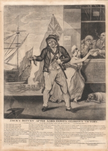
Jack's return after Lord Howe's glorious victory...
sold
- Digital Map Information
- Suitable for large format printing
- DPI: 600
- File Size: 24.57 MB
- File Type: ZIP / TIFF
- ICC color profile embedded
- Delivered instantly via download link
A British patriotic broadsheet mezzotint issued in the wake of the Glorious First of June (1794), a decisive British naval victory over Napoleonic France in the War of the First Coalition (1772 - 1797). It depicts a street scene at the wharf where victorious sailors are disembarking. (more details)
Identifies the Sea of Korea.
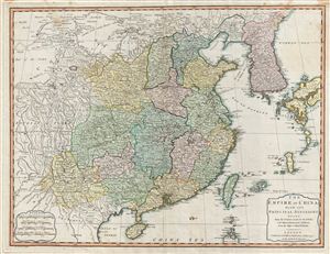
The Empire of China with its Principal Divisions.
sold
- Digital Map Information
- Suitable for large format printing
- Full resolution TIFF file
- ICC color profile embedded
- Delivered instantly via download link
A fine 1794 map of China and Korea by the London firm of Laurie and Whittle. Centered on China, this maps covers from Chinese Tartary to the Gulf of Tonkin and the Philippines and from the Gobi ... (more details)
An Essential American Revolutonary War map rvised to reflect the independence of the United States.
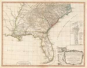
A New and General Map of the Southern Dominions Belonging to The United States of America, viz: North Carolina, South Carolina, and Georgia: with the Bordering Indian Countries, and The Spanish Possessions of Louisiana and Florida.
sold
- Digital Map Information
- Suitable for large format printing
- DPI: 600
- File Size: 24.8 MB
- File Type: ZIP / TIFF
- ICC color profile embedded
- Delivered instantly via download link
A scarce 1794 map of the southeastern part of the United States and Florida issued by the London firm of Laurie and Whittle. The coverage extends from North Carolina to the Florida Keys and from just beyond the Mississippi River to the Atlantic seaboard and the Bahamas. It encompasses the modern-day states of North Carolina, South Carolina, Georgia, Kentucky, Tennessee, Alabama, Mississippi, Louisiana (very little detail), and Florida. At right, there are inset detail maps of Charleston and St. Augustine. (more details)
Best general map of the Southeast of the 18th Century.
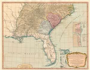
A New and General Map of the Southern Dominions Belonging to The United States of America, viz: North Carolina, South Carolina, and Georgia: with the Bordering Indian Countries, and The Spanish Possessions of Louisiana and Florida.
sold
- Digital Map Information
- Suitable for large format printing
- DPI: 600
- File Size: 24.34 MB
- File Type: ZIP / TIFF
- ICC color profile embedded
- Delivered instantly via download link
A scarce 1794 Laurie and Whittle / Sayer map of the southeastern part of the United States and Florida. This is the second edition of Sayer's map of the southeast, and the first to recognize the United States as an independent nation. At the time of initial publication, it represented the finest general cartography of the southeast obtainable. (more details)
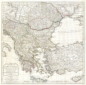
A New Map of Turkey in Europe Divided into all its Provinces' with the Adjacent Countries in Europe and Asia: Drawn Chiefly from the Maps Published by the Imperial Academy of St. Petersburg.
sold
- Digital Map Information
- Suitable for large format printing
- DPI: 300
- File Size: 22.18 MB
- File Type: ZIP / TIFF
- ICC color profile embedded
- Delivered instantly via download link
An extraordinary large format 1794 map of Greece, Turkey in Europe, the Balkans and adjacent regions by Laurie and Whittle. Map covers from the Gulf of Taranto, Italy, eastward as far as the ... (more details)
A beautifully detailed map of Turkey, Greece, and the Balkans.
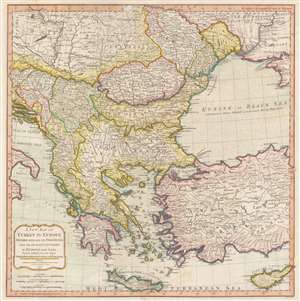
A New Map of Turkey in Europe Divided into all its Provinces' with the Adjacent Countries in Europe and Asia: Drawn Chiefly from the Maps Published by the Imperial Academy of St. Petersburg.
sold
- Digital Map Information
- Suitable for large format printing
- Full resolution TIFF file
- ICC color profile embedded
- Delivered instantly via download link
An extraordinary large format 1794 map of Greece, Turkey in Europe, the Balkans and adjacent regions by Laurie and Whittle. The map depicts the region from the Gulf of Taranto, Italy, to the Crimea, and from Transylvania and Moldova to Crete and Cyprus. The modern-day nations of Greece, Turkey, Cyprus, Bosnia, Croatia, Albania, Serbia, Macedonia, Bulgaria, Hungary, Rumania, Bulgaria, and Moldova, as well as parts of Italy, Austria and the Ukraine are illustrated. Extraordinary detail is evident throughout, noting cities, roads, geographical features, and sub-states. (more details)
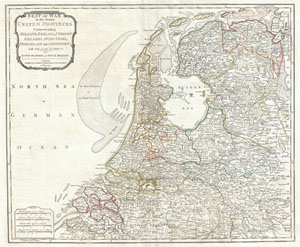
Seat of War in the Seven United Provinces, Comprehending Holland, Zeeland, Utrecht, Gelders, Over-Yssel, Frieseland and Groningen; with The Land of Drent, also Dutch Flanders and Dutch Brabant.
sold
- Digital Map Information
- Suitable for large format printing
- DPI: 300
- File Size: 16.37 MB
- File Type: ZIP / TIFF
- ICC color profile embedded
- Delivered instantly via download link
An extraordinary 1794 map of Holland or the Netherlands by Laurie and Whittle. Covers from Zeeland eastward as far as the Circle of Westphalia, north to the mouth of the Ems River, and south ... (more details)
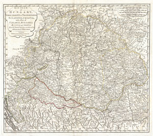
Kingdom of Hungary, Principality of Transilvania, Sclavonia, Croatia, with a Part of Valakla, Bulgaria, Bosnia and Servia from the Latest Surveys ascertained by Astronomical Observations.
sold
- Digital Map Information
- Suitable for large format printing
- DPI: 300
- File Size: 16.11 MB
- File Type: ZIP / TIFF
- ICC color profile embedded
- Delivered instantly via download link
An rare and attractive 1794 map of the Kingdom of Hungary by Laurie and Whittle. Covers the Kingdom of Hungary and its surrounding states, including Transylvania (modern day Romania), ... (more details)
The region made famous by Bram Stoker's classic novel Dracula.
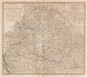
Kingdom of Hungary, Principality of Transilvania, Sclavonia, Croatia, with a Part of Valakla, Bulgaria, Bosnia and Servia from the Latest Surveys ascertained by Astronomical Observations.
sold
- Digital Map Information
- Suitable for large format printing
- Full resolution TIFF file
- ICC color profile embedded
- Delivered instantly via download link
A rare and attractive 1794 map of the Kingdom of Hungary by Laurie and Whittle. The map depicts the Kingdom of Hungary and its surrounding states, including Transylvania (modern-day ... (more details)
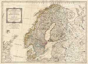
A New Map of the Northern States containing The Kingdoms of Sweden, Denmark and Norway, with The Western Parts of Russia, Livonia, Courland and Ca.
sold
- Digital Map Information
- Suitable for large format printing
- DPI: 300
- File Size: 17.21 MB
- File Type: ZIP / TIFF
- ICC color profile embedded
- Delivered instantly via download link
An extraordinary 1794 map of Scandinavia by Laurie and Whittle. Covers from the Faroe Islands east as far as Moscow, north as far as the Arctic, and south as far as Prussia. ... (more details)
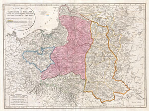
A New Map of the Kingdom of Poland, with its Dismembered Provinces and the Kingdom of Prussia.
sold
- Digital Map Information
- Suitable for large format printing
- DPI: 300
- File Size: 19.62 MB
- File Type: ZIP / TIFF
- ICC color profile embedded
- Delivered instantly via download link
This important 1794 map by Thomas Kitchin depicts the Kingdom of Poland during the brief transitional period between the second and third partitions. Covers from Brandenburg ... (more details)
Between the First and Second Anglo-Carib Wars.
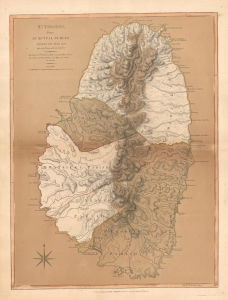
St. Vincent, from an Actual Survey made in the year 1775, after the Treaty with the Caribs.
sold
- Digital Map Information
- Suitable for large format printing
- File Size: 23.74 MB
- File Type: ZIP / TIFF
- ICC color profile embedded
- Delivered instantly via download link
This is the 1794 Laurie and Whittle map of Saint Vincent according to the treaty that ended the First Carib War (1769 - 1773) and a year before the outbreak of the Second Carib War (1795 - 1797). (more details)
An extremely scarce nautical chart of the waters around Singapore.

A New Chart Containing the Southwest Part of the China Sea, comprised between The Malaya Peninsula, Straits of Sincapore &c, The Straits of Banca, Gaspar and Billiton, and The Isle of Borneo.
sold
- Digital Map Information
- Suitable for large format printing
- DPI: 300
- File Size: 14.78 MB
- File Type: ZIP / TIFF
- ICC color profile embedded
- Delivered instantly via download link
A scarce 1794 nautical chart or maritime map of the southern tip of the Malay Peninsula, including the island of Singapore (the city had not yet been founded), the Straits of ... (more details)
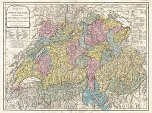
A New Map of Switzerland Divided into the Thirteen Cantons with their Allies and their Subjects.
sold
- Digital Map Information
- Suitable for large format printing
- DPI: 300
- File Size: 23.49 MB
- File Type: ZIP / TIFF
- ICC color profile embedded
- Delivered instantly via download link
An extraordinary 1794 map of the Switzerland. Covers the entire country in extraordinary detail offering both topographical and political information. Color coded ... (more details)
Scarce nautical chart of Table Bay, Cape Town, South Africa.
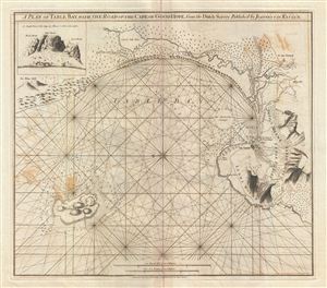
A Plan of Table Bay with the Road of th Cape of Good Hope, from the Dutch Survey Published by Joannes Van Keulen.
sold
- Digital Map Information
- Suitable for large format printing
- DPI: 300
- File Size: 16.3 MB
- File Type: ZIP / TIFF
- ICC color profile embedded
- Delivered instantly via download link
A scarce 1794 nautical chart or maritime map of the Table Bay, South Africa, by Robert Laurie and James Whittle. Oriented to the east, this stunning map of the ... (more details)
The New British Frontier
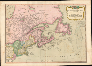
A New And Correct Map Of The British Colonies In North America.
sold
- Digital Map Information
- Suitable for large format printing
- Full resolution TIFF file
- ICC color profile embedded
- Delivered instantly via download link
A significant 1794 Laurie and Whittle map of the northeastern United States and eastern Canada, capturing North America at a pivotal moment between the American Revolutionary War (1775 - 1783) and the War of 1812 (1812 - 1815). The map reflects the geopolitical order created by American Independence: the 1783 Treaty of Paris boundary divides the United States from British Canada, while Vermont, admitted to the Union only three years earlier, appears in one of its earliest dated cartographic representations. The map offers a striking cartographic portrait of redrawn political boundaries that remained far from settled. (more details)
Best general map of the Southeast of the 18th Century.
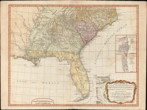
A New and General Map of the Southern Dominions Belonging to the United States of America, viz: North Carolina, South Carolina, and Georgia: with the Bordering Indian Countries and The Spanish Possessions of Louisiana and Florida.
sold
- Digital Map Information
- Suitable for large format printing
- DPI: 600
- File Size: 723.14 MB
- File Type: ZIP / TIFF
- ICC color profile embedded
- Delivered instantly via download link
A scarce 1794 Laurie and Whittle / Sayer map of the southeastern part of the United States and Florida. This is the second edition of Sayer's map of the southeast, and the first to recognize the United States as an independent nation. At the time of initial publication, it represented the finest general cartography of the southeast obtainable. (more details)
Labels numerous cities, including Constantinople, Baghdad, and Alexandria.
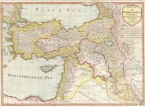
A New Map of Turkey in Asia.
sold
- Digital Map Information
- Suitable for large format printing
- File Size: 19.11 MB
- File Type: ZIP / TIFF
- ICC color profile embedded
- Delivered instantly via download link
This is a 1794 Laurie and Whittle map of Turkey. The map depicts the region form the Aegean Sea to Iraq and from the Black Sea to the Nile Delta in Egypt and the Persian Gulf. Highly detailed, myriad cities, towns, and villages are labeled throughout, including Constantinople (Istanbul), Jerusalem, Baghdad, Basra, and Alexandria. Roads wind their way across the landscape, including the Route of the Caravan through the Desert. Rivers, such as the Tigris and Eurphrates, Lakes, including Lake Urmia in Iran, mountain ranges are also illustrated. The Sea of Marmara and the Dardanelles are both labeled. Cyprus is detailed in the Mediterranean, with cities and towns labeled across the island. (more details)
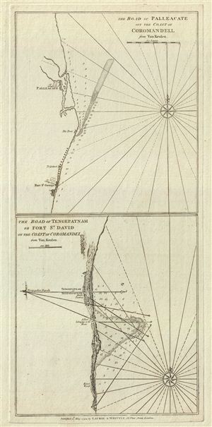
The Road of Palleacate, off the Coast of Coromandell. The Road of Tengepatnam or Fort St. David on the Coast of Coromandel.
sold
- Digital Map Information
- Suitable for large format printing
- DPI: 300
- File Size: 7.46 MB
- File Type: ZIP / TIFF
- ICC color profile embedded
- Delivered instantly via download link
This is a fine example of Laurie and Whittle's 1794 nautical chart or maritime map of Palleacate (Pulicat) and Tengepatnam or Fort St. David on the Coromandel ... (more details)
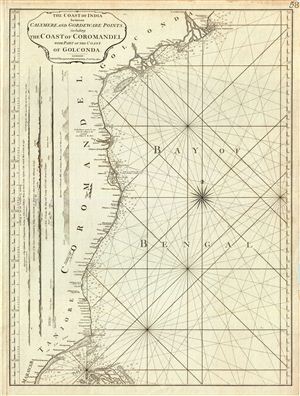
The Coast of India between Calymere and Gordeware Points, including the Coast of Coromandel, with part of the Coast of Golconda.
sold
- Digital Map Information
- Suitable for large format printing
- DPI: 300
- File Size: 15.45 MB
- File Type: ZIP / TIFF
- ICC color profile embedded
- Delivered instantly via download link
This is a fine example of Laurie and Whittle's 1794 nautical chart or maritime map of the southeastern coast of India or the Coromandel Coast. The map covers ... (more details)
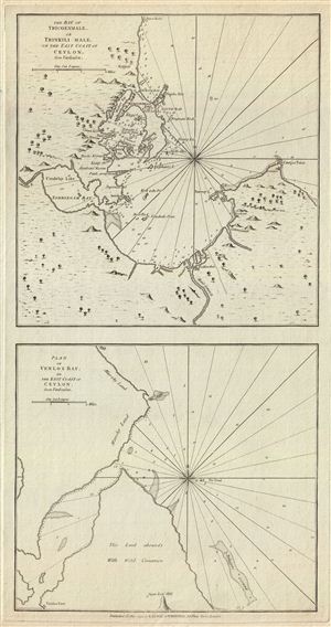
The Bay of Tricoenmale or Trinkili-Male, on the East Coast of Ceylon. Plan of Venlos Bay, on the East Coast of Ceylon.
sold
- Digital Map Information
- Suitable for large format printing
- DPI: 300
- File Size: 10.57 MB
- File Type: ZIP / TIFF
- ICC color profile embedded
- Delivered instantly via download link
This is a fine example of Laurie and Whittle's 1794 nautical chart or maritime map of the Tricoenmale or Trinkili-Male (Trincomalee) Bay and the Venlos ... (more details)
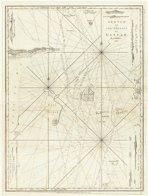
Sketch of the Straits of Gaspar.
sold
- Digital Map Information
- Suitable for large format printing
- DPI: 300
- File Size: 15.38 MB
- File Type: ZIP / TIFF
- ICC color profile embedded
- Delivered instantly via download link
This is a fine example of Laurie and Whittle's 1794 nautical chart or maritime map of the Gaspar Strait, Indonesia. The map covers the strait between ... (more details)
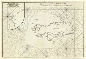
Plan of the Isle Rodrigues, Commonly called Diego Rays Island.
sold
- Digital Map Information
- Suitable for large format printing
- DPI: 300
- File Size: 9.66 MB
- File Type: ZIP / TIFF
- ICC color profile embedded
- Delivered instantly via download link
This is a fine example of Laurie and Whittle's 1794 nautical chart or maritime map of the Isle Rodrigues or Diego Rays Island, part of the Mascarene ... (more details)
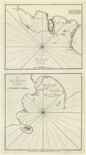
Plan of Ponta de Gala, on the South Coast of Ceylon.
sold
- Digital Map Information
- Suitable for large format printing
- DPI: 300
- File Size: 7.81 MB
- File Type: ZIP / TIFF
- ICC color profile embedded
- Delivered instantly via download link
This is a fine example of Laurie and Whittle's 1794 nautical chart or maritime map of Ponta de Gala (Galle) and Nilewelle (Nilwella) on the southern ... (more details)
Important East India nautical chart issued shortly after the 1794 Battle of the Straits of Sunda.
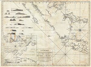
A Chart of the South Part of Sumatra and of the Straits of Sunda and Banca with Gaspar Straits.
sold
- Digital Map Information
- Suitable for large format printing
- DPI: 300
- File Size: 35.58 MB
- File Type: ZIP / TIFF
- ICC color profile embedded
- Delivered instantly via download link
This is a fine example of Laurie and Whittle's 1794 nautical chart or maritime map of Southern Sumatra, Western Java, and the Straits of Sunda and ... (more details)
A scarce map of Bali, Indonesia, during the Dutch colonial period.
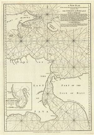
A New Plan of the Straits Situated to the East of Java & Madura commonly called The Straits of Bali and of Pondi and Respondi.
sold
- Digital Map Information
- Suitable for large format printing
- DPI: 300
- File Size: 10.51 MB
- File Type: ZIP / TIFF
- ICC color profile embedded
- Delivered instantly via download link
This is a fine example of Laurie and Whittle's 1794 nautical chart or maritime map of the Strait of Bali, Indonesia. It covers from Java's ... (more details)
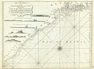
The Coast of India from Point Gordeware to the Ganges Comprehending Part of the Coast of Golconda, the Coasts of Orissa and Bengal, with the Mouth of Hoogly River.
sold
- Digital Map Information
- Suitable for large format printing
- DPI: 300
- File Size: 16.31 MB
- File Type: ZIP / TIFF
- ICC color profile embedded
- Delivered instantly via download link
This is a fine example of Laurie and Whittle's 1794 nautical chart or maritime map of the Golconda Coast, the coast of Orissa and Bengal ... (more details)
The largest and most detailed map of Bombay (Mumbai) to appear in the 18th century.
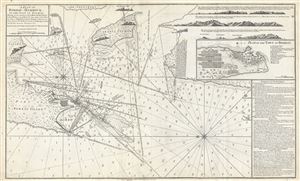
A Plan of Bombay-Harbour on th Coast of Malabar.
sold
- Digital Map Information
- Suitable for large format printing
- DPI: 300
- File Size: 20.38 MB
- File Type: ZIP / TIFF
- ICC color profile embedded
- Delivered instantly via download link
This is a fine example of Laurie and Whittle's 1794 nautical chart or maritime map of Bombay (Mumbai) Island, city, and harbor, India. ... (more details)
The third episode in the 18th century British mapping of Bombay!
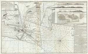
A Plan of Bombay-Harbour on th Coast of Malabar.
sold
- Digital Map Information
- Suitable for large format printing
- Full resolution TIFF file
- ICC color profile embedded
- Delivered instantly via download link
This is a fine example of Laurie and Whittle's 1794 nautical chart or maritime map of Bombay (Mumbai) Island, city, and harbor, India. ... (more details)