
Osaka Mainichi Shimbun (sold) (毎日新聞)

The Osaka Mainichi Shimbun (大阪毎日新聞; 1876 - 1942) was an Osaka based daily newspaper active in the late 19th and early 20th century. The Osaka Mainichi Shimbun (大阪毎日新聞, Osaka Daily News) was founded in 1876 as Osaka Nippo(大阪日報). In 1888 it was renamed Osaka Mainichi Shimbun. In 1911 it merged with the Tokyo Nichi Nichi Shimbun (東京日日新聞), but both companies continued to print their newspapers independently until 1943, they were consolidated under the Mainichi Shimbun (毎日新聞, Daily News) masthead. The Mainichi Shimbun is today one of Japans larges and longest lasting newspapers.
Osaka Mainichi Shimbun (sold) is also known as: 毎日新聞
Japan asserting its position on the world stage.
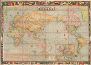
世界交通全图 / World Traffic Map. / Sekai kōtsū zenzu.
sold
- Digital Map Information
- Suitable for large format printing
- Full resolution TIFF file
- ICC color profile embedded
- Delivered instantly via download link
An exceptional 1909 or Meiji 42 Osaka Daily News Agency map of the world on Mercator's Projection. The map embraces an art nouveau aesthetic with regard to its decorative borders, which incorporate the flags and ensigns of the world's powers, among them the Azure Dragon flag of the Qing. The whole is centered on Japan and the Pacific and includes shipping routes throughout the world. Statistical tables in the lower quadrants advance detail regarding the land, population, fiscal revenue, and armaments of each nation. (more details)
How a wood and paper city burns.
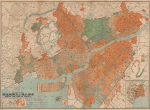
帝都大震火災系統地圖 / Map of the Fire of Tokyo.
sold
- Digital Map Information
- Suitable for large format printing
- File Size: 191.05 MB
- File Type: ZIP / TIFF
- ICC color profile embedded
- Delivered instantly via download link
An infographic masterpiece detailing the ignition and development of the Great Fire of Tokyo following the 1923 Great Kanto Earthquake. This partially bilingual 1923 map of the Great Tokyo Fire was issued by the Relief Information Bureau of Tokyo Imperial University just four months after the disaster. It focuses on ignition points and on the strong winds that coincided with the earthquake, which caused fire to spread rapidly and eventually burn down much of the dense wooden city. (more details)
How a wood and paper city burns.
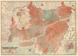
帝都大震火災系統地圖 / Map of the Fire of Tokyo.
sold
- Digital Map Information
- Suitable for large format printing
- File Size: 69.11 MB
- File Type: ZIP / TIFF
- ICC color profile embedded
- Delivered instantly via download link
An astounding infographic masterpiece detailing the ignition and development of the Great Fire of Tokyo following the 1923 Great Kanto Earthquake. This is a partially bilingual 1923 map of Great Tokyo Fire was issued by the Bureau of Tokyo Imperial University just four months after the disaster. It focuses ignition points and on the strong winds that coincided with the earthquake, which caused fire to spread rapidly and eventually burn down much of the city - which was constructed of tightly packed wooden buildings. (more details)
How a wood and paper city burns.
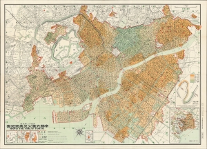
帝都大震火災系統地圖 / Map of the Fire of Tokyo.
sold
- Digital Map Information
- Suitable for large format printing
- File Size: 70.51 MB
- File Type: ZIP / TIFF
- ICC color profile embedded
- Delivered instantly via download link
An infographic masterpiece detailing the ignition and development of the Great Fire of Tokyo following the 1923 Great Kanto Earthquake. This partially bilingual 1923 map of the Great Tokyo Fire was issued by the Relief Information Bureau of Tokyo Imperial University just four months after the disaster. It focuses on ignition points and on the strong winds that coincided with the earthquake, which caused fire to spread rapidly and eventually burn down much of the dense wooden city. (more details)
First mapping of the devastation of the Great Kanto Earthquake.
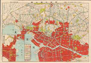
Earthquake Disaster Map. / 關唇東大震災圖
sold
- Digital Map Information
- Suitable for large format printing
- Full resolution TIFF file
- ICC color profile embedded
- Delivered instantly via download link
This is an extraordinary 1923 (Taisho 12) Japanese of Tokyo illustrating the staggering damage caused by the Great Kanto Earthquake. The map was published by the daily Osaka Mainichi Shimbun on September 13, just 12 days after the devastating event, making it one of the earliest, if not the earliest published map to illustrate the wreckage. Like most 19th and early 20th century maps of Tokyo, this map is oriented to the East with north on the right. The focus area roughly corresponds with central Tokyo and is centered on the Imperial Palace. Coverage includes Chiyoda, Shinjuku, Toshima, Bunkyo, Arakawa, Taito, Minato, Chuo, and more. An inset in the lower left, oriented to the northwest, illustrates Yokohama. Red zones indicating those areas devastated by the earthquake and subsequent fires. Verso printed in cyan offers images and text describing the disaster. (more details)
The Earthquake that Transformed Tokyo.
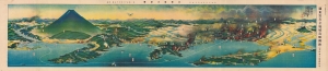
關東震災全地域鳥瞰圖繪 / [Bird's-eye View of the Entire Area of the Kanto Earthquake Disaster].
sold
- Digital Map Information
- Suitable for large format printing
- Full resolution TIFF file
- ICC color profile embedded
- Delivered instantly via download link
This is a rare, poignant bird's-eye view of Tokyo in the aftermath of the 1923 Great Kanto Earthquake by master painter-cartographer Yoshida Hatsusaburō. Coverage includes Tokyo, Yokohama, Mt. Fuji, and surrounding areas. This view was printed and distributed in 1924 (Taisho 13), just after the one-year anniversary of the disaster by the Osaka Mainichi Shimbun and is a fascinating record of both commemoration and reconstruction. (more details)
Charming Japanese pictorial map of the world with illustrations of cannibalism.
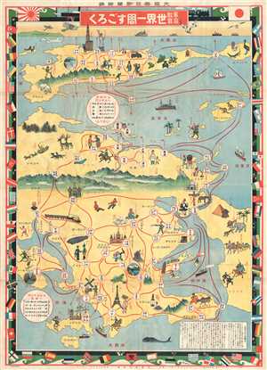
家庭教育世界一周すごろく / Home Education Round-the-World Sugoroku./ Katei kyōiku sekai isshū sugoroku.
sold
- Digital Map Information
- Suitable for large format printing
- File Size: 35.75 MB
- File Type: ZIP / TIFF
- ICC color profile embedded
- Delivered instantly via download link
This is an exceptionally charming Taisho 15 or 1926 Japanese pictorial world map and round-the-world sugoroku game. Although somewhat distorted and not drawn to scale, this is both a game board and a map of the world. Oriented with east at the top, this map is ... (more details)
Charming Japanese pictorial map of the world with illustrations of cannibalism.
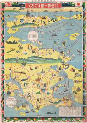
家庭教育世界一周すごろく / Home Education Round-the-World Sugoroku./ Katei kyōiku sekai isshū sugoroku.
sold
- Digital Map Information
- Suitable for large format printing
- File Size: 37.45 MB
- File Type: ZIP / TIFF
- ICC color profile embedded
- Delivered instantly via download link
This is an exceptionally charming Taisho 15 or 1926 Japanese pictorial world map and round-the-world sugoroku game. Although somewhat distorted and not drawn to scale, this is both a game board and a map of the world. Oriented with east at the top, this map is ... (more details)
A gorgeous view of the Japanese home islands.
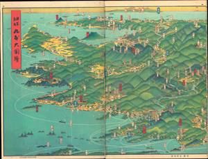
日本鳥瞰 大日本パノラマ大圖繪張 / [Bird's Eye View of Japan - Japan Panorama Foldout Map].
sold
- Digital Map Information
- Suitable for large format printing
- Full resolution TIFF file
- ICC color profile embedded
- Delivered instantly via download link
This is a beautiful 1927 panoramic view of Japan drawn by Yoshida Hatsusaburō and published by the Osaka Mainichi Shimbun. The view is published in atlas format, with pages printed on both sides. It is divided into three sections, each consisting of six pages, covering the entirety of Kyūshū, Honshū, and Shikoku. (more details)
Graphically wonderful Japanese world aviation board game.
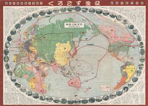
世界航空路圖 / Sekai kōkūrozu. / World Aviation Route Map. / 征空すごろく/ Seikū su-goro ku.
sold
- Digital Map Information
- Suitable for large format printing
- File Size: 56.49 MB
- File Type: ZIP / TIFF
- ICC color profile embedded
- Delivered instantly via download link
A rare 1930 Showa 5 Japanese pictorial map of the world and sugoroku game. Centered on Japan, this map covers the entire world with global flights paths are outlined in red. It was issued by the Japanese daily newspaper, Ōsaka Mainichi Shinbun ... (more details)
Japan's Expanding Empire on the Eve of the Second-Sino Japanese War.
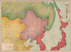
日滿露支交通國境大地圖 / [Map of Transportation and National Borders of Japan, Manchukuo, the Soviet Union, and China].
sold
- Digital Map Information
- Suitable for large format printing
- File Size: 92.59 MB
- File Type: ZIP / TIFF
- ICC color profile embedded
- Delivered instantly via download link
This is a large 1935 map of Northeast Asia (Japan, Korea, Manchuria, northern China, Mongolia, Siberia) that appeared in the Japanese newspaper, Osaka Mainichi Shimbun. It is designed to highlight transportation and communication lines connecting Japan's empire at a time when the empire was expanding and Japan's domestic politics were moving towards militarism. (more details)
Japanese anti-Soviet anti-Communist Propaganda Pictorial!
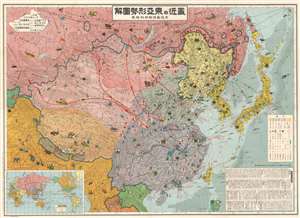
最近の東 亞形勢圖解 / Illustrated Explanation of Recent East Asia Situations. / Saikin no Tōa keisei zukai.
sold
- Digital Map Information
- Suitable for large format printing
- File Size: 129.91 MB
- File Type: ZIP / TIFF
- ICC color profile embedded
- Delivered instantly via download link
A remarkable and rare 1937 Osaka Mainichi Shimbun large-format Japanese anti-Soviet propaganda pictorial map of East Asia. Centered on China, this stunning map depicts from Central Asia and India to Japan, and from Siberia to Vietnam. The map employs text, color coding, and cartoon imagery to illustrate the confusing political, military, and economic environment in East Asia at this time, expressing the dangers of Soviet expansionism, and suggest a Japanese military buildup to counter it. (more details)
Japanese anti-Soviet anti-Communist Propagana Pictorial!
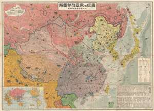
最近の東 亞形勢圖解 / Illustrated Explanation of Recent East Asia Situations. / Saikin no Tōa keisei zukai.
sold
- Digital Map Information
- Suitable for large format printing
- File Size: 53.01 MB
- File Type: ZIP / TIFF
- ICC color profile embedded
- Delivered instantly via download link
A remarkable and rare 1937 large format Japanese anti-Soviet propaganda pictorial map of East Asia. Centered on China, this stunning map covers from Central Asia and India to Japan and from Siberia to Vietnam. The map employs text, color coding, ... (more details)
Japanese anti-Soviet anti-Communist Propaganda Pictorial!
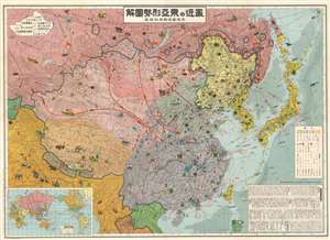
最近の東 亞形勢圖解 / Illustrated Explanation of Recent East Asia Situations. / Saikin no Tōa keisei zukai.
sold
- Digital Map Information
- Suitable for large format printing
- File Size: 138.77 MB
- File Type: ZIP / TIFF
- ICC color profile embedded
- Delivered instantly via download link
A remarkable and rare 1937 Osaka Mainichi Shimbun large format Japanese anti-Soviet propaganda pictorial map of East Asia. Centered on China, this stunning map depicts from Central Asia and India to Japan and from Siberia to Vietnam. The map employs text, color coding, and cartoon imagery to illustrate the confusing political, military, and economic environment in East Asia at this time, express the dangers of Soviet expansionism, and suggest a Japanese military buildup to counter it. (more details)
Japanese anti-Soviet anti-Communist Propaganda Pictorial!
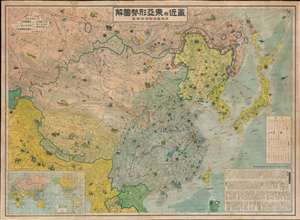
最近の東 亞形勢圖解 / Illustrated Explanation of Recent East Asia Situations. / Saikin no Tōa keisei zukai.
sold
- Digital Map Information
- Suitable for large format printing
- File Size: 133.07 MB
- File Type: ZIP / TIFF
- ICC color profile embedded
- Delivered instantly via download link
A remarkable and rare 1937 large format Japanese anti-Soviet propaganda pictorial map of East Asia. Centered on China, this stunning map covers from Central Asia and India to Japan and from Siberia to Vietnam. The map employs text, color coding, ... (more details)
Japanese anti-Soviet anti-Communist Propaganda Pictorial!
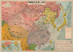
最近の東 亞形勢圖解 / Illustrated Explanation of Recent East Asia Situations. / Saikin no Tōa keisei zukai.
sold
- Digital Map Information
- Suitable for large format printing
- File Size: 173.24 MB
- File Type: ZIP / TIFF
- ICC color profile embedded
- Delivered instantly via download link
A remarkable 1937 Osaka Mainichi Shimbun large-format Japanese anti-Soviet propaganda pictorial map of East Asia. Centered on China, this stunning map depicts from Central Asia and India to Japan, and from Siberia to Vietnam. The map employs text, color coding, and cartoon imagery to illustrate the confusing political, military, and economic environment in East Asia at this time, expressing the dangers of Soviet expansionism, and suggesting a Japanese military buildup to counter it. (more details)
The start of WWII in Europe, as seen from Japan.
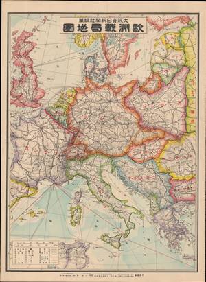
歐洲戰局地圖 / [Map of the War Situation in Europe].
sold
- Digital Map Information
- Suitable for large format printing
- File Size: 20.17 MB
- File Type: ZIP / TIFF
- ICC color profile embedded
- Delivered instantly via download link
This is a September 1939 Japanese map of Europe soon after Nazi Germany's invasion of Poland at the start of World War II (1939 - 1945). It appeared in the Osaka Mainichi Shimbun, one of the leading newspapers in Japan at the time. The map is one of only a few Japanese war-time maps to focus on the European Theater - a are of great interest to Japanese citizenry despite being on the opposite side of the world - see below. (more details)
Japanese interest in Operation Barbarossa!
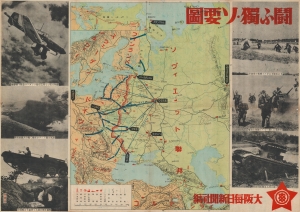
闘ふ獨ソ要圖 / [Map of German-Soviet Fighting].
sold
- Digital Map Information
- Suitable for large format printing
- File Size: 115.12 MB
- File Type: ZIP / TIFF
- ICC color profile embedded
- Delivered instantly via download link
This is a very rare 1941 or Showa 16 map of Eastern Europe and Russia by the Osaka Mainchi Shimbun showing the advance of German forces into the Soviet Union during Operation Barbarossa. The map illustrates the battlefront just as the Germans had captured Minsk, were moving towards Moscow, and had encircled Kiev and Leningrad, in August or September 1941. The legend at bottom-left indicates symbols for crucial information such as national and provincial borders, capital cities, railways, ports, military bases, fortifications, important industrial centers, mines, and so on. The inset map at top-left shows distances (presumably by rail) between Berlin, Moscow, Baku, Khabarovsk, and Vladivostok, with Japan at far-right. As one of the major newspapers in Japan, the Osaka Mainchi Shimbun played a crucial role in informing the Japanese public about world affairs. Although Japan was part of the Tripartite Pact with Nazi Germany, the map does not evince any favor towards either side and appears to reproduce photographs from both the German and Soviet press (German on the left, Soviet on the right). Events on the Eastern Front and in the wider European war were followed closely in Japan, which was fighting its own war in China that, at this point, was transforming into a wider regional conflict. Although the wars in Europe and Asia were separate, they would be tied together following the Japanese attack on Pearl Harbor and the entry of the United States into the war. (more details)
Japanese interest in Operation Barbarossa!
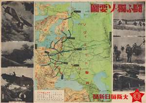
闘ふ獨ソ要圖 / [Map of German-Soviet Fighting].
sold
- Digital Map Information
- Suitable for large format printing
- File Size: 39.92 MB
- File Type: ZIP / TIFF
- ICC color profile embedded
- Delivered instantly via download link
This is a very rare 1941 or Showa 16 map of Eastern Europe and Russia by the Osaka Mainchi Shimbun showing the advance of German forces into the Soviet Union during Operation Barbarossa. The map illustrates the battlefront just as the Germans had captured Minsk, were moving towards Moscow, and had encircled Kiev and Leningrad, in August or September 1941. The legend at bottom-left indicates symbols for crucial information such as national and provincial borders, capital cities, railways, ports, military bases, fortifications, important industrial centers, mines, and so on. The inset map at top-left shows distances (presumably by rail) between Berlin, Moscow, Baku, Khabarovsk, and Vladivostok, with Japan at far-right. As one of the major newspapers in Japan, the Osaka Mainchi Shimbun played a crucial role in informing the Japanese public about world affairs. Although Japan was part of the Tripartite Pact with Nazi Germany, the map does not evince any favor towards either side and appears to reproduce photographs from both the German and Soviet press (German on the left, Soviet on the right). Events on the Eastern Front and in the wider European war were followed closely in Japan, which was fighting its own war in China that, at this point, was transforming into a wider regional conflict. Although the wars in Europe and Asia were separate, they would be tied together following the Japanese attack on Pearl Harbor and the entry of the United States into the war. (more details)