
Pluth, Franz

Franz Pluth (1800 - 1871) was an engraver based in Prague, the capital of the Kingdom of Bohemia, then part of the Habsburg Austrian Empire. Pluth was born in Prague and most likely died in Zbraslav. He was active as a map engraver until at least 1848. His work is similar in style to that of Karl Ferdinand Weiland, a prolific German engraver, with whom he may have worked.
Depicts an 'unknown maelstrom' in the Atlantic Ocean off the coast of South America.
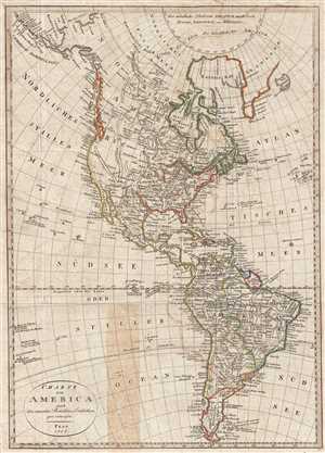
Charte von America nach den neuesten Berichten u. Entdeckun gen enworfen.
$350.00
Acquire
- Digital Map Information
- Suitable for large format printing
- DPI: 300
- File Size: 6.65 MB
- File Type: ZIP / TIFF
- ICC color profile embedded
- Delivered instantly via download link
This is an 1818 Franz Pluth map of North and South America. The map depicts the Western Hemisphere from Alaska and the Arctic to Tierra del Fuego and from the Pacific Ocean to the Azores in the Atlantic Ocean. Highly detailed, myriad locations throughout the ... (more details)
Boundary ambiguity.
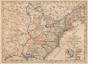
Charte von den Vereinigten Staaten von Nord=America mit Luisiana.
$750.00
Acquire
- Digital Map Information
- Suitable for large format printing
- DPI: 600
- File Size: 14.62 MB
- File Type: ZIP / TIFF
- ICC color profile embedded
- Delivered instantly via download link
This is an 1818 Franz Pluth map of the eastern United States. The is an intriguing Czech production published in Prague. It is both impressively detailed and utterly confusing, reflecting ambiguity regarding U.S territorial claims following the Louisiana Purchase. (more details)
A beautifully engraved and highly detailed map of South America.
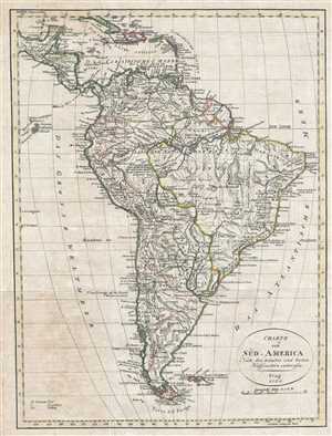
Charte von Süd - America Nach den neuesten und besten Hülfomitteln entworfen.
$200.00
Acquire
- Digital Map Information
- Suitable for large format printing
- DPI: 300
- File Size: 5.14 MB
- File Type: ZIP / TIFF
- ICC color profile embedded
- Delivered instantly via download link
This is an 1820 Franz Pluth map of South America. The map depicts the region from Central America and the West Indies to Tierra del Fuego and Cape Horn and from the Pacific Ocean and the Galapagos Islands to the Atlantic Ocean. Highly detailed, innumerable ... (more details)
Guadeloupe's active volcano, La Souffrière, is illustrated in profile.
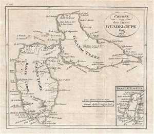
Charte von der Insel Guadeloupe.
$125.00
Acquire
- Digital Map Information
- Suitable for large format printing
- DPI: 300
- File Size: 1.76 MB
- File Type: ZIP / TIFF
- ICC color profile embedded
- Delivered instantly via download link
This is an 1822 Franz Pluth map of Guadeloupe. An island in the Caribbean, Guadeloupe is actually an overseas region and department of France. The map depicts both of Guadeloupe's two main islands: Basse-Terre and Grande-Terre. Numerous locations ... (more details)
A stunning depiction of the Caribbean paradise.
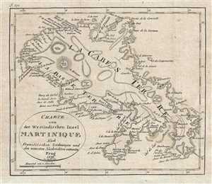
Charte von des Westindischen Insel Martinique.
$125.00
Acquire
- Digital Map Information
- Suitable for large format printing
- DPI: 300
- File Size: 1.54 MB
- File Type: ZIP / TIFF
- ICC color profile embedded
- Delivered instantly via download link
This is an 1822 Franz Pluth map of Martinique. Highly detailed, the map depicts the entirety of the island. Numerous towns and villages are labeled, including Fort Libre, which would become Fort de France, the island's current capital. Trinité ... (more details)
Identifies St. Lucia, the Bahamas, Curaçao, and Cozumel.
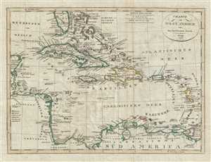
Charte von West_Indien oder den Antillischen_Inseln.
$225.00
Acquire
- Digital Map Information
- Suitable for large format printing
- DPI: 300
- File Size: 7.14 MB
- File Type: ZIP / TIFF
- ICC color profile embedded
- Delivered instantly via download link
This is a rare 1822 map of the Caribbean prepared by Czech engraver Franz Pluth. The map depicts the region from the Yucatan Peninsula to the islands of Martinique, St. Lucia, and Trinidad and Tobago and from southern Florida and the Bahamas ... (more details)
Unusual Czech comparative mountains chart with uncommon icicle style.
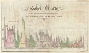
Höhen Charte oder bildlich vergleichende Übersicht der bedeutendsten Berge in Europa Asien, Africa, America und den Südsee Ländern.
$500.00
Acquire
- Digital Map Information
- Suitable for large format printing
- DPI: 300
- File Size: 6.22 MB
- File Type: ZIP / TIFF
- ICC color profile embedded
- Delivered instantly via download link
This is an unusual 1823 comparative mountains chart prepared by the Czech engraver Franz Pluth. The chart juxtaposes in close proximity the mountains of Europe, Asia, Africa, America, and Australia. This unusual style of comparative chart, ... (more details)