
Sanuto, Giulio (sold)

Giulio Sanuto (fl. 1540 – 1580) was a Venetian engraver. He was born the illegitimate son of Cavaliere Francesco di Angelo Sanuto; With his brother, the cartographer and scientific instrument maker Livio Sanuto (1520 – 1576) he produced an array of some of the most important geographical works produced in Venice during the second half of the sixteenth century. These included a 27-inch globe and the 1588 12-sheet atlas, Geografia della Africa. Giulio's career is singluar among Venice's engraves in that it appears to have been equally based on artistic, figurative work as well as his cartographic works. Giulio is more broadly known for a small but sought-after selection of decorative engravings; no more than twelve of these can be attributed confidently to him, including the monumental Apollo and Marsyas, measuring over 1.30 meters wide. Whilst Sanuto's engravings were generally based upon the designs of other artists, his work was both ambitious and grand, and he often signed these works.
Greatest Phantom Island of the Old World.
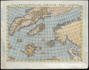
Septentrionalium Partium Nova Tabula.
sold
- Digital Map Information
- Suitable for large format printing
- Full resolution TIFF file
- ICC color profile embedded
- Delivered instantly via download link
This is Girolamo Ruscelli's 1562 edition of the 1558 Carta Da Navegar De Nicolo et Antonio Zeni Furono In Tramontana Lano MCCCLXXX by Nicoló Zeno the Younger, revealing the alleged 14th century voyages of his ancestors, Nicoló and Antonio Zeno. The fraud, seen largely as an attempt to co-opt the 1492 Columbian discovery of America, is responsible for the tenacity with which 16th and early 17th century geographers mapped the phantom islands Frisland, Icaria, Deogeo, and the coastline of Estotiland, which was taken to be the coast of Labrador. This first-plate example of Ruscelli's 1561 engraving, in its 1562 Latin text edition, which would have seen the greatest early dissemination of this image outside of Venice, and the biggest impact of its content on European geographical ideas. (more details)
Edition of the Earliest Acquirable Englishman's Map of the British Isles.
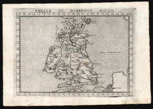
Anglia et Hibernia Nova.
sold
- Digital Map Information
- Suitable for large format printing
- Full resolution TIFF file
- ICC color profile embedded
- Delivered instantly via download link
This is a handsome example of Girolamo Ruscelli's 1561 / 1574 map of the British Isles. Of the maps prepared for Ruscelli's Ptolemy, it is among the most important: while most were larger, superior copies of the maps appearing in the 1548 Gastaldi Ptolemy, this map was a unique, updated work. (more details)
Northeastern limits of Ptolemy's landlocked Indian Ocean.
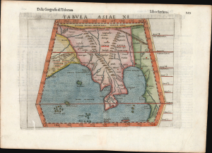
Tabula Asiae XI.
sold
- Digital Map Information
- Suitable for large format printing
- Full resolution TIFF file
- ICC color profile embedded
- Delivered instantly via download link
This is Girolamo Ruscelli's 1561 / 1598 map of Southeast Asia and the Malay Peninsula. The region was known to ancient geographers as 'India Extra Gangem,' or 'India Beyond the Ganges'. (more details)
Early map of Italy.
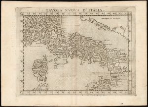
Tavola Nuova d' Italia.
sold
- Digital Map Information
- Suitable for large format printing
- DPI: 600
- File Size: 12.99 MB
- File Type: ZIP / TIFF
- ICC color profile embedded
- Delivered instantly via download link
This is Girolamo Ruscelli's 1574 edition of Giocomo Gastaldi's modern map of Italy, an attractive early copperplate map based on contemporary cartographic information. (more details)
One of the earliest works to depict a peninsular Qatar.
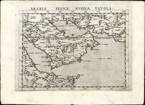
Arabia Felice Nuova Tavola.
sold
- Digital Map Information
- Suitable for large format printing
- Full resolution TIFF file
- ICC color profile embedded
- Delivered instantly via download link
This is a superb example of Girolamo Ruscelli's 1561, first edition of the first modern map of the Arabian Peninsula, specifically the fertile part of Arabia, 'Arabia Felix.' It is an expanded and more finely engraved evolution on Gastaldi's 1548 cartography, and one of the earliest acquirable depictions of Arabia not based on the 2nd-century work of Claudius Ptolemy. The island of Bahrain (Baharam) appears. This is also one of the earliest works to depict a peninsular Qatar. (more details)
Ptolemy's Second Projection.
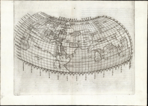
Ptolemaei Typus.
sold
- Digital Map Information
- Suitable for large format printing
- Full resolution TIFF file
- ICC color profile embedded
- Delivered instantly via download link
This is a superb example of a foundational work of Renaissance cartography: Girolamo Ruscelli's 1561 map of the known world during the ascendency of the Roman Empire. This presentation of ancient geography is refreshingly unique in that it employs Ptolemy's second projection rather than the more typical, simpler first projection. (more details)
Ptolemy's Second Projection, Ruscelli's First Edition.
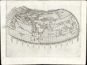
Ptolemaei Typus.
sold
- Digital Map Information
- Suitable for large format printing
- Full resolution TIFF file
- ICC color profile embedded
- Delivered instantly via download link
This is a strong example of a foundational work of Renaissance cartography, in its first edition: Girolamo Ruscelli's 1561 map of the known world during the ascendency of the Roman Empire. This presentation of ancient geography is refreshingly unique in that it employs Ptolemy's second projection rather than the more typical, simpler first projection. (more details)
Ptolemy's Second Projection.
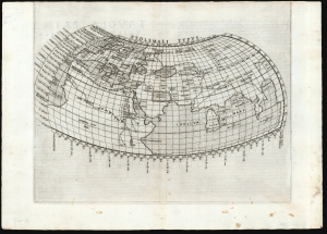
Ptolemaei Typus.
sold
- Digital Map Information
- Suitable for large format printing
- Full resolution TIFF file
- ICC color profile embedded
- Delivered instantly via download link
This is Girolamo Ruscelli's 1561 first issue of a foundational work of Renaissance cartography: the map of the known world as understood at the time of the Roman Empire. This presentation of ancient geography is refreshingly unique in that it employs Ptolemy's second projection, as opposed to the more typical, simpler first projection. (more details)
Ptolemy's Second Projection.
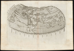
Ptolemaei Typus.
sold
- Digital Map Information
- Suitable for large format printing
- Full resolution TIFF file
- ICC color profile embedded
- Delivered instantly via download link
This is Girolamo Ruscelli's 1561 plate of a foundational work of Renaissance cartography: the map of the known world as understood at the time of the Roman Empire. This presentation of ancient geography is refreshingly unique in that it employs Ptolemy's second projection, as opposed to the more typical, simpler first projection. (more details)
First State of one of the Earliest Modern Maps of the Holy Land and Cyprus.
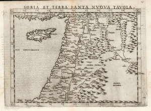
Soria et Terra Santa Nuova Tavola.
sold
- Digital Map Information
- Suitable for large format printing
- Full resolution TIFF file
- ICC color profile embedded
- Delivered instantly via download link
This is a superb, first state example of Girolamo Ruscelli's 1561 map of the Holy Land and Cyprus. It is an enlarged, more finely-engraved iteration of Giocomo Gastaldi's 1548 Soria e Terra Sancta nova tabula. While Tibbetts avers that the Ruscelli contains fewer place names than its Gastaldi source, he is incorrect: Ruscelli's map preserves all the data of the Gastaldi, but between the increased size of the plate and the clear, legible, and well-spaced engraving of the newer map, its data is presented without the crowding evident on the 1548 map. The skill evident in this 1561 work can be credited to the engraver Giulio Sanuto, one of the few Venetian engravers whose career was not isolated either to map engraving or to figurative artistic works, but consisted of both over a career of more than forty years. (more details)
One of the earliest Acquirable Post-Magellan Maps of Southeast Asia.
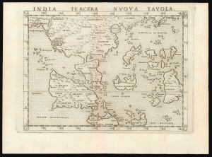
India Tercera Nuova Tavola.
sold
- Digital Map Information
- Suitable for large format printing
- Full resolution TIFF file
- ICC color profile embedded
- Delivered instantly via download link
This is a superb example of the first state of Girolamo Ruscelli's 1561 map of the East Indies and Southeast Asia. It is among the earliest maps of Southeast Asia. Although based on Giacomo Gastaldi's 1548 map of the same title, it is roughly twice the size, and overall, a superior engraving. This was the third of the modern regional Asia maps of this edition of Ptolemy, hence 'Tercera'. (more details)
One of the earliest acquirable Post-Magellan maps of Southeast Asia.
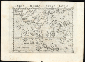
India Tercera Nuova Tavola.
sold
- Digital Map Information
- Suitable for large format printing
- Full resolution TIFF file
- ICC color profile embedded
- Delivered instantly via download link
This is a beautiful first state example of Girolamo Ruscelli's 1561 map of the East Indies and Southeast Asia, among the earliest maps of Southeast Asia. Although based on Giacomo Gastaldi's 1548 map of the same title, it is roughly twice the size and better engraved. (more details)
Northeastern limits of Ptolemy's landlocked Indian Ocean.
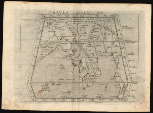
Tabula Asiae XI.
sold
- Digital Map Information
- Suitable for large format printing
- Full resolution TIFF file
- ICC color profile embedded
- Delivered instantly via download link
This is a handsome example of Girolamo Ruscelli's 1561 / 1574 map of Southeast Asia and the Malay Peninsula. The region was known to ancient geographers as 'India Extra Gangem,' or 'India Beyond the Ganges'. (more details)
Mapping the Northern Limits of the Roman Empire.
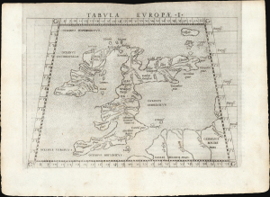
Tabula Europae I.
sold
- Digital Map Information
- Suitable for large format printing
- Full resolution TIFF file
- ICC color profile embedded
- Delivered instantly via download link
This is a handsome example of Girolamo Ruscelli's 1561 Ptolemaic map of the British Isles. The map captures the northwest limits of what Ancient Rome knew of the world, reflecting Julius Caesar and Claudius' invasions of England. (more details)
Early Glimpses of Mexico, California and the Gulf Coast.
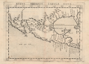
Nueva Hispania Tabula Nova.
sold
- Digital Map Information
- Suitable for large format printing
- DPI: 600
- File Size: 10.08 MB
- File Type: ZIP / TIFF
- ICC color profile embedded
- Delivered instantly via download link
This is Girolamo Ruscelli's 1574 map Tierra Nveva, an early and influential map of what would become Mexico, California, Texas, and Florida. Ruscelli's work is an enlarged and improved version of the 1548 map of the same region by fellow Venetian Giacomo Gastaldi. Apart from the Gastaldi, Ruscelli's map is the earliest to focus so closely on the southern parts of what would become the United States and is one of the earliest acquirable maps to reflect Spanish exploration and colonization in the Americas. Overall, along with the map covering the East Coast north of Florida, this is among the earliest maps to focus on North America. (more details)
Reconciling Verrazano and Cartier.
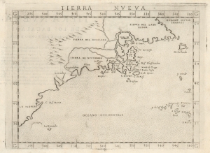
Tierra Nveva.
sold
- Digital Map Information
- Suitable for large format printing
- Full resolution TIFF file
- ICC color profile embedded
- Delivered instantly via download link
This is Girolamo Ruscelli's 1574 map Tierra Nveva, an early and influential map of what would become New England and the Canadian Maritime Provinces. Although the cartography can be confusing by modern standards, the map covers the eastern coastline of North America from somewhere in upper Florida northwards past Cabo de Santa Maria to Larcadia (Kitty Hawk), Angoulesme (New York Harbor), Nova Scotia, and Labrador. Based on the Ptolemaic model, Ruscelli's work follows on the 1548 map of the same region by fellow Venetian Giacomo Gastaldi. (more details)
Geographical Reassessment of the Ethiopian Empire.
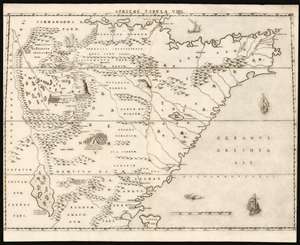
Africae Tabula VIIII.
sold
- Digital Map Information
- Suitable for large format printing
- DPI: 600
- File Size: 49.23 MB
- File Type: ZIP / TIFF
- ICC color profile embedded
- Delivered instantly via download link
This elegant map of East Africa was printed in a single edition in 1588 for Livio and Giulio Sanuto's twelve-sheet 'atlas' of Africa. This map represents a thorough reconsideration of African geography in the light of both conventional and newly available sources. Due to superficial similarities, some have suggested that Sanuto's geography is derived from Gastaldi's seminal 1564 Il disegno della geografia moderna de tutta la parte dell'Africa. This is not the case, as this and the other maps from the Sanuto atlas diverged sharply any contemporaneous or prior map - marking it as a unique and underappreciated masterpiece of geographical thought. (more details)
Geographical Reassessment of the African Red Sea Coast.
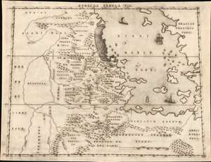
Africae Tabula VIII.
sold
- Digital Map Information
- Suitable for large format printing
- DPI: 600
- File Size: 20.66 MB
- File Type: ZIP / TIFF
- ICC color profile embedded
- Delivered instantly via download link
This elegant map of the Upper Nile and the Red Sea was printed in a single edition in 1588 for Livio and Giulio Sanuto's twelve-sheet 'atlas' of Africa. It is the first detailed and reasonably accurate map of what is today Eritrea, Djibouti, Ethiopia, and Sudan. While the general outline of Sanuto's map superficially resembles the 1564 Gastaldi Il disegno della geografia moderna de tutta la parte dell'Africa, its detail diverges sharply from that source, and any other contemporaneous map. This map thus represents a thorough reconsideration of African geography in the light of both conventional and newly available sources - marking it as a unique and underappreciated masterpiece of geographical thought. (more details)