
Stieler, Adolf (sold)
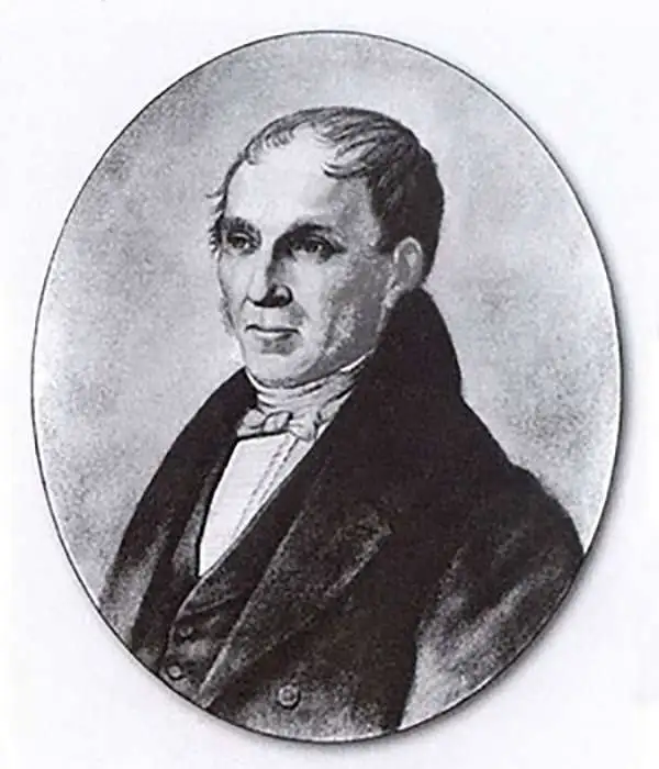
Adolf Stieler (1775 – 1836) was a German cartographer who worked most of his life in the Justus Perthes Geographical Institute in Gotha. His atlases are deservedly held in high esteem for their excellence. His Handatlas was the leading German world atlas until the middle of the 20th century, parts of which were printed until 1944.
Dates from just after the Mexican-American War and just before the California Gold Rush and illustrates Texas at its fullest.
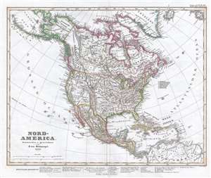
Nord-America. Entworfen u. gezeichnet von F. von Stulpnagel. 1848.
sold
- Digital Map Information
- Suitable for large format printing
- DPI: 300
- File Size: 5.66 MB
- File Type: ZIP / TIFF
- ICC color profile embedded
- Delivered instantly via download link
This is an 1848 Adolf Stieler map of North America just after the Mexican-American War and near the beginning of the California Gold Rush. It also features a depiction of Texas at its largest, with boundaries extending westward well into modern day New Mexico and ... (more details)
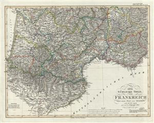
Der Sudliche Theil von Frankreich nebst einem Theile von Spanien.
sold
- Digital Map Information
- Suitable for large format printing
- Full resolution TIFF file
- ICC color profile embedded
- Delivered instantly via download link
This is a fascinating example of the 1850 Justus Perthes map of southwestern France. It covers the southern part of France from Clermont to the northern part of Spain and from Basses Pyrenees east as far as Var. Map is highly detailed with both political and ... (more details)
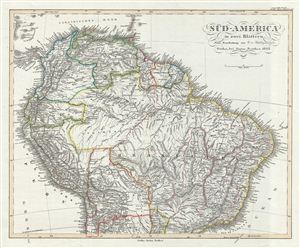
Sud-America in zwei Blatten.
sold
- Digital Map Information
- Suitable for large format printing
- DPI: 300
- File Size: 8.85 MB
- File Type: ZIP / TIFF
- ICC color profile embedded
- Delivered instantly via download link
This is a fascinating example of the 1850 Justus Perthes map of the northern part of South America. It covers the northern part of the continent including Panama, New Granada, Venezuela, ecuador, Peru, Brazil, Bolivia, Chile and Guyana. Shows Bolivia's ... (more details)
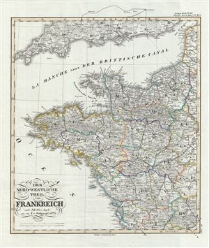
Der Nord-Westliche Teil von Frankreich.
sold
- Digital Map Information
- Suitable for large format printing
- DPI: 300
- File Size: 9.01 MB
- File Type: ZIP / TIFF
- ICC color profile embedded
- Delivered instantly via download link
This is a fascinating example of the 1854 Justus Perthes map of northwestern France. It covers from Seine Infer to Charente in the South and west as far as Finisterre, including parts of neighboring england. Map is highly detailed with both political ... (more details)
A German colony in Texas.
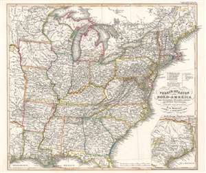
Verein-Staaten von Nord-America mit Ausnahme Florida's und der westlichen Territorien.
sold
- Digital Map Information
- Suitable for large format printing
- Full resolution TIFF file
- ICC color profile embedded
- Delivered instantly via download link
This is a beautifully engraved 1851 Johann Friedrich von Stülpnagel map of the eastern United States. The map depicts from Galveston Bay to the Atlantic Ocean and from Lake Superior to the Gulf of Mexico. Roads, canals, and railroads highlight the nation's transportation network. An inset in the lower right corner details and Texas as it appeared during the Mexican-American War. Cities, towns, and rivers appear here as well. (more details)
Northwest Germany only 4 years after the Revolution of 1848.
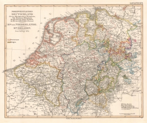
Nordwestliches Deutschland (Preuss, Rheinprovinz u. Westphalen, Kgr. Hannover, Oldenburg, Braunschweig, Lippe, Waldeck, die Hessischen Lande, Nassau) Kgr. der Niederlande. Kgr. Belgien.
sold
- Digital Map Information
- Suitable for large format printing
- File Size: 13.54 MB
- File Type: ZIP / TIFF
- ICC color profile embedded
- Delivered instantly via download link
This is an 1852 Justus Perthes map of northwestern Germany, Holland, and Belgium. (more details)
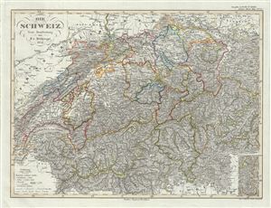
Die Schwiez.
sold
- Digital Map Information
- Suitable for large format printing
- DPI: 300
- File Size: 12.15 MB
- File Type: ZIP / TIFF
- ICC color profile embedded
- Delivered instantly via download link
This is a fascinating example of the 1852 Justus Perthes map of Switzerland. It covers all of Switzerland and parts of neighboring France, Germany, Austria and Italy. Map is highly detailed with both political and physical data. Various cities, ... (more details)
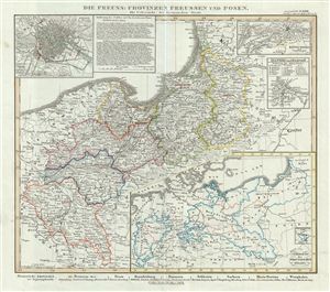
Die Preuss: Provinzen Preussen und Posen Mit Uebersicht des Preussischen Staats.
sold
- Digital Map Information
- Suitable for large format printing
- DPI: 300
- File Size: 7.91 MB
- File Type: ZIP / TIFF
- ICC color profile embedded
- Delivered instantly via download link
This is a fascinating example of the 1854 Justus Perthes map of Prussia. It covers from Brandenburg to Grodno, part of modern day Poland and Lithuania. An inset in the lower right quadrant offers an overview of the Prussian States. Three other ... (more details)
Includes profile views of the three isthmuses of Central America.
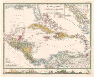
West-Indien und Central-Amerika.
sold
- Digital Map Information
- Suitable for large format printing
- File Size: 13.5 MB
- File Type: ZIP / TIFF
- ICC color profile embedded
- Delivered instantly via download link
A striking 1861 Hermann Berghaus map of the West Indies and Central America. The map depicts the region from the Tehuantepec Isthmus in Mexico to the Leeward Islands and from the Gulf Coast of the United States to northern South America. Published near the height of the mid-19th century European race for colonial acquisition, six different colors are used to highlight British, French, Dutch, Spanish, Danish, and Swedish colonies. The only Swedish colony in the Caribbean at the time was Saint Barthelemy, a small island near Anguilla, Saint Martin, and Barbuda, although it is not correctly colored. An inset map in the upper right corner details the Isthmus of Nicaragua, highlighting the roads throughout the region, particularly along the Pacific coast. An inset of the Isthmus of Panama is included just below the one of Nicaragua and presents in detail the rail line constructed across the isthmus from Colon to Panama City, one of the preferred ways to transfer goods from the Atlantic to the Pacific before the construction of the Panama Canal. There are profile illustrations of the Isthmuses of Panama, Nicaragua, and Tehuantepec in southern Mexico, all three of which were used to transfer goods across Central America, and all three of which were being promoted as potential options for an inter-oceanic canal. (more details)