
Waterlow and Sons (sold)
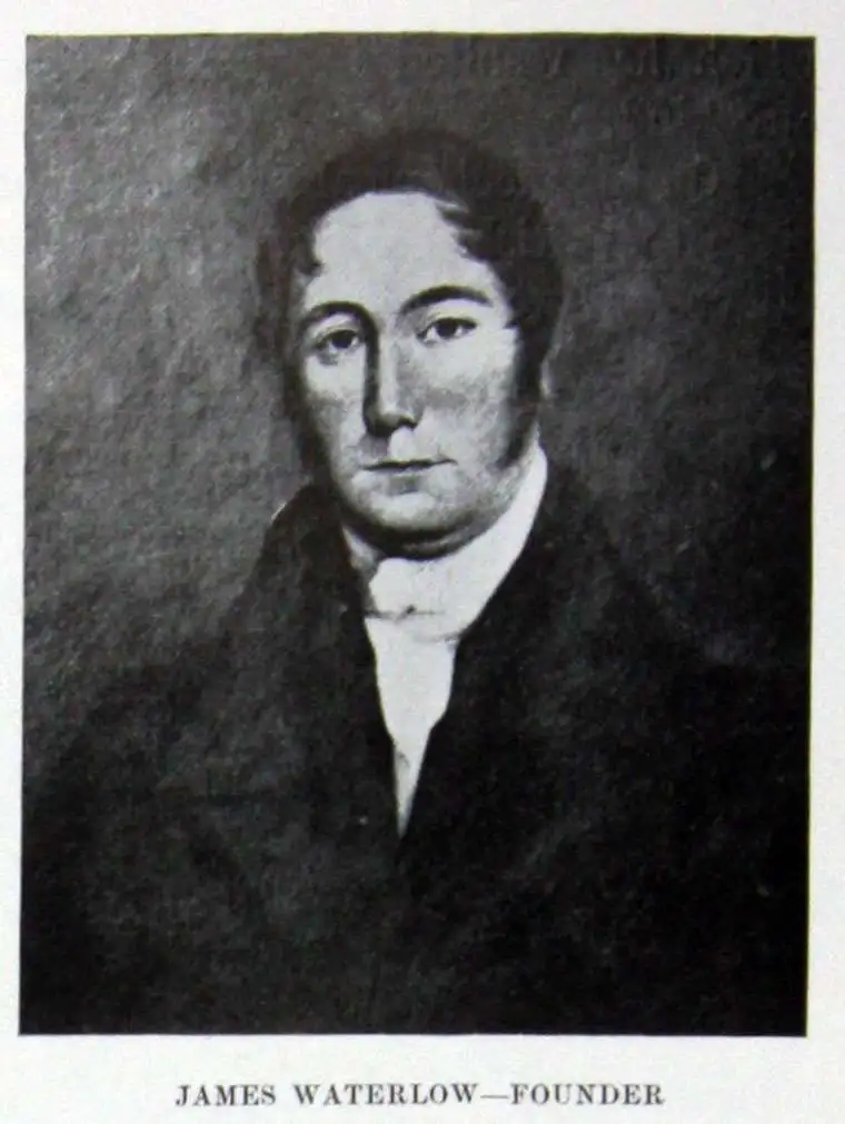
Waterlow and Sons (1810 - 1961) was a British engraving and printing concern active in London specializing in currency, postage stamps, bond certificates, and occasionally maps. The firm was founded by James Waterlow (1790 - 1876) in 1810 on Birchin Lane, London, as a legal document printer and copyist. By 1852, they had expanded into stamps and his sons, Albert, Alfred, Sydney, and Walter joined the business. One year after James Waterlow's death, in 1877, infighting among the sons led Alfred Waterlow to split off, forming Waterlow Brothers and Layton. The rift was settled by 1920, and the two firms once again merged under the Waterlow and Sons imprint. They were involved in the Portuguese Bank Note Affair of 1925, wherein the Portuguese fraudster Artur Virgílio Alves Reis convinced the firm to print 200,000 banknotes of 500 Portuguese Escudos each, amounting to roughly 88% of Portugal's GDP. The affair was settled in court with a ruling against Waterlow. In 1928, Waterlow lost its most lucrative contract, printing English banknotes, and began to fall into decline. In 1961, they were acquired by Purnell and Sons who, shortly afterwards, sold the firm to De La Rue. Ironically, De La Rue acquired the contract to print Bank of England banknotes again in 2003 – 75 years after Waterlow lost it!
A unique and special broadsheet propaganda piece relating to the early colonization of Queensland, Australia.
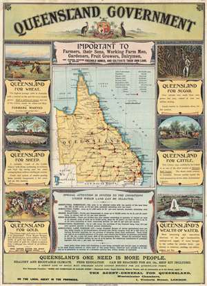
Queensland Government : important to farmers, their sons, working farm men, gardeners, fruit growers, dairymen, and others wishing to obtain freehold homes, and cultivate their own land.
sold
- Digital Map Information
- Suitable for large format printing
- File Size: 10.12 MB
- File Type: ZIP / TIFF
- ICC color profile embedded
- Delivered instantly via download link
An extraordinary rare government-issued 1898 broadsheet chromolithograph poster promoting immigration to Queensland, Australia. Surrounding a map of Queensland highlighting regional Land Offices, this broadsheet boasts of Queensland's incredible wheat and ... (more details)
The 'Coffee Republic'.
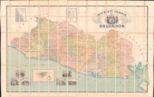
Nuevo Mapa Del Salvador Levantado por disposicion y bajo los auspicios del Supremo Gobierno por los Ingenieros Doctores Don Santiago I Barberena y Don Jose E. Alcaine de la Universidad de San Salvador 1892 - 1905.
sold
- Digital Map Information
- Suitable for large format printing
- File Size: 347.2 MB
- File Type: ZIP / TIFF
- ICC color profile embedded
- Delivered instantly via download link
This is the rare large scale national map of El Salvador, the 'Coffee Republic', composed by Santiago I. Barberena and Jose E. Alcaine. The map, as the title suggests is a 'nuevo' national map, expanding upon and superseding the 1859 Maximillian von Sonnenstern Mapa General. It appeared during a period of political and economic optimism for El Salvador. On May 1892, the year work on this map began, El Salvador, Guatemala, Honduras, and Nicaragua signed a peace treaty strengthen relations and open the path for a future Central American Union (1896 - 1898). While the union did not last to see the map's publication, there can be little doubt that it originated from optimism associated with these efforts. (more details)
Asia's 1st major Railroad.
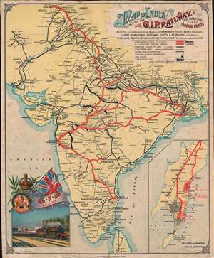
Map of India Shewing the G.I.P. Railway. Chief Connections and Through Routes.
sold
- Digital Map Information
- Suitable for large format printing
- File Size: 23.17 MB
- File Type: ZIP / TIFF
- ICC color profile embedded
- Delivered instantly via download link
A striking and rare discovery - this is a 1911 Waterlow and Company chromolithograph promotional broadside issued to promote the Great Indian Peninsular Railway (GIPR), Asia's first and greatest railroad. Boldly promoting the GIPR's expansive sub-continent wide rail network, this map was designed for display in railroad stations throughout India. The map covers the entire subcontinent, with GIPR trunk lines highlighted in red and subsidiary lines via a keyed network of symbols. In the lower right, a large inset of Bombay promotes GIPR services within the network's nucleus. In the lower-left, a finely executed vignette illustrates a GIPR train leaving Bombay's Victoria Terminus (Chhatrapati Shivaji Maharaj Terminus), with theIconic Mumbai Municipal Corporation Building (MMCB) recognizable in the background. (more details)
The 'All Red Line' is Secure...
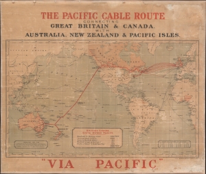
The Pacific Cable Route Connecting Great Britain and Canada with Australia, New Zealand, and Pacific Isles.
sold
- Digital Map Information
- Suitable for large format printing
- File Size: 36.69 MB
- File Type: ZIP / TIFF
- ICC color profile embedded
- Delivered instantly via download link
This is a c. 1911 John Waterlow and Sons map of the world highlighting British government telegraph cables. Known as the 'All Red Line', this vast telegraph network linked the entirety of the British Empire, allowing for near instant global communication with even the most remote outposts of the empire. This map was issued to celebrate the trans-Pacific cable, linking Vancouver, British Columbia, to Southport, Australia. (more details)
Extremely rare, large map of South Africa.
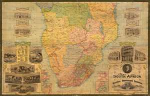
Map of South Africa presented by Sammel Brothers Limited.
sold
- Digital Map Information
- Suitable for large format printing
- File Size: 66.97 MB
- File Type: ZIP / TIFF
- ICC color profile embedded
- Delivered instantly via download link
Here in its only known example, this is Waterlow and Sons striking 1913 map of Southern Africa, focusing on South Africa and Rhodesia but also including Portuguese East and West Africa, German East and West Africa, and the Belgian Congo. The map was printed to promote Sammel Brothers Limited, a London importer of South African wool, mohair, skins, hides and ostrich feathers. The map includes inset views of the firm's six South African warehouses, and the fashionably-appointed London head office at 16 Mincing Lane. A table to the left (bordered with depictions of the avian and bovine sources of their products) presents the prospects for the company, giving the size in square miles of the parts of South Africa and Rhodesia, as well as the population (Whites versus 'Natives and Coloured') and the total imports and exports (in British pounds) of the colonies. The exports are broken down between gold, diamonds, 'other minerals,' wool, ostrich feathers, mohair, and hides and skins. The numbers reflected the reality that after gold, diamonds and mineral extraction, the export of cattle skins and wool was the most important source of wealth in South Africa, and until the dual advent of the automobile and wartime austerity, ostrich feathers were a much sought-after embellishment for the finest hats. (more details)
Rare city planning map of Shanghai with mansucript additions of prospective new streets.
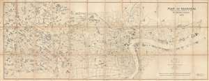
Plan of Shanghai Published under Authority of the Municipal Council. 1923
sold
- Digital Map Information
- Suitable for large format printing
- File Size: 46.17 MB
- File Type: ZIP / TIFF
- ICC color profile embedded
- Delivered instantly via download link
An extremely rare and important 1923 large format map of Shanghai issued by the Shanghai Municipal Council. The map is enormous and extends from the Huangpu River westward as far as the Tianshan Road Residential District. It is in this area that several ... (more details)
A long-dreamt of connection.
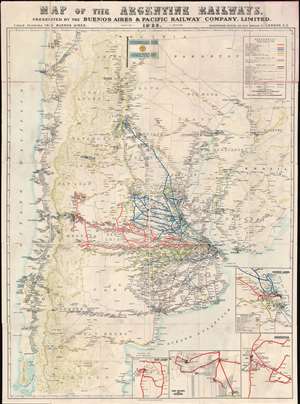
Map of the Argentine Railways. Presented by the Buenos Aires and Pacific Railway Company, Limited.
sold
- Digital Map Information
- Suitable for large format printing
- Full resolution TIFF file
- ICC color profile embedded
- Delivered instantly via download link
This is a striking 1925 chromolithograph railroad map of Argentina and Chile. The map covers from Atlantic to Pacific and from Tocopilla to Isla Chiloe and Rawson. Railroad lines are coded by color and design, with a focus, in red, on the routes operated by the Buenos Aires and Pacific Railway - who sponsored this map. This map was likely made to spur additional British investment in Argentine railroad infrastructure - much of which was already heavily leveraged to British consortiums. Insets in the lower right detail railroad connections in Buenos Aires, Mendoza, San Juan, and San Rafael. (more details)
Garbutt return's the Underground Map to Beck's Values.
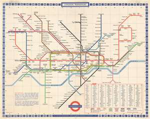
London Transport. Underground.
sold
- Digital Map Information
- Suitable for large format printing
- File Size: 82.02 MB
- File Type: ZIP / TIFF
- ICC color profile embedded
- Delivered instantly via download link
A c. 1972 large format map of the London Underground as drawn by Paul E. Garbutt made for in-station display. This map, or rather schematic transport diagram, is drawn on the c. 1930s Harry Beck model. In 1960, when the Victoria Line was introduced, the classic Beck map had to be redrawn. The job fell to publicity artist Harold Hutchison, who redesigned the Beck map, replacing Beck's curves with unpopular angles and square interchanges. The map was so unpopular, that in 1962 London Transit worker Paul E. Garbutt, again redesigned it, returning to the Beck style, but retaining some of Huchinson's ideas, including black rings for interchanges and lower-case text for non-interchange stations. Around this time Garbutt also introduced the distinctive bottle shape of the Circle Line which, years later, Absolute Vodka was able to leverage for some clever advertising. This version of the underground map was prepared in 1972 and includes plans to extend the Piccadilly Line to Hattan Cross and Heathrow Airport, a project that was not completed until 1977. (more details)