
Young, James H.

James Hamilton Young (December 18, 1792 - c. 1870) was a Scottish-American draughtsman, engraver, and cartographer active in Philadelphia during the first half of the 19th century. Young was born in Avondale, Lanark, Scotland and emigrated to the United States sometime before 1817. Young was a pioneer in American steel plate engraving, a process superior to copper plate engraving due to the increased durability of steel. His earliest known maps date to about 1817, when Young was 25. At the time he was partnered with William Kneass (1780 - 1840), as Kneass, Young and Company, an imprint that was active from 1817 to 1820. He then partnered with with George Delleker, publishing under the imprint of Young and Delleker, active from 1822 to 1823. Young engraved for numerous cartographic publishers in the Philadelphia area, including Anthony Finley, Charles Varle, and Samuel Augustus Mitchell, among others. His most significant work includes maps engraved for Anthony Finley and later Samuel Augustus Mitchell. Mitchell proved to be Young's most significant collaborator. The pair published numerous maps from about 1831 well into the 1860s. Young retired sometime in the mid to late 1860s. In 1840 he registered a patent for an improved system of setting up typography for printing. ˆˆ
First Edition of Early American Pocket Map.
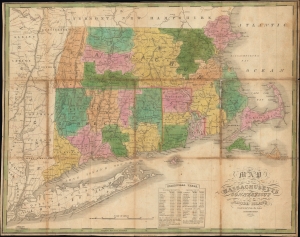
Map of Massachusetts, Connecticut, and Rhode Island constructed from the Latest Authorities.
$600.00
Acquire
- Digital Map Information
- Suitable for large format printing
- File Size: 21.64 MB
- File Type: ZIP / TIFF
- ICC color profile embedded
- Delivered instantly via download link
This is an attractive 1825 folding map of southern New England - Massachusetts, Connecticut, and Rhode Island - produced by Anthony Finley, James H. Young, and David H. Vance. (more details)
The Americas in the Wake of Independence.
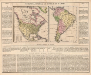
Geographical, Statistical, And Historical Map Of America.
$600.00
Acquire
- Digital Map Information
- Suitable for large format printing
- Full resolution TIFF file
- ICC color profile embedded
- Delivered instantly via download link
An informative c. 1827 map of the Americas that appeared in Matthew Carey and Isaac Lea's A Complete Historical, Chronological, And Geographical American Atlas. Among other features, it reflects territorial disputes that emerged in the wake of independence movements throughout the hemisphere. (more details)
Maine before the U.S.-Canadian border was settled.
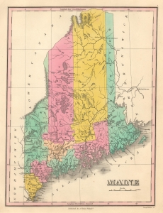
Maine.
$250.00
Acquire
- Digital Map Information
- Suitable for large format printing
- File Size: 4.6 MB
- File Type: ZIP / TIFF
- ICC color profile embedded
- Delivered instantly via download link
This is an 1827 Anthony Finley map of Maine. The map highlights Maine's early county configuration. Here, the state's northern border appears as it was before the Aroostook War (1838 - 1839) and the Webster-Ashburton Treaty (1842), which fixed the border between the United States and British Canada. (more details)
The last days of Mexican Texas.
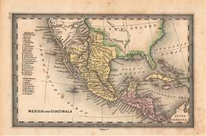
Mexico and Guatimala.
$200.00
Acquire
- Digital Map Information
- Suitable for large format printing
- DPI: 600
- File Size: 23.78 MB
- File Type: ZIP / TIFF
- ICC color profile embedded
- Delivered instantly via download link
A masterwork of small-scale engraving, this is J. H. Young's 1832 map of Mexico and Central America, which appeared in Henry Carey and Isaac Lea's Family Cabinet Atlas. It depicts the region in the wake of the collapse of Spain's American empire and on the eve of the westward expansion of the United States of America. (more details)
Early railroads of New England.
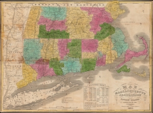
Map of Massachusetts Connecticut and Rhode Island constructed from the latest authorities.
$800.00
Acquire
- Digital Map Information
- Suitable for large format printing
- Full resolution TIFF file
- ICC color profile embedded
- Delivered instantly via download link
A hand-colored 1838 pocket map of Massachusetts, Connecticut, and Rhode Island, published by Flavius Brown and Edward Parsons. It captures the region in the early days of the railroad boom, when both canals and railroads were being proposed and built at a frenetic pace. (more details)
Only edition of Mitchell's Wall Map to include the Republic of Texas!
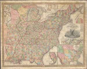
Mitchell's Reference and Distance Map of the United States.
$6,000.00
Acquire
- Digital Map Information
- Suitable for large format printing
- DPI: 600
- File Size: 308.25 MB
- File Type: ZIP / TIFF
- ICC color profile embedded
- Delivered instantly via download link
This is a rare 1844 edition of S. A. Mitchell and J. H. Young's important large-scale wall map of the United States and the only edition to include both the short-lived Republic of Texas and the even more ephemeral Florida Leigh Read County. (more details)
Texas on the eve of Statehood.
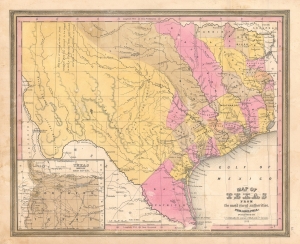
Map of Texas from the most recent authorities.
$950.00
Acquire
- Digital Map Information
- Suitable for large format printing
- DPI: 600
- File Size: 12.43 MB
- File Type: ZIP / TIFF
- ICC color profile embedded
- Delivered instantly via download link
A rare 1845 / 1846 example of the C. S. Williams / J. H. Young / S. A. Mitchell map of Texas, published in the final days of the Republic of Texas just as Texas was preparing to join the United States. Coverage includes Texas at its fullest extent, reaching from Santa Fe and the Rio Grande del Norte to the Sabin River and extending as far north as the Arkansas River (plus a stovepipe encompassing the Green Mountains not fully illustrated). Northwestern Texas is incorporated via an inset in the lower left. (more details)
Texas-New Mexico border conflict after the Mexican-American War.
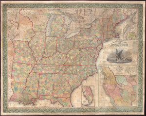
Mitchell's Reference and Distance Map of the United States.
$4,000.00
Acquire
- Digital Map Information
- Suitable for large format printing
- DPI: 600
- File Size: 259.78 MB
- File Type: ZIP / TIFF
- ICC color profile embedded
- Delivered instantly via download link
This is the only known example of the 1847 edition of S. A. Mitchell and J. H. Young's important large-scale wall map of the United States. Issued at the end of the Mexican-American War (1846 - 1847), the map reflects new territorial acquisitions from the Treaty of Guadeloupe-Hidalgo, including Texas, New Mexico, California, and what would become Utah, Nevada, and Arizona. Points of interest include ambiguity over the Texas-New Mexico border and the 54°40' dispute over U.S. claims in modern-day British Columbia. (more details)
Birth of Railroads in Northern New England.
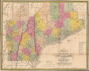
Map of Maine New Hampshire and Vermont compiled from the Latest Authorities. / Maine New Hampshire and Vermont.
$750.00
Acquire
- Digital Map Information
- Suitable for large format printing
- File Size: 23.18 MB
- File Type: ZIP / TIFF
- ICC color profile embedded
- Delivered instantly via download link
This is Samuel Augustus Mitchell's 1852 pocket map of Maine, New Hampshire, and Vermont, engraved by James Young. Among other features, it is especially important for illustrating the early development of railroad networks in these states. (more details)
Europe during the Crimean War.
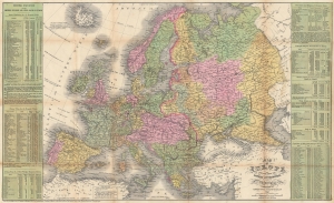
Map of Europe Compiled From the Latest Authorities.
$450.00
Acquire
- Digital Map Information
- Suitable for large format printing
- File Size: 34.39 MB
- File Type: ZIP / TIFF
- ICC color profile embedded
- Delivered instantly via download link
This is a separate issue 1854 Young and Cowperthwait map of Europe published during the Crimean War. Likely printed to capitalize on American interest in the war, Austrian gains in the Balkans in 'Servia' (Serbia) and Wallachia are outlined in red manuscript. (more details)