
Blaeu, Johannes
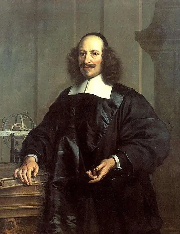
Joan (Johannes) Blaeu (September 23, 1596 - December 21, 1673) was a Dutch cartographer active in the 17th century. Joan was the son of Willem Janszoon Blaeu, founder of the Blaeu firm. Like his father Willem, Johannes was born in Alkmaar, North Holland. He studied Law, attaining a doctorate, before moving to Amsterdam to join the family mapmaking business. In 1633, Willem arranged for Johannes to take over Hessel Gerritsz's position as the official chartmaker of the Dutch East India Company, although little is known of his work for that organization, which was by contract and oath secretive. What is known is his work supplying the fabulously wealthy VOC with charts was exceedingly profitable. Where other cartographers often fell into financial ruin, the Blaeu firm thrived. It was most likely those profits that allowed the firm to publish the Theatrum Orbis Terrarum, sive, Atlas Novus, their most significant and best-known publication. When Willem Blaeu died in 1638, Johannes, along with his brother Cornelius Blaeu (1616 - 1648) took over the management of the Blaeu firm. In 1662, Joan and Cornelius produced a vastly expanded and updated work, the Atlas Maior, whose handful of editions ranged from 9 to an astonishing 12 volumes. Under the brothers' capable management, the firm continued to prosper until the 1672 Great Amsterdam Fire destroyed their offices and most of their printing plates. Johannes Blaeu, witnessing the destruction of his life's work, died in despondence the following year. He is buried in the Dutch Reformist cemetery of Westerkerk. Johannes Blaeu was survived by his son, also Johannes but commonly called Joan II, who inherited the family's VOC contract, for whom he compiled maps until 1712.
Classic Dutch Golden Age Map of America.
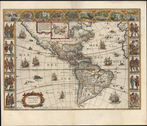
Americae Nova Tabula. Auct. Guilielmo Blaeuw.
$3,500.00
Acquire
- Digital Map Information
- Suitable for large format printing
- Full resolution TIFF file
- ICC color profile embedded
- Delivered instantly via download link
This is the essential Dutch map of America: Willem Janszoon Blaeu's 1635 carte-á-figures of the Western Hemisphere. It is among the most desirable printed maps, encapsulating in one piece the most sought-after aesthetic qualities of the Dutch Golden Age of Cartography. The present example dates to 1638, an early atlas edition. (more details)
The Mythical Kingdom of Prester John, in a Superb Example with a Bold Strike.
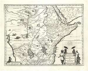
Aethiopia Superior vel Interior vulgo Abissinorum sive Presbiteri Joannis Imperium.
$950.00
Acquire
- Digital Map Information
- Suitable for large format printing
- DPI: 600
- File Size: 21.51 MB
- File Type: ZIP / TIFF
- ICC color profile embedded
- Delivered instantly via download link
This is the map of the mythical Kingdom of Prester John in eastern Africa, issued by Willem Blaeu in 1635, in a beautiful example. The map covers from the Bight of Benin to the Indian Ocean and from Arabia and the Red Sea to Mozambique. It includes two decorative cartouches, as well as stylized images of African fauna, including elephants, monkeys, and ostriches. While the African coast exhibits considerable advances over earlier maps of the region, the interior of Africa exhibits a cartography primarily based on the literature of antiquity and little changed from the days of Ptolemy, and its primary subject matter is that of legend. (more details)
Colonial rivalries in early America - fine original color.
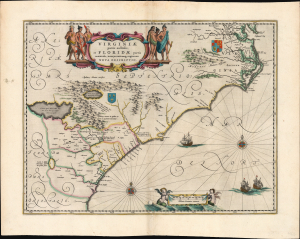
Virginiae Partis australis, et Floridae partis orientalis, interjacentiumqus regionum Nova Descriptio.
$2,250.00
Acquire
- Digital Map Information
- Suitable for large format printing
- Full resolution TIFF file
- ICC color profile embedded
- Delivered instantly via download link
This is Willem Blaeu's map of Virginia and Florida, engraved in 1638 and appearing here in an early, 1642 Appendix issue of the map in beautiful original color. This classic Dutch map, which encompassed the Carolinas and what would become Georgia and part of Florida, has been called 'the most correct map of this area yet to appear.' (Cumming) (more details)
Mantua, Patron of the Arts.
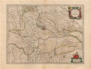
Ducato di Mantova.
$450.00
Acquire
- Digital Map Information
- Suitable for large format printing
- DPI: 600
- File Size: 49.64 MB
- File Type: ZIP / TIFF
- ICC color profile embedded
- Delivered instantly via download link
This is a beautiful, original color example of Joan Blaeu's map of the Duchy of Mantua, Lombardy, Italy. It is centered on the city of Mantua, set on its peninsula amidst the array of lakes created by the widening of the Mincio River. The region's network of rivers is evocatively presented. The Po dominates, roughly bisecting the map. Blaeu's work is a more skilled, artistic rendering of the Antonio Magini map of the same title. Magini's map was the first map of the duchy based on modern surveys, and at the time of this map's production remained the state-of-the-art. Its fortresses, towns, farms, and canals are faithfully presented - here, in the sharp, clear engraving that characterizes Blaeu. (more details)
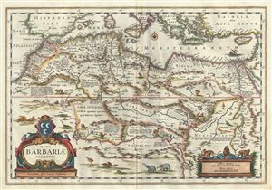
Nova Barbariae Descriptio.
$800.00
Acquire
- Digital Map Information
- Suitable for large format printing
- Full resolution TIFF file
- ICC color profile embedded
- Delivered instantly via download link
This is a fascinating example of Johannes Bleau's decorative c.1640 map of the Maghreb or Barbary Coast of northern Africa. It covers from the Morocco to the Nile Delta. The region consists of the modern day nations of Tunisia, Libya, Algeria, Egypt and Morocco. ... (more details)
A beautifully executed and detailed map of the Dutch trade routes into Russia.
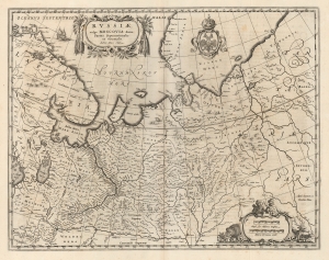
Russiae, vulgo Moscovia dictae, Partes Septentrionalis. Auctore Isaaco Massa.
$1,200.00
Acquire
- Digital Map Information
- Suitable for large format printing
- DPI: 600
- File Size: 51.6 MB
- File Type: ZIP / TIFF
- ICC color profile embedded
- Delivered instantly via download link
This is a superb example of Blaeu's 1640 map of Muscovy north of the Volga, and the northernmost parts of Russia. It represents the best Dutch knowledge of Russia in the first part of the 17th century. (more details)
Humorous yet puzzling cartouche.
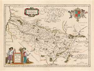
Picardia Regio Belgica, Auctore Ioanne Surhonio.
$300.00
Acquire
- Digital Map Information
- Suitable for large format printing
- DPI: 600
- File Size: 20.02 MB
- File Type: ZIP / TIFF
- ICC color profile embedded
- Delivered instantly via download link
This is Willem Blaeu's map of Picardy, easily the most entertaining map ever produced of this region of northern France. The map focuses on the Somme River valley. Amiens, St. Quentin, and La Fere are given particular emphasis. Putti bear a superb coat of arms with Fleurs-de-lis aloft in the upper right, and the scales are presented in a strapwork frame. (more details)
Masterwork of Dutch Engraving in Original Color Heightened with Gold.
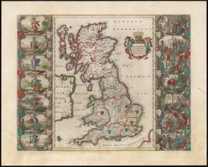
Britannia prout divisa fuit temporibus Anglo-Saxonum praestertim durante illorum Heptarchia.
$3,000.00
Acquire
- Digital Map Information
- Suitable for large format printing
- Full resolution TIFF file
- ICC color profile embedded
- Delivered instantly via download link
This is a beautiful original color example of Joan Blaeu's map of England in the early Middle Ages. It features masterfully engraved illustrations of early British kings. (more details)
Most beautiful 17th century map of the Channel Islands.
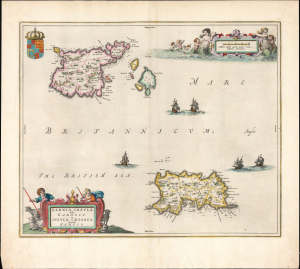
Sarnia insula, vulgo Garnsey et Insula Caesaraea, Vernacule Jarsey.
$1,200.00
Acquire
- Digital Map Information
- Suitable for large format printing
- Full resolution TIFF file
- ICC color profile embedded
- Delivered instantly via download link
This is a gorgeous, original-color example of Joan Blaeu's 1645 map of Guernsey and Jersey, the most beautiful map of the primary Channel Islands to be produced in the 17th century. (more details)
Stonehenge and the English Civil War.
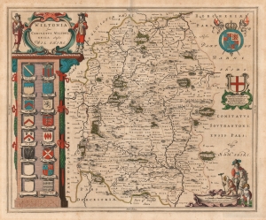
Wiltonia sive Comitatus Wiltoniensis; Anglis Wilshire.
$500.00
Acquire
- Digital Map Information
- Suitable for large format printing
- DPI: 600
- File Size: 53.46 MB
- File Type: ZIP / TIFF
- ICC color profile embedded
- Delivered instantly via download link
This is Joan Blaeu's 1645 map of the county of Wiltshire in southwestern England. While not the first atlas map to detail the county (this honor goes to Speed's map, from which Blaeu's is derived), it is among the most beautifully engraved and colored. (more details)
Establishing Dutch Territorial Claims in Brazil.
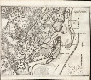
Mauritiopolis, Reciffa et circumjacentia castra.
$800.00
Acquire
- Digital Map Information
- Suitable for large format printing
- Full resolution TIFF file
- ICC color profile embedded
- Delivered instantly via download link
This is Joan Blaeu and Georg Marcgrave's 1647 map of the environs of Mauritiopolis and Recife, the main Dutch colonial foothold in Brazil during the impactful tenure of Dutch Governor Johan Maurits van Nassau-Siegen (1604 - 1679). The map was issued to promote Maurits' leadership and incontrovertible Dutch claims in the region. (more details)
Leige as a Renaissance Cathedral Town.
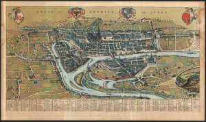
Legia, Sive Leodium; vulgo, Liege.
$2,000.00
Acquire
- Digital Map Information
- Suitable for large format printing
- File Size: 52.24 MB
- File Type: ZIP / TIFF
- ICC color profile embedded
- Delivered instantly via download link
This large, detailed, and ornate bird's-eye view style map of Liege, Belgium, was produced by Joan Blaeu in 1649 for inclusion in his city atlas of the Netherlands. (more details)
Sumptuously Engraved Map of the Home Port and its Surrounds
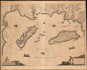
Insulae Divi Martini et Uliarus, Vulgo l’Isle de Re et Oleron.
$600.00
Acquire
- Digital Map Information
- Suitable for large format printing
- Full resolution TIFF file
- ICC color profile embedded
- Delivered instantly via download link
An exquisite 1649 Blaeu map of the La Rochelle region of western coastal France, including the Isle de Re and the Isle de Oleron. The centrally depicted, largely Protestant city of La Rochelle was a port of prime importance for Atlantic exploration and trade until the religious wars of the 17th century. The east-oriented map shows coastal forts, roads, wetlands and salt plains. In many respects it also resembles a chart, with rhumb lines, three fine compass roses, and navigational hazards such as shallows marked. The map's rich decoration alludes to the region's maritime importance, with nineteen ships, a sea monster, and a beautiful cartouche portraying a mermaid nursing a mer-infant. The quality of the engraving is typical of the superb standard set by the younger Blaeu, this example being embellished with delicate contemporary color. (more details)
Beautiful City of French Flanders.
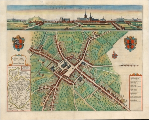
Balliolum vulgo Belle.
$350.00
Acquire
- Digital Map Information
- Suitable for large format printing
- File Size: 23.06 MB
- File Type: ZIP / TIFF
- ICC color profile embedded
- Delivered instantly via download link
This is Joan Blaeu's 1649 bird's-eye plan and panorama, of Bailleul, France. This city, now in the Département Nord, was then part of the Netherlands; consequently, it was one of the cities featured in Blaeu's rare atlas of the cities of the Netherlands. (more details)
From the final, Spanish edition of the Atlas Maior.
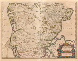
Pars Australior Iutiae Septentrionalis, in qua Dioeceses Ripensis et Arhusiensis.
$650.00
Acquire
- Digital Map Information
- Suitable for large format printing
- DPI: 600
- File Size: 48.15 MB
- File Type: ZIP / TIFF
- ICC color profile embedded
- Delivered instantly via download link
This is Joan Blaeu's 1659 map of southern-central Denmark, or the southern part of Jutland. It is among the scarcest of Blaeu's maps, appearing in a sole edition of the Novuus Atlas and subsequently in the Atlas Maior. It shows the Dioceses of Ribe and Aarhus, the Protestant sees administering the southern Jutland Peninsula from as far south as Haderslev and the island of Fionia, as far north as Onsild in the east and Lemvig in the west. The map is superbly detailed and engraved, typical of the younger Blaeu's work at its creative peak. There is a superb cartouche, behind which three cowherds and their bovine charges are trying unsuccessfully to hide. (more details)
From the final, Spanish edition of the 'Atlas Maior'.
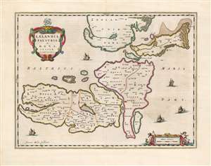
Lalandia, Falstria et Mona Insulae in Mari Balthico.
$450.00
Acquire
- Digital Map Information
- Suitable for large format printing
- DPI: 600
- File Size: 45.31 MB
- File Type: ZIP / TIFF
- ICC color profile embedded
- Delivered instantly via download link
This is Joan Blaeu's 1659 map of the islands of Laaland, Falster, and Møn, the southeastern part of Denmark. It is among the scarcest of Blaeu's maps, appearing in a sole edition of the Novuus Atlas and subsequently only in the Atlas Maior. The map is superbly engraved and colored, with a lovely cartouche and sailing ships: typical of the younger Blaeu's work at its creative peak. (more details)
Trace the course of the longest European river from Wesloma to the Caspian Sea.
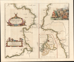
Nova and Accurata Wolgae Fluminis, olim Rha dicti, Delineatio.
$850.00
Acquire
- Digital Map Information
- Suitable for large format printing
- Full resolution TIFF file
- ICC color profile embedded
- Delivered instantly via download link
This is an impressive 1659 map by Blaeu of the Volga River, Russia, based on the travels of the German diplomat Adam Olearius. The map reveals the Volga in the wake of the Russo-Persian War (1651 - 1653), when it served as an artery of conquest, diplomacy, and trade with Safavid Persia. (more details)
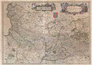
Nova Picardiae Tabula.
$250.00
Acquire
- Digital Map Information
- Suitable for large format printing
- Full resolution TIFF file
- ICC color profile embedded
- Delivered instantly via download link
An attractive c. 1660 map of Picardy, France, by Johannes Blaeu. The map covers the French region of Picardy region, from Calais to Luxembourg and the Ardennes, and south as far as Valois. This map was most likely issued by Johanner Blaeu c. 1660. Includes the ... (more details)
Beautifully executed map of the Russian Frontier with Sweden.
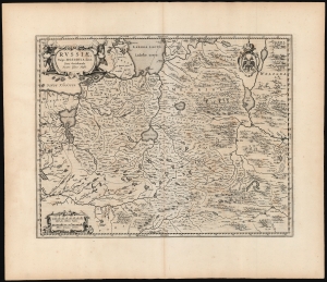
Russiae, vulgo Moscovia dictae, Para Occidentalis. Auctore Isaaco Massa.
$1,500.00
Acquire
- Digital Map Information
- Suitable for large format printing
- DPI: 600
- File Size: 56.46 MB
- File Type: ZIP / TIFF
- ICC color profile embedded
- Delivered instantly via download link
This is a handsome, first edition example of Blaeu's 1662 map covering from Moscow to Estonia, and part of Lithuania, including the frontier with the Swedish Empire. This is among the rarest Blaeu atlas maps of Russia, being one of those first appearing in Joan Blaeu's 1662 Atlas Maior. The map would only appear in the five editions of that atlas before the Blaeu warehouse burned in 1672. (more details)
Prime artery of Russian trade through the 19th century.
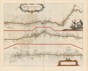
Dwina Fluvius.
$850.00
Acquire
- Digital Map Information
- Suitable for large format printing
- DPI: 600
- File Size: 38.14 MB
- File Type: ZIP / TIFF
- ICC color profile embedded
- Delivered instantly via download link
This is a beautiful, original color example of Joan Blaeu's 1662 map of the Northern Dvina River in Russia: the conduit connecting Muscovy with global markets, via the port of Archangel. (more details)
17th Century Map of the Emilia-Romagna region.
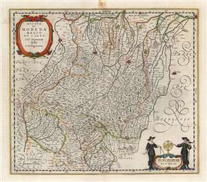
Ducato di Modena Regio et Carpi Col Dominio della Carfagnana.
$750.00
Acquire
- Digital Map Information
- Suitable for large format printing
- Full resolution TIFF file
- ICC color profile embedded
- Delivered instantly via download link
A beautiful, original color example of Willem and Joan Blaeu's map of the Emilia-Romagna region, focusing on the cities of Parma, Regio, and Modena. At the north and east extremes of the map, the cities of Mirandola, Ferrara, and Bologna are pictured as well. The superb copperplate is the product of the house of Blaeu at their height, with its delicately engraved cities, pictorially represented mountains and forests, and meticulously detailed cities, towns, and villages. Among its details is a road, connecting Parma, Regio, and Moden. The other regional maps would continue this road to Piacenza and Bologna, and beyond. Though not named, the course of the road corresponds to the Roman road known as the Via Aemilia. (more details)
Landmark of Cyrillic calligraphic printing.
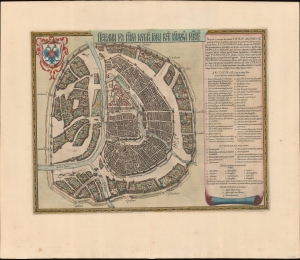
Царствающои град Москва началнои город всех московских государствах. / Carstvajuščoi grad Moskva načalo I gorod všeh Moskovech I carstvach. Urbis Moskvae.
$4,400.00
Acquire
- Digital Map Information
- Suitable for large format printing
- Full resolution TIFF file
- ICC color profile embedded
- Delivered instantly via download link
This is the 1662 Hessel Gerritsz and Willem Janszoon Blaeu city map or plan of Moscow, Russia. The map is significant as the dominant plan of Moscow in the 17th century. It is also significant for its innovative use of Cyrillic calligraphy to name both the city gates and in the map's titling - a first for non-Russian publishers. The Cyrillic calligraphy of the title is especially innovative, revealing the designer as a master of the style. (more details)
Tracking English and French efforts to establish a Caribbean Foothold.
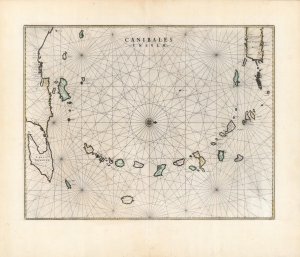
Canibales Insulae.
$1,500.00
Acquire
- Digital Map Information
- Suitable for large format printing
- DPI: 600
- File Size: 54.87 MB
- File Type: ZIP / TIFF
- ICC color profile embedded
- Delivered instantly via download link
This is a handsome, first edition example of Blaeu's 1662 map of the Lesser Antilles, in an attractive original color example in superb condition. It appeared only in the four final editions of Joan Blaeu's Atlas Maior; consequently, it is among the scarcest of the Blaeu Atlas maps. (more details)
'Most Attractive of its Time' -Shirley
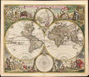
Nova Orbis Tabula In Lucem Edita, A. F. de Wit.
$6,000.00
Acquire
- Digital Map Information
- Suitable for large format printing
- Full resolution TIFF file
- ICC color profile embedded
- Delivered instantly via download link
This is a striking c. 1689 example, in original color, of Frederick De Wit's classic double hemisphere map of the world. Shirley praised it as 'one of the most attractive of its time'. It features many of the tropes of 17th-century Dutch mapmaking: Insular California, imaginary islands, etc., as well as new discoveries, such as Western Australia, and cartographic reconsiderations, among them the removal of the imaginary Terra Australis. (more details)
'Most Attractive of its Time' -Shirley
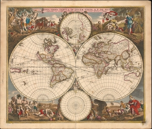
Nova Orbis Tabula In Lucem Edita, A. F. de Wit.
$5,500.00
Acquire
- Digital Map Information
- Suitable for large format printing
- File Size: 31.77 MB
- File Type: ZIP / TIFF
- ICC color profile embedded
- Delivered instantly via download link
This is a striking c. 1689 example, in original color, of Frederick De Wit's classic double hemisphere map of the world. Shirley praised it as 'one of the most attractive of its time'. It features many of the tropes of 17th-century Dutch mapmaking: Isular California, imaginary islands, etc., as well as new discoveries, such as Western Australia, and cartographic reconsiderations, among them the removal of the imaginaryTerra Australis. (more details)
Key Fort in Dutch Brazil.
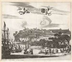
Castrum Mauritij ad Ripam Fluminis S. Francisci.
$475.00
Acquire
- Digital Map Information
- Suitable for large format printing
- DPI: 600
- File Size: 26.03 MB
- File Type: ZIP / TIFF
- ICC color profile embedded
- Delivered instantly via download link
This is a 1673 Arnold Montanus view of the Dutch defenses at Fort Maurits, controlling access to Brazil's Rio São Francisco. It shows the fort atop the bluffs overlooking the São Francisco. On the shore, traders from sailing ships and river sloops meet sugar plantationers and their slaves hauling barrels of sugar or molasses. (more details)
Coronelli's most focused map of the Hong Kong / Macao - Fujian - Manila circuit.
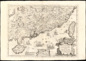
Quantung, e Fokien, Provincie della China, Dedicate Al Motlo Reverendo Padre Carlo Trigona, dell Compagnia di Gesu, Teologo diu Monsignor Illustriss. Arciuescovo di Palermo, etc.
$3,000.00
Acquire
- Digital Map Information
- Suitable for large format printing
- DPI: 600
- File Size: 73.55 MB
- File Type: ZIP / TIFF
- ICC color profile embedded
- Delivered instantly via download link
This is Vincenzo Coronelli's 1696 map of Guangdong and Fujian, China, including the islands of Hainan and Taiwan, the South China Sea, and part of Luzon in the Philippines. Of Coronelli's maps, it is the most focused on Hong Kong, the Pearl River Delta, and Macau, and is among the most detailed depictions of Taiwan of the 17th century. (more details)
Seaside Resort and Final Resting Place of Roman Elites.
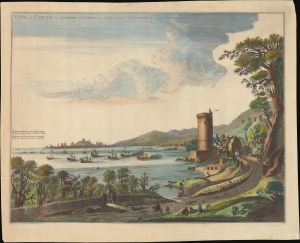
Veue de Caiete du Royaume de Naples. vers le Golfe de Venise.
$500.00
Acquire
- Digital Map Information
- Suitable for large format printing
- File Size: 21.94 MB
- File Type: ZIP / TIFF
- ICC color profile embedded
- Delivered instantly via download link
A lovely c. 1704 view of Gaeta, Italy, originally prepared by Johannes Blaeu in 1663 for the Theatrum Civitatum et Admirandorum Italiæ and reissued with minor changes by Pierre Mortier for his Nouveau Theatre d'Italie. (more details)