
Blaeu, Johannes (sold)
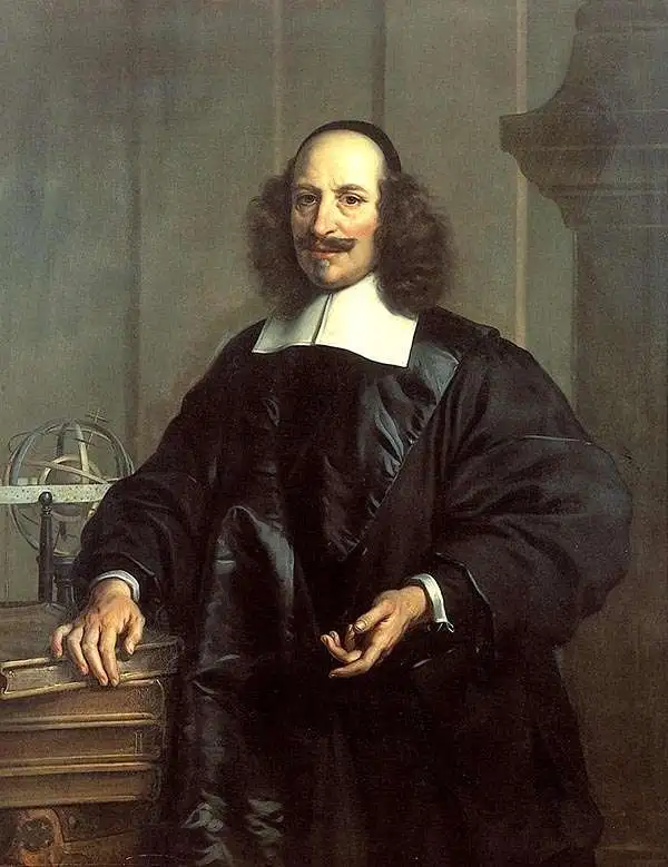
Joan (Johannes) Blaeu (September 23, 1596 - December 21, 1673) was a Dutch cartographer active in the 17th century. Joan was the son of Willem Janszoon Blaeu, founder of the Blaeu firm. Like his father Willem, Johannes was born in Alkmaar, North Holland. He studied Law, attaining a doctorate, before moving to Amsterdam to join the family mapmaking business. In 1633, Willem arranged for Johannes to take over Hessel Gerritsz's position as the official chartmaker of the Dutch East India Company, although little is known of his work for that organization, which was by contract and oath secretive. What is known is his work supplying the fabulously wealthy VOC with charts was exceedingly profitable. Where other cartographers often fell into financial ruin, the Blaeu firm thrived. It was most likely those profits that allowed the firm to publish the Theatrum Orbis Terrarum, sive, Atlas Novus, their most significant and best-known publication. When Willem Blaeu died in 1638, Johannes, along with his brother Cornelius Blaeu (1616 - 1648) took over the management of the Blaeu firm. In 1662, Joan and Cornelius produced a vastly expanded and updated work, the Atlas Maior, whose handful of editions ranged from 9 to an astonishing 12 volumes. Under the brothers' capable management, the firm continued to prosper until the 1672 Great Amsterdam Fire destroyed their offices and most of their printing plates. Johannes Blaeu, witnessing the destruction of his life's work, died in despondence the following year. He is buried in the Dutch Reformist cemetery of Westerkerk. Johannes Blaeu was survived by his son, also Johannes but commonly called Joan II, who inherited the family's VOC contract, for whom he compiled maps until 1712.
Unique and visually engaging early map of the American Northeast.
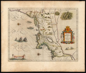
Nova Belgica Et Anglia Nova.
sold
- Digital Map Information
- Suitable for large format printing
- Full resolution TIFF file
- ICC color profile embedded
- Delivered instantly via download link
This is a beautiful example of Willem Blaeu's 1634 map of the American Northeast, the regions settled by the Dutch (New Netherlands) and the English (New England). Oriented to the west, Blaeu's map covers the American coast from Virginia, past New York and Long Island to Cape Cod, New England, and Quebec. The map is the first of the region to accurately depict the fur-bearing and food animals of the region, and it does so in profusion. Between this imagery, and the fleet of trade ships heading towards the coast, the decorative elements vividly emphasize the potential for wealth offered by this region. (more details)
The Classic Map of America of the Dutch Golden Age of Cartography.
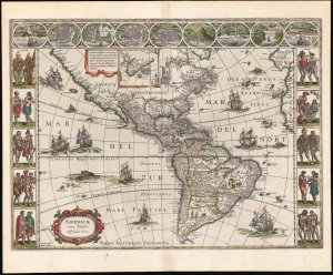
Americae Nova Tabula. Auct. Guilielmo Blaeuw.
sold
- Digital Map Information
- Suitable for large format printing
- Full resolution TIFF file
- ICC color profile embedded
- Delivered instantly via download link
The essential Dutch map of America: Willem Janszoon Blaeu's 1635 carte-á-figures of the Western Hemisphere. This is among the most desirable printed maps, encapsulating in one piece the most sought-after aesthetic qualities of the Dutch Golden Age of Cartography. (more details)
Iconic Map of America of the Dutch Golden Age of Cartography.
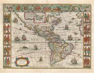
Americae Nova Tabula. Auct. Guilielmo Blaeuw.
sold
- Digital Map Information
- Suitable for large format printing
- Full resolution TIFF file
- ICC color profile embedded
- Delivered instantly via download link
The essential Dutch map of America: Willem Janszoon Blaeu's 1635 carte-á-figures map of the Western Hemisphere. This is among the most desirable printed maps, encapsulating in one piece the most sought-after aesthetic qualities of the Dutch Golden Age of Cartography. In particular, it is the prime example of the carte-á-figures, or 'figured map,' displaying in its upper border the most important cities in the mapped region, and in its left and right borders finely-engraved depictions of the peoples native to it. The cities thus depicted are (from left) Havana, Santo Domingo, Cartagena, Mexico, Cusco, Potosi, La Mocha, Rio de Janeiro, and Olinda. The denizens of the Americas here depicted include Greenlanders, Virginians, Floridians, Californians (specifically, the King and Queen of Nova Albion) Mexicans, Peruvians, Brazilians, Chileans, and the natives of Magellanica (these last, possibly intended to be the giants reported by the survivors of Magellan's voyage). The decorative elements of the map are not limited to the borders: the seas are sailed by no fewer than eight ships. (more details)
Previously suppressed new cartography for Australia and the Philippines.
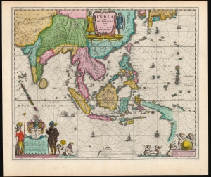
India quae Orientalis dicitur, et Insulae Adiacentes.
sold
- Digital Map Information
- Suitable for large format printing
- Full resolution TIFF file
- ICC color profile embedded
- Delivered instantly via download link
This is a sumptuous example of Willem Blaeu's 1635/1642 map of India, Southeast Asia, China, the Philippines, and Japan - including new information on the Philippines and Austraila. It is also among the earliest maps to depict the Philippine archipelago with any degree of precision. The map's cartographic content was engraved (probably in 1630 but as late as 1632) by Hessel Gerritsz, Blaeu's predecessor as official chartmaker for the Dutch East India Company, thus many of its features were previously suppressed, seeing public print first in this Blaeu edition. (more details)
The Mythical Kingdom of Prester John, in a Superb Example.
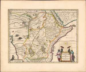
Aethiopia Superior vel Interior vulgo Abissinorum sive Presbiteri Joannis Imperium.
sold
- Digital Map Information
- Suitable for large format printing
- DPI: 600
- File Size: 21.56 MB
- File Type: ZIP / TIFF
- ICC color profile embedded
- Delivered instantly via download link
This is the map of the mythical Kingdom of Prester John in eastern Africa, issued by Willem Blaeu in 1635, in a beautiful original color example. The map covers from the Bight of Benin to the Indian Ocean and from Arabia and the Red Sea to Mozambique. It includes two decorative cartouches as well as stylized images of African fauna, including elephants, monkeys, and ostriches. While the African coast exhibits considerable advances over earlier maps of the region, the interior of Africa exhibits a cartography primarily based on the literature of antiquity and little changed from the days of Ptolemy, and its primary subject matter is that of legend. (more details)
Insular Korea.
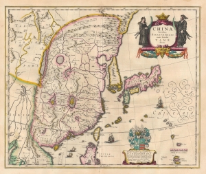
China Veteribus Sinarum Regio nunc Incolis Tame dict.
sold
- Digital Map Information
- Suitable for large format printing
- Full resolution TIFF file
- ICC color profile embedded
- Delivered instantly via download link
This is an example of Willem Blaeu's 1634 map of China, Korea, and Japan in its first 1635 French edition. It constitutes the best European knowledge of East Asia before the reports of Martino Martini, which in the 1650s caused a complete revision of Blaeu's maps. Major advancements include the mapping of Korea, novel detail in Taiwan/Formosa, and a reconsideration of the authoritative Ortelius/Barbuda map. (more details)
Map showing Korea as an Island!
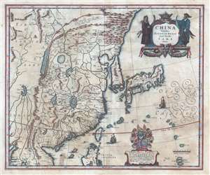
China Veteribus Sinarum Regio nunc Incolis Tame dict.
sold
- Digital Map Information
- Suitable for large format printing
- Full resolution TIFF file
- ICC color profile embedded
- Delivered instantly via download link
An important c. 1636 map of China, Korea, and Japan by Willem and Johannes Blaeu. The map covers East Asia from Lake Chiamay (apocryphal) to Japan and from Mongolia to the Philippines. Blaeu’s map represents the most complete illustration of China and East Asia in general available at the time. (more details)
Insular Korea.
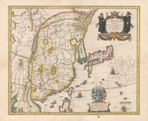
China Veteribus Sinarum Regio nunc Incolis Tame dict.
sold
- Digital Map Information
- Suitable for large format printing
- DPI: 600
- File Size: 50.83 MB
- File Type: ZIP / TIFF
- ICC color profile embedded
- Delivered instantly via download link
This is a beautiful example of Willem Blaeu's 1634 map of China, Korea, and Japan. It constitutes the best European knowledge of East Asia prior to the reports of Martino Martini, which in the 1650s caused the complete revision of Blaeu's maps. Major advancements include the mapping of Korea, novel detail in Taiwan / Formosa, and a reconsideration of the authoritative Ortelius/Barbuda map. (more details)
Colonial rivalries in early America - fine original color.
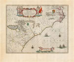
Virginiae Partis australis, et Floridae partis orientalis, interjacentiumque regionum Nova Descriptio.
sold
- Digital Map Information
- Suitable for large format printing
- Full resolution TIFF file
- ICC color profile embedded
- Delivered instantly via download link
This is Willem Blaeu's beautiful map of Virginia and Florida, engraved in 1638 and appearing here in a superb example of the 1662 Atlas Maior edition, printed for Joan Blaeu's mammoth masterpiece atlas. This classic Dutch map, which encompassed the Carolinas and what would become Georgia and part of Florida, has been called 'the most correct map of this area yet to appear.' (Cumming) (more details)
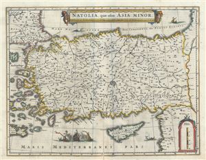
Natolia, quae olim Asia Minor.
sold
- Digital Map Information
- Suitable for large format printing
- Full resolution TIFF file
- ICC color profile embedded
- Delivered instantly via download link
This is an attractive c. 1640 map of Turkey or Asia Minor by Johannes Blaeu. It covers Turkey from the Aegean Sea east as far as the Euphrates River. Cyprus and some of the Aegean Islands are also included. The map is beautifully detailed, noting several ... (more details)
A Classic Dutch Map of Crete.
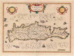
Candia olim Creta.
sold
- Digital Map Information
- Suitable for large format printing
- Full resolution TIFF file
- ICC color profile embedded
- Delivered instantly via download link
This is Joan Blaeu's map of the island of Crete, in its first edition. It was prepared for the 1640 Latin edition of the Blaeu Atlas Novus. Blaeu's map follows the work of Georgio Sideri Calapoda (fl. c. 1537 - 1565), also used by Ortelius, Mercator, and Hondius. The primacy of Calapoda's manuscripts was not misplaced: as a denizen of Crete, he knew the island and its history well. His model for the mapping of the island superseded the 1513 Waldseemüller model. The place names here reproduce those as they appeared in Jodocus Hondius' Candia cum Insulis Aliquot Graeciam, but Blaeu's fine engraving improves greatly in terms of legibility and brightness. (So far improved was Blaeu's version that Jan Jansson would copy it faithfully for his 1644 Candia olim Creta. (more details)
The most unique and visually engaging early map of the American Northeast
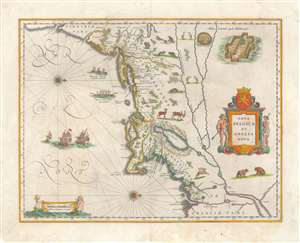
Nova Belgica Et Anglia Nova.
sold
- Digital Map Information
- Suitable for large format printing
- Full resolution TIFF file
- ICC color profile embedded
- Delivered instantly via download link
This is an attractive example of Willem Blaeu’s 1635 map of the American Northeast, the regions settled by the Dutch (New Netherlands) and the English (New England). Oriented to the west, Blaeu's map covers the American coast from Virginia, past New York and Long Island to Cape Code, New England, and Quebec. Fur-bearing animals frolic inland while a caravan of trade ships heads towards the coast - underscoring the potential and wealth of this region. (more details)
The most unique and visually engaging early map of the American Northeast.
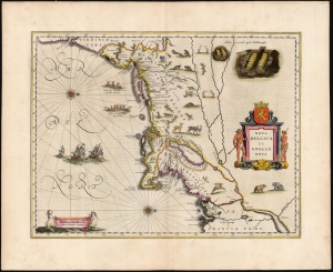
Nova Belgica Et Anglia Nova.
sold
- Digital Map Information
- Suitable for large format printing
- Full resolution TIFF file
- ICC color profile embedded
- Delivered instantly via download link
This is a beautiful c. 1640 example of Willem Blaeu's 1634 map of the American Northeast, the region settled by the Dutch (New Netherlands) and the English (New England). Oriented to the west, Blaeu's map covers the American coast from Virginia, past New York and Long Island to Cape Cod, New England, and Quebec. The map is the first of the region to accurately depict the fur-bearing and food animals of the region, and it does so in profusion. Between this imagery, and the fleet of trade ships heading towards the coast, the decorative elements vividly emphasize the potential for wealth offered by this region. (more details)
Wonderful map of northern India intended to illustrate the trade potential of the region.
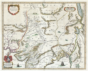
Magni Mogolis Imperium.
sold
- Digital Map Information
- Suitable for large format printing
- DPI: 300
- File Size: 13.18 MB
- File Type: ZIP / TIFF
- ICC color profile embedded
- Delivered instantly via download link
A marvelous 1640 map by Joan and Cornelius Blaeu representing the kingdom of the Great Mogul in northern India. Extending from the Indus River Valley to the Irrawaddy River Valley and from Tibet to Bombay, this map covers much of modern day India as well ... (more details)
First accurate mapping of the Indus River and western and central India.
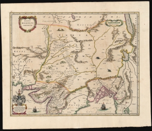
Magni Mogolis Imperium.
sold
- Digital Map Information
- Suitable for large format printing
- Full resolution TIFF file
- ICC color profile embedded
- Delivered instantly via download link
This is an attractive, original color example of Joan and Cornelis Blaeu's 1640 map of the Mughal Empire of Northern India. It is among the most attractively engraved of the 17th-century maps derived from the unacquirable Baffin/Roe map. The map features the first accurate mapping of the Indus River and western and central India. At its heart, the map reveals the vital trade routes between the chief cities of Gujarat, Agra, and Jaisalmer and their linkage to the Silk Road center of Kabul. (more details)
The First Specific Norway Map in a Blaeu Atlas.
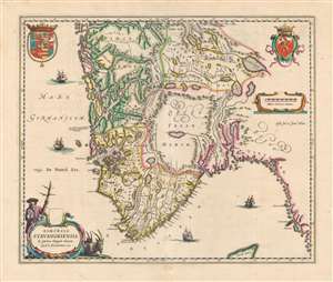
Dioecesis Stavangriensis et partes aliquot vicinae, operâ L. Scavenii, S.S..
sold
- Digital Map Information
- Suitable for large format printing
- DPI: 600
- File Size: 50.94 MB
- File Type: ZIP / TIFF
- ICC color profile embedded
- Delivered instantly via download link
This is a beautiful, original color example of Joan and Cornelis Blaeu's 1640 map of the Diocese of Stavanger, Norway - the first of the Blaeu maps to relate to Norway specifically. The map is a lovely example of the Blaeus' work: its geographical delineations clear, its lettering attractive and uniformly legible, and with an array of decorative elements. The waters of the North Sea are sailed by four ships; the coat of arms of Norway is displayed to the upper right while the arms of the kingdom of Denmark appears to the upper left (both countries were at the time ruled by King Christian IV of Denmark). In the lower left, a beautifully engraved title cartouche is flanked by two Norwegian goats, and a woodsman - an allusion to the region's role as exporter of lumber to Europe in general, and the Netherlands specifically. (more details)
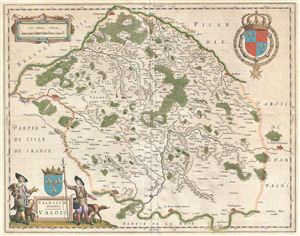
Valesium Ducatus. Valois.
sold
- Digital Map Information
- Suitable for large format printing
- DPI: 300
- File Size: 13.69 MB
- File Type: ZIP / TIFF
- ICC color profile embedded
- Delivered instantly via download link
A beautiful c. 1641 Johannes Blaeu map of Valois, France. This region, an ancient French Duchy, is located slightly northeast of Paris and includes the cities of Senlis, Compiegne, Crepy, Soissons, and Meaux. The region is today included in the modern ... (more details)
The most unique and visually engaging early map of the American Northeast.
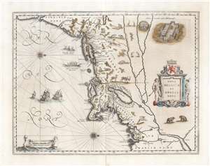
Nova Belgica Et Anglia Nova.
sold
- Digital Map Information
- Suitable for large format printing
- Full resolution TIFF file
- ICC color profile embedded
- Delivered instantly via download link
This is an attractive example of Willem Blaeu’s 1634 map of the American Northeast, the regions settled by the Dutch (New Netherlands) and the English (New England). Oriented to the west, Blaeu's map covers the American coast from Virginia, past New York and Long Island to Cape Cod, New England, and Quebec. The map is the first of the region to accurately depict the fur-bearing and food animals of the region, and it does so in profusion. Between this imagery, and the fleet of trade ships heading towards the coast, the decorative elements of the map vividly emphasize the potential for wealth offered by this region. (more details)
A beautifully excecuted and detailed map of the Dutch trade routes into Russia.
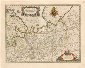
Russiae, vulgo Moscovia dictae, Partes Septentrionalis et Orientalis.
sold
- Digital Map Information
- Suitable for large format printing
- DPI: 600
- File Size: 23.05 MB
- File Type: ZIP / TIFF
- ICC color profile embedded
- Delivered instantly via download link
This is a beautiful example of Blaeu's 1640 map of Muscovy north of the Volga, and the Northernmost parts of Russia. It was derived primarily from the geographical information of the Dutch trader and diplomat Isaac Massa, whose experience in Russia during the Time of Troubles remained the best firsthand source on Russian society and Geography well into the 17th century. The granular detail for the trade route from Archangel on the White Sea to Yaroslavl testifies to Massa's years in the region, working to secure trade for textiles and grain both for the Netherlands and for Sweden. The whole of this route, following the Dvina to the Sukhona Rivers and on to the portage between Vologda and Yaroslavl on the Volga shows more than a hundred towns which would have been familiar way stations on the long river journey. (more details)
The most beautiful example of Blaeu's city map of Moscow.
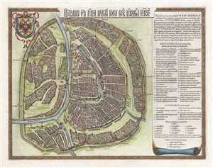
Царствающои град Москва началнои город всех московских государствах. / Carstvajuščoi grad Moskva načalo I gorod všeh Moskovech I carstvach. Urbis Moskvae.
sold
- Digital Map Information
- Suitable for large format printing
- DPI: 300
- File Size: 10.89 MB
- File Type: ZIP / TIFF
- ICC color profile embedded
- Delivered instantly via download link
This is a 1642 Hessel Gerritsz city map or plan of Moscow, Russia. With the Kremlin at its center, the map depicts the city from the city from the Moscow River to Zemlyanoy Gorod, which is surrounded by ramparts and a moat. This historical district in ... (more details)
A beautiful example of a plan of Moscow's 'fortress'.
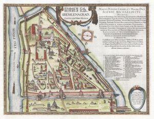
КРЕМЛЁН ГРАД. / Kremlenagrad, Castellum Urbis Moskvæ.
sold
- Digital Map Information
- Suitable for large format printing
- DPI: 300
- File Size: 11.39 MB
- File Type: ZIP / TIFF
- ICC color profile embedded
- Delivered instantly via download link
This is a 1642 Hessel Gerritsz map of the Kremlin, Moscow, Russia. (more details)
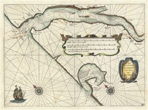
Caarte van de Rivier van Bourdeaux en de haven van Arcachon.
sold
- Digital Map Information
- Suitable for large format printing
- DPI: 300
- File Size: 5.56 MB
- File Type: ZIP / TIFF
- ICC color profile embedded
- Delivered instantly via download link
This is a beautiful c.1643 Johannes Blaeu map or nautical chart of the Bordeaux River in France. This maritime map covers part of the coastal department of Gironde from the Port of Arcachon to Royan (Roian) and the city of Bordeaux. It offers ... (more details)
A beautifully engraved map of England and Wales.
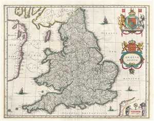
Anglia Regnum.
sold
- Digital Map Information
- Suitable for large format printing
- DPI: 300
- File Size: 10.98 MB
- File Type: ZIP / TIFF
- ICC color profile embedded
- Delivered instantly via download link
This is a c. 1645 Blaeu map of England and Wales. The map depicts the region from Ireland to the North Sea and from Scotland to the English Channel and Calais. Highly detailed, innumerable cities, towns, and villages are labeled throughout ... (more details)
Speculative early map of Siberia based upon the journals of Marco Polo.
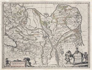
Tartaria sive Magni Chami Imperium.
sold
- Digital Map Information
- Suitable for large format printing
- DPI: 300
- File Size: 13 MB
- File Type: ZIP / TIFF
- ICC color profile embedded
- Delivered instantly via download link
A fine c. 1645 map of northeast Asia (Siberia or Tartary) by J. Blaeu. The map covers from the Caspian Sea and the Volga River east as far as the China Sea and the city of Xanadu. It extends north to Nova Zembla and south to the Upper ... (more details)
Incredible old color 17th century map of Genoa and Liguria showing nearby Cinque Terre
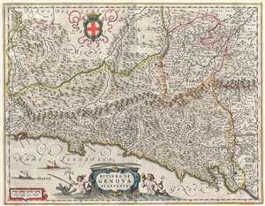
Riviera di Genova di Levante
sold
- Digital Map Information
- Suitable for large format printing
- DPI: 300
- File Size: 9.55 MB
- File Type: ZIP / TIFF
- ICC color profile embedded
- Delivered instantly via download link
This incredible 1646 Johannes Blaeu map of the Bay of Genoa depicts the Ligurian coast from Genoa (Genoua) to the Cinque Terre. There is a large, allegorical decorative cartouche for the title of the map. A few sailing ships are present ... (more details)
Spectacular highly decorative old color 17th century map of Tuscany.

Dominio Fiorentino
sold
- Digital Map Information
- Suitable for large format printing
- DPI: 300
- File Size: 9.26 MB
- File Type: ZIP / TIFF
- ICC color profile embedded
- Delivered instantly via download link
This is a spectacular 1646 old color map of Tuscany, or the Florentine Territory (Fiorentino) by Johannes Blaeu. The map covers the entire region of Tuscany with the cities of Perugia, Siena, Florence (Firenze), Lucca, and Pisa ... (more details)
The Classic Dutch Cartes-à-Figures of Africa.
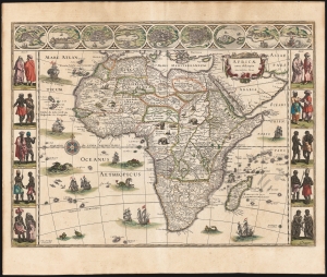
Africae nova descriptio. Auct: Guiljelmo Blaeuw.
sold
- Digital Map Information
- Suitable for large format printing
- Full resolution TIFF file
- ICC color profile embedded
- Delivered instantly via download link
This is a superb, original-color example of Willem Blaeu's 1647 atlas map of Africa. It is one of the most desirable maps of the Dutch Golden Age of mapmaking. Norwich hailed it as 'one of the most decorative and popular of all the early maps of Africa'. The seas are filled with ships and sea monsters and the land teems with elephants, ostriches, lions, and other beasts. The borders of this superb carte à figures depict the greatest African cities of the day along the top, while on each side the borders display the natives of ten parts of the continent, in their traditional dress. Although separated from Europe only by the Mediterranean Sea, Europeans were nearly as ignorant of this massive continent as they were of the remote portions of Asia, or of the Americas, so maps such as this one provided a glimpse into what amounted to a different world. (more details)
The Classic Dutch Cartes-à-Figures Map of Africa.
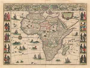
Africae nova descriptio. Auct: Guiljelmo Blaeuw.
sold
- Digital Map Information
- Suitable for large format printing
- DPI: 600
- File Size: 41.31 MB
- File Type: ZIP / TIFF
- ICC color profile embedded
- Delivered instantly via download link
This is a lovely, original-color example of Willem Blaeu's atlas map of Africa. It is one of the most desirable maps of the Dutch Golden Age of mapmaking. Norwich hailed it rightly as 'one of the most decorative and popular of all the early maps of Africa.' The seas are filled with ships and sea monsters; the land teems with elephants, ostriches, lions, and other beasts. And the borders of this superb carte à figure map depict the greatest African cities of the day along the top, while on each side the borders display the natives of ten parts of the continent, in their traditional dress. Although separated from Europe only by the Mediterranean Sea, Europeans were nearly as ignorant of this massive continent as they were of the remote portions of Asia, or of the Americas, so maps such as this one provided a glimpse into what amounted to a different world. (more details)
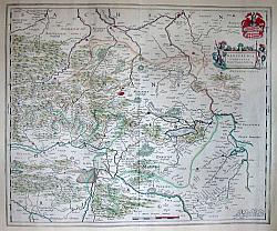
Mansfeldia in West Germany
sold
- Digital Map Information
- Suitable for large format printing
- Full resolution TIFF file
- ICC color profile embedded
- Delivered instantly via download link
This magnificent 1647 map by Johannes Blaeu represents Mansfeldia, an area in Eastern Germany near Belgium and Luxembourg. Cartouche in the top right depicts the Mansfeld coat of ... (more details)
The Classic Dutch Atlas Map of Paraguay and the Rio De La Plata
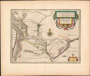
Paraguay, o Prov. De Rio De La Plata cum regionibus adiacentibus Tucuman et Sta. Cruz de la Sierra
sold
- Digital Map Information
- Suitable for large format printing
- DPI: 600
- File Size: 26.33 MB
- File Type: ZIP / TIFF
- ICC color profile embedded
- Delivered instantly via download link
A superb old color example of Blaeu's 1650 map of Paraguay. The map focuses on central South America, focusing on the course of the Rio de la Plata. The cartouche and scales are magnificently colored, and the map’s decorations include a fine compass rose and a lurking sea monster. Buenos Aires, Asuncion,Cordoba, Potosi and other modern place names appear on the map, primarily in modern day Paraguay and Argentina. (more details)
First European Atlas Map of the Beijing Region.
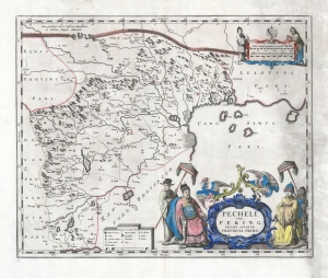
Pecheli, sive Peking, Imperii Sinarum Provincia Prima.
sold
- Digital Map Information
- Suitable for large format printing
- DPI: 600
- File Size: 46.6 MB
- File Type: ZIP / TIFF
- ICC color profile embedded
- Delivered instantly via download link
This is Martino Martini's 1655 map of Beijing / Peking vicinity, China, printed by Joan Blaeu for the Novus Atlas Sinensis, considered the first European atlas of China. The work was based on Chinese sources edited by Martini, who spent years in China, and thus was 'far in advance of any previous European work. For the period, it was remarkably accurate' (Tooley). (more details)
First appearance of Chinese geographical data in a European atlas.
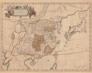
Imperii Sinarum Nova Descriptio.
sold
- Digital Map Information
- Suitable for large format printing
- Full resolution TIFF file
- ICC color profile embedded
- Delivered instantly via download link
This is the 1655 edition of Martino Martini and Johannes Blaeu's seminal map of China, Japan, and Korea, with fine old color. This is among the most important and influential maps of China issued in the 17th century, being the first publication of Martino Martini's revolutionary geographical data, brought to Europe just months earlier. (more details)
A map from the first Western atlas of China created by the 'first to study the history and geography of China with rigorous scientific objectivity.'
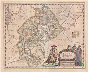
Kiangsi, Imperii Sinarum Provincia Octava.
sold
- Digital Map Information
- Suitable for large format printing
- DPI: 300
- File Size: 10.98 MB
- File Type: ZIP / TIFF
- ICC color profile embedded
- Delivered instantly via download link
This is a 1655 Martino Martini and Joan Blaeu map of Jiangxi (Kiangsi) Province in China. The map depicts the region from the Yangtze River and Poyang Lake to Guangdong ... (more details)
A highly accurate map of Yunnan province from the first Western atlas of China!
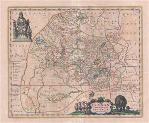
Iunnan Imperii Sinarum Provincia.
sold
- Digital Map Information
- Suitable for large format printing
- DPI: 300
- File Size: 10.55 MB
- File Type: ZIP / TIFF
- ICC color profile embedded
- Delivered instantly via download link
This is a 1655 Martino Martini and Joan Blaeu map of Yunnan (Iunnan) Province, China. The map depicts the region from Tibet to Guangxi Province and from Sichuan ... (more details)
Classic Dutch Double Hemisphere World in Original Color.
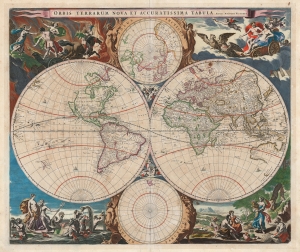
Orbis Terrarum Nova et Accuratissima Tabula. Auctore Nicolao Visscher.
sold
- Digital Map Information
- Suitable for large format printing
- Full resolution TIFF file
- ICC color profile embedded
- Delivered instantly via download link
This is Nicolas Visscher's classic 1658 double hemisphere map of the world, in beautiful original color. It epitomizes, both aesthetically and geographically, the Dutch World map of the second part of the 17th century. As such, according to Rodney Shirley, it is the 'master fore-runner' of the highly decorative style of Dutch world map that characterized the latter part of the Dutch Golden Age of Mapmaking. (more details)
Cosmography Explained.
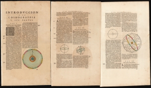
Introduccion a la Cosmographia y sus Partes (Chapters 1-4).
sold
- Digital Map Information
- Suitable for large format printing
- Full resolution TIFF file
- ICC color profile embedded
- Delivered instantly via download link
These are the first four chapters of the introduction to Cosmography published in the first volume of Joan Blaeu's 1659 Spanish-text Nuevo Atlas. It includes elegantly-engraved charts illustrating the text's descriptions of important concepts, the most beautiful of which are the two planispheres depicting the Ptolemaic, geocentric system and the Copernican solar system. These represent the only separate celestial charts to appear in Blaeu atlases. (more details)
First edition of a rare Blaeu.
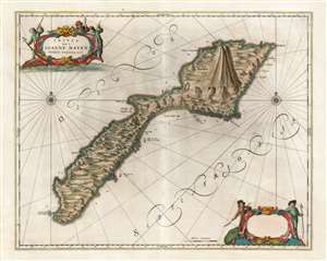
Insula quae à Joanne Mayen nomen sortita est.
sold
- Digital Map Information
- Suitable for large format printing
- DPI: 600
- File Size: 45.6 MB
- File Type: ZIP / TIFF
- ICC color profile embedded
- Delivered instantly via download link
This is a beautiful and rare original-color Dutch Golden Age 1659 Blaeu map of Jan Mayen, a volcanic island in the Arctic, and a possession of Norway. Having no permanent population, the island was primarily a whaling post, as witness the hapless cetaceans and harpoon-brandishing sailors in the superbly engraved cartouches. (more details)
Original-color. Proof state.
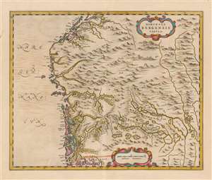
Dioecesis Bergensis Tabula.
sold
- Digital Map Information
- Suitable for large format printing
- DPI: 600
- File Size: 47.19 MB
- File Type: ZIP / TIFF
- ICC color profile embedded
- Delivered instantly via download link
This is a beautiful example of the 1659 proof state of Joan Blaeu's map of the Diocese of Bergen, Norway - encompassing the newly-formed county of Vestland. It is among the scarcest of Blaeu's maps, appearing in a sole edition of the Novuus Atlas and subsequently in the Atlas Maior. Engraved at the height of Blaeu's career, with superbly executed pictorial mountains evoking the mountainous terrain of Norway's fjord country (more details)
Blaeu's first atlas map to specifically focus on the Grand Banks and the eastern parts of New France.
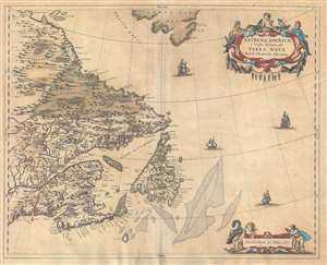
Extrema Americae Versus Boream, ubi Terra Nova Nova Franci.
sold
- Digital Map Information
- Suitable for large format printing
- DPI: 300
- File Size: 10.62 MB
- File Type: ZIP / TIFF
- ICC color profile embedded
- Delivered instantly via download link
An old color example of Johannes Blaeu's 1662 map of eastern Canada, including Nova Scotia, Newfoundland, Cape Breton Island, and Labrador. Blaeu based this ... (more details)
An beautiful and historic map of the region surrounding Shanghai and the Yangtze River.
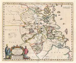
Nanking Sive Kiangnan, Imperii Sinarum Provincia Nona.
sold
- Digital Map Information
- Suitable for large format printing
- DPI: 600
- File Size: 24.16 MB
- File Type: ZIP / TIFF
- ICC color profile embedded
- Delivered instantly via download link
This is a 1662 Martino Martini and Joan Blaeu map of Jiangsu Province and Shanghai Municipality in China. The map depicts the environs of the lower Yangtze ... (more details)
First Blaeu edition of the first map of Madagascar based on firsthand report.
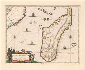
Insula S. Laurentii, vulgo Madagascar.
sold
- Digital Map Information
- Suitable for large format printing
- Full resolution TIFF file
- ICC color profile embedded
- Delivered instantly via download link
This is the first, 1662 edition of Joan Blaeu's map of Madagascar, in a superb original color example heightened with gold. It is among the scarcest of Blaeu's atlas maps,and one of the most beautifully engraved. This example is particularly desirable, featuring sumptuous original color and delicate gold highlighting. (more details)
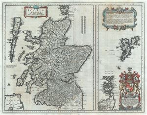
Scotia Regnum cum insulis adjacentibus.
sold
- Digital Map Information
- Suitable for large format printing
- DPI: 300
- File Size: 13.77 MB
- File Type: ZIP / TIFF
- ICC color profile embedded
- Delivered instantly via download link
This is a beautiful map of the Kingdom of Scotland by Joan Blaeu in 1662. Essentially divided into two panels within a single border, the panel on the ... (more details)
Among the earliest maps of the Dnipro River.
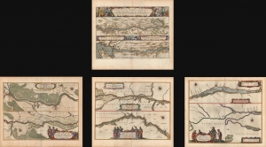
Tractus Borysthenis, Vulgo Dniepr er Niepr dicti.
sold
- Digital Map Information
- Suitable for large format printing
- Full resolution TIFF file
- ICC color profile embedded
- Delivered instantly via download link
A beautiful 1662 original-color set of Joan Blaeu maps of the Dnipro (Dnieper) River, the Ukrainian frontier of the Polish-Lithuanian Commonwealth. At the time, the region was undergoing a radical rearrangement, with Poland-Lithuania ejected as the major outside power and replaced by Tsarist Russia. (more details)
A Sumptuous Example of the Classic Dutch Map of Oxfordshire, with the University's College Arms
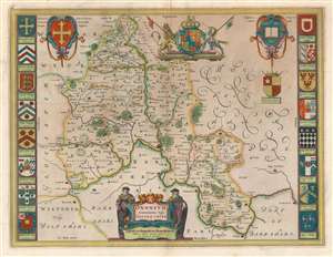
Oxonium Comitatus, Vulgo Oxfordshire.
sold
- Digital Map Information
- Suitable for large format printing
- DPI: 600
- File Size: 18.56 MB
- File Type: ZIP / TIFF
- ICC color profile embedded
- Delivered instantly via download link
This is a 1662 Johannes Blaeu map of Oxfordshire, one of the most decorative maps of Oxfordshire and the most desirable Dutch map of a British county. The geography is derived from Speed's map, with the map centered on the city of Oxford, dividing the county into its Hundreds and showing its parks and towns. Blaeu's map shines in its decorative elements: The cartouche, which incorporates both the title and the scales, is flanked by two English scholars in formal garb. The British Royal arms are displayed front and center, but the map is cornered with the arms of King Alfred (with the dubious claim that the king founded Oxford,) the arms of the County, and the insignia of the University itself. The map is bordered with sixteen coats of arms belonging to the University's Colleges. The map is embellished with rich contemporary color. (more details)
'Most Attractive of its Time' -Shirley
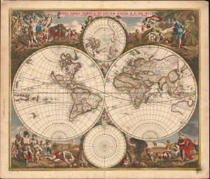
Nova Orbis Tabula In Lucem Edita, A. F. de Wit.
sold
- Digital Map Information
- Suitable for large format printing
- DPI: 600
- File Size: 64.85 MB
- File Type: ZIP / TIFF
- ICC color profile embedded
- Delivered instantly via download link
This is a striking c. 1689 example, in original color, of Frederick De Wit's classic double hemisphere map of the world. Shirley praised it as 'one of the most attractive of its time'. It features many of the tropes of 17th-century Dutch mapmaking: Isular California, imaginary islands, etc., as well as new discoveries, such as Western Australia, and cartographic reconsiderations, among them the removal of the imaginaryTerra Australis. (more details)
'Most Attractive of its Time' ~ Shirley
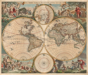
Nova Orbis Tabula In Lucem Edita, A.F.de Wit.
sold
- Digital Map Information
- Suitable for large format printing
- DPI: 600
- File Size: 61.1 MB
- File Type: ZIP / TIFF
- ICC color profile embedded
- Delivered instantly via download link
This is a first-plate, first-state example in original color of Frederick De Wit's classic double hemisphere map of the world. Shirley praised it as 'one of the most attractive of its time'. De Wit's map presents the state of the art of Dutch mapmaking as was expressed in Nicolas Visscher's 1658 map of the world, its detail drawn primarily from Joan Blaeu's Nova et Accuratissima Totius Terrarum Orbis Tabula. In both its geographical detail and the composition of its primary and subordinate hemispheres, it is a faithful copy of the Visscher. (more details)
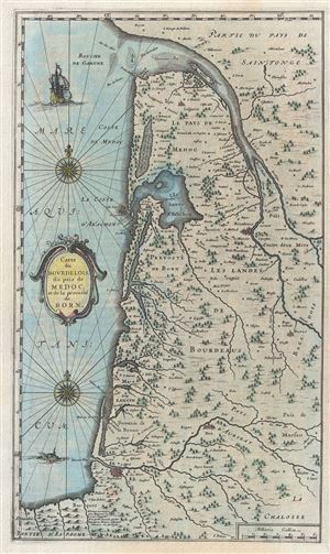
Carte du Bourdelois du pais de Medoc et de la prevoste de Born.
sold
- Digital Map Information
- Suitable for large format printing
- DPI: 300
- File Size: 6.5 MB
- File Type: ZIP / TIFF
- ICC color profile embedded
- Delivered instantly via download link
An attractive c. 1667 Blaeu map of Bordeax and the Pays de Medoc, France. Covers the modern day Department of Gironde from the Garonne River to Spain ... (more details)
17th century map of Morocco on the Barbary Coast of Africa.
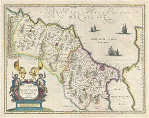
Fezzae et Marocchi Regna Africae Celeberrima.
sold
- Digital Map Information
- Suitable for large format printing
- DPI: 300
- File Size: 12.14 MB
- File Type: ZIP / TIFF
- ICC color profile embedded
- Delivered instantly via download link
This is a beautiful 1675 map of Morocco on the Barbary Coast of northern Africa by Johannes Blaeu. Oriented with north on the right, the map covers ... (more details)
Extremely Rare Imprint of one of Blaeu's Rarest Maps.
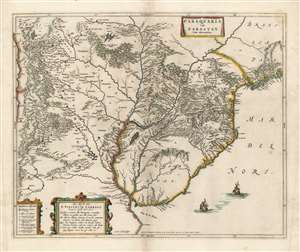
Paraquaria Vulgo Paraguay Cum adjacentibus.
sold
- Digital Map Information
- Suitable for large format printing
- Full resolution TIFF file
- ICC color profile embedded
- Delivered instantly via download link
This rare, superb Blaeu map is one of the finest maps of the lower Rio de la Plata, and the first map to name the Uruguay River. It covers what is now Uruguay, Paraguay, northern Argentina, and part of Chile in magnificent detail, illustrating the complicated regional river system, Argentina's endoheiric lakes, and other bodies of water appear. Some, for example the Lago de los Caracaras flowing into the Corriente River, depict areas accurately that remain poorly mapped today. (The Caracaras would appear to be the Itatí Lagoon.) Mountains and highlands are shown pictorially. Numerous settlements and missions are named. With the assistance of a key in the lower left, one is able to differentiate indigenous settlements from Spanish cities (both extant and ruined,) clerical schools, Jesuit missions (both extant and ruined,) and Franciscan missions. (more details)
Superbly Engraved view of Naples.
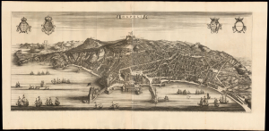
Napoli.
sold
- Digital Map Information
- Suitable for large format printing
- Full resolution TIFF file
- ICC color profile embedded
- Delivered instantly via download link
This is Pierre Mortier's 1704 edition of Joan Blaeu's magnificent two-sheet panorama of Naples, one of the grandest portrayals of the great seaport created in the 17th century. (more details)