
Fries, Lorenz (sold) (Laurentius Phrisius)
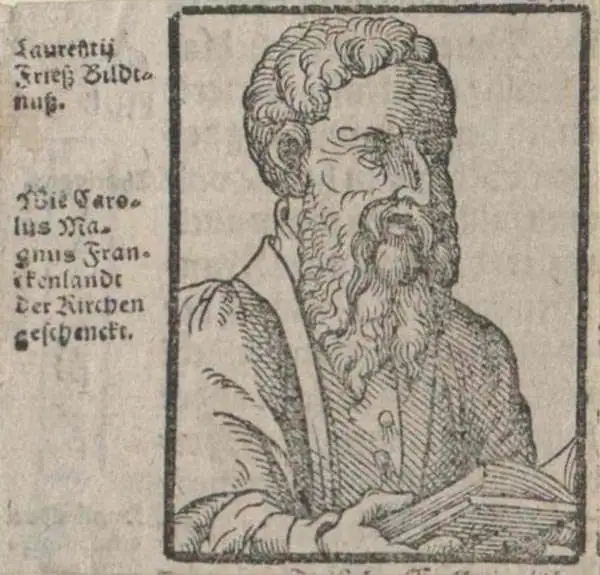
Lorenz Fries (c. 1490 – 1531) was a German cartographer, cosmographer, astrologer, and physician based in Strasbourg. Little is known of Fries' early life. He may have studied in Padua, Piacenza, Montpellier, and Vienna, but strong evidence of this is unfortunately lacking. The first recorded mention of Fries on a 1513 Nuremberg broadside. Fries settled in Strasbourg in March of 1519, where he developed a relationship with the St. Die scholars, including, among others, Walter Lud, Martin Ringmann, and Martin Waldseemüller. There, he also befriended the printer and publisher Johann Grüninger. Although his primary profession was as a doctor, from roughly 1520 to 1525, he worked closely with Grüninger as the geographic editor of various maps and atlases based upon the work of Martin Waldseemüller. Although his role is unclear, his first map seems to have been a 1520 reissue of Waldseemüller's world map of 1507. Around this time, Fries also began working on Grüninger's reissue of Waldseemüller's 1513 edition of Ptolemy's Geographie Opus Novissima. That edition included three new maps by Fries based upon the Waldseemüller world map of 1507 – two of these, his maps of East Asia and Southeast Asia, are quite significant as the first specific maps of these regions issued by a European publisher. In 1525, Fries decided to leave Strasbourg and surrendered his citizenship, relocating to Trier. In 1528, he moved to Basel. Afterward, he relocated to Metz where he most likely died. In addition to his cartographic work, Fries published tracts on medicine, religion, and astrology.
AKA: Laurentius Phrisius
The earliest acquirable map to name America.
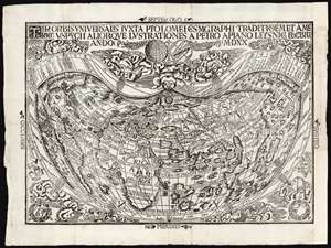
Tipus Orbis Universalis Iuxta Ptolomei Cosmographi Traditionem Et Americi Vespucii Aliorque Lustrationes A Petro Apiano Leysnico Elucbrat An. Do. MDXX.
sold
- Digital Map Information
- Suitable for large format printing
- Full resolution TIFF file
- ICC color profile embedded
- Delivered instantly via download link
This is an attractive example of Petrus Apianus's 1520 map of the world, the earliest acquirable map to include the place name 'America.' In this respect it is pre-dated only by Waldseemüller's 1507 wall map, which exists in a sole surviving example held by the Library of Congress. Apianus was a well-respected and better-connected scholar, and in some respects his map's use of the name 'America' for the new world had broader impact even than the map on which the name first appeared. The map's projection and the lion's share of its geographical information derive from the 1507 Waldseemüller map of the world. In place of the hemisphere views present on the 1507 map, Apianus' displays in the upper decorative border an armillary sphere and a graticule, tools whose geometrical features allowed the composition of the map's projection. (more details)
Earliest Acquirable use of 'America' on a map.
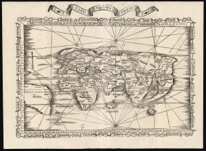
Orbis Typus Universalis Iuxta Hydrographorum Traditionem Exactissime Depicta. 1522 L. F.
sold
- Digital Map Information
- Suitable for large format printing
- File Size: 19.83 MB
- File Type: ZIP / TIFF
- ICC color profile embedded
- Delivered instantly via download link
This is a superb example of Lorenz Fries's 1522 map of the world in its 1535 edition: a key discovery-era document, being the second earliest, acquirable, printed map to name 'America' (appearing here in South America). (more details)
Earliest Acquirable map to name 'America'
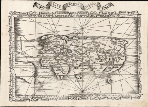
Orbis Typus Universalis Iuxta Hydrographorum Traditionem Exactissime Depicta. 1522 L. F.
sold
- Digital Map Information
- Suitable for large format printing
- File Size: 17.38 MB
- File Type: ZIP / TIFF
- ICC color profile embedded
- Delivered instantly via download link
This is Lorenz Fries' 1522 map of the world in its 1535 edition: a key discovery-era document, being the second earliest acquirable printed map to name 'America' (appearing here in South America). (more details)
Reconciling New Discovery with Ptolemy.
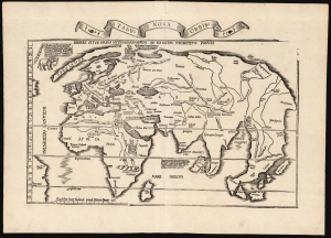
Tabu. Nova Orbis.
sold
- Digital Map Information
- Suitable for large format printing
- Full resolution TIFF file
- ICC color profile embedded
- Delivered instantly via download link
A superb example of Lorenz Fries's 1522 map of the world. This is one of the great Discovery-Era world maps, capturing the impact of contemporary exploration on the late-Roman cartographic models of Ptolemy. (more details)
One of the Earliest Modern Maps of the Indian Ocean.
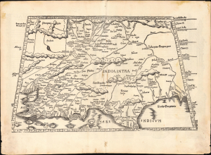
[Tabula X. Asiae.]
sold
- Digital Map Information
- Suitable for large format printing
- Full resolution TIFF file
- ICC color profile embedded
- Delivered instantly via download link
This is Laurent Fries' 1535 edition of Martin Waldseemüller's Ptolemaic map of India, one of the earliest acquirable maps of the area and an essential step in the subcontinent's cartographic evolution. (more details)
First European Map of the Spice Islands.
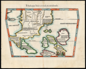
Tabula nova Indiae orientalis et meridionalis.
sold
- Digital Map Information
- Suitable for large format printing
- Full resolution TIFF file
- ICC color profile embedded
- Delivered instantly via download link
A groundbreaking work, this is the 1522 Lorenz Fries map of Southeast Asia and the East Indies, considered the first European printed map so focused. Fries incorporates Marco Polo's geographical reports of Southeast Asia into geography derived topographically from the world maps of Waldseemüller (1507) and Martellus (c. 1490). It is also one of the first maps included in an edition of Ptolemy's Geographia to portray lands beyond the scope of Ptolemaic 2nd-century geographical knowledge. (more details)
The Silk Road between the Caspian Sea and the Hindu Kush.
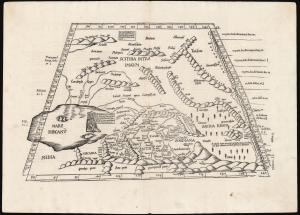
[Tabula Septima Asiae].
sold
- Digital Map Information
- Suitable for large format printing
- Full resolution TIFF file
- ICC color profile embedded
- Delivered instantly via download link
This is Laurent (Lorenz) Fries' 1522 map of central Asia and the Silk Road, among the earliest acquirable maps of Central Asia east of the Caspian Sea. Although presenting 2nd-century Ptolemaic geography, this map remained relevant as the best map of the region available. Additionally, Fries' iteration of this Ptolemaic map is distinct from any other in its incorporation of contemporary information about the denizens of the region - in this case, drawn from the texts on Waldseemüller's 1516 Carta Marina. (more details)
One of the Earliest Modern Maps of the Indian Ocean.
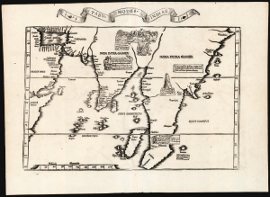
Tabu. Moder. Indiae.
sold
- Digital Map Information
- Suitable for large format printing
- Full resolution TIFF file
- ICC color profile embedded
- Delivered instantly via download link
This is Laurent Fries' edition of the earliest acquirable modern mapping of South Asia. While the topography and place names are faithfully drawn from Martin Waldseemüller's map of 1513, Fries' map also includes evocative woodcut illustrations and descriptive text drawn not from the 1513 Ptolemy, but instead from Waldseemüller's 1516 Carta Marina. Consequently, the geography shown here was thoroughly modern. (more details)
First generally acquirable Map of Scandinavia, Iceland and Greenland.
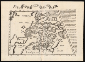
Norbegia et Gottia.
sold
- Digital Map Information
- Suitable for large format printing
- Full resolution TIFF file
- ICC color profile embedded
- Delivered instantly via download link
This is Lorenz Fries' 1522 map, in a 1535 edition, of one of the earliest maps to focus on the northern parts of Europe, including Iceland and Greenland. It is one of the earliest acquirable maps to include the geography of Claudius Clavus (1388 - 14??). (more details)
First acquirable map of China and Japan.
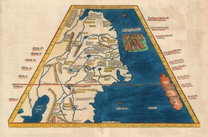
Tabula Superioris Indiae et Tartariae Majoris.
sold
- Digital Map Information
- Suitable for large format printing
- DPI: 600
- File Size: 17.18 MB
- File Type: ZIP / TIFF
- ICC color profile embedded
- Delivered instantly via download link
A seminal work, this 1522 Lorenz Fries map is the first European map to focus on China and Japan and the first specific map to utilize Marco Polo's geographical reports of East Asia. It was also one of the first maps in a printed edition of Ptolemy's Geographia to reflect a contemporaneous understanding of the region depicted. It is, moreover, the only acquirable printed map of the region derived from Martin Waldseemüller's great 1507 world map. Surprisingly, Waldseemüller's depiction of Japan was not reprised in the 1513 Ptolemy, either on the world map or on any more narrowly focused map. It represents one of the first efforts to reconcile ancient geography with the growing stream of new information coming back from recent exploration and geographical theory. (more details)
Ancient Persia.
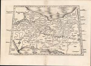
[Tabula V. Asiae].
sold
- Digital Map Information
- Suitable for large format printing
- Full resolution TIFF file
- ICC color profile embedded
- Delivered instantly via download link
This is Laurent Fries' Ptolemaic map of Persia, one of the earliest generally acquirable maps of what would become Iran and Iraq. The map spans from Mesopotamia - the Tigris and Euphrates Rivers valleys - to a mountain range roughly corresponding with the Masjed Mountains of easternmost Persia, embracing modern-day Iran, Iraq, the Caspian Sea, and the Persian Gulf. (more details)
Western China, Mongolia and Central Asia North of the Himalayas
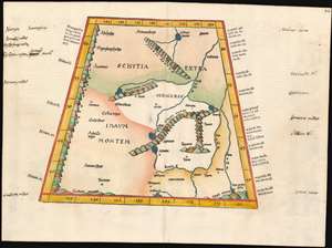
(Tabula VIII Asiae)
sold
- Digital Map Information
- Suitable for large format printing
- DPI: 600
- File Size: 17.68 MB
- File Type: ZIP / TIFF
- ICC color profile embedded
- Delivered instantly via download link
This map depicts the area now known as China and Mongolia. Specifically, it shows the lands known to Strabo and Ptolemy as Scythia Extra Imaum and Serica. Scythia Extra Imaum refers to the territory of the nomadic Scythians to the east of the Tian Shan mountain range, while Serica was a mysterious land thought to be the source of silk: indeed, the place name literally means “the land where silk comes from.” The map includes specific descriptors for some of the people to be found in the region: in the northwestern extreme of the map, Hippophagi (horse-eaters) and Anthropophagi (cannibals) can be found. Since this map covers one of the norther nmost regions addressed in Ptolemy's work, it includes notation in its margins indicating the increase in the length of the days as one travels north, a phenomenon not easily observed during Ptolemy's time but one with which northern European travelers of the 16th century would have been growing familiar. (more details)
First acquirable map of China and Japan.
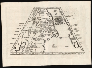
[Ta. Superioris. Indiae Et Tartariae Maioris.]
sold
- Digital Map Information
- Suitable for large format printing
- Full resolution TIFF file
- ICC color profile embedded
- Delivered instantly via download link
A seminal work, this 1522 Lorenz Fries map is the first European map to focus on China and Japan and the first specific map to utilize Marco Polo's geographical reports of East Asia. It was also one of the first maps included in a printed edition of Ptolemy's Geographia to reflect a contemporaneous understanding of the subject region. It is also the only acquirable printed map of the region derived from Martin Waldseemüller's 1507 world map, representing one of the first efforts to reconcile ancient geography with new information from exploration and geographical theory. (more details)
Early ptolemaic map of Central Asia!
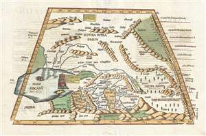
[Title on Verso] Tabula Septima Asiae Complectitur Margianam, Bactrianam, Sogdianam, Sacas, & Scythiam, Intra Imaum Montem.
sold
- Digital Map Information
- Suitable for large format printing
- DPI: 300
- File Size: 5.73 MB
- File Type: ZIP / TIFF
- ICC color profile embedded
- Delivered instantly via download link
A fine example of the 1541 Vienne-in-the-Dauphane edition of Lorenz Fries' Ptolemaic map of central Asia. The map's coverage extends from the western Caspian Sea and the Central Asian Steppe, Afghanistan, including all or parts of modern day Kazakhstan, Turkmenistan, Iran, Afghanistan, Uzbekistan, and Iran. The Himalayas are evident at the base of the map and have a rope-like aspect. The map exhibits the typical trapezoidal projection common to early Ptolemaic maps. (more details)