
National Publishing Company (sold)

National Publishing Company (1897 - 1902) was an American map publishing firm founded in Portland, Maine in 1897. The founders, brothers Walter C. Scarborough (June 4, 1862 - May 9, 1904) and Howard G. Scarborough (December 23, 1867 - June 10, 1905), were also proprietors of the Scarborough Company and the Dominion Publishing Company. The National Publishing Company was intended to be managed by Howard, with Walter serving as treasurer. By 1901, the firm had relocated to Boston, where it published and sold large scale brilliantly printed road maps. In 1902, the Scarborough brothers merged their three concerns into the Boston based Scarborough Company and opened an office in Indianapolis, Indiana. Walter and Howard died in 1904 and 1905, both from tuberculous, but the Scarborough Company continued, transferring its offices to Indianapolis. In 1913 it became the Scarborough Motor Guide Company (c. 1913 - c. 1933). It does not appear to be related to the more prominent general publisher of the same name based out of Philadelphia.
Celebrating the newly acquired empire after the Spanish-American War.
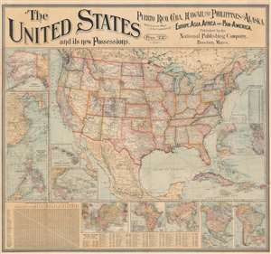
The United States and its new Possessions. Puerto Rico, Cuba, Hawaii, the Philippines and Alaska, With General Maps of the Continents of Europe, Asia, Africa, and Pan-America.
sold
- Digital Map Information
- Suitable for large format printing
- Full resolution TIFF file
- ICC color profile embedded
- Delivered instantly via download link
This is an 1899 National Publishing Company wall map of the United States published shortly after the Spanish-American War. The map of the United States dominates the sheet, with the country's railroad network, river systems, and mountain ranges all appearing. However, given the recent victory over Spain during the war and the acquisition of Puerto Rico, the Philippines, and Guam, along with Cuba as a protectorate, the Caribbean islands and the insets likely would have commanded just as much, if not more, attention from a contemporary audience. Dashed lines trace Plant Steamship Lines and Florida East Coast Steam Ship Lines routes in the Caribbean from Florida, informing viewers how Americans could visit their newly acquired overseas 'empire'. Cuba's rail network is illustrated as well. (more details)
Large and impressive.
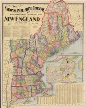
The National Publishing Company's New Railroad, Post-Office, Township, and County Map of New England.
sold
- Digital Map Information
- Suitable for large format printing
- File Size: 83.82 MB
- File Type: ZIP / TIFF
- ICC color profile embedded
- Delivered instantly via download link
This is the 1899 National Publishing Company map of New England, one of the rarer publications of that firm. This colorful map features the firm's distinctive typographical flourishes and large titling. Coverage broadly embraces Maine, Vermont, New Hampshire, Connecticut, Massachusetts, and Rhode Island, as well as parts of adjacent New York and Canada. A large inset of Boston and demographic statistics occupy the lower right. (more details)
The first edition of an iconic transportation map!
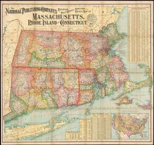
The National Publishing Company's Railroad, Post Office, Township and County Map of Massachusetts, Rhode Island and Connecticut.
sold
- Digital Map Information
- Suitable for large format printing
- File Size: 96.47 MB
- File Type: ZIP / TIFF
- ICC color profile embedded
- Delivered instantly via download link
This is a 1900 National Publishing Company map of Massachusetts, Connecticut, and Rhode Island. The map depicts all three states in their entirety, along with parts of Long. Island, New Hampshire, Vermont, New York State, and Maine. (more details)
The Green Mountain State.
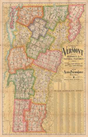
Complete map of Vermont showing highways and natural features…
sold
- Digital Map Information
- Suitable for large format printing
- File Size: 289.22 MB
- File Type: ZIP / TIFF
- ICC color profile embedded
- Delivered instantly via download link
An impressive, large-format 1902 indexed folding map of Vermont by the National Publishing Company highlighting the rail network at the start of the 20th century. (more details)
The Green Mountain State.
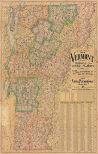
Complete map of Vermont showing highways and natural features…
sold
- Digital Map Information
- Suitable for large format printing
- File Size: 252.64 MB
- File Type: ZIP / TIFF
- ICC color profile embedded
- Delivered instantly via download link
An impressive, large-format 1902 indexed folding map of Vermont by the National Publishing Company highlighting the state's rail network at the start of the 20th century. (more details)
The United States at the turn of the 20th century.
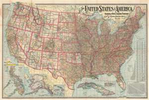
The United States of America Including All Its Newly Acquired Territory.
sold
- Digital Map Information
- Suitable for large format printing
- File Size: 191.89 MB
- File Type: ZIP / TIFF
- ICC color profile embedded
- Delivered instantly via download link
This is a 1902 National Publishing Company map of the United States with a typographically elaborate title. Each of the states and territories are divided into counties and the distinction between the developing western states, with enormous scarcely populated counties and the eastern states is made stark by the map's rich coloring. The road network spreads across the country like a web with major cities as hubs. Shipping lanes are noted in the Atlantic and Pacific, with each lane is identified by destination and company. Several inset maps are situated along the lower border, including Puerto Rico, Cuba, Hawaii, Wake Island, Guam, Samoa, Tutuila Island, Howland Island, and Baker Island, Alaska (with a smaller inset of the western portion of the Aleutian Islands), and the Philippines. (more details)
The United States at the turn of the 20th century.
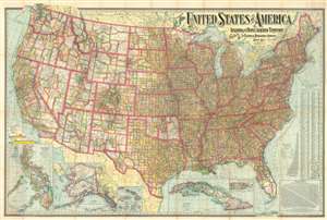
The United States of America Including All Its Newly Acquired Territory.
sold
- Digital Map Information
- Suitable for large format printing
- File Size: 190.01 MB
- File Type: ZIP / TIFF
- ICC color profile embedded
- Delivered instantly via download link
This is a 1902 National Publishing Company map of the United States with a typographically elaborate title. The map depicts the continental United States from the Pacific Ocean to the Atlantic Ocean and the Bahamas and from Canada to Mexico and the Gulf of Mexico. Each of the states and territories are divided into counties, with myriad cities, towns, and villages labeled. The distinction between the developing western states, with enormous scarcely populated counties and the eastern states is made stark by the map's rich coloring. The road network spreads across the country like a web, with major cities functioning as hubs. Shipping lanes are noted in the Atlantic and Pacific, with their destination and the company which operates on that route provided. Several inset maps are situated along the lower border, including Puerto Rico, Cuba, Hawaii, Wake Island, Guam, Samoa, Tutuila Island, Howland Island and Baker Island, Alaska (with a smaller inset of the western portion of the Aleutian Islands), and the Philippines. (more details)
The United States at the turn of the 20th century.
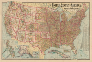
The United States of America Including All Its Newly Acquired Territory.
sold
- Digital Map Information
- Suitable for large format printing
- Full resolution TIFF file
- ICC color profile embedded
- Delivered instantly via download link
This is a first edition 1901 National Publishing Company map of the United States that features a typographically elaborate title. It was issued in the wake of the Spanish-American War and consequently was updated to reflect American occupation of the Philippines. (more details)
The Whites.
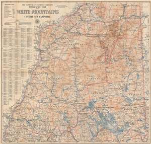
The National Publishing Company's Topographic Map of the White Mountains and Central New Hampshire.
sold
- Digital Map Information
- Suitable for large format printing
- File Size: 76.02 MB
- File Type: ZIP / TIFF
- ICC color profile embedded
- Delivered instantly via download link
This is a 1902 National Publishing Company map of the White Mountains and central New Hampshire. Coverage embraces central New Hampshire from Lancaster and Berlin Mills south to Cornish, South Danbury, and Alton Bay. Many individual peaks throughout the White Mountains are noted. Cities, towns, and villages are labeled, with communities served by post offices and railroad stations labeled as such. Grants and purchases around the area are labeled in different typefaces, with some marked in large bold lettering, while others, like the Allen grant in Waterville County, are much less noticeable. Roads are illustrated, as are several railroads, including the Northern Division and the White Mountain Division of the Boston and Maine Railroad and several abandoned lumber railroads. Counties are demarcated and identified, and rivers and lakes are colored blue and labeled. Mountains are illustrated using contour lines, labeled, and their elevations provided. An index along the left side lists post offices, railroad stations, principal lakes and streams, and principal mountains, and provides the grid location for each one. (more details)
A wonderful wall map of the White Mountains.
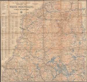
The National Publishing Company's Topographic Map of the White Mountains and Central New Hampshire.
sold
- Digital Map Information
- Suitable for large format printing
- File Size: 83.26 MB
- File Type: ZIP / TIFF
- ICC color profile embedded
- Delivered instantly via download link
This is a 1902 National Publishing Company map of the White Mountains and central New Hampshire that labels individual peaks throughout the area. Depicting central New Hampshire from Lancaster and Berlin Mills south to Cornish, South Danbury, and Alton Bay, cities, towns, and villages are labeled, with communities served by post offices and railroad stations labeled as such. Grants and purchases around the area are labeled in different typefaces, with some marked in large bold lettering, while others, like the Allen grant in Waterville County, are much less noticeable. Roads are illustrated, as are several railroads, including the Northern Division and the White Mountain Division of the Boston and Maine Railroad and several abandoned lumber railroads. Counties are demarcated and identified, and rivers and lakes are colored blue and labeled. Mountains are illustrated using contour lines, labeled, and their elevations provided. An index along the left side lists post offices, railroad stations, principal lakes and streams, and principal mountains and provides the grid location for each one. (more details)
Wonderland of Mountains and Forests (without the Forests).
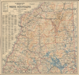
Scarborough's Topographic Map of the White Mountains and Central New Hampshire.
sold
- Digital Map Information
- Suitable for large format printing
- File Size: 77.98 MB
- File Type: ZIP / TIFF
- ICC color profile embedded
- Delivered instantly via download link
This large and impressive map of the White Mountains and central New Hampshire was published by the Scarborough Company, successor to the National Publishing Company, in 1903. It displays the region on the eve of the automobile era, when it was a favorite retreat of well-heeled tourists from Boston, New York, and beyond. (more details)
Wonderland of Mountains and Forests (without the Forests).
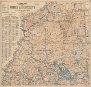
Scarborough's Topographic Map of the White Mountains and Central New Hampshire.
sold
- Digital Map Information
- Suitable for large format printing
- File Size: 191.39 MB
- File Type: ZIP / TIFF
- ICC color profile embedded
- Delivered instantly via download link
This large and impressive map of the White Mountains and central New Hampshire was published by the Scarborough Company, successor to the National Publishing Company, in 1903. It displays the region on the eve of the automobile era, when it was a favorite retreat of well-heeled tourists from Boston, New York, and beyond. (more details)