
Reid, John (sold)

John Reid (fl. c. 1775 - c. 1800) was an American bookseller and commercial mapmaker active in New York during the latter part of the 18th century. He is known for publishing the second American commercial atlas, the 1795 American Atlas. Unlike most American printers of his day, which were based in Philadelphia, Reid maintained his office at 106 Water Street, New York City. Little else is known of Reid's life and career.
From the second commercial atlas printed in America.
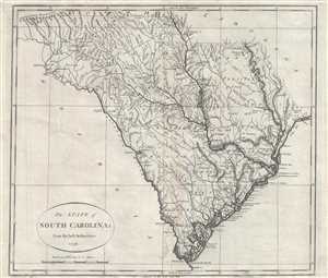
The State of South Carolina: from the best Authorities. 1796.
sold
- Digital Map Information
- Suitable for large format printing
- DPI: 300
- File Size: 7.59 MB
- File Type: ZIP / TIFF
- ICC color profile embedded
- Delivered instantly via download link
A fine example of John Reid's scarce and important 1796 map of South Carolina. This is the second folio map of a U.S. state to appear in an American commercial atlas. The map covers roughly the territory of modern day South Carolina, running along the Atlantic ... (more details)
Fascinating map. One of the earliest obtainable maps of Kentucky and Tennessee.
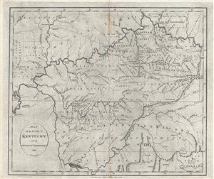
Map of the State of Kentucky; with the Adjoining Territories. 1795.
sold
- Digital Map Information
- Suitable for large format printing
- DPI: 300
- File Size: 8.93 MB
- File Type: ZIP / TIFF
- ICC color profile embedded
- Delivered instantly via download link
This 1795 map by John Reid is one of the earliest obtainable maps of Kentucky and Tennessee. Centered on the Cumberland River, the map covers from New Madrid on the Mississippi River to, roughly, the Cumberland Gap, and from the confluence of the Ohio and Great ... (more details)
Rare map of Maryland and Delaware from the 2nd earliest American Atlas published.
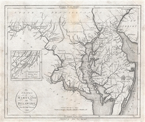
States of Maryland and Delaware from the latest Surveys. 1795.
sold
- Digital Map Information
- Suitable for large format printing
- DPI: 300
- File Size: 9.56 MB
- File Type: ZIP / TIFF
- ICC color profile embedded
- Delivered instantly via download link
An important map of Maryland and Delaware issued by John Reid in 1796. This map is from Reid's American Atlas , only the second atlas to be published in America. The map details the Chesapeake Bay Region from Fort Cumberland on the Potomac River to the ... (more details)
Rare map of North Carolina from the 2nd earliest American Atlas published.
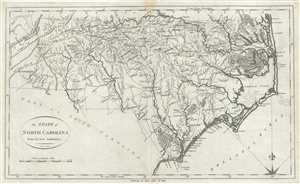
The State of North Carolina from the best Authorities.
sold
- Digital Map Information
- Suitable for large format printing
- Full resolution TIFF file
- ICC color profile embedded
- Delivered instantly via download link
A fine example of John Reid’s scarce and important 1796 map of North Carolina. The map covers roughly the territory of modern day North Carolina, running along the Atlantic coast from Currituck to Little River and inland as far as Buncombe County. ... (more details)
The second map of South Carolina to appear in an American commercial atlas.
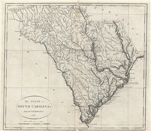
The State of South Carolina: from the best Authorities. 1796.
sold
- Digital Map Information
- Suitable for large format printing
- DPI: 300
- File Size: 7.95 MB
- File Type: ZIP / TIFF
- ICC color profile embedded
- Delivered instantly via download link
A fine example of John Reid's scarce and important 1796 map of South Carolina. This is the second folio map of South Carolina appear in an American commercial atlas. The map covers roughly the territory of modern day South Carolina, running along ... (more details)
A fine example of one of the second earliest obtainable map of Tennessee, issued 1796, the first year of Tennessee's statehood.
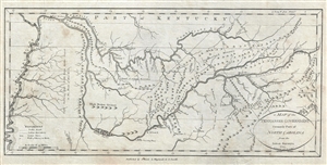
A Map of the Tennassee Government formerly Part of North Carolina from the latest Surveys. 1795.
sold
- Digital Map Information
- Suitable for large format printing
- DPI: 300
- File Size: 3.78 MB
- File Type: ZIP / TIFF
- ICC color profile embedded
- Delivered instantly via download link
A fine example of one of the second earliest obtainable map of Tennessee, issued 1796, the first year of Tennessee's statehood. This is the rare first state of John Reid's 1796 Map of the Tennassee Government . Cartographically derived from ... (more details)
Second Atlas Map of Virginia Published in the United States.
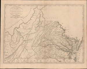
The State of Virginia from the best Authorities. 1796.
sold
- Digital Map Information
- Suitable for large format printing
- File Size: 354.95 MB
- File Type: ZIP / TIFF
- ICC color profile embedded
- Delivered instantly via download link
This is John Reid's 1796 map of the state of Virginia, engraved by Benjamin Tanner for Reid's An American Atlas. It was only the second atlas map of Virginia published in the United States and is one of the earliest obtainable maps of Virginia as a U.S. state. (more details)
One of the earliest obtainable specific maps of Georgia. Issued with the second atlas published in America.
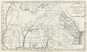
Georgia, from the latest Authorities.
sold
- Digital Map Information
- Suitable for large format printing
- DPI: 300
- File Size: 4.57 MB
- File Type: ZIP / TIFF
- ICC color profile embedded
- Delivered instantly via download link
One of the earliest obtainable specific maps of Georgia, this is a very attractive example of John Reid's 1796 presentation of Georgia. The map covers from the Atlantic Ocean to the Mississippi and from the Tennessee River to the Gulf of ... (more details)