
Union News Company (sold)

Union News Company (fl. c. 1890 - 1969) was founded by William Skelly in the late 1800's and operated until the late 1960s. After the railroads opened it became custom to have boys -newsboys- pass through the cars with waters, newspapers, and other small amenities. Skelly was the first newsboy on the railroad and became well known among railroad passengers. He gradually increased his facilities, hiring additional newsboys, until he virtually monopolized the railroad, and later steamship, news business. He made a small fortune and used this to found the Union News Company. The company was first known for the sales of newspapers in stations until it was able to expand and being selling papers on the train and in station restaurants. Union News continued to grow becoming major distributors of postcards and other printed items through their newsstands at hotels, rail and subway stations. The company officially folded in 1969.
Spectacular view of Boston and Cape Cod.
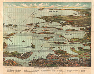
Bird's Eye View of Boston Harbor in colors Along the South Shore to Plymouth Cape Code Canal and Provincetown Showing all Steamboat Routes.
sold
- Digital Map Information
- Suitable for large format printing
- File Size: 4.78 MB
- File Type: ZIP / TIFF
- ICC color profile embedded
- Delivered instantly via download link
A remarkable chromolithograph map and view of Boston Harbor from Boston to Provincetown. Includes all of Cape Cod Bay, Quincy Bay and Dorchester Bay with the communities of Boston, East Boston, South Boston, Dorchester, Quincy, Hough's Neck, Mingham, Nantasket, ... (more details)
Steamship from Boston north along the New England coast!
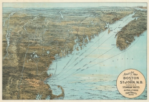
Bird's Eye Map Boston to St. John, N.B. Showing Steamboat Routes and Points of Interest.
sold
- Digital Map Information
- Suitable for large format printing
- Full resolution TIFF file
- ICC color profile embedded
- Delivered instantly via download link
This is the c. 1910 George Walker and Union News chromolithograph bird's-eye view map of the New England coast of the United States and the Maritime Provinces in Canada. Cities are labeled and steamship lines from Boston emphasize travel possibilities from that city. Such views were sold as novelties both at newsstands in ferry and train terminals and onboard those respective vessels. (more details)
From Boston to Cape Cod.
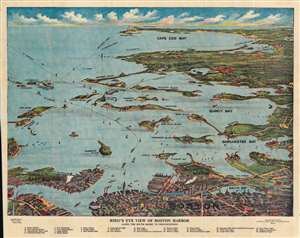
Bird's Eye View of Boston Harbor along the South Shore to Provincetown.
sold
- Digital Map Information
- Suitable for large format printing
- File Size: 54.87 MB
- File Type: ZIP / TIFF
- ICC color profile embedded
- Delivered instantly via download link
This is a 1914 William J. Finn chromolithograph bird's eye view of Boston Harbor from Boston to Provincetown. This view was drawn and published for sale to steamship passengers at the Union News stands at the Rowes Wharf steamship terminal, which serviced the Nantasket Line. All of Cape Cod Bay, Quincy Bay, and Dorchester Bay are depicted, including the communities of Boston, East Boston, South Boston, Dorchester, Quincy, and Hough's Neck, Mingham, Nantasket, Duxbury, Cohasset, and Scituate. Numerous islands in Boston Harbor are illustrated and labeled, including Moon Island, Spectacle Island, Thomson's Island, and Governor's Island. Ferry and steamboat lines are also labeled. Twenty-five locations throughout the region are numerically labeled and correspond with an index situated along the bottom border. Four additional locations are labeled alphabetically, which are also included in said index. (more details)
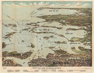
Bird's Eye View of Boston Harbor along the South Shore to Provincetown.
sold
- Digital Map Information
- Suitable for large format printing
- DPI: 300
- File Size: 13.6 MB
- File Type: ZIP / TIFF
- ICC color profile embedded
- Delivered instantly via download link
A remarkable 1917 color lithograph map and view of Boston Harbor from Boston to Provincetown. Includes all of Cape Cod Bay, Quincy Bay and Dorchester Bay with the communities of Boston, east Boston, South Boston, Dorchester, Quincy, Hough's Neck, Mingham, ... (more details)
A detailed view of Boston Harbor.
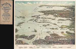
Bird's Eye View of Boston Harbor along the South Shore to Provincetown.
sold
- Digital Map Information
- Suitable for large format printing
- File Size: 9.09 MB
- File Type: ZIP / TIFF
- ICC color profile embedded
- Delivered instantly via download link
This is a 1917 William J. Finn color lithograph bird's eye view of Boston Harbor from Boston to Provincetown. All of Cape Cod Bay, Quincy Bay, and Dorchester Bay are depicted, along with the communities of Boston, East Boston, South Boston, Dorchester, ... (more details)
Weekends on the Cape and how to get there.
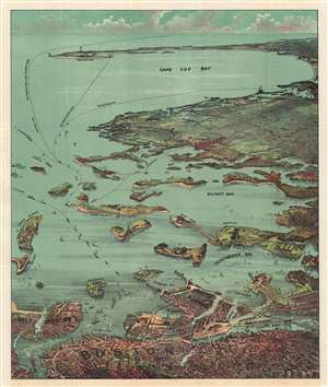
Bird's Eye View of Boston Harbor and South Shore to Provincetown Showing Steamship Routes.
sold
- Digital Map Information
- Suitable for large format printing
- Full resolution TIFF file
- ICC color profile embedded
- Delivered instantly via download link
This is a remarkable c. 1917 chromolithograph map and view of Boston Harbor from Boston to Provincetown published by Union News. Including all of Cape Cod Bay, Quincy Bay, and Dorchester Bay, the cities of Boston, Dorchester, Plymouth, and Provincetown are named, among others. Islands in Boston Harbor are illustrated as well, including Moon Island, Spectacle Island, Long Island, Governor's Island. Ferry and steamboat routes are illustrated and labeled, with lines to Plymouth, Provincetown, and New York. Smoke rises from Boston's many manufactories. Today, such are construed as pollution and urban defilement, but when this view was printed busy smokestacks were indicative of commercial prosperity and industrial optimism. (more details)
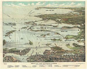
Bird's Eye View of Boston Harbor along the South Shore to Provincetown.
sold
- Digital Map Information
- Suitable for large format printing
- Full resolution TIFF file
- ICC color profile embedded
- Delivered instantly via download link
A remarkable 1918 color lithograph map and view of Boston Harbor from Boston to Provincetown. Includes all of Cape Cod Bay, Quincy Bay and Dorchester Bay with the communities of Boston, East Boston, South Boston, Dorchester, Quincy, Hough's Neck, ... (more details)
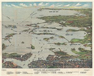
Birds Eye View of Boston Harbor Along the South Shore to Provincetown.
sold
- Digital Map Information
- Suitable for large format printing
- File Size: 15.97 MB
- File Type: ZIP / TIFF
- ICC color profile embedded
- Delivered instantly via download link
This is a remarkable 1920 chromolithograph map and view of the Boston Harbor from Boston to Provincetown. It covers all of Cape Cod Bay, Quincy Bay and Dorchester Bay with the communities of Boston, east Boston, south Boston, Dorchester, Quincy, ... (more details)
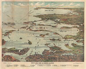
Bird's Eye View of Boston Harbor Along the South Shore to Provincetown.
sold
- Digital Map Information
- Suitable for large format printing
- File Size: 14.05 MB
- File Type: ZIP / TIFF
- ICC color profile embedded
- Delivered instantly via download link
This is a remarkable 1920 chromolithograph map and view of the Boston Harbor from Boston to Provincetown. It covers all of Cape Cod Bay, Quincy Bay and Dorchester Bay with the communities of Boston, east Boston, south Boston, Dorchester, Quincy, ... (more details)
Bird's-eye view of Boston Harbor.
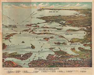
Bird's Eye View of Boston Harbor Along the South Shore to Provincetown.
sold
- Digital Map Information
- Suitable for large format printing
- Full resolution TIFF file
- ICC color profile embedded
- Delivered instantly via download link
This is a remarkable 1920 chromolithograph map and view of the Boston Harbor from Boston to Provincetown. It covers all of Cape Cod Bay, Quincy Bay, and Dorchester Bay with the communities of Boston, East Boston, South Boston, Dorchester, Quincy, Hough's Neck, Mingham, Nantucket, Duxbury, Plymouth, Cohasset, Scituate, and Provincetown noted. Many of the islands in Boston Harbor, including Moon Island, Spectacle Island, Thomson's Island, Long Island, Governor's Island, and others are also identified. An index in the bottom margin lists several other important places identified on the map. Ferry and steamboat routes are noted throughout. (more details)
Bird's-eye view of Boston Harbor.
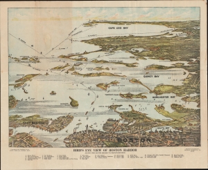
Bird's Eye View of Boston Harbor Along the South Shore to Provincetown.
sold
- Digital Map Information
- Suitable for large format printing
- File Size: 59.19 MB
- File Type: ZIP / TIFF
- ICC color profile embedded
- Delivered instantly via download link
This is a 1920 Union News map and view of the Boston Harbor from Boston to Provincetown. In the late 19th and early 20th century, such views were popular travel souvenirs sold at newsstands in train and ferry stations, as well as by newsboys onboard the trains and ferries themselves. (more details)
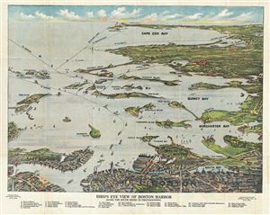
Birds Eye View of Boston Harbor Along the South Shore to Provincetown.
sold
- Digital Map Information
- Suitable for large format printing
- File Size: 15.5 MB
- File Type: ZIP / TIFF
- ICC color profile embedded
- Delivered instantly via download link
This is a remarkable 1920 chromolithograph map and view of the Boston Harbor from Boston to Provincetown. It covers all of Cape Cod Bay, Quincy Bay and Dorchester bay with the communities of Boston, east Boston, south Boston, Dorchester, Quincy, ... (more details)