
Van Loon, Harmanus (sold)

Harmanus van Loon (fl. c. 1690 - c. 1725) was a Flemish engraver active in Paris during the late 17th and early 18th centuries. Van Loon worked primarily in Paris and often signed his work, which includes maps and other engravings for such prominent cartographers as Nicolas de Fer, Jean Baptiste Nolin, Guillaume Delisle, and others. There is some speculation that he may have been related to the Brussels born painter Theodorus van Loon.
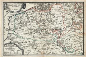
Pais Bas Catoliques Connues sous le nom de Flandre.
sold
- Digital Map Information
- Suitable for large format printing
- Full resolution TIFF file
- ICC color profile embedded
- Delivered instantly via download link
This is an attractive 1701 map of Flanders by Nicholas De Fer. The map depicts modern day Belgium and Luxemburg along with parts of Germany, France and Holland, a region commonly called Flanders at the time. It covers from Breda south as far as Thionville and ... (more details)
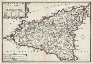
Isle et Royaume de Sicile.
sold
- Digital Map Information
- Suitable for large format printing
- Full resolution TIFF file
- ICC color profile embedded
- Delivered instantly via download link
A beautiful 1701 map of Sicily, Italy by Nicholas De Fer. It covers the Mediterranean Island in its entirety and renders the region in extraordinary detail offering both topographical and political information with mountains beautifully rendered in profile. ... (more details)
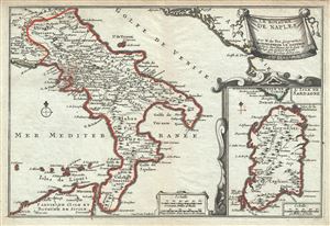
Le Royaume de Naples.
sold
- Digital Map Information
- Suitable for large format printing
- Full resolution TIFF file
- ICC color profile embedded
- Delivered instantly via download link
This is a scarce 1701 map of the Kingdom of Naples (officially the Kingdom of Sicily, although the Island of Sicily was not part of the kingdom since the 13th century), in southern Italy by Nicholas De Fer. It covers the southern part of Italy from Ascoli ... (more details)
The first edition of the first modern map of Arabia and the foundation of most subsequent maps of Arabia until the mid-18th century.
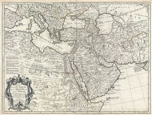
Carte de la Turquie de L'Arabie et de la Perse.
sold
- Digital Map Information
- Suitable for large format printing
- Full resolution TIFF file
- ICC color profile embedded
- Delivered instantly via download link
A scarce first edition first state example of Guillaume De L'Isle's 1701 map of Arabia, Turkey, and Persia. This is a foundational map and may be considered the first modern map of the Arabian Peninsula, in which the vagaries of the Ptolemaic era were ... (more details)
Uncommon early map of the West Indies.
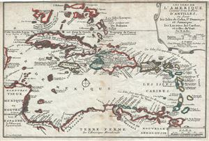
Les Isles de L'Amerique Connues sous le Nom D'Antilles, ou Sont les Isles de Cuba, St. Domingue et Jamaique les Lucayes, les Caribes, et celles du Vent.
sold
- Digital Map Information
- Suitable for large format printing
- Full resolution TIFF file
- ICC color profile embedded
- Delivered instantly via download link
This is a scarce and attractive 1702 map of the West Indies by Nicholas De Fer. It covers the Caribbean from the eastern coast of Yucatan east as far as Barbados and from the southern tip of Florida south to Trinidad and Tobago. Includes Cuba, the ... (more details)
Uncommon map of Asia illustrating the geographical confusions of the early 18th century.
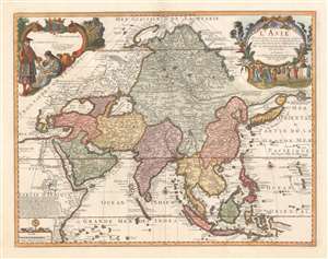
L'Asie dressée selon les dernières relations et suivant les nouvelles découvertes dont les points principaux sont placés sur les observations de Mrs. de l'Académie Royale des Sciences par N. de Fer.
sold
- Digital Map Information
- Suitable for large format printing
- Full resolution TIFF file
- ICC color profile embedded
- Delivered instantly via download link
A scarce 1705 separate issue Nicolas De Fer map of Asia dedicated to the children of France. The map features two decorative cartouches engraved by N. Guerard. Coverage on an unusual conical projection extends from the Mediterranean to the Philippine Archipelago (Archipel de St. Lazare), and from Nova Zembla to Java. The map embraces many of the confusions and misconceptions regarding the geography of Asia prevalent during the late 17th and late 18th centuries, among them a mismapping of the Caspian Sea, the apocryphal lake of Chiamay, and confusion regarding the seas north of Japan and the Siberian Arctic. (more details)
Uncommon map illustrating nascent French colonial expansionism before the French and Indian War.
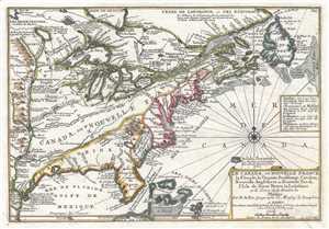
Le Canada, ou Nouvelle France La Floride, La Virginie, Pensilvanie, Caroline, Nouvelle Angleterre et Nouvelle Yorck, I'Isle de Terre Neuve, La Louisiane et le Courss de la Riviere de Misisipi.
sold
- Digital Map Information
- Suitable for large format printing
- DPI: 300
- File Size: 3.62 MB
- File Type: ZIP / TIFF
- ICC color profile embedded
- Delivered instantly via download link
This is a 1705 map of North America east of the Mississippi River by French cartographer Nicolas De Fer. Centered roughly on the Great Lakes and the Hudson Valley, this map depicts from the Mississippi River east to Newfoundland and the Grand ... (more details)
Uncommon map illustrating nascent French colonial expansionism before the French and Indian War.
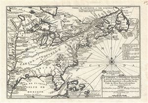
Le Canada, ou Nouvelle France La Floride, La Virginie, Pensilvanie, Caroline, Nouvelle Angleterre et Nouvelle Yorck, I'Isle de Terre Neuve, La Louisiane et le Courss de la Riviere de Misisipi.
sold
- Digital Map Information
- Suitable for large format printing
- DPI: 300
- File Size: 5.76 MB
- File Type: ZIP / TIFF
- ICC color profile embedded
- Delivered instantly via download link
This is a 1705 map of North America east of the Mississippi River by French cartographer Nicolas De Fer. Centered roughly on the Great Lakes and the Hudson Valley, this map depicts from the Mississippi River east to Newfoundland and the Grand ... (more details)
Highly decorative world map full of cartographic speculation.
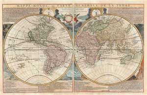
Mappe-Monde, ou Carte Generale de la Terre, divisée en deux himisphere suivant la Projection la plus commune ou tous les points principaux sont placez sur les observations de Mes. de L'Academie Royale Des Sciences.
sold
- Digital Map Information
- Suitable for large format printing
- DPI: 600
- File Size: 46.66 MB
- File Type: ZIP / TIFF
- ICC color profile embedded
- Delivered instantly via download link
An attractive example of Nicolas de Fer's c. 1718 map of the world in two hemispheres. This map is an intermediate proof state of a map first published in 1700. Note the empty cartouche at top center - representing a transitional phase between the 1708 and 1718 editions. The map features numerous interesting cartographic anomalies, among them 'California as an Island', a speculative pacific northwest and Siberian Arctic, and partial pre-Cook mappings of New Zealand, New Guinea, and Australia. The whole is surrounded by beautiful decorative engraving by Herman van Loon illustrating tides, volcanos, and extreme weather. (more details)