

Colton’s Persia Arabia
sold
- Digital Map Information
- Suitable for large format printing
- File Size: 3.11 MB
- File Type: ZIP / TIFF
- ICC color profile embedded
- Delivered instantly via download link
Map of Persia and Arabia from J. H. Colton's 1855 Atlas of the World. Covers Afghanistan, Iran, Iraq, Jordan, and the Arabian peninsula ( Saudi Arabia, Yemen, Kuwait, United Arab Emirates, and Oman). Map is a lithograph from a steel plate engraving. Details ... (more details)
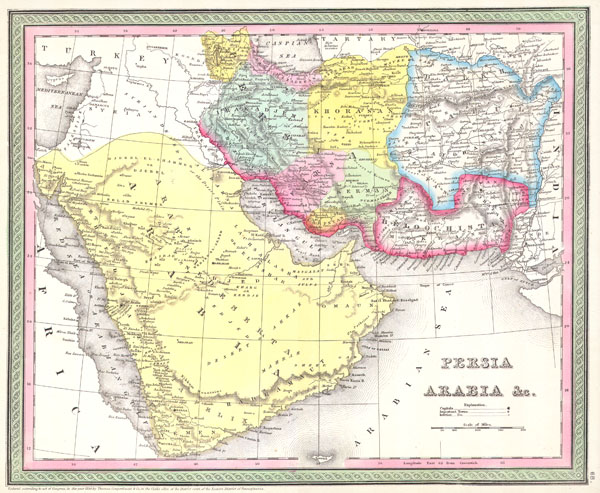
Persia, Arabia, and Afghanistan.
sold
- Digital Map Information
- Suitable for large format printing
- Full resolution TIFF file
- ICC color profile embedded
- Delivered instantly via download link
This beautiful hand colored map is a lithographic engraving of Persian and Arabia, dating to 1850, by the legendary American map publisher S.A. Mitchell, the elder. Includes what is today Saudi Arabia, Israel, Syria, Jordan, Iran, Iraq and Afghanistan. Many ... (more details)

Arabia, Egypt, and Ethiopia or Abyssinia.
sold
- Digital Map Information
- Suitable for large format printing
- File Size: 0.01 MB
- File Type: ZIP / TIFF
- ICC color profile embedded
- Delivered instantly via download link
This fine hand colored map is a steel plate lithograph depicting Arabia ( Arabian Peninsula ), Egypt and Ethiopia or Abyssinia in ancient times. Includes the ancient, almost mythical, kingdom of Axum in northern Ethiopia – birthplace of the Queen of Sheba ... (more details)

Greece
sold
- Digital Map Information
- Suitable for large format printing
- Full resolution TIFF file
- ICC color profile embedded
- Delivered instantly via download link
This hand colored map is a copper plate engraving, dating to 1850 by the legendary American Mapmaker S.A. Mitchell, the elder. It represents the southern portion of what is today Greece from Macedonia to the Peloponnesus and includes many of the islands in ... (more details)

Johnson’s Cuba, Jamaica, and Porto Rico.
sold
- Digital Map Information
- Suitable for large format printing
- File Size: 2.74 MB
- File Type: ZIP / TIFF
- ICC color profile embedded
- Delivered instantly via download link
This is a beautifully hand colored 1861 map of the West India islands of Cuba, Jamaica and Puerto Rico by A. J. Johnson. Covers from the Florida Keys south through the Cayman Islands to Jamaica and west to the Bahamas. There is an inset map of Puerto ... (more details)

A Comparative View of the Principal Waterfalls, Islands, Lakes, Rivers and Mountains in the Western Hemisphere.
sold
- Digital Map Information
- Suitable for large format printing
- Full resolution TIFF file
- ICC color profile embedded
- Delivered instantly via download link
This is Tallis's c. 1850 chart of comparative geographic features for the Western Hemisphere. Shows the islands of New Zealand, Cuba, Iceland etc., the Great Lakes and others, the rivers Mississippi, St Lawrence and Amazon and the mountains with the ... (more details)
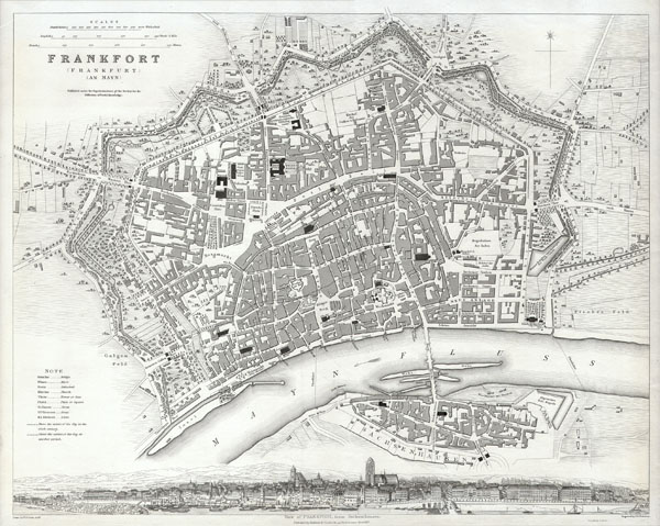
Frankfort, Germany.
sold
- Digital Map Information
- Suitable for large format printing
- Full resolution TIFF file
- ICC color profile embedded
- Delivered instantly via download link
This map is a steel plate engraving, dating to 1837 and published by the S.D.U.K. or 'The Society for the Diffusion of Useful Knowledge.' It represents the world famous German city of Frankfort or Frankfurt. All important buildings, bridges, and ... (more details)
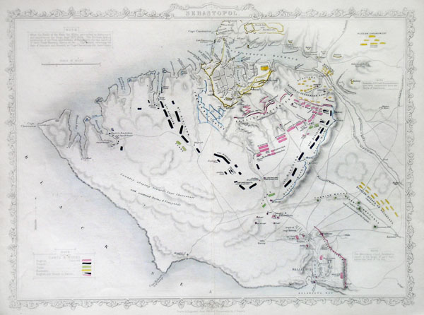
Siege of Sebastopol
sold
- Digital Map Information
- Suitable for large format printing
- File Size: 1.34 MB
- File Type: ZIP / TIFF
- ICC color profile embedded
- Delivered instantly via download link
This hand colored map is a copper plate engraving of the city of Sebastopol, Russia. It depicts the city and areas surrounding Sebastopol & Balaklava (western Crimean Peninsula) in incredible detail. Sebastopol's place in history was cemented ... (more details)

United States No. 2.
sold
- Digital Map Information
- Suitable for large format printing
- File Size: 1.92 MB
- File Type: ZIP / TIFF
- ICC color profile embedded
- Delivered instantly via download link
This hand colored map depicts the western half of the United States including Texas, Arizona, California, Utah and Nevada. The map was made in 1864 by the English mapmaker Mackenzie. It shows Arizona extending into what is today Southern ... (more details)

Johnson’s Cuba, Jamaica, and Porto Rico.
sold
- Digital Map Information
- Suitable for large format printing
- File Size: 4.8 MB
- File Type: ZIP / TIFF
- ICC color profile embedded
- Delivered instantly via download link
This is a beautifully hand colored 1864 map of the West India islands of Cuba, Jamaica and Porto Rico by A. J. Johnson and Ward. Covers from the Florida Keys south through the Cayman Islands to Jamaica and west to the Bahamas. Each ... (more details)
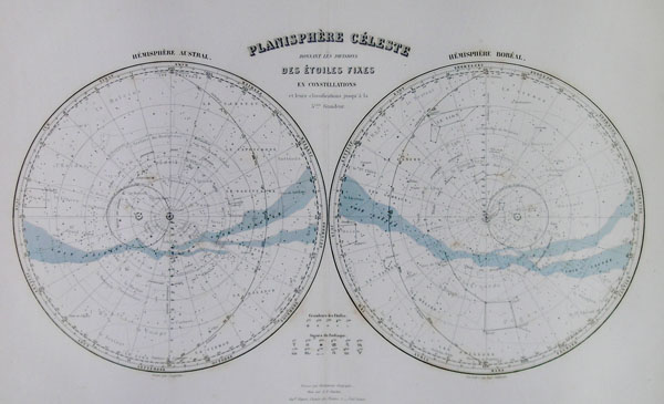
Planisphere Celeste Donnant Les Divisions Des Etoiles Fixes en Constellations et leurs classifications jusqua'a la 5eme Grandeur.
sold
- Digital Map Information
- Suitable for large format printing
- Full resolution TIFF file
- ICC color profile embedded
- Delivered instantly via download link
This hand colored celestial map of the Stars and Constellations is a steel plate engraving, dating to 1878 by the well regarded French cartographer Migeon. This map depicts the night skies of both the northern and southern ... (more details)
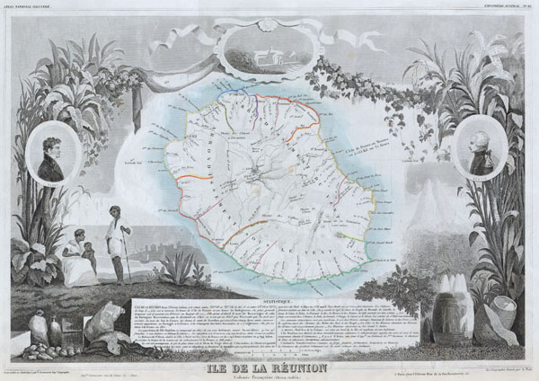
Ile de La Reunion Colonie Francaise (ocean indien)
sold
- Digital Map Information
- Suitable for large format printing
- Full resolution TIFF file
- ICC color profile embedded
- Delivered instantly via download link
This is a fascinating 1850 map of the French island colony of Reunion in the Indian Ocean, off the coast of Madagascar. Depicts the island in moderate detail with both political and geographical indications. The whole is ... (more details)

Turkey in Asia.
sold
- Digital Map Information
- Suitable for large format printing
- Full resolution TIFF file
- ICC color profile embedded
- Delivered instantly via download link
This beautiful hand colored map is a lithographic engraving of Turkey in Asia, dating to 1849. Beautiful map depicts most of modern day nations of Turkey, Iran, Iraq, Israel, Palestine, Jordan, Syria, Lebanon and ... (more details)
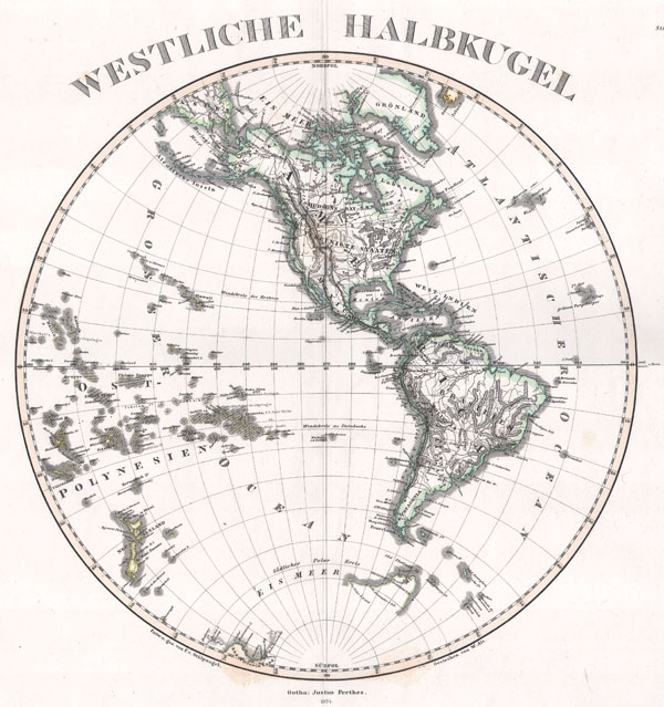
Westliche Halbkugel
sold
- Digital Map Information
- Suitable for large format printing
- File Size: 3.26 MB
- File Type: ZIP / TIFF
- ICC color profile embedded
- Delivered instantly via download link
This superb map is a copperplate engraving, dating to 1873 by the famed German mapmaker Adolf Stieler, describing the Western hemisphere. All national and political boundaries are clearly outlined in vibrant ... (more details)

Salem, Massachusettes.
sold
- Digital Map Information
- Suitable for large format printing
- Full resolution TIFF file
- ICC color profile embedded
- Delivered instantly via download link
This hand-colored map is a steel-plate engraving, dating to 1873 by the American mapmakers Walling & Gray. It represents the city of Salem Massachusetts. Salem is infamous for the horrifying Salem ... (more details)
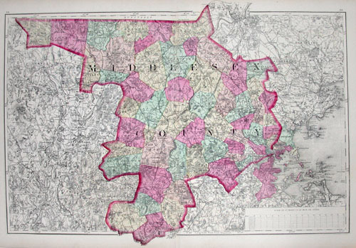
Middlesex County.
sold
- Digital Map Information
- Suitable for large format printing
- Full resolution TIFF file
- ICC color profile embedded
- Delivered instantly via download link
This hand-colored map is a steel-plate engraving, dating to 1873 by the American mapmakers Walling & Gray. It represents Middlesex County, Massachusetts. Middlesex County includes the immediate ... (more details)

Mittel-Ostliches Deutschland enthalt Preuss. Prov. Schlesien, dan die Oesterreich Kronlander Kgr. Bohemen, Markgrafschaft Mahren, Hezogth, Ober-u. Neider-Schlesien.
sold
- Digital Map Information
- Suitable for large format printing
- Full resolution TIFF file
- ICC color profile embedded
- Delivered instantly via download link
This fascinating hand colored map depicts Bohemia or modern day Czech Republic. Includes Bohmen, Schlesien and Mahren. All text is in German. Issued in the 1850 edition of Stieler's Hand ... (more details)
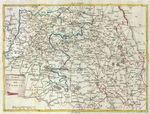
Parte settentrionale della Francia
sold
- Digital Map Information
- Suitable for large format printing
- Full resolution TIFF file
- ICC color profile embedded
- Delivered instantly via download link
This map is a hand colored depiction of central France ( the vicinity of Paris ) by an A. Zatta. Map depicts France from Chartes in the West to Langres in the Southeast to Verdun in the ... (more details)
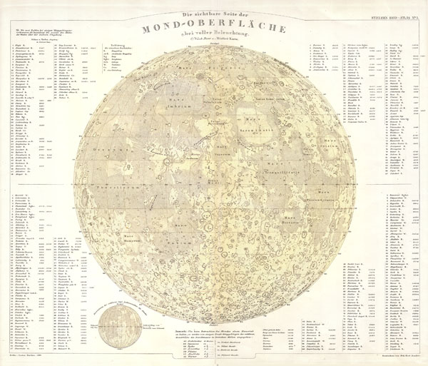
Die sichtbare Seite der Mone-Oberflache ebei voller Beleuchtung.
sold
- Digital Map Information
- Suitable for large format printing
- File Size: 5.03 MB
- File Type: ZIP / TIFF
- ICC color profile embedded
- Delivered instantly via download link
This fascinating hand colored map depicts the Moon. All major craters, seas, and other physical features are noted. All text in German. Published for Stieler's Hand Atlas, 1880 ... (more details)
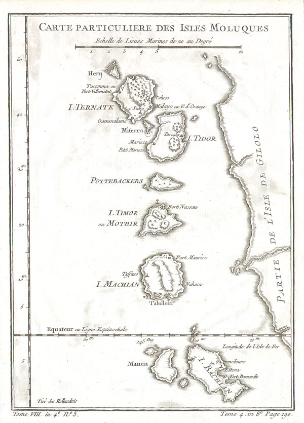
Carte Particuliere Des Isles Moluques.
sold
- Digital Map Information
- Suitable for large format printing
- Full resolution TIFF file
- ICC color profile embedded
- Delivered instantly via download link
This beautiful little map of the Moluques (also known as the Moluccas, Moluccan Islands or simply Maluku) was produced by the French Cartographer Jacques-Nicolas Bellin in 1760. ... (more details)