
State-of-the-art mapping of Lake Champlain at the outbreak of the French and Indian War.
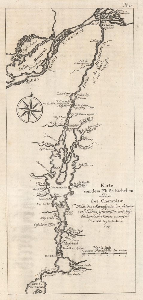
Karte von dem Fluße Richeliue und dem See Champlain Nach den Manuscripten des Schatzes von Karten Grüdrißen und Tagebüchern der Marine.
sold
- Digital Map Information
- Suitable for large format printing
- File Size: 3.14 MB
- File Type: ZIP / TIFF
- ICC color profile embedded
- Delivered instantly via download link
This is the 1756 German edition of the 1744 Bellin map of Lake Champlain and the St. Lawrence River. Bellin composed this map from French surveys conducted in the 1740s, making it one of the earliest accurate maps of Lake Champlain. This map was the state-of-the-art of Lake Champlain cartography and was the best available map of Lake Champlain at the outbreak of the French and Indian War (1754 - 1763) and the American Revolutionary War (1775 - 1783). Bellin's work was only supplanted when the British published Brassier's map in 1776. (more details)
Magini's First Latin Edition.
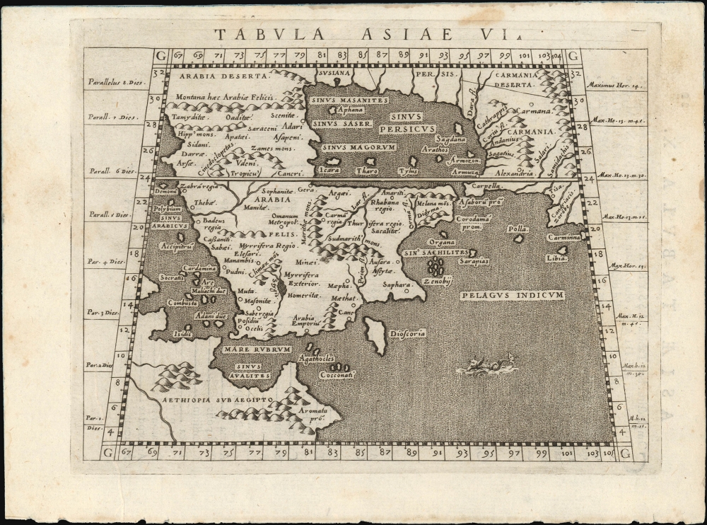
Tabula Asiae VI.
$650.00
Acquire
- Digital Map Information
- Suitable for large format printing
- Full resolution TIFF file
- ICC color profile embedded
- Delivered instantly via download link
This is Giovanni Antonio Magini's Ptolemaic map of Arabia, appearing in his first 1596 edition of Ptolemy's Geographia. This new translation, engraved by Girolamo Porro, was the most attractively executed small-format edition of the ancient geographic text. (more details)
One of America's First Golfing Communities.
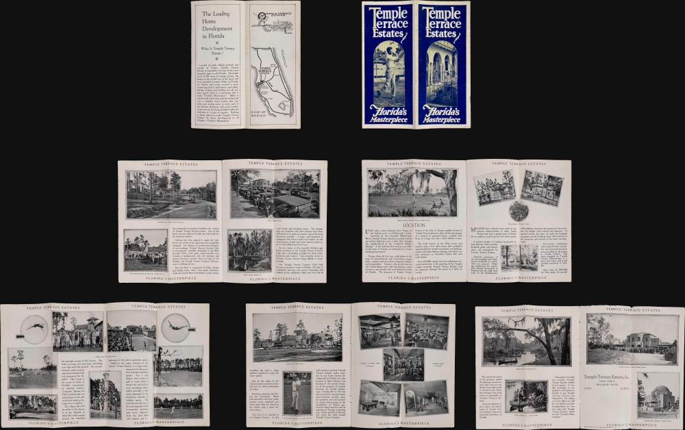
Temple Terrace Estates Florida's Masterpiece.
sold
A scarce c. 1925 brochure for Temple Terrace Estates, a suburban area located northeast of downtown Tampa along West Busch Boulevard. This development (incorporated as a city in 1925) holds historical significance as one of the earliest golfing communities in the United States and served as a model for later real-estate developments in Florida. (more details)
Florida's Chain of Opulent Hotel Resorts.

The Florida East Coast Hotel System St. Augustine Ponce de Leon, Alcazar, Cordova Ormond Hotel Ormond Palm Beach Royal Poinciana, Palm Beach Inn.
sold
This map and brochure is a 28-page pamphlet promoting tourism and hotels along Florida's Atlantic coastline, produced c. 1895 by the Florida East Coast Railway under superintendent of the hotel system, C. B. Knott. (more details)
High Desert and Higher Mountains.

Parts Of Eastern Nevada And Western Utah, Atlas Sheet No. 49.
$350.00
Acquire
- Digital Map Information
- Suitable for large format printing
- File Size: 24.13 MB
- File Type: ZIP / TIFF
- ICC color profile embedded
- Delivered instantly via download link
A detailed c. 1879 George Montague Wheeler survey map of northeastern Nevada and northwestern Utah, issue for the Topographical Atlas Projected to Illustrate United States Geographical Surveys West of the 100th Meridian of Longitude. It is one of the earliest detailed maps of this region and includes interesting details on the Native American and early American inhabitants of the area, including mines, ranches, and early settlements. (more details)
Key to the current Russo-Ukrainian War.

Bassin du Donetz.
sold
- Digital Map Information
- Suitable for large format printing
- File Size: 6.99 MB
- File Type: ZIP / TIFF
- ICC color profile embedded
- Delivered instantly via download link
This is a 1931 coal mining map of the Donbas, or Donets Basin, in Ukraine - today the focal point of the Russo-Ukrainian War (2014 - ?). The Donbas has been a key coal mining region since the 1870s. (more details)
Shortest-Safest-Fastest All Paved Highway North and South.

Travel U.S. 41 Highway Shortest-Safest-Fastest All Paved Highway North and South. / Scenic-Historical U.S. 41 Highway to the Land of Sunshine.
sold
- Digital Map Information
- Suitable for large format printing
- Full resolution TIFF file
- ICC color profile embedded
- Delivered instantly via download link
This is a c. 1939 U.S. 41 Highway Association of Georgia and Florida highway map of U.S. Highway 41. The map highlights the advertised route and includes information for travelers on the verso. (more details)
Recording the First Naval Battle of the American Revolution.

A Survey Of Lake Champlain, including Lake George, Crown Point And St. John. /A Particular Plan of Lake George.
sold
- Digital Map Information
- Suitable for large format printing
- File Size: 22.53 MB
- File Type: ZIP / TIFF
- ICC color profile embedded
- Delivered instantly via download link
This is a premier example of William Furness Brasier's 1762 map of Lakes Champlain and George, in its 1776 second state. The map overall is the first separate map of Lake Champlain and Lake George. Both this and its earlier state would certainly have been in the hands of the British officers leading the Fall 1777 campaign during the American Revolutionary War (1775 - 1783) culminating in a pivotal American victory at Saratoga. (more details)
Heart of British Strategy in the Revolutionary War.

A Topographical Map of Hudsons River, with the channels depth of water, rocks, shoals etc. and the country adjacent, from Sandy-Hook, New York and bay to Fort Edward, also the communication with Canada by Lake George and Lake Champlain, as high as Fort Chambly on Sorel River.
sold
- Digital Map Information
- Suitable for large format printing
- Full resolution TIFF file
- ICC color profile embedded
- Delivered instantly via download link
This is Claude Joseph Sauthier's scarce, magnificent 1776 map of the Hudson River, Lake George, and Lake Champlain: the linchpin of Great Britain's strategy to swiftly achieve victory in the American Revolution. Control of the strategic New York - Montreal corridor would have divided the colonies effectively, allowing Britain to defeat the Revolution piecemeal. (more details)
Foundational Map of the American West.

Map of Oregon and Upper California From the Surveys of John Charles Frémont.
sold
- Digital Map Information
- Suitable for large format printing
- File Size: 46.06 MB
- File Type: ZIP / TIFF
- ICC color profile embedded
- Delivered instantly via download link
A landmark 1848 map of the American West by John C. Frémont and Carl Preuss. In the words of Carl Wheat,
More than any other persons, John Charles Fremont and Charles Preuss dominate the cartography of the American West during the three years before the Gold Rush and brought a human tide surging into that land which had so long lain beyond the ken of most Americans. (Wheat, C. I., Mapping of the Transmississippi West, 1540 - 1861, 523).(more details)
One of the few route maps published during the war. An example with special provenance.

'Hell on Wheels' 1942 - 1943 - 1944. Second United States Armored Division.
sold
- Digital Map Information
- Suitable for large format printing
- Full resolution TIFF file
- ICC color profile embedded
- Delivered instantly via download link
A rarity in an underappreciated genre, this is the 1944/45 Marion E. Baker World War II Second Armored Division Pictorial Route Map of Europe. Two elements stand out from most World War II (1939 - 1945) route maps. One is the scope of the Second Armored Division campaign, including North Africa, Sicily, and Western Europe. The second is that, unlike most route maps, the present map was published during the war, making it a part of the war experience, instead of a post-war summary. (more details)
Bikini Atoll Nuclear Tests participant archive.
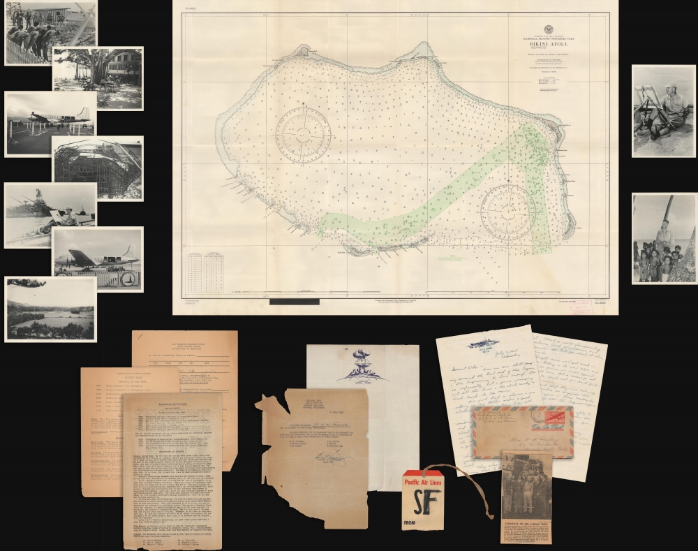
[Bikini Atoll Test Archive.]
sold
This is a 1946 document archive relating to Operation Crossroads, the first post-war nuclear test conducted by the United States. Compiled by W. Ward Fowler (one of the scientists who participated in the tests), these documents provide insight into a critical moment in the immediate aftermath of World War II (1939 - 1945) that helped usher in the Cold War. (more details)
Quintessential Vermont town.

West Randolph, Vt. 1886.
sold
- Digital Map Information
- Suitable for large format printing
- File Size: 24.89 MB
- File Type: ZIP / TIFF
- ICC color profile embedded
- Delivered instantly via download link
This is L. Burleigh's 1886 bird's-eye view map of Randolph, Vermont. (more details)
Earliest acquirable state of the Zeno map.
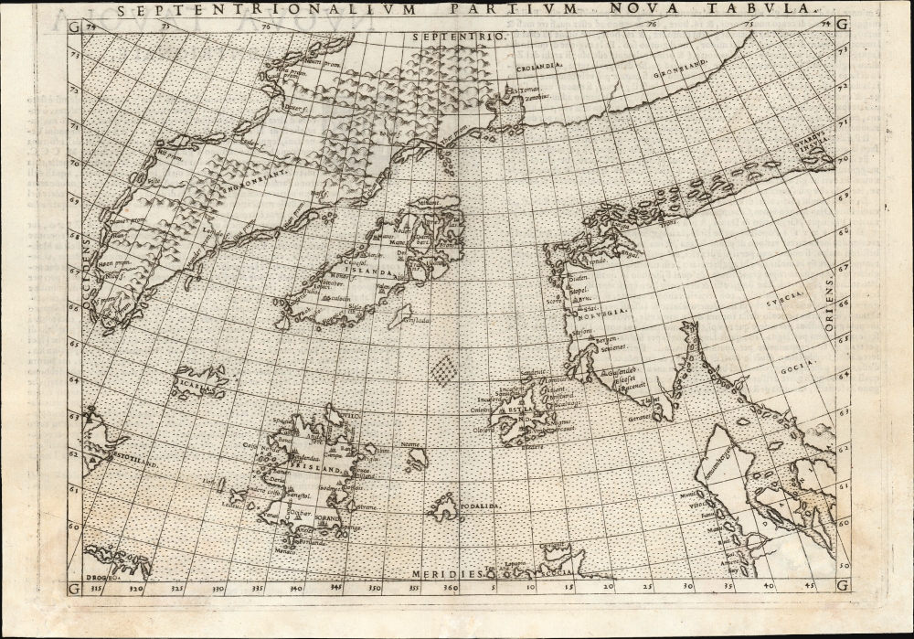
Septentrionalium Partium Nova Tabula.
$1,400.00
Acquire
- Digital Map Information
- Suitable for large format printing
- Full resolution TIFF file
- ICC color profile embedded
- Delivered instantly via download link
This is the most important map of Girolamo Ruscelli's 1561 - 1564 edition Ptolemy: the earliest acquirable iteration of Nicoló Zeno's 1558 Carta Da Navegar De Nicolo et Antonio Zeni Furono In Tramontana Lano MCCCLXXX, revealing the alleged 14th-century voyages of Zeno's ancestors, Nicoló and Antonio. Zeno's fraud, likely intended to enhance his political power in Venice and later embraced to co-opt the 1492 Columbia discovery of America, was responsible for the initial appearance and subsequent tenacity of the apocryphal islands Frisland, Icaria, Drogeo, and the coastline of Estotiland, which was taken by some of Europe's finest geographers to be the coast of Labrador. (more details)
Monumental Map of Milan.

[Milano.]
sold
- Digital Map Information
- Suitable for large format printing
- File Size: 1464.44 MB
- File Type: ZIP / TIFF
- ICC color profile embedded
- Delivered instantly via download link
A very large and one-of-a-kind case map of Milan and environs, produced around the time of the Revolutions of 1848, prepared by Francesco de Valmagini. (more details)
Between the First and Second Anglo-Carib Wars.

St. Vincent, from an Actual Survey made in the year 1775, after the Treaty with the Caribs.
sold
- Digital Map Information
- Suitable for large format printing
- File Size: 23.74 MB
- File Type: ZIP / TIFF
- ICC color profile embedded
- Delivered instantly via download link
This is the 1794 Laurie and Whittle map of Saint Vincent according to the treaty that ended the First Carib War (1769 - 1773) and a year before the outbreak of the Second Carib War (1795 - 1797). (more details)
A Brilliantly-Colored Example of an Early Colonial Map of North America.
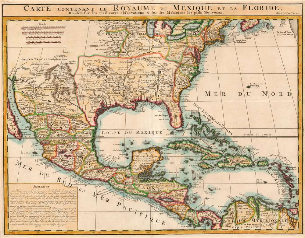
Carte Contenant le Royaume du Mexique et la Floride.
sold
- Digital Map Information
- Suitable for large format printing
- DPI: 600
- File Size: 19.34 MB
- File Type: ZIP / TIFF
- ICC color profile embedded
- Delivered instantly via download link
A charming 1719 Chatelain map of North America, Mexico, Central America, and the Caribbean. (more details)
One of the Earliest Tourist Maps of Lake Champlain.
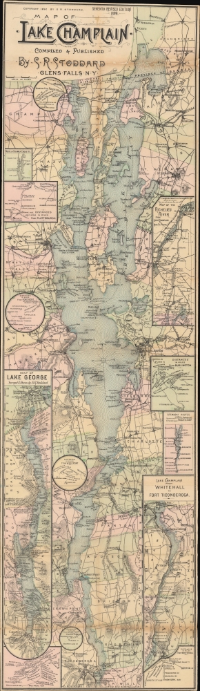
Map of Lake Champlain.
sold
- Digital Map Information
- Suitable for large format printing
- File Size: 21.34 MB
- File Type: ZIP / TIFF
- ICC color profile embedded
- Delivered instantly via download link
A scarce 1899 Seneca Ray Stoddard map of Lake Champlain. It was published at the height of the lake's late 19th-century popularity as a tourist destination. (more details)
Discoveries of Le Maire and Schouten.
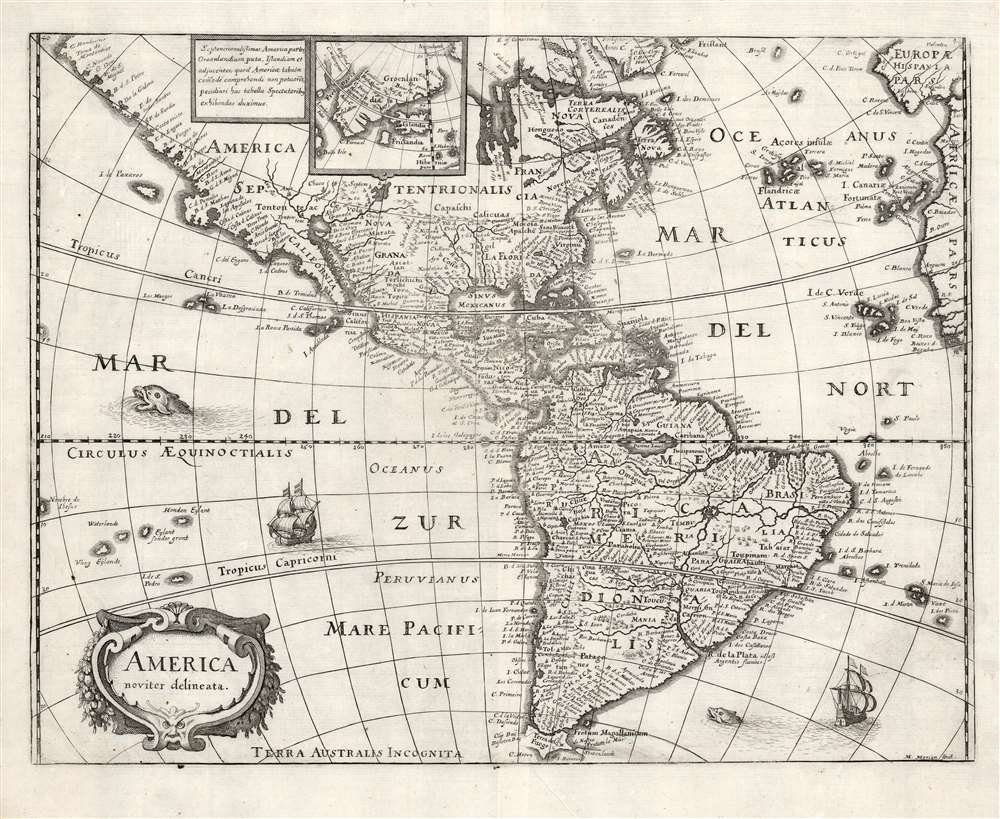
America noviter delineata.
sold
- Digital Map Information
- Suitable for large format printing
- DPI: 600
- File Size: 11.26 MB
- File Type: ZIP / TIFF
- ICC color profile embedded
- Delivered instantly via download link
This is a scarce 1638 Matthais Merian map of the Americas. The map offers a wealth of interesting cartographic tropes and ideas of the early 17th century: El Dorado, Norumbega, new islands in the Pacific, and more. (more details)
Superb example. Dramatic Map.
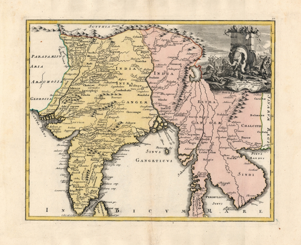
India Intra et Extra Gangem.
$850.00
Acquire
- Digital Map Information
- Suitable for large format printing
- Full resolution TIFF file
- ICC color profile embedded
- Delivered instantly via download link
An exceptional example of this 1720 map of India and Southeast Asia from Christoph Weigel's Descriptio Orbis Antiqui. The map shows the region according to early 18th-century topography but integrates with it the ancient, second-century toponomy from Claudius Ptolemy's Geographia. (more details)