
Intricately engraved and revolutionary city map or plan of Paris
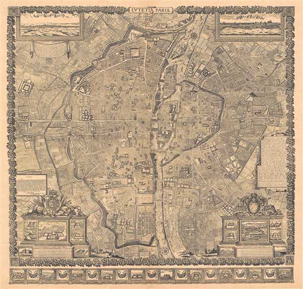
Lutetia Paris.
sold
- Digital Map Information
- Suitable for large format printing
- File Size: 16.64 MB
- File Type: ZIP / TIFF
- ICC color profile embedded
- Delivered instantly via download link
This is a reduction of a plan of Paris originally issued in 1652 by Jacques Gomboust. Gomboust held the position of Ingenieur du Roi and, in that capacity completed a number of important survey's of Paris which eventually evolved into this spectacular map. ... (more details)
Majestic and revolutionary multi panel wall map of Paris.

Lutetia Paris.
sold
- Digital Map Information
- Suitable for large format printing
- Full resolution TIFF file
- ICC color profile embedded
- Delivered instantly via download link
This majestic nine panel plan of Paris is the c. 1900 Taride reissue of an important map originally issued in 1652 by Jacques Gomboust. Gomboust held the position of Ingenieur du Roi and, in that capacity completed several important surveys of Paris which ... (more details)
The third episode in the 18th century British mapping of Bombay!
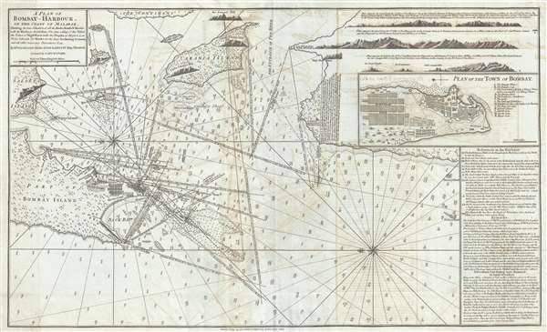
A Plan of Bombay-Harbour on th Coast of Malabar.
sold
- Digital Map Information
- Suitable for large format printing
- Full resolution TIFF file
- ICC color profile embedded
- Delivered instantly via download link
This is a fine example of Laurie and Whittle's 1794 nautical chart or maritime map of Bombay (Mumbai) Island, city, and harbor, India. This map is significant as the third major episode in the mapping of Bombay. The map covers from Salsette Island to the ... (more details)
Very rare Bird's-Eye View of Portland, Maine. Only 4 known examples.

Bird's Eye View of the City of Portland Maine, 1876.
sold
- Digital Map Information
- Suitable for large format printing
- File Size: 40.22 MB
- File Type: ZIP / TIFF
- ICC color profile embedded
- Delivered instantly via download link
An exceptional 1876 Bird's-Eye View Map of Portland, Maine, by Joseph Warner. One of only three known views by Warner, this is a dramatic aerial view of Portland as seen from the east looking west. The cartographer has identified some 90 locations, ... (more details)
De Wit's masterful sea chart of the West Indies during the Golden Age of Caribbean Piracy.
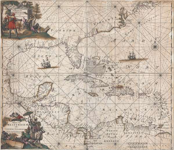
Indiarum Occidentalium Tractus Littorales cum Insulis Caribicis. / Pascaert van Westindien ende Caribise Eylanden.
sold
- Digital Map Information
- Suitable for large format printing
- DPI: 300
- File Size: 12.56 MB
- File Type: ZIP / TIFF
- ICC color profile embedded
- Delivered instantly via download link
A fine and rare old color example of the second edition of Frederick de Wit's 1680 nautical chart or maritime map of the West Indies, Central America, Gulf of Mexico, and Florida. Printed during the Golden Age of Caribbean Piracy, this sea chart ... (more details)
Rare political broadsheet calling for a Boston Oil Party to impeach Nixon and Big Business!

Tea Party! Citizens of Boston! Impeach Big Business Too!
sold
A fascinating 1973 political broadsheet of considerable rarity calling for the impeachment of President Nixon. This poster is the rallying promotional for the December 16, 1973 Boston 'Oil Party' sponsored by the People's Bicentennial Action ... (more details)
Remarkable example of New Hampshire Folk Art!

New Hampshire.
sold
- Digital Map Information
- Suitable for large format printing
- File Size: 1.49 MB
- File Type: ZIP / TIFF
- ICC color profile embedded
- Delivered instantly via download link
A stunning folk art manuscript pictorial map of central New Hampshire focusing on the historic inns, grand lodges, and sties of the Lake Winnipesauke / White Mountains region. The map is undated but, based upon some of the content, we are ... (more details)
Scarce map of the Pacific showing California as an Island as well as early exploration of New Zealand and Australia.
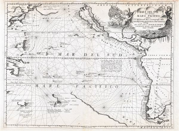
Mare del Svd, detto altrimenti Mare Pacifico.
sold
- Digital Map Information
- Suitable for large format printing
- DPI: 300
- File Size: 14.22 MB
- File Type: ZIP / TIFF
- ICC color profile embedded
- Delivered instantly via download link
An exceptional 1691 nautically styled map of the Pacific Ocean by the Venetian cartographer Vincenzo Maria Coronelli. Coronelli's map covers the Pacific from Japan to New Zealand and from New Guinea to Tiera Del Fuego and the Yucatan. The ... (more details)
The central office of the National Asylum for Disabled Volunteer Soldiers, now the Dayton Veterans Affairs Medical Center.

National Soldiers Home, Near Dayton, Ohio.
sold
- Digital Map Information
- Suitable for large format printing
- Full resolution TIFF file
- ICC color profile embedded
- Delivered instantly via download link
A rare 1878 Adolph Krebs chromolithograph view of the National Soldier's Home (National Asylum for Disabled Volunteer Soldiers) near Dayton, Ohio. The view looks west and slightly north on the campus of the National Soldier's Home from a ... (more details)
Japan's vision for the Pacific during World War II.

標準大東亞分圖 / Standard Map of the Great East Co-Prosperity Sphere.
sold
This is an important and rare full set of 20 maps from the 1943 Showa 18 World War II (WWII) Greater East Asian Co-Prosperity Sphere series. The series of maps covers from India to Hawaii and from Japan to Australia. Those areas of ... (more details)
Chart with nautical annotations for an East India voyage!
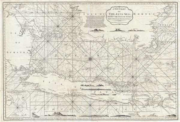
A New Chart of the Java Sea, within the Isles of Sunda; with its Straits and the Adjacent Seas.
sold
- Digital Map Information
- Suitable for large format printing
- DPI: 300
- File Size: 22.8 MB
- File Type: ZIP / TIFF
- ICC color profile embedded
- Delivered instantly via download link
This is a 1799 Laurie and Whittle nautical chart or maritime map of the Java Sea. The map depicts from southern Sumatra to the Straits of Makassar and from southern Borneo to Java, Bali (Bally), Lombok, western Sumbawa, and the Indian ... (more details)
The largest Japanese map of the world issued before the end of World War II
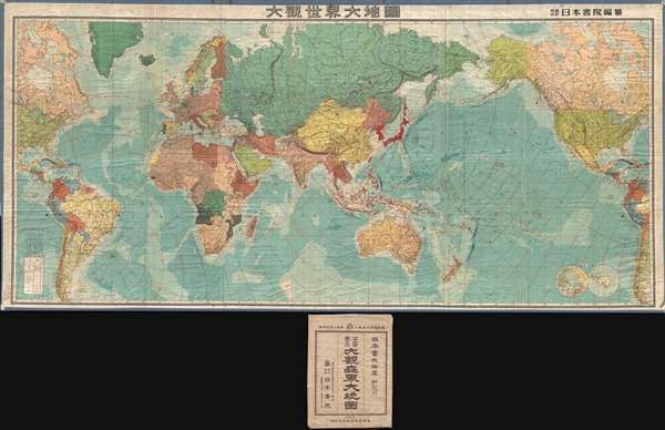
大觀世界大地圖 / Dàguān shìjiè dà dìtú. / Grand World Map.
sold
- Digital Map Information
- Suitable for large format printing
- File Size: 153.33 MB
- File Type: ZIP / TIFF
- ICC color profile embedded
- Delivered instantly via download link
A truly monumental 1945 World War II Era Japanese world map with its original slipcase. This map is enormous, measuring roughly 10 feet x 5 feet, or 3.15 x 1.5 meters. It is centered on the Dai Nippon Teikoku , or Greater Japanese ... (more details)
World War II Era Japanese map of Hawaii!

標準大東亞分圖 : ハワイ誻島 / Standard Map of the Great East Co-Prosperity Sphere. Hawaiian Islands.
sold
- Digital Map Information
- Suitable for large format printing
- File Size: 16.68 MB
- File Type: ZIP / TIFF
- ICC color profile embedded
- Delivered instantly via download link
This is a rare 1943 Showa 18 map Japanese World War II (WWII) map of Hawaii from the Greater East Asian Co-Prosperity Sphere series. The map details the major Hawaiian Islands with an inset of Honolulu and Pearl Harbor, and other ... (more details)
States that temporary changes due to war conditions have not been added to the chart.
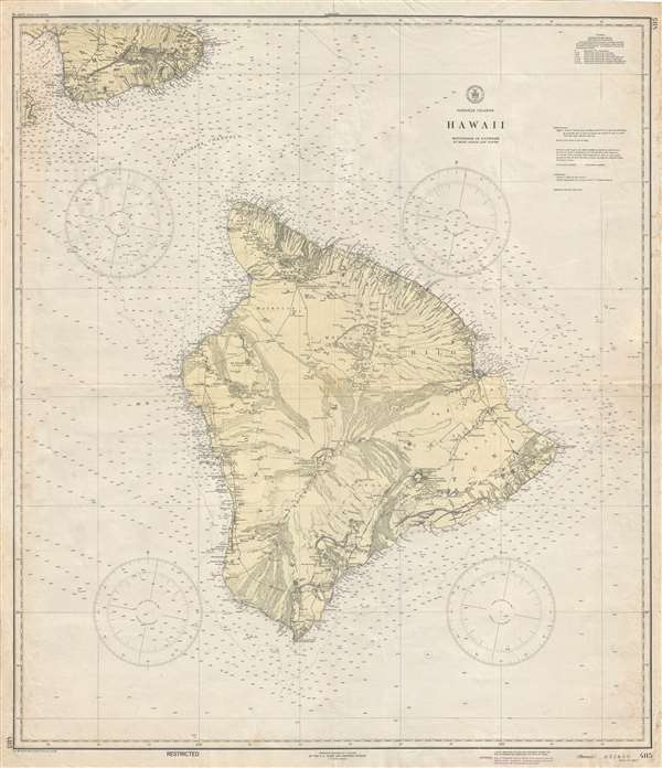
Hawaiian Islands Hawaii.
sold
- Digital Map Information
- Suitable for large format printing
- File Size: 21.92 MB
- File Type: ZIP / TIFF
- ICC color profile embedded
- Delivered instantly via download link
This is a 1944 U.S. Coast and Geodetic Survey map of Hawaii - the largest island in the Hawaiian Archipelago. The map depicts the entire island of Hawaii and the southern third of the island of Maui. Hawaii and Maui are ... (more details)
Situated on the world's longest straight line railway!

Cook. Queen City of Nullarbor. On the Long Straight. South Australia.
sold
- Digital Map Information
- Suitable for large format printing
- File Size: 14.08 MB
- File Type: ZIP / TIFF
- ICC color profile embedded
- Delivered instantly via download link
This is a c. 1960 map of Cook, Australia. The map depicts the continent of Australia, labeling all six provinces and several cities, including Sydney, Canberra, Melbourne, Darwin, and Perth. A sketch of a train, most ... (more details)
Depicts Candlestick Park!
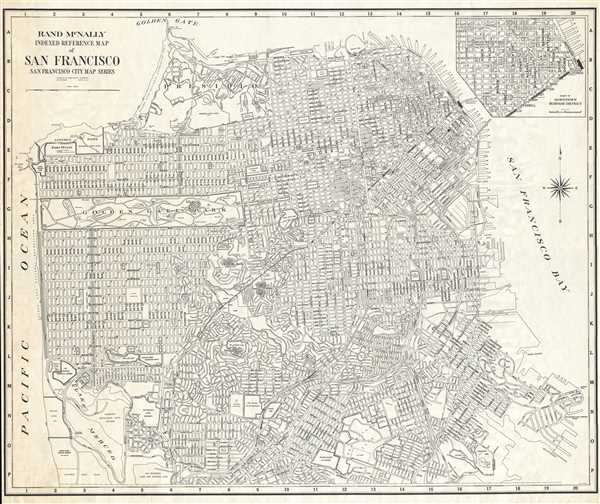
Rand McNally Indexed Reference Map of San Francisco San Francisco City Map Series.
sold
- Digital Map Information
- Suitable for large format printing
- File Size: 47.14 MB
- File Type: ZIP / TIFF
- ICC color profile embedded
- Delivered instantly via download link
This is a c. 1960 Rand McNally wall map or city plan of San Francisco. The map depicts the city of San Francisco from the Pacific Ocean to San Francisco Bay and from the Golden Gate Bridge to Candlestick Park (former ... (more details)
Labels the Wabash and Erie Canal.

Johnson's Indiana.
sold
- Digital Map Information
- Suitable for large format printing
- File Size: 12.66 MB
- File Type: ZIP / TIFF
- ICC color profile embedded
- Delivered instantly via download link
This is Johnson and Ward's 1864 map of Indiana. It covers Indiana in full as well as parts of the adjacent states. Various towns, cities, rivers and several other topographical features are noted with relief shown ... (more details)
First elephant folio Johnson map of Ohio.

Johnson's Ohio.
sold
- Digital Map Information
- Suitable for large format printing
- File Size: 21.71 MB
- File Type: ZIP / TIFF
- ICC color profile embedded
- Delivered instantly via download link
This is an 1864 A. J. Johnson map of Ohio. This map depicts the state of Ohio from Indiana to Pennsylvania and from Lake Erie and Michigan to Kentucky and West Virginia. Myriad cities, towns are labeled, along with ... (more details)
Highly detailed map of the Caribbean.

Johnson's West Indies.
sold
- Digital Map Information
- Suitable for large format printing
- File Size: 9.75 MB
- File Type: ZIP / TIFF
- ICC color profile embedded
- Delivered instantly via download link
This is an 1864 A. J. Johnson map of the West Indies. The map depicts from Florida to Venezuela and from Honduras to Barbados, including the Bahamas, Cuba, Jamaica, Santo Domingo (Hispaniola), Porto Rico, and the ... (more details)
Inset of Charleston Harbor with Fort Sumter, engraved views of Chimney Rocks and Table Mountain.

Johnson's North and South Carolina.
sold
- Digital Map Information
- Suitable for large format printing
- File Size: 17.32 MB
- File Type: ZIP / TIFF
- ICC color profile embedded
- Delivered instantly via download link
This is an 1864 A. J. Johnson map of North America. North Carolina and South Carolina, offering a fascinating snapshot of these states during the American Civil War. The map depicts both states in full and ... (more details)