
Map of Tennessee featuring Knoxville and Nashville.

A New Map of Tennessee with its Roads and Distances from place to place along the Stage and Steam Boat Routes.
sold
- Digital Map Information
- Suitable for large format printing
- DPI: 300
- File Size: 7.64 MB
- File Type: ZIP / TIFF
- ICC color profile embedded
- Delivered instantly via download link
This is a fine example of Thomas Cowperthwait and S. A. Mitchell's 1854 map of Tennessee with two inset maps: environs of Nashville and Knoxville in the upper left and right quadrants, respectively. Steam Boat routes along with distances in tabular format are ... (more details)
Large inset of New Orleans.

A New Map of Louisiana with its Canals, Roads and Distances from place to place, along the Stage and Steam Boat Routes.
sold
- Digital Map Information
- Suitable for large format printing
- DPI: 300
- File Size: 7.39 MB
- File Type: ZIP / TIFF
- ICC color profile embedded
- Delivered instantly via download link
This is an extremely attractive example of S. A. Mitchell's 1854 map of Louisiana. It depicts the entire state color coded according to individual counties. Shows canals and roads with notations regarding steamboat and overland mileage. A large inset in the ... (more details)
The state of Georgia with its roads.

A New Map of Georgia with its Roads & Distances.
sold
- Digital Map Information
- Suitable for large format printing
- DPI: 300
- File Size: 6.24 MB
- File Type: ZIP / TIFF
- ICC color profile embedded
- Delivered instantly via download link
A fine example of S. A. Mitchell's 1854 new map of Georgia. Through its elegant design, this map of Georgia centers our attention on the roads and railroads that crisscross the state. Steamboat routes and mileages are presented in tabular format in the lower ... (more details)
Pre Civil War map of South Carolina.

A New Map of South Carolina with its Canals, Roads & Distances from place to place along the stage & steam boat routes.
sold
- Digital Map Information
- Suitable for large format printing
- DPI: 300
- File Size: 6.91 MB
- File Type: ZIP / TIFF
- ICC color profile embedded
- Delivered instantly via download link
A fine example of Samuel Augustus Mitchell's important 1854 map of South Carolina. This map shows cities, topographical features, railways, ferries and roads with color coding at the county level. In addition to cartographic information this map is full of ... (more details)
Predates the 1862 separation of Virginia and West Virginia.

A New Map of Virginia with its Canals, Roads and Distances from place to place, along the Stage and Steam Boat Routes.
sold
- Digital Map Information
- Suitable for large format printing
- DPI: 300
- File Size: 6.82 MB
- File Type: ZIP / TIFF
- ICC color profile embedded
- Delivered instantly via download link
This is a fine example of S. A. Mitchell's 1854 map of Virginia. This map predates the 1862 separation of Virginia and West Virginia, and so contains both modern states in full as well as parts of adjacent Kentucky, Ohio, Maryland, and North Carolina. The ... (more details)
Mississippi on the cusp of the American Civil War.

Mississippi.
sold
- Digital Map Information
- Suitable for large format printing
- File Size: 7.25 MB
- File Type: ZIP / TIFF
- ICC color profile embedded
- Delivered instantly via download link
An excellent 1859 example of Colton's map of Mississippi. Like most of Colton's state maps, this map was derived from an earlier wall map of North America produced by Colton and D. Griffing Johnson. The movers the entire state of Mississippi as well as ... (more details)
Maps the crypts of ancient Popes and martyrs.

Plan der Catacombe St. Callixtus in Rom.
sold
- Digital Map Information
- Suitable for large format printing
- DPI: 300
- File Size: 12.69 MB
- File Type: ZIP / TIFF
- ICC color profile embedded
- Delivered instantly via download link
This is a scarce 1849 plan or map of the Catacombs of Callixtus in Rome. The detailed map covers the cemetery complex noting its subterranean galleries and recesses for individual Tombs. Surrounding the map are illustrations of various artifacts and scenes, as well as a plan the Church of St. Sebastian at the Catacombs. A numerical list to the left and right of the map proper references numbered locations on the map. (more details)
Shows the actual curvature of the Earth.
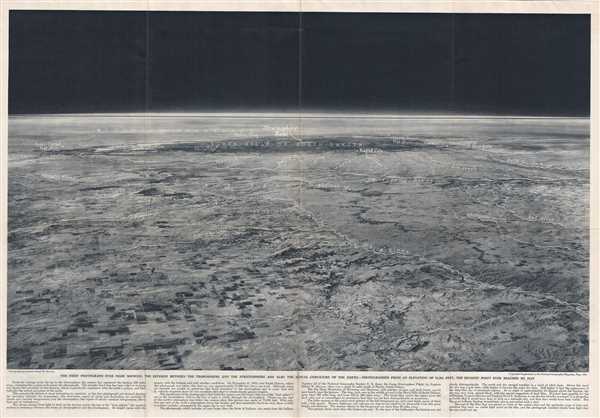
The first photograph ever made showing the division between the troposphere and the stratosphere and also the actual curvature of the Earth.
sold
This is a beautiful view issued as a supplement to the National Geographic Magazine in May, 1936. The image, taken from 72,395 feet above the surface of the Earth from a point approximately 35 miles south of Murdo, South Dakota, looks west towards the ... (more details)
Charming pictorial map of London intended for use by children.
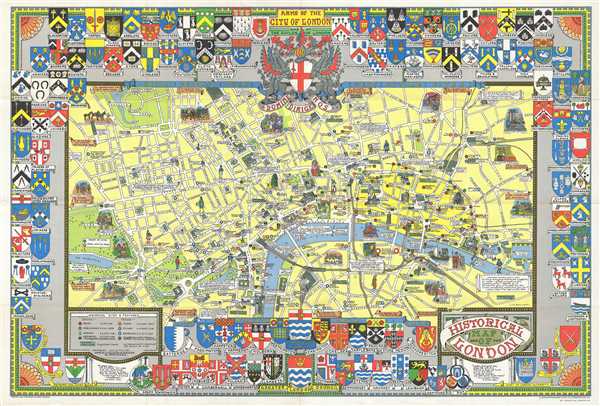
Historical Map of London.
sold
A colorful and attractive c. 1978 pictorial map of London printed by John Bartholomew & Sons. The historical map covers central London from Hyde Park to the London Docks and from Westminster to the Inner Circle in the Regent’s Park. Throughout, the ... (more details)
Wonderful pictorial view of Rome.

Pianta Panoramica di Roma.
sold
- Digital Map Information
- Suitable for large format printing
- File Size: 36.95 MB
- File Type: ZIP / TIFF
- ICC color profile embedded
- Delivered instantly via download link
A very compelling c. 1960 pictorial map of Rome, Italy, by Augusto Trabacchi. It covers the 'Eternal City' in incredible detail, revealing individual streets, parks, historic buildings, piazzas, temples, ancient ruins, bridges, rivers and ... (more details)
Historical sites identified.
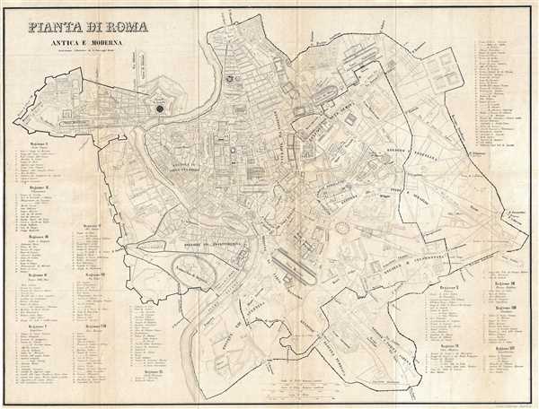
Pianta di Roma Antica E Moderna.
sold
- Digital Map Information
- Suitable for large format printing
- DPI: 300
- File Size: 10.46 MB
- File Type: ZIP / TIFF
- ICC color profile embedded
- Delivered instantly via download link
This is a beautiful c.1852 map depicting the city of Rome during ancient and modern times. Covers the entire city of Rome including the Vatican. Known as the birthplace of western civilization, Rome was the capital of the Roman Empire. The ... (more details)
Detailed map of Hong Kong and the New Territories.

Map of the Colony of Hong Kong and New Territory.
sold
- Digital Map Information
- Suitable for large format printing
- File Size: 5.05 MB
- File Type: ZIP / TIFF
- ICC color profile embedded
- Delivered instantly via download link
This is a lovely c.1920s map of Hong Kong and the New Territories. Extends from Kowloon and Junk Bay to the Startling Inlet and Crooked Harbor. Incredibly detailed, notes important roads, railways, hill paths, police stations, rivers, ... (more details)
Street map of Kowloon, Hong Kong.

Kowloon.
sold
- Digital Map Information
- Suitable for large format printing
- File Size: 3 MB
- File Type: ZIP / TIFF
- ICC color profile embedded
- Delivered instantly via download link
This is a lovely c.1920 map of Kowloon, Hong Kong. It covers from Tsim Sha Tsui north to Kau Lung Tsai. Offers nice street level detail, noting streets, parks, cemeteries, buildings, and other topographical features. The map was ... (more details)
Detailed map of western Victoria City in Hong Kong.

Western District of Victoria City.
sold
- Digital Map Information
- Suitable for large format printing
- File Size: 1.88 MB
- File Type: ZIP / TIFF
- ICC color profile embedded
- Delivered instantly via download link
This is a lovely c.1920 map of the western district of Victoria City, Hong Kong. It covers from Tai Ping Shan east to Kennedy Town. Offers nice street level detail, noting streets, parks, piers, buildings, and other ... (more details)
Detailed map of eastern Victoria City in Hong Kong.

Eastern District of Victoria City.
sold
- Digital Map Information
- Suitable for large format printing
- File Size: 2.27 MB
- File Type: ZIP / TIFF
- ICC color profile embedded
- Delivered instantly via download link
This is a lovely c.1920 map of the eastern district of Victoria City, Hong Kong. It covers from Causeway Bay to Wan Chai. Offers nice street level detail, noting recreation grounds, hills, valleys, and other ... (more details)
Lovely map of Hong Kong island.

A Map of the Roads and Hills of Hong Kong.
sold
- Digital Map Information
- Suitable for large format printing
- File Size: 3.75 MB
- File Type: ZIP / TIFF
- ICC color profile embedded
- Delivered instantly via download link
This is a beautiful c.1920 map of Hong Kong. It covers the island of Hong Kong and includes Lamma Island and Beaufort Island. The map notes roads, rivers, hills, railroads, and other topographical features. ... (more details)
Iconic humorous map satirizing the stereotypical insular Bostonian.
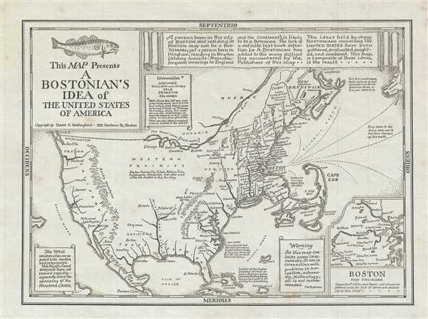
This Map Presents A Bostonian's Idea of the United States of America.
sold
This is a reduced edition of Wallingford’s 1936 humorous aggregate cognitive map 'Bostonian's View of the United States of America.' The map pokes fun at the stereotypical provincially minded Bostonian, ... (more details)
The first scientific topographical map of the Philippines and the most important map of the Philippines to appear in the 19th century.
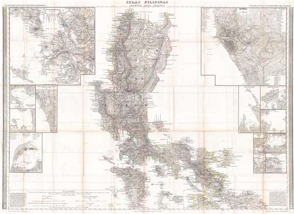
Islas Filipinas Primera Hoja Central.
sold
- Digital Map Information
- Suitable for large format printing
- DPI: 300
- File Size: 40.69 MB
- File Type: ZIP / TIFF
- ICC color profile embedded
- Delivered instantly via download link
A stunning 1849 Francisco Coello map of the Philippine Islands. This map is considered the first scientific topographical map of the Philippines and the most important map of the Philippines to appear in ... (more details)
Scarce early Japanese language map of Honolulu.

太平洋上之樂園ホツルル便覽圖. / Paradise on the Pacific. / 內案ルルノホ 部 内案客旅會年青 / How to see Honolulu.
sold
- Digital Map Information
- Suitable for large format printing
- File Size: 5.01 MB
- File Type: ZIP / TIFF
- ICC color profile embedded
- Delivered instantly via download link
An unusual c. 1885 Japanese guidemap to Honolulu, Hawaii. Oriented to the northeast, the map is centered on the Honolulu chapter of the YMCA and focuses on the surrounding downtown area, identifying ... (more details)
The first detailed western atlas map of Jiangsu Province and Shanghai Municipality featuring gold foiling.
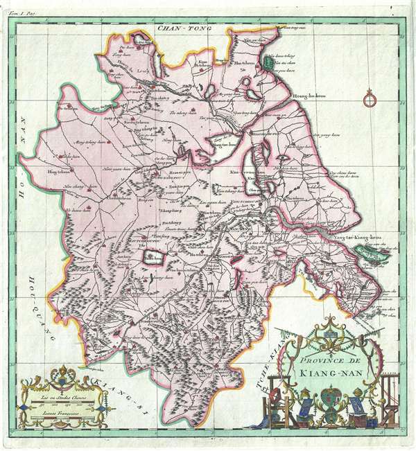
Province de Kiang-Nan.
sold
- Digital Map Information
- Suitable for large format printing
- DPI: 300
- File Size: 6.45 MB
- File Type: ZIP / TIFF
- ICC color profile embedded
- Delivered instantly via download link
A rare and important 1737 map of Kiang-Nan Province, China, by the prominent French cartographer Jean Baptiste Bourguignon d'Anville. Centered loosely on Nanjing, the map roughly covers the ... (more details)