
Beautiful map of Hungary and Romania.
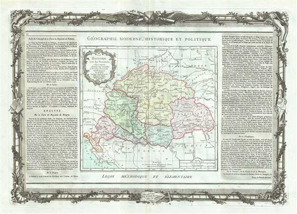
La Hongrie avec les Provinces adjacentes.
sold
- Digital Map Information
- Suitable for large format printing
- DPI: 300
- File Size: 14.23 MB
- File Type: ZIP / TIFF
- ICC color profile embedded
- Delivered instantly via download link
This is an attractive 1786 map of Hungary and Transylvania (modern day Romania) by French cartographer Louis Brion de la Tour. The map covers the region from the Carpathian Mountains south as far as the Danube River, including parts of modern day Hungary, Romania, ... (more details)
Poland following the First partition.

Etats de Pologne et de Lithuanie Divises par Palaunats et Provinces Ecclesiastiques Avec le Roiaume de Prusse et le Duche de Curlande.
sold
- Digital Map Information
- Suitable for large format printing
- DPI: 300
- File Size: 13.54 MB
- File Type: ZIP / TIFF
- ICC color profile embedded
- Delivered instantly via download link
This is a fine 1786 map of Poland and Lithuania by Brion de la Tour and Louis Charles Desnos. It covers modern day Poland, Lithuania, Latvia, Belarus, Ukraine, etc. The map depicts the Polish boundaries set following the First partition of Poland. Renders the ... (more details)
Sweden and Norway in the late 18th century.

La Suede et La Norwege Avec l'Islande.
sold
- Digital Map Information
- Suitable for large format printing
- DPI: 300
- File Size: 13.15 MB
- File Type: ZIP / TIFF
- ICC color profile embedded
- Delivered instantly via download link
This is a nice example of French cartographer Louis Brion de la Tour’s 1786 map of Scandinavia. Covers Sweden and Norway in beautiful detail and includes Iceland in a smaller inset in the top left quadrant of the map. Renders the entire region in ... (more details)
European Russia under Catherine the Great.

La Russie Europeenne.
sold
- Digital Map Information
- Suitable for large format printing
- DPI: 300
- File Size: 13.27 MB
- File Type: ZIP / TIFF
- ICC color profile embedded
- Delivered instantly via download link
This is a lovely 1786 map of European Russia by French cartographer Louis Brion de la Tour. It depicts the European portion of Russia extending from the Baltic Sea to the Ural Mountains and rendered the entire region in extraordinary detail ... (more details)
Early map of Southeast Asia identifies Singapore.

Chine, Et Indes Avec Les Isles.
sold
- Digital Map Information
- Suitable for large format printing
- DPI: 300
- File Size: 14.12 MB
- File Type: ZIP / TIFF
- ICC color profile embedded
- Delivered instantly via download link
This is an appealing 1786 map of India, Southeast Asia, China, and the East Indies by French cartographer Louis Brion de la Tour. Extends from the Indus River eastward to include India, Southeast Asia ((modern day Burma or Myanmar, Thailand ... (more details)
Sea of Korea identified.

L'Asie, dressee pour l'etude de la Geographie.
sold
- Digital Map Information
- Suitable for large format printing
- DPI: 300
- File Size: 14.25 MB
- File Type: ZIP / TIFF
- ICC color profile embedded
- Delivered instantly via download link
This is an attractive example of French cartographer Louis Brion de la Tour’s 1786 map of Asia. It covers from Africa and the Mediterranean east to Bering Strait and south as far as Java and New Guinea. This map is most interesting in its ... (more details)
Early map of European Turkey.
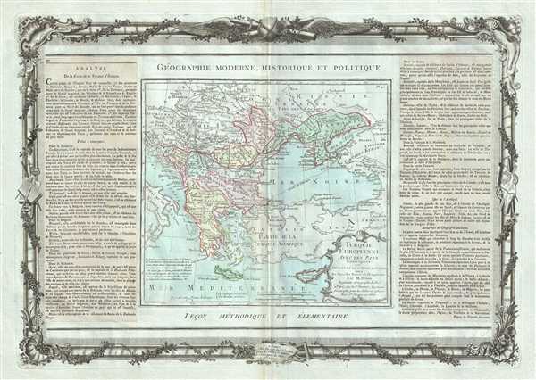
Turquie Europeenne, Avec Les Pays limitropes ou Theatre de la Guerre Actuelle.
sold
- Digital Map Information
- Suitable for large format printing
- DPI: 300
- File Size: 14.02 MB
- File Type: ZIP / TIFF
- ICC color profile embedded
- Delivered instantly via download link
This is a lovely 1786 example of French cartographer Louis Brion de la Tour’s map of European Turkey. The map covers from the boot of Italy eastward as far as Crimea and the Sea of Azov. It extends southwards to include Crete and Cyprus. ... (more details)
18th century map of the Arabian Peninsula and Persia.
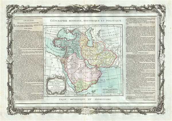
Perse, Turquie Asiatique et Arabie.
sold
- Digital Map Information
- Suitable for large format printing
- DPI: 300
- File Size: 13.37 MB
- File Type: ZIP / TIFF
- ICC color profile embedded
- Delivered instantly via download link
This is an appealing 1786 map of Persia, Arabia and Turkey by French cartographer Louis Brion de la Tour. It covers from the Mediterranean to the Indus River and includes the modern day nations of Saudi Arabia, Israel, Jordan, Turkey, ... (more details)
Detailed city plan of Paris.

Nouveau Plan De Paris Divise en Vingt Arrondisements.
sold
- Digital Map Information
- Suitable for large format printing
- File Size: 43.01 MB
- File Type: ZIP / TIFF
- ICC color profile embedded
- Delivered instantly via download link
This is a beautiful c. 1878 city plan or map of Paris, France by the French cartographer A. Vuillemin. Centered on the Seine River, it covers embastilled Paris as contained in the Thiers Wall. Parts of the Bois de Boulogne and the ... (more details)
Remarkable photographic archive illustrating Pre-War China from the perspective of an American navy man. Includes historically unknown images of graphic war events, General Chiang Kai-shek, and Chinese life.

Memory of my China Cruise.
sold
A unique photographic archive covering China and the Philippines in the years of 1927 – 1931, just prior to World War II. The photo archive contains hundreds of photos, loosely arranged thematically and chronologically, ... (more details)
One of the most beautiful, important, and enduring maps of Manhattan ever published.

Sanitary & Topographical Map of the City and Island of New York Prepared for the Council of Hygene & Public Health, of the Citizens' Association under the direciton of Egbert L. Viele, Topographical Engineer.
sold
- Digital Map Information
- Suitable for large format printing
- File Size: 30.96 MB
- File Type: ZIP / TIFF
- ICC color profile embedded
- Delivered instantly via download link
This is Egbert L. Viele's 1865 topography and waterways map of Manhattan, one of the scarcest, most important, and most enduring maps of New York City ever published. Covering the entirety of Manhattan Island, Viele's map ... (more details)
Exquisitely detailed large format nautical chart of Mount Desert Island (Acadia National Park) and Vicinity.
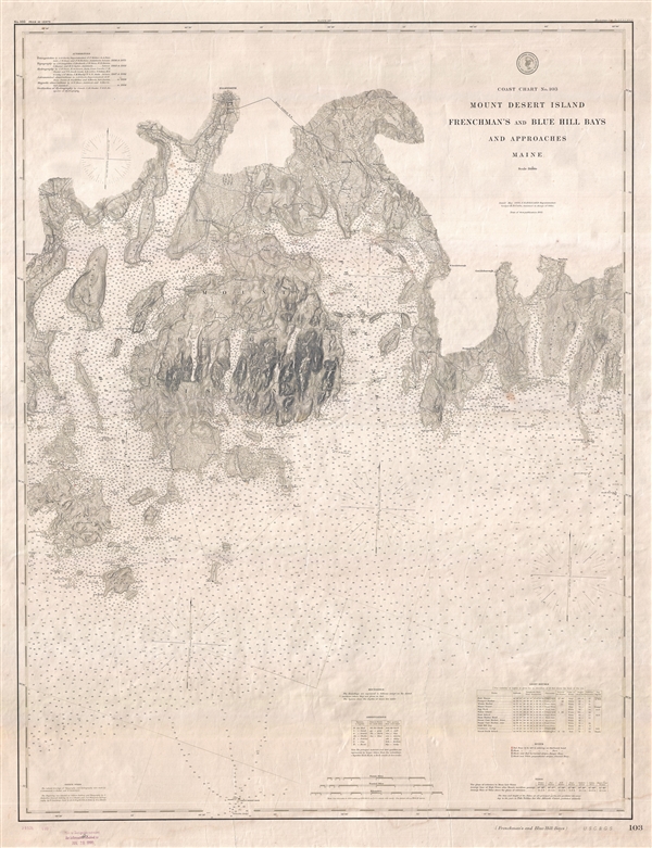
Coast Chart No. 103 Mount Desert Island Frenchman's and Blue Hill Bays and Approaches Maine.
sold
- Digital Map Information
- Suitable for large format printing
- File Size: 26.43 MB
- File Type: ZIP / TIFF
- ICC color profile embedded
- Delivered instantly via download link
A very rare independently issued 1883 (updated to 1895) U.S. Coast and Geodetic Survey nautical chart of Mount Desert Island and the adjacent Frenchman Bay and Blue Hill Bay. The map covers from North Sedgwick eastward ... (more details)
Iconic humorous map satirizing the stereotypical insular Bostonian.

A Bostonian's View of the United States of America.
sold
This is an enlarged later (1975) edition of Wallingford's 1936 humorous aggregate cognitive map 'Bostonian's View of the United States of America.' The map pokes fun at the stereotypical provincially minded Bostonian, ... (more details)
Signed Ernest Dudley Chase's 1938 extraordinarily detailed whimsical pictorial map of Boston and its vicinity.
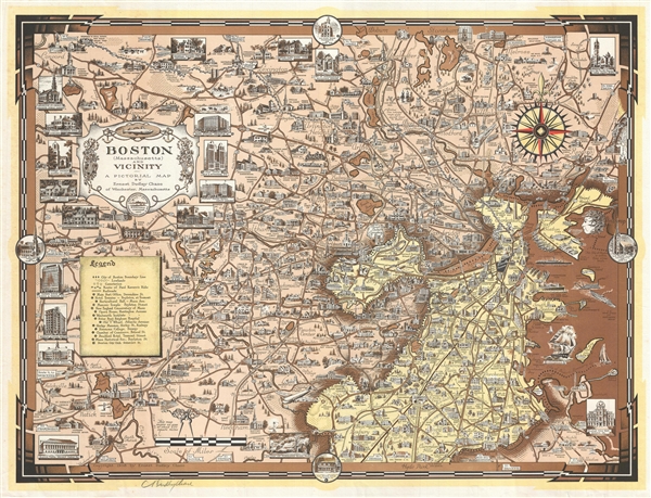
Boston (Massachusetts) and Vicinity. A Pictorial Map.
sold
- Digital Map Information
- Suitable for large format printing
- File Size: 14.38 MB
- File Type: ZIP / TIFF
- ICC color profile embedded
- Delivered instantly via download link
A fine example of Ernest Dudley Chase's 1938 extraordinarily detailed whimsical pictorial map of Boston and its vicinity. The map is roughly centered on Watertown and covers from Wayland to Boston Harbor and from ... (more details)
First editon of Pierre Mortier's fascinating world map based upon Sanson.
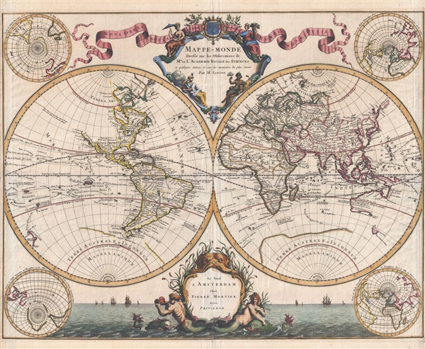
Mappe-Monde Dresse sur les Observations de Mrs. De L'Academie Royale des Sciences et quelques autres et sur les memories les plus recens.
sold
- Digital Map Information
- Suitable for large format printing
- DPI: 300
- File Size: 13.15 MB
- File Type: ZIP / TIFF
- ICC color profile embedded
- Delivered instantly via download link
Published by Pierre Mortier and attributed to the venerable Nicolas Sanson, this scarce first edition is a beautiful 1696 map of the world in two hemispheres. The map consists of two central hemispheres, eastern ... (more details)
The first and finest scientific map of the Fiji Islands.

Chart of the Viti Group or Feejee Islands by the U.S. Ex. Ex.
sold
- Digital Map Information
- Suitable for large format printing
- Full resolution TIFF file
- ICC color profile embedded
- Delivered instantly via download link
A beautiful example of Wilkes' 1840 map of the Fiji Islands. Considered to be the first accurate scientifically produced map of the Fiji Islands, this map includes three main islands, Vanua Levu, Viti Levu, and ... (more details)
Attractive nautical map of Monteray Bay
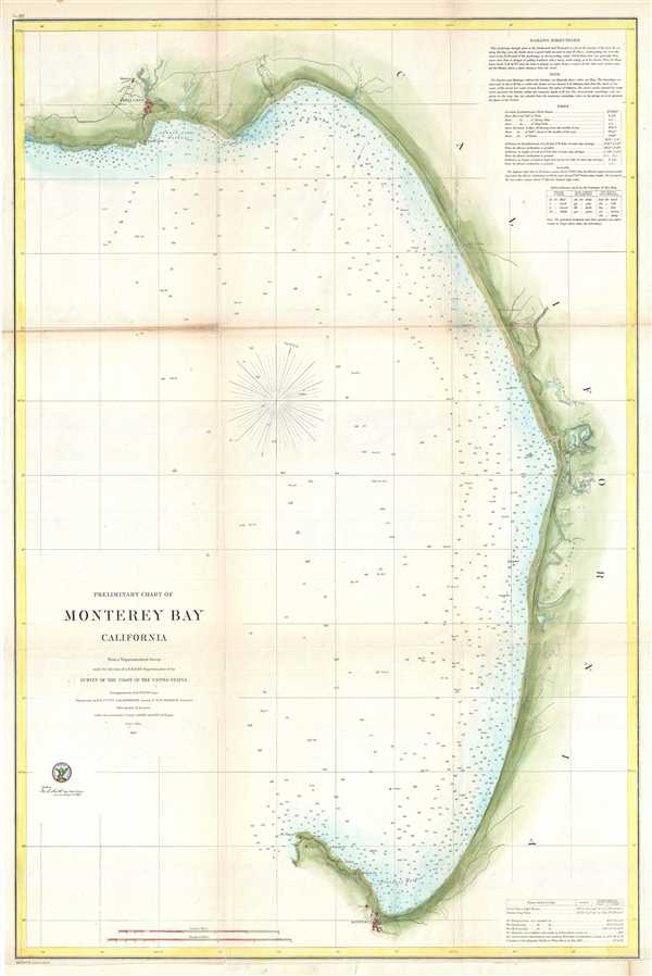
Preliminary Chart of Monterey Bay California.
sold
- Digital Map Information
- Suitable for large format printing
- File Size: 10.29 MB
- File Type: ZIP / TIFF
- ICC color profile embedded
- Delivered instantly via download link
This is an uncommon 1857 U.S. Coast Survey Chart or Map of Monterey Bay, California Covers from the town and mission of Santa Cruz, south to Monterey City and Point Pinos. Countless depth soundings ... (more details)
An important early mapping of the shoals off Nantucket.

(A No. 3) Preliminary Sketch Showing the positions of Davis's South Shoal and Other Dangers Recently Discovered by the Coast Survey and the sounding on the Old South Shoal, Bass Rip, Old Man, Pochick Rip etc.
sold
- Digital Map Information
- Suitable for large format printing
- DPI: 300
- File Size: 9.37 MB
- File Type: ZIP / TIFF
- ICC color profile embedded
- Delivered instantly via download link
This beautiful and important sea chart or map depicts the waters immediately surrounding the island of Nantucket, Massachusetts, including Davis' Shoal, Old South Shoal, and others. Uncommon, highly ... (more details)
Coast Survey chart of the Florida Peninsula.

Sketch F Showing the Progress of the Survey in Section VI. With a General Reconnaissance of the Western Coast of Florida 1848-51.
sold
- Digital Map Information
- Suitable for large format printing
- DPI: 300
- File Size: 4.58 MB
- File Type: ZIP / TIFF
- ICC color profile embedded
- Delivered instantly via download link
A beautiful coastal chart of Florida by the U. S. Coast Survey, 1851. Depicts the whole of the Florida peninsula, but specifically details the western coastline, showing all bays and harbors, as ... (more details)
Detailed map of Columbia River with nautical markings.
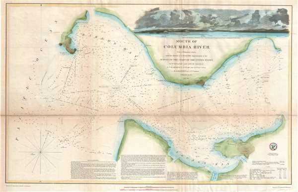
Mouth of Columbia River.
sold
- Digital Map Information
- Suitable for large format printing
- DPI: 300
- File Size: 12.21 MB
- File Type: ZIP / TIFF
- ICC color profile embedded
- Delivered instantly via download link
This is an attractive example of the U. S. Coast Survey's 1851 nautical chart or maritime map of the mouth of the Columbia River. The Columbia River, the largest river in the Pacific Northwest ... (more details)