
City plan of Copenhagen with beautiful profile view included.

Copenhagen (Kiobenhaven).
sold
- Digital Map Information
- Suitable for large format printing
- DPI: 300
- File Size: 7.54 MB
- File Type: ZIP / TIFF
- ICC color profile embedded
- Delivered instantly via download link
This is a beautiful 1837 first edition map or plan of the city of Copenhagen, Denmark prepared for publication by the Society for the Diffusion of Useful Knowledge, or S.D.U.K. It covers the capital city of Denmark from Freetown Christiania to Frederiksberg Have. ... (more details)
Beautiful city plan of the Netherlands capital city - Amsterdam.

Amsterdam.
sold
- Digital Map Information
- Suitable for large format printing
- DPI: 300
- File Size: 8.57 MB
- File Type: ZIP / TIFF
- ICC color profile embedded
- Delivered instantly via download link
This is an attractive 1835 first edition map or plan of the city of Amsterdam, Netherlands prepared for publication by the Society for the Diffusion of Useful Knowledge, or S.D.U.K. It covers the capital city of the Netherlands from the IJ southward. It depicts ... (more details)
1841 S.D.U.K. Subscriber's Edition Map of the Western Hemisphere and Eastern Hemisphere - set of 2 m
Beautiful two map set depicting the world according to hemispheres.
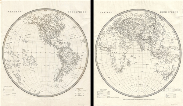
Eastern Hemisphere. Western Hemisphere.
sold
- Digital Map Information
- Suitable for large format printing
- DPI: 300
- File Size: 10.64 MB
- File Type: ZIP / TIFF
- ICC color profile embedded
- Delivered instantly via download link
This is a beautiful set of two 1841 first edition maps of the World on hemispherical projections by the Society for the Diffusion of Useful Knowledge or S.D.U.K. They depict the Western and Eastern Hemispheres offering a fascinating snapshot of the world ... (more details)
Beautiful two set map depicting Rome during ancient and modern times.

Plan of Ancient Rome. Plan of Modern Rome.
sold
- Digital Map Information
- Suitable for large format printing
- DPI: 300
- File Size: 12.05 MB
- File Type: ZIP / TIFF
- ICC color profile embedded
- Delivered instantly via download link
This is a beautiful set of the Society for the Diffusion of Useful Knowledge or S.D.U.K.’s 1830 first edition maps depicting the city of Rome during ancient and modern times. The first map (image top) depicts ancient Rome with the Wall of Aurelian and ... (more details)
Attractive map of western India and Pakistan.

India V.
sold
- Digital Map Information
- Suitable for large format printing
- DPI: 300
- File Size: 6.02 MB
- File Type: ZIP / TIFF
- ICC color profile embedded
- Delivered instantly via download link
This is an uncommon 1833 first edition example of the Society for the Diffusion of Useful Knowledge or S.D.U.K.’s map of the western parts of India. It covers from Beloochistan in modern day Pakistan to the Gulf of Cambay. Includes the Indus River ... (more details)
Attractive map showing Indian tribes in Mississippi.
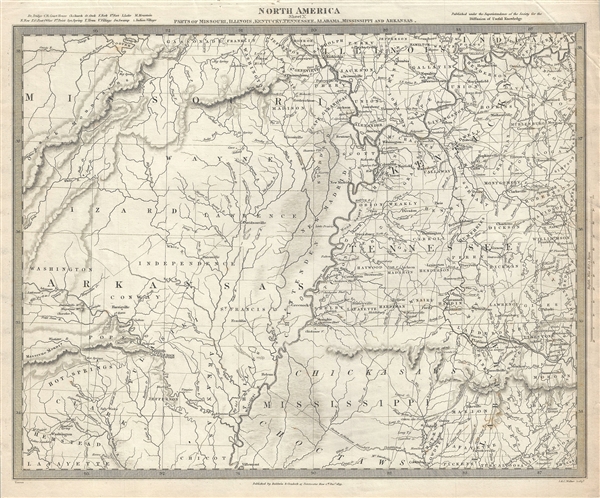
North America Sheet X Parts of Missouri, Illinois, Kentucky, Tennessee, Alabama, Mississippi and Arkansas.
sold
- Digital Map Information
- Suitable for large format printing
- DPI: 300
- File Size: 7.42 MB
- File Type: ZIP / TIFF
- ICC color profile embedded
- Delivered instantly via download link
An attractive 1833 first edition example of the Society for the Diffusion of Useful Knowledge or S.D.U.K. map of Arkansas, Missouri, Mississippi, Kentucky, Tennessee, Alabama and Illinois. The map covers from St. Clair in Missouri to Hempstead in ... (more details)
Map of Asia at a time when the continent was coming under increasingly imperial European sway.
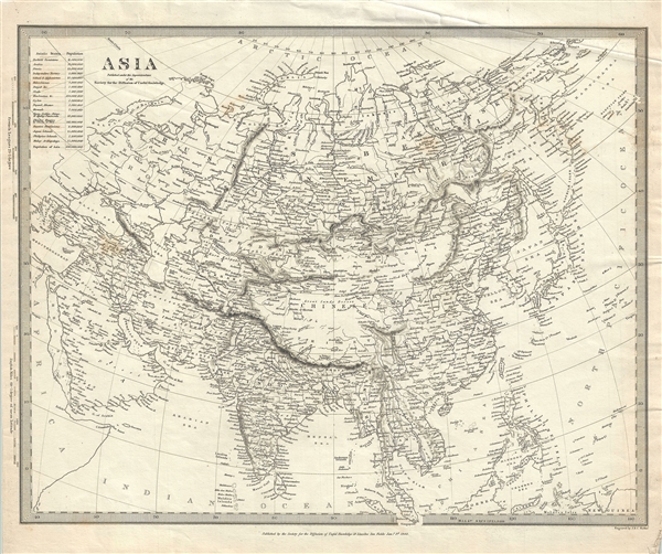
Asia.
sold
- Digital Map Information
- Suitable for large format printing
- DPI: 300
- File Size: 6.88 MB
- File Type: ZIP / TIFF
- ICC color profile embedded
- Delivered instantly via download link
This is a nice example of the Society for the Diffusion of Useful Knowledge or S.D.U.K.’s 1840 first edition map of Asia. It covers the entire continent from the Arctic Ocean to the Indian Ocean and from the Mediterranean Sea to the North ... (more details)
First edition map of Australia depicting early colonies.
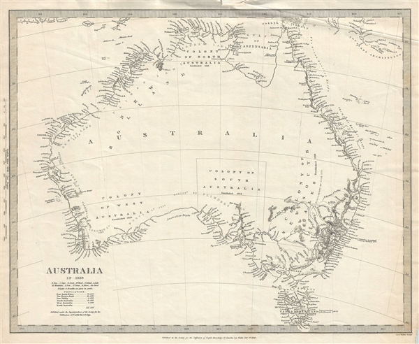
Australia in 1839.
sold
- Digital Map Information
- Suitable for large format printing
- DPI: 300
- File Size: 5.28 MB
- File Type: ZIP / TIFF
- ICC color profile embedded
- Delivered instantly via download link
This is the 1840 first edition map of Australia issued by the Society for the Diffusion of Useful Knowledge or S.D.U.K. It covers the entire continent of Australia along with Van Diemen's Land or Tasmania in 1839. An interesting map issued ... (more details)
Lovely first edition map depicting Louisiana, Arkansas, Mississippi and vicinity.
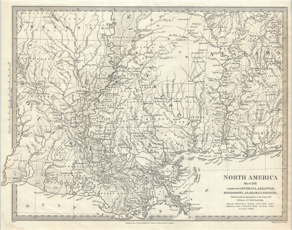
North America Sheet XIII Parts of Louisiana, Arkansas, Mississippi, Alabama and Florida.
sold
- Digital Map Information
- Suitable for large format printing
- DPI: 300
- File Size: 7.67 MB
- File Type: ZIP / TIFF
- ICC color profile embedded
- Delivered instantly via download link
This is an uncommon 1833 first edition of the Society for the Diffusion of Useful Knowledge or S.D.U.K. map of Mississippi, Louisiana and Alabama. It depicts a major portion of the states of Louisiana, Mississippi and Alabama, along with ... (more details)
First edition SDUK map issued by subscription.

North America Sheet XI Parts of North and South Carolina.
sold
- Digital Map Information
- Suitable for large format printing
- DPI: 300
- File Size: 7.48 MB
- File Type: ZIP / TIFF
- ICC color profile embedded
- Delivered instantly via download link
This is a lovely 1833 first edition map of North Carolina and South Carolina by the Society for the Diffusion of Useful Knowledge. The map covers part of North and South Carolina from Ashe County in North Carolina to the Atlantic Ocean. ... (more details)
Charming city plan of Edinburgh, Scotland.

Edinburgh.
sold
- Digital Map Information
- Suitable for large format printing
- DPI: 300
- File Size: 8.81 MB
- File Type: ZIP / TIFF
- ICC color profile embedded
- Delivered instantly via download link
This is a beautiful 1834 first edition map or plan of the city of Edinburgh, Scotland by the Society for the Diffusion of Useful Knowledge. Centered on Old Town, it covers the city of Edinburgh, known as the 'Athens of the North' in ... (more details)
Beautiful first edition city plan of St. Petersburg.

St. Petersburg [CAHKTIIETEPBYPTA].
sold
- Digital Map Information
- Suitable for large format printing
- DPI: 300
- File Size: 9.34 MB
- File Type: ZIP / TIFF
- ICC color profile embedded
- Delivered instantly via download link
This is a scarce 1834 first edition map or city plan of St. Petersburg, Russia, published by the Society for the Diffusion of Useful Knowledge. It covers the second largest city in Russia located on the Zayachii Ostrov in the Neva ... (more details)
Scarce first edition SDUK map of New York City 'issued by subscription'.

New York.
sold
- Digital Map Information
- Suitable for large format printing
- DPI: 300
- File Size: 7.17 MB
- File Type: ZIP / TIFF
- ICC color profile embedded
- Delivered instantly via download link
This is a scarce 1840 first edition map or city plan of New York City, published by the Society for the Diffusion of Useful Knowledge. The map covers southern Manhattan from the Battery northwards to 42nd street as well as portions ... (more details)
Details the coast of New England from Narragansett Bay to Casco Bay, including Cape Cod, Marthas Vineyard, and Nantucket.

Sketch A Showing the progress of the Survey in Section No. 1 from 1844 to 1861.
sold
- Digital Map Information
- Suitable for large format printing
- File Size: 13.03 MB
- File Type: ZIP / TIFF
- ICC color profile embedded
- Delivered instantly via download link
This is an attractive example of the 1861 U. S. Coast Survey map or triangulation chart of the New England coastline. It covers the coast line from Greenwich Bay (Rhode Island) eastward past Martha's Vineyard and Nantucket, then ... (more details)
One of the rarest and most desirable U.S. Coast Survey report maps of the Chesapeake Bay.

Sketch C Showing the Progress of the Survey in Section No. III From 1843 to 1851.
sold
- Digital Map Information
- Suitable for large format printing
- DPI: 300
- File Size: 17.27 MB
- File Type: ZIP / TIFF
- ICC color profile embedded
- Delivered instantly via download link
This is an exceptional example of the 1851 U.S. Coast Survey's progress chart of the Chesapeake Bay. The map covers from the mouth of the Susquehanna River southwards as far as Cape Henry and Norfolk. This chart includes both ... (more details)
An attractive Pre-WWII map of San Francisco showing proposed landfills.
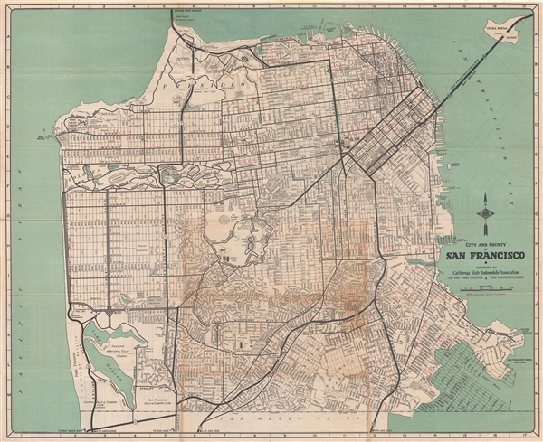
City and County of San Francisco.
sold
- Digital Map Information
- Suitable for large format printing
- File Size: 16.93 MB
- File Type: ZIP / TIFF
- ICC color profile embedded
- Delivered instantly via download link
An uncommon map of San Francisco dating to the years just prior to World War II. This map covers all of San Francisco from the Golden Gate to the border with San Mateo County. It shows major and minor roads, parks, and ... (more details)
One of the earliest maps of Brooklyn to adopt a north-south orientation.
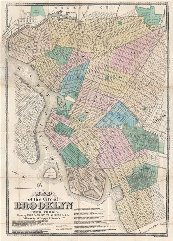
Map of the City of Brooklyn New York.
sold
- Digital Map Information
- Suitable for large format printing
- File Size: 14.98 MB
- File Type: ZIP / TIFF
- ICC color profile embedded
- Delivered instantly via download link
A rare 1873 map of Brooklyn New York by Matthew Drips. Unlike most maps of Brooklyn from this period, which were oriented to the west, Dripps adopts a more modern convention by orienting his map no the north – and in ... (more details)
An important Qing map of China that intentionally omits Ming allied Formosa.

大清国 / Dà Qīng Guó / Great Qing Empire
sold
- Digital Map Information
- Suitable for large format printing
- DPI: 300
- File Size: 16.8 MB
- File Type: ZIP / TIFF
- ICC color profile embedded
- Delivered instantly via download link
A very unusual Chinese language manuscript map of China under the early Qing (Ching / 清朝). The map covers from all of china from the Great Wall to the China Sea and the borders with Vietnam. This depiction most ... (more details)
A scarce early map of the Entrance to the Chesapeake drawn from original survey work by Mark Tiddeman.
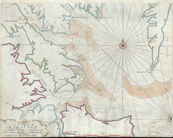
A Draught of Virginia from the Capes to York in York River and to Kuiquotan or Hamton in James River.
sold
- Digital Map Information
- Suitable for large format printing
- DPI: 300
- File Size: 13.39 MB
- File Type: ZIP / TIFF
- ICC color profile embedded
- Delivered instantly via download link
An important c. 1755 map of the Chesapeake Bay entrance by Mark Tiddemen. Oriented to the north, the map covers from the York River and Williamsburg to Norfolk and from Williamsburg to Cape Charles. It includes the ... (more details)
Unusual German map illustrating the outbreak of the American Revolutionary War to a French Audience.
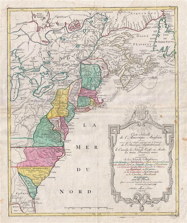
Carte Nouvelle de L'Amerique Angloise contenant tout ce que les Anglois possedent sur le Continent de L'Amerique Septentrionale savoir le Canada, la Nouvelle Ecosse ou Acadie, les treize Provinces unies
sold
- Digital Map Information
- Suitable for large format printing
- DPI: 300
- File Size: 17.72 MB
- File Type: ZIP / TIFF
- ICC color profile embedded
- Delivered instantly via download link
An uncommon 1776 Mathais Albrecht Lotter map of the United States on the cusp of the American Revolutionary War. Focused on the 13 original British Colonies, this map covers from Florida to Newfoundland and t Hudson ... (more details)