
Robert Baldwin and Cradock

Baldwin and Cradock (fl. c. 1810 - 1860) were London based publishers working in the early to mid 19th century. They are best known for their publication of the Society for the Diffusion of Useful Knowledge's ground breaking subscription atlas. They also published John Thomson's magnificent New General Atlas from 1814 - c. 1820. In addition to their cartographic corpus, the firm had wide ranging publishing interests in many other areas, including books, broadsides, and an investment in Blackwoods Magazine. They had their offices at 47 Paternoster Row, London, England. This firm also published under the imprint Baldwin, Cradock, and Joy and Cradock and Joy.
The Ohio Company of Associates and Virginia Military Tract.
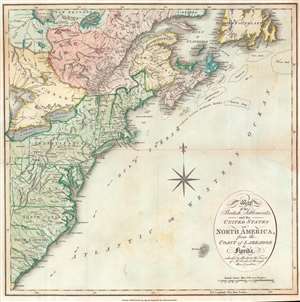
Map of the British Settlements, and the United States of North America, from the Coast of Labrador to Florida. Intended to illustrate the Travels of Mr. Lambert through those Countries.
$550.00
Acquire
- Digital Map Information
- Suitable for large format printing
- DPI: 600
- File Size: 12.55 MB
- File Type: ZIP / TIFF
- ICC color profile embedded
- Delivered instantly via download link
This is an 1813 Cradock and Joy map of the United States and Canada issued to accompany the first volume of John Lambert's Travels through Canada and the United States of America, in the years 1806, 1807, and 1808. Coverage extends along the Eastern Seaboard from the Gulf of St. Lawrence to roughly St. Augustine, Florida, embracing the Canadian Maritimes, the United States as far west as Ohio and Lake Erie. Of note, Washington D.C. is named, as the Federal government occupied the capital in 1800. (more details)
Before the momentous mid-19th century.
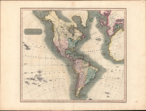
America.
$350.00
Acquire
- Digital Map Information
- Suitable for large format printing
- DPI: 600
- File Size: 709.93 MB
- File Type: ZIP / TIFF
- ICC color profile embedded
- Delivered instantly via download link
A striking example of John Thomson's 1813 map of the Americas. The America presented here predates the momentous events of the mid-19th century: the Mexican American War, the Gold Rush, and the Latin American Wars of Independence. (more details)
Happy Arabia.
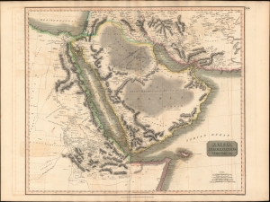
Arabia, Egypt, Abyssinia, Red Sea etc.
$550.00
Acquire
- Digital Map Information
- Suitable for large format printing
- DPI: 600
- File Size: 78.89 MB
- File Type: ZIP / TIFF
- ICC color profile embedded
- Delivered instantly via download link
This is an example of John Thomson's 1814 map of Arabia, Egypt, and Abyssinia. Centered on the Arabian Peninsula, Thomson's map covers from the eastern Mediterranean to the Horn of Africa, and from the Libyan Desert to Persia. The whole of this map is beautifully engraved in the minimalist English style pioneered in the early part of the 19th century. Relief is shown by hachure with towns, caravan routes, cities, and major topographical features identified. (more details)
The Indian Ocean and arteries of trade.
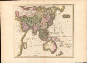
Asia.
$450.00
Acquire
- Digital Map Information
- Suitable for large format printing
- DPI: 600
- File Size: 64.28 MB
- File Type: ZIP / TIFF
- ICC color profile embedded
- Delivered instantly via download link
This is a first edition 1814 John Thomson map of Asia, the Indian Ocean, and Australia. (more details)
Australia with an unknown interior.
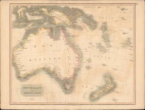
New Holland and Asiatic Isles.
$650.00
Acquire
- Digital Map Information
- Suitable for large format printing
- DPI: 600
- File Size: 707.73 MB
- File Type: ZIP / TIFF
- ICC color profile embedded
- Delivered instantly via download link
This a wonderful example of John Thompson's 1814 Map of Australia, New Zealand, New Guinea, and parts of Polynesia. (more details)
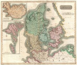
Denmark.
$350.00
Acquire
- Digital Map Information
- Suitable for large format printing
- DPI: 300
- File Size: 16.83 MB
- File Type: ZIP / TIFF
- ICC color profile embedded
- Delivered instantly via download link
This fascinating hand colored 1814 map depicts Denmark, Iceland and the Faeroe Islands. The whole is beautifully engraved in the minimalist English style pioneered in the early part of the 19th century. Thomson maps are known for their stunning color, awe ... (more details)
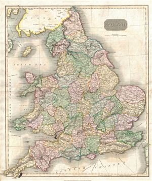
England.
$350.00
Acquire
- Digital Map Information
- Suitable for large format printing
- DPI: 300
- File Size: 19.16 MB
- File Type: ZIP / TIFF
- ICC color profile embedded
- Delivered instantly via download link
This hand colored 1814 map of England and Wales is beautifully engraved in the minimalist English style pioneered in the early part of the 19th century. Thomson maps are known for their stunning color, awe inspiring size, and magnificent detail. ... (more details)
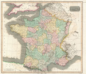
France.
$230.00
Acquire
- Digital Map Information
- Suitable for large format printing
- DPI: 300
- File Size: 8.85 MB
- File Type: ZIP / TIFF
- ICC color profile embedded
- Delivered instantly via download link
This hand colored map is a steel plate engraving, dating to 1814 by the important English mapmaker John Thomson. It depicts France divided into its color coded departments. Thomson maps are known for their stunning color, awe inspiring size, and ... (more details)
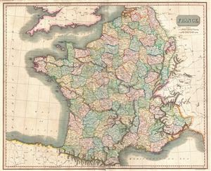
France.
$250.00
Acquire
- Digital Map Information
- Suitable for large format printing
- DPI: 300
- File Size: 19.53 MB
- File Type: ZIP / TIFF
- ICC color profile embedded
- Delivered instantly via download link
This hand-colored 1814 map by John Thomson details France the in year of Napoleon Bonaparte's defeat and subsequent imprisonment at Elba. One year later, Napoleon's escape and final defeat at Waterloo would end 22 years of almost continuous ... (more details)
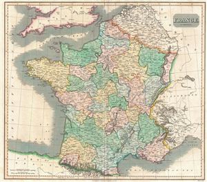
France in provinces.
$250.00
Acquire
- Digital Map Information
- Suitable for large format printing
- DPI: 300
- File Size: 17 MB
- File Type: ZIP / TIFF
- ICC color profile embedded
- Delivered instantly via download link
This hand colored map is a steel plate engraving, dating to 1814 by the important English mapmaker John Thomson. It depicts France divided into its color coded provinces. Until 1790 France was divided into 40 provinces based on local ... (more details)
The height of the British East India Company.
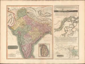
Hindoostan. / A View of the course of the Ganges...
$550.00
Acquire
- Digital Map Information
- Suitable for large format printing
- DPI: 600
- File Size: 77.31 MB
- File Type: ZIP / TIFF
- ICC color profile embedded
- Delivered instantly via download link
This is the 1814 first edition John Thomson map of India with inset maps of the Ganges River. This is the rarest of the Thomson India series, having appeared only in the first edition of his atlas. It is one of the finest atlas maps of India to appear in the early 19th century. (more details)
Before the exploration of the American West.
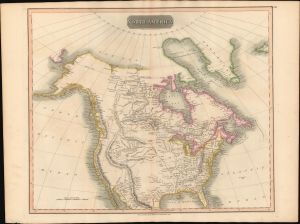
North America.
$500.00
Acquire
- Digital Map Information
- Suitable for large format printing
- DPI: 600
- File Size: 64.65 MB
- File Type: ZIP / TIFF
- ICC color profile embedded
- Delivered instantly via download link
This is John Thomson's 1814 map of North America. It is perhaps the best general atlas map of North America to appear in the 19th century. (more details)
Poland on the eve of Partition.
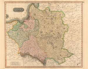
Poland.
$400.00
Acquire
- Digital Map Information
- Suitable for large format printing
- DPI: 600
- File Size: 78.93 MB
- File Type: ZIP / TIFF
- ICC color profile embedded
- Delivered instantly via download link
This is a fine example of John Thomson's 1814 map of Poland. It illustrates the lands of the former Polish-Lithuanian Commonwealth at the end of the Napoleonic Wars and on the cust of its partition betweem Russia, Prussia, and Austria. (more details)
Beautifully detailed map of Scandinavia.
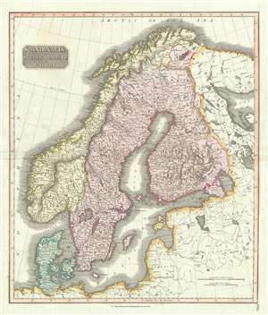
Scandinavia, or Sweden, Denmark and Norway.
$350.00
Acquire
- Digital Map Information
- Suitable for large format printing
- DPI: 300
- File Size: 16.31 MB
- File Type: ZIP / TIFF
- ICC color profile embedded
- Delivered instantly via download link
This fascinating hand colored 1814 map depicts Sweden, Denmark, and Norway. Modern day Finland, though included, was then part of the Kingdom of Sweden. Relief is shown by hachure with towns, cities, and major topographical features ... (more details)
Some 'doubtful' islands.
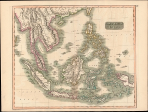
East India Isles.
$450.00
Acquire
- Digital Map Information
- Suitable for large format printing
- DPI: 600
- File Size: 720.5 MB
- File Type: ZIP / TIFF
- ICC color profile embedded
- Delivered instantly via download link
This is John Thomson's 1814 map of Southeast Asia and the East India Islands. (more details)
Some 'doubtful' islands.
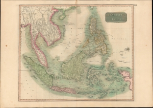
East India Isles.
$400.00
Acquire
- Digital Map Information
- Suitable for large format printing
- DPI: 600
- File Size: 49.65 MB
- File Type: ZIP / TIFF
- ICC color profile embedded
- Delivered instantly via download link
This is the first edition of John Thomson's 1814 map of Southeast Asia and the East India Islands. (more details)
Features a remarkable view of Mont Blanc.
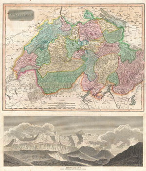
Swisserland. Mont Blanc Nearly Three Miles Above the Level of the Sea.
$300.00
Acquire
- Digital Map Information
- Suitable for large format printing
- DPI: 300
- File Size: 19.67 MB
- File Type: ZIP / TIFF
- ICC color profile embedded
- Delivered instantly via download link
This is an excellent example of John Thomson's 1814 map of Switzerland according to its division into 26 constituent Cantons under the 1648 Treaty of Westphalia. Features a splendid view of Mont Blanc in the lower quadrants. This ... (more details)
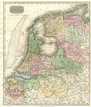
Holland.
$250.00
Acquire
- Digital Map Information
- Suitable for large format printing
- DPI: 300
- File Size: 18.3 MB
- File Type: ZIP / TIFF
- ICC color profile embedded
- Delivered instantly via download link
This beautiful hand colored 1814 map of Holland is beautifully engraved in the minimalist English style pioneered in the early part of the 19th century. The Broad Fourteen sandbar, scene of countless naval battles, is shown here ... (more details)
Wonderfully detailed map of the West Indies.
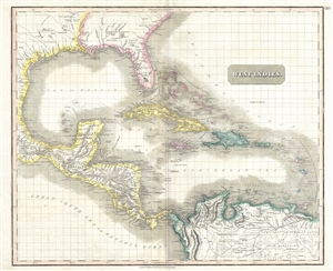
West Indies.
$600.00
Acquire
- Digital Map Information
- Suitable for large format printing
- DPI: 300
- File Size: 14.55 MB
- File Type: ZIP / TIFF
- ICC color profile embedded
- Delivered instantly via download link
This is a fascinating 1814 map of the West Indies and Central America by the Edinburgh cartographer John Thomson. It covers from the Carolinas south through Texas, Mexico and Central America to the northern part of South America ... (more details)
The icy northern waters.
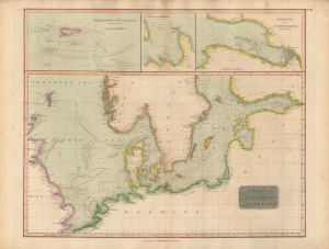
Chart of the North and Baltic Seas, etc.
$300.00
Acquire
- Digital Map Information
- Suitable for large format printing
- DPI: 600
- File Size: 19.01 MB
- File Type: ZIP / TIFF
- ICC color profile embedded
- Delivered instantly via download link
An impressive, hand-colored 1816 chart of the North and Baltic Seas, which appeared in John Thomson's New General Atlas. Remarkable detail is provided on depths, coasts, hazards, and other important navigational information. (more details)
Tracks across the Atlantic.
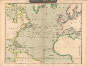
Chart of North Atlantic Ocean : with tracks of the shipping to West Indies, North America etc.
$350.00
Acquire
- Digital Map Information
- Suitable for large format printing
- Full resolution TIFF file
- ICC color profile embedded
- Delivered instantly via download link
A lovely 1815 map of the Atlantic Ocean, including tracks of recent voyages, produced for the first edition of John Thomson's New General Atlas in 1817. It provides considerable useful information for mariners while also including some speculative features. (more details)
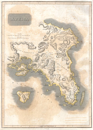
Attica.
$220.00
Acquire
- Digital Map Information
- Suitable for large format printing
- DPI: 300
- File Size: 4.03 MB
- File Type: ZIP / TIFF
- ICC color profile embedded
- Delivered instantly via download link
This is an attractive 1814 John Thomson map of Attica, Greece. Map features many of the important cities and site in early Greek History. Shows Athens, the Plain of Marathon, Salamis, and the sites of numerous historic ruins. ... (more details)
British fascination with China.
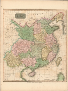
China.
$375.00
Acquire
- Digital Map Information
- Suitable for large format printing
- Full resolution TIFF file
- ICC color profile embedded
- Delivered instantly via download link
This is John Thomson's 1815 map of China with its provinces. (more details)
The 'closed' countries of Korea and Japan.
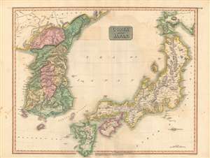
Corea and Japan.
$750.00
Acquire
- Digital Map Information
- Suitable for large format printing
- DPI: 600
- File Size: 84.26 MB
- File Type: ZIP / TIFF
- ICC color profile embedded
- Delivered instantly via download link
This fascinating hand colored 1815 map depicts Joseon Korea and Tokugawa Japan, both of which would be drastically changed by the end of the century. The level of detail attempted here is impressive given the great difficulties faced by foreigners trying to travel to either country at the time. (more details)
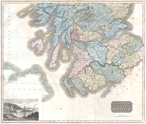
Southern Scotland
$200.00
Acquire
- Digital Map Information
- Suitable for large format printing
- DPI: 300
- File Size: 9 MB
- File Type: ZIP / TIFF
- ICC color profile embedded
- Delivered instantly via download link
This hand colored map is a steel plate engraving, dating to 1815 by the important English map publisher John Thomson. It depicts the southern portion of Scotland from the Island of Mull to the border with England. In the ... (more details)
Enticing fur traders.
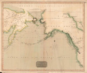
Chart of the Northern Passage Between Asia and America.
$300.00
Acquire
- Digital Map Information
- Suitable for large format printing
- DPI: 600
- File Size: 42.82 MB
- File Type: ZIP / TIFF
- ICC color profile embedded
- Delivered instantly via download link
This is John Thomson's 1816 map of the Bering Strait. It is one of the earliest atlas maps to give attention to the northern Alaskan coastline. (more details)
Waning days of the Transatlantic Slave Trade in British and Spanish West Indian Colonies.
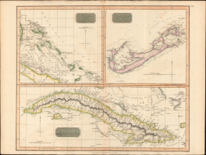
Island of Cuba. / The Bermudas. or Summer Islands. / Chart of the Bahama Islands.
$600.00
Acquire
- Digital Map Information
- Suitable for large format printing
- DPI: 600
- File Size: 63.75 MB
- File Type: ZIP / TIFF
- ICC color profile embedded
- Delivered instantly via download link
This is a striking 1816 map of Cuba, the Bahamas, and Bermuda issued by John Thomson. It captures the islands in the waning days of the Transatlantic slave trade in the British and Spanish West Indies. (more details)
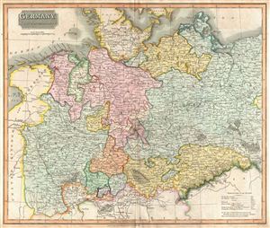
Germany North of the Mayne.
$250.00
Acquire
- Digital Map Information
- Suitable for large format printing
- DPI: 300
- File Size: 18.29 MB
- File Type: ZIP / TIFF
- ICC color profile embedded
- Delivered instantly via download link
This fascinating hand colored 1816 map depicts the semi-autonomous kingdoms, duchies, and Prussian territories of northern Germany. These include Westphalia, Rhineland, Saxony, Brandenburg, Bremen, Munster, Pomerania, and ... (more details)
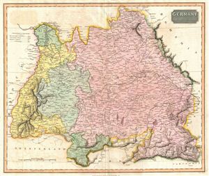
Germany South of the Mayne.
$250.00
Acquire
- Digital Map Information
- Suitable for large format printing
- DPI: 300
- File Size: 15.26 MB
- File Type: ZIP / TIFF
- ICC color profile embedded
- Delivered instantly via download link
This fascinating hand colored 1816 map depicts the semi-autonomous kingdoms, duchies, and Prussian territories in southern Germany. These include Bavaria, Baden, Darmstadt, and Wurttemberg. Following the Napoleonic Wars, ... (more details)
After the Maroon Wars.
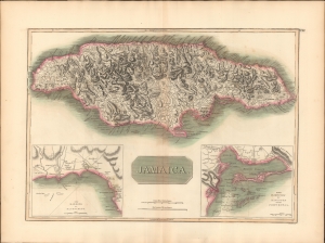
Jamaica.
$300.00
Acquire
- Digital Map Information
- Suitable for large format printing
- DPI: 600
- File Size: 71.09 MB
- File Type: ZIP / TIFF
- ICC color profile embedded
- Delivered instantly via download link
This is a striking 1816 map of Jamaica issued by John Thomson. The map illustrates Jamaica when it was one of Britain's most profitable West Indian colonies, but also suffering island-wide instability as the indigenous and African populations struggled to throw off the yoke of slavery. (more details)
Vying for the Veneto.
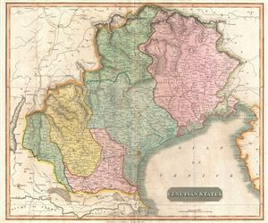
Venetian States.
$250.00
Acquire
- Digital Map Information
- Suitable for large format printing
- DPI: 300
- File Size: 15.79 MB
- File Type: ZIP / TIFF
- ICC color profile embedded
- Delivered instantly via download link
An 1816 map of Venice and environs (the Veneto and Friuli) in northern Italy, published in John Thomson's New General Atlas. It was produced in the immediate wake of the Congress of Vienna at the end of the Napoleonic Wars, which created the Austrian-ruled Kingdom of Lombardy-Venetia. (more details)
Beautiful map of Belgium and Netherlands depicting the Departments of the First French Republic.
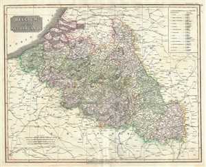
Belgium or the Netherlands.
$200.00
Acquire
- Digital Map Information
- Suitable for large format printing
- DPI: 300
- File Size: 19.37 MB
- File Type: ZIP / TIFF
- ICC color profile embedded
- Delivered instantly via download link
This is a beautiful 1817 map of Belgium and Luxembourg by the Edinburgh cartographer John Thomson. The title ‘The Netherlands’ refers to the old name for Belgium, also called Royal Netherlands and Catholic Netherlands. ... (more details)
Thomson's two panel map of Egypt and Ethiopia.
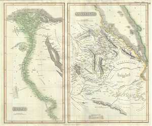
Egypt. Abyssinia.
$250.00
Acquire
- Digital Map Information
- Suitable for large format printing
- DPI: 300
- File Size: 15.81 MB
- File Type: ZIP / TIFF
- ICC color profile embedded
- Delivered instantly via download link
This is a beautiful example of John Thomson’s 1817 map of Egypt and Abyssinia. Essentially two maps on a single sheet, the map on the left represents Egypt while the right hand side of the sheet features a map of ... (more details)
Beautiful Thomson map focusing on the southeastern parts of Europe.
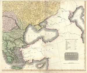
Europe after the Congress of Vienna.
$250.00
Acquire
- Digital Map Information
- Suitable for large format printing
- DPI: 300
- File Size: 16.58 MB
- File Type: ZIP / TIFF
- ICC color profile embedded
- Delivered instantly via download link
This is an attractive 1817 map of Greece, the Balkans and Ukraine by the Edinburgh cartographer John Thomson. It depicts the region from Greece north to include the southern portions of Ukraine, including Crimea. ... (more details)
British expansion in India.
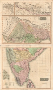
British India, Northern Part. British India, Southern Part.
$400.00
Acquire
- Digital Map Information
- Suitable for large format printing
- Full resolution TIFF file
- ICC color profile embedded
- Delivered instantly via download link
This is a stunning set of two 1817 maps of India and Nepal by Edinburgh cartographer John Thomson. As a whole, the maps illustrate India when the British East India Company had expanded their control - here in pink - from coast to coast. Color coding, with a key on the lower sheet, defines spheres of influence, including both British allies and enemies. (more details)
Thomson's two panel map of South Africa and the Barbary Coast.
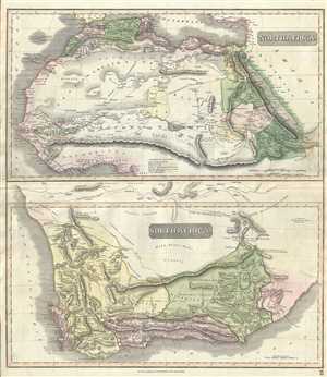
North Africa. South Africa.
$350.00
Acquire
- Digital Map Information
- Suitable for large format printing
- DPI: 300
- File Size: 18.31 MB
- File Type: ZIP / TIFF
- ICC color profile embedded
- Delivered instantly via download link
This unusual hand-colored 1817 map by John Thomson is essentially two maps in one: North Africa and South Africa. Thomson's decision to focus on these two parts of Africa may seem unusual until one realizes that ... (more details)
Early 19th century map of Chile, Peru and Argentina.
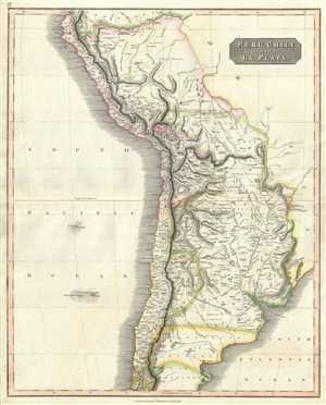
Peru, Chili and La Plata.
$225.00
Acquire
- Digital Map Information
- Suitable for large format printing
- DPI: 300
- File Size: 16.31 MB
- File Type: ZIP / TIFF
- ICC color profile embedded
- Delivered instantly via download link
This is a beautiful 1817 Thomson map of Peru, Chile and Argentina. It covers Bolivia, Paraguay, Uruguay and parts of Peru, Chile, Argentina and Brazil. The map identifies towns, rivers, mountains, indigenous ... (more details)
Map of Switzerland with beautiful view of Mont Blac.
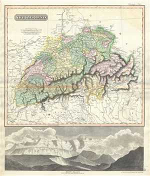
Switzerland.
$250.00
Acquire
- Digital Map Information
- Suitable for large format printing
- DPI: 300
- File Size: 17.78 MB
- File Type: ZIP / TIFF
- ICC color profile embedded
- Delivered instantly via download link
This is a beautiful example of Thomson’s 1817 map of Switzerland. Divided into two parts, the top part of the sheet covers the Helvetic Confederation of Switzerland as divided into cantons. Several ... (more details)
Thomson's depiction of the territories of the Austrian Empire.
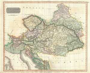
Austrian Dominions.
$200.00
Acquire
- Digital Map Information
- Suitable for large format printing
- DPI: 300
- File Size: 17.43 MB
- File Type: ZIP / TIFF
- ICC color profile embedded
- Delivered instantly via download link
This is a beautiful map of the Austrian Empire by John Thomson dating to 1817. It covers the territories claimed by the once vast Austrian Empire, including in whole or part of the modern day nations ... (more details)
Beautiful map focusing on the Balkans during ancient and modern times.
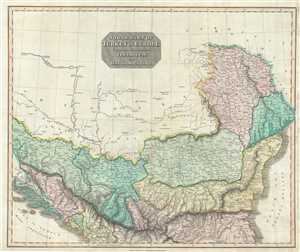
North Part of Turkey in Europe Comprehending Ancient Illyricum, and Dacia, Moesia, etc.
$250.00
Acquire
- Digital Map Information
- Suitable for large format printing
- DPI: 300
- File Size: 15.73 MB
- File Type: ZIP / TIFF
- ICC color profile embedded
- Delivered instantly via download link
This is an attractive 1817 map of the Balkans by the Edinburgh cartographer John Thomson. It depicts the region from modern day Slovenia east to the Black Sea and from Moldova south to include ... (more details)
Thomson's map representing northern Italian states.
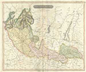
Milanese States.
$300.00
Acquire
- Digital Map Information
- Suitable for large format printing
- DPI: 300
- File Size: 15.22 MB
- File Type: ZIP / TIFF
- ICC color profile embedded
- Delivered instantly via download link
This fascinating hand colored 1817 map by Edinburgh cartographer John Thomson depicts the Milanese States of northern Italy. These include Milan, Alto Po and Mantua. Bounded on the south by ... (more details)
The romance of a 'savage paradise'.
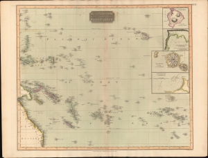
Map of the Islands in the Pacific Ocean.
$300.00
Acquire
- Digital Map Information
- Suitable for large format printing
- DPI: 600
- File Size: 56.99 MB
- File Type: ZIP / TIFF
- ICC color profile embedded
- Delivered instantly via download link
This is John Thomson's 1816 map of the Polynesia and the South Pacific. It is one of the few early 19th century maps to focus on Polynesia, despite, in the wake of Cook's travels (and gruesome death), the area being heavily romanticized as an savage paradise in the minds of the British public. (more details)
1817 Thomson Map of the Southeastern United States: Georgia, Carolina, Virginia, Tennessee, Kentucky
A young nation looking west.
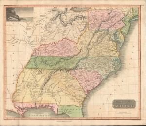
Southern Provinces of the United States.
$950.00
Acquire
- Digital Map Information
- Suitable for large format printing
- DPI: 600
- File Size: 633.59 MB
- File Type: ZIP / TIFF
- ICC color profile embedded
- Delivered instantly via download link
A scarce first edition of John Thomson's 1817 map of the southeastern part of the United States. Thomson prepared this map during a transitional period of expansion shortly following the American Revolutionary War and is among most thorough treatments of this region prior to the U.S. Government Surveys. It records early U.S. efforts to acquire and assimilate American Indian territories west of the Appalachian Mountains. (more details)
The 'District of Maine' and the Connecticut Western Reserve!
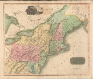
Northern Provinces of the United States.
$450.00
Acquire
- Digital Map Information
- Suitable for large format printing
- DPI: 600
- File Size: 631.07 MB
- File Type: ZIP / TIFF
- ICC color profile embedded
- Delivered instantly via download link
A scarce first edition example of John Thomson's 1817 map of the northeastern parts of the United States, including New York, Massachusetts, Connecticut, Vermont, New Hampshire, Maine, Pennsylvania, New Jersey, Maryland, Rhode Island, and parts of adjacent Virginia, Canada, and the Great Lakes. There appears a large inset of Niagara Falls along the top border. (more details)
Map of North America that predates the Louisiana Purchase.
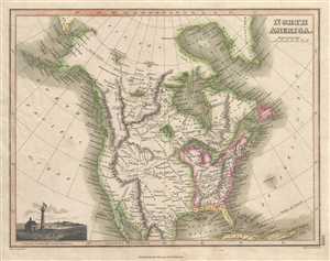
North America.
$275.00
Acquire
- Digital Map Information
- Suitable for large format printing
- DPI: 300
- File Size: 4.02 MB
- File Type: ZIP / TIFF
- ICC color profile embedded
- Delivered instantly via download link
This 1819 Thomson map of North America depicts the entire continent from north of the Arctic Circle to northern Mexico and Baja California. The United States is labeled in detail, including ... (more details)
Promoting European investment in the dream of a unified independent Latin America.
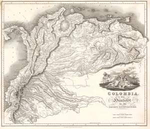
Colombia, from Humboldt and other Recent Authorities.
$2,200.00
Acquire
- Digital Map Information
- Suitable for large format printing
- Full resolution TIFF file
- ICC color profile embedded
- Delivered instantly via download link
This is the rare and important 1823' Zea Map of Colombia', one of the earliest specific maps of Gran Colombia at its height. This map was printed on behalf of the Colombian vice president under Simón Bolívar, Francisco Antonio Zea (1766 - 1822), to court European, and specifically British, investment in the new Republic, which was in dire need of financial support. The title references the naturalist Alexander von Humboldt, not for any cartographic contributions, as the map is based on the maps of John Arrowsmith, but rather for his unwavering support of an independent Gran Colombia and his promotion of its natural wealth. (more details)
Early map of German Confederate states including Czech Republic, Hungary and Austria.
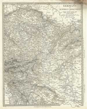
Germany IV Austrian Dominions I Bohemia, Moravia, Austria, Styria, Illyria, Croatia, Sclavonia and Western Hungary.
$75.00
Acquire
- Digital Map Information
- Suitable for large format printing
- DPI: 300
- File Size: 9.24 MB
- File Type: ZIP / TIFF
- ICC color profile embedded
- Delivered instantly via download link
This is a beautiful 1832 first edition S.D.U.K. map of Central Europe and the German States including Eastern Austria, Western Hungary, Czech Republic and parts of the Balkan states. ... (more details)
Attractive map showing Indian tribes in Mississippi.
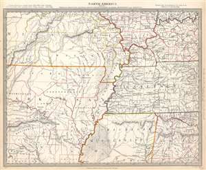
North America Sheet X Parts of Missouri, Illinois, Kentucky, Tennessee, Alabama, Mississippi and Arkansas.
$125.00
Acquire
- Digital Map Information
- Suitable for large format printing
- Full resolution TIFF file
- ICC color profile embedded
- Delivered instantly via download link
This is an 1833 Society for the Diffusion of Useful Knowledge or S.D.U.K. map of Arkansas, Missouri, Mississippi, Kentucky, Tennessee, Alabama and Illinois. The map depicts the region from the Ozark Mountains to Rome, Indiana and Huntsville, Alabama and from Mount Leansboro, Illinois to Columbus, Mississippi. The states are outlined in different colors to allow for easy differentiation, along with individual counties within each state, which are also labeled. Cities, towns, and villages are identified throughout, including Little Rock, Arkansas. Rivers, mountains, Indian villages, and topographical features are also noted throughout, with relief shown by hachure. (more details)