
Attractive map of Maryland and Delaware.
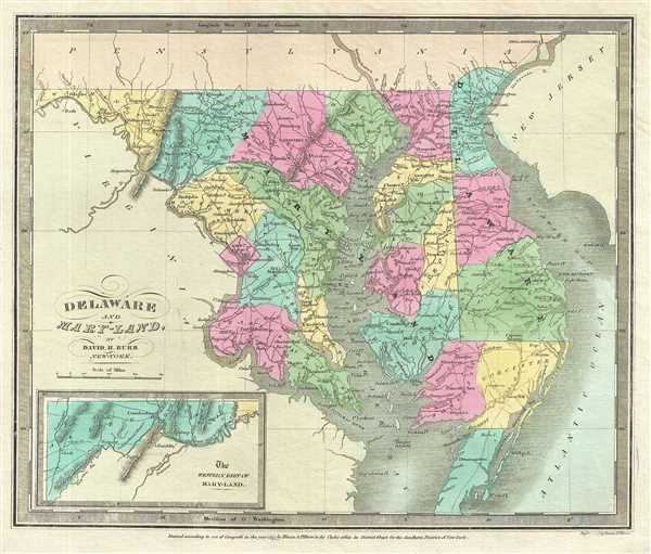
Delaware and Maryland.
sold
- Digital Map Information
- Suitable for large format printing
- DPI: 300
- File Size: 5.61 MB
- File Type: ZIP / TIFF
- ICC color profile embedded
- Delivered instantly via download link
This is an attractive 1833 first edition map of Maryland and Delaware including Washington D.C. by David H. Burr. Rendered the Chesapeake Bay in full. The western part of Maryland is depicted in an inset in the lower left quadrant. The map offers color-coding at ... (more details)
Burr's representation of the state of New Jersey.

New Jersey.
sold
- Digital Map Information
- Suitable for large format printing
- DPI: 300
- File Size: 4.7 MB
- File Type: ZIP / TIFF
- ICC color profile embedded
- Delivered instantly via download link
This is an attractive 1835 first edition map of New Jersey by David H. Burr. It depicts the state of New Jersey in detail with color-coding at a county level. Notes roads, railways, rivers, islands, cities and towns with elevation rendered by hachure. According ... (more details)
Uncommon map featuring Pennsylvania

Pennsylvania.
sold
- Digital Map Information
- Suitable for large format printing
- DPI: 300
- File Size: 5.69 MB
- File Type: ZIP / TIFF
- ICC color profile embedded
- Delivered instantly via download link
This is an important 1834 first edition map of Pennsylvania by David H. Burr. Depicts the state in detail, noting rivers, roads, cities, town and other topographical features, with elevation rendered by hachure. Offers color-coding at a county level. It is very ... (more details)
Beautiful map of New York State.

New York.
sold
- Digital Map Information
- Suitable for large format printing
- DPI: 300
- File Size: 5.72 MB
- File Type: ZIP / TIFF
- ICC color profile embedded
- Delivered instantly via download link
A nice example of David H. Burr’s 1832 first edition map of New York State. Includes Lake Ontario. The southern end of the state including Long Island in depicted in an inset in the lower left quadrant of the map. The map is detailed with important roads, ... (more details)
Map of Maine showing early county configurations.

Maine.
sold
- Digital Map Information
- Suitable for large format printing
- DPI: 300
- File Size: 5.74 MB
- File Type: ZIP / TIFF
- ICC color profile embedded
- Delivered instantly via download link
This is an appealing first edition map of Maine by David H. Burr issued in 1835. It covers the state of Maine in superb detail, noting towns, cities, bays, islands, rivers, inlets and a host of other topographical features, with elevation rendered by ... (more details)
Burr's vivid depiction of the British Isles.
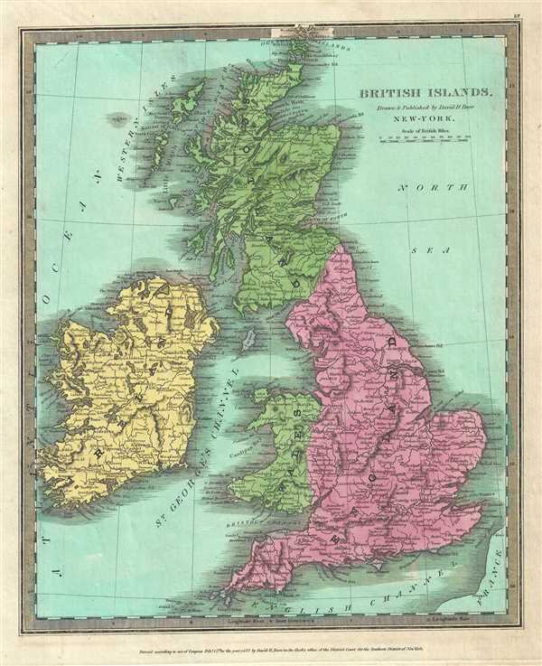
British Islands.
sold
- Digital Map Information
- Suitable for large format printing
- DPI: 300
- File Size: 6.05 MB
- File Type: ZIP / TIFF
- ICC color profile embedded
- Delivered instantly via download link
This is a beautiful 1832 first edition map of the British Isles by David Burr. In includes England, Scotland, Wales and Ireland and covers from the southern tip of the Shetland Islands to the Scilly Isles in the south. This map notes towns, rivers, ... (more details)
Attractive 19th century map of Europe.
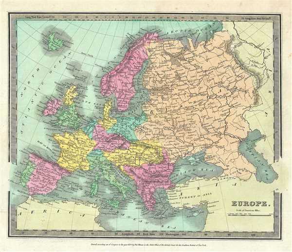
Europe.
sold
- Digital Map Information
- Suitable for large format printing
- DPI: 300
- File Size: 5.75 MB
- File Type: ZIP / TIFF
- ICC color profile embedded
- Delivered instantly via download link
This is a fine 1834 first edition map of Europe by David Burr. It covers the entire European continent and covers from the Atlantic to the Ural Mountains and from the Arctic Circle south to the Mediterranean Sea. Important cities, rivers, islands, ... (more details)
Beautiful map of the southern hemisphere.

Southern Hemisphere.
sold
- Digital Map Information
- Suitable for large format printing
- DPI: 300
- File Size: 4.34 MB
- File Type: ZIP / TIFF
- ICC color profile embedded
- Delivered instantly via download link
This is a first edition 1835 map of the Southern Hemisphere by David Burr. It depicts the world as seen from the South Pole. Important cities, islands, and rivers are noted throughout. 'New Holland' officially changed its name to Australia in ... (more details)
Map of the world as seen from the North Pole.

Northern Hemisphere.
sold
- Digital Map Information
- Suitable for large format printing
- DPI: 300
- File Size: 4.23 MB
- File Type: ZIP / TIFF
- ICC color profile embedded
- Delivered instantly via download link
This is a nice beautiful first edition 1833 David Burr map of the Northern Hemisphere. It depicts the world as seen from the North Pole and includes all of North America, Europe and Asia along with the northern portions of Africa and South ... (more details)
Burr's representation of the Eastern Hemisphere.

Eastern Hemisphere.
$400.00
Acquire
- Digital Map Information
- Suitable for large format printing
- DPI: 300
- File Size: 5.37 MB
- File Type: ZIP / TIFF
- ICC color profile embedded
- Delivered instantly via download link
This is a beautiful first edition 1834 David Burr map of the Eastern Hemisphere. It covers the entirety of Asia, Africa and Europe as well as Australia and the East Indies and much of the Pacific. Important cities, rivers, islands and ... (more details)
Scarce Revolutionary War Era map of the Atlantic - the sort that would have been used by merchants, pirates, slavers, and smugglers.
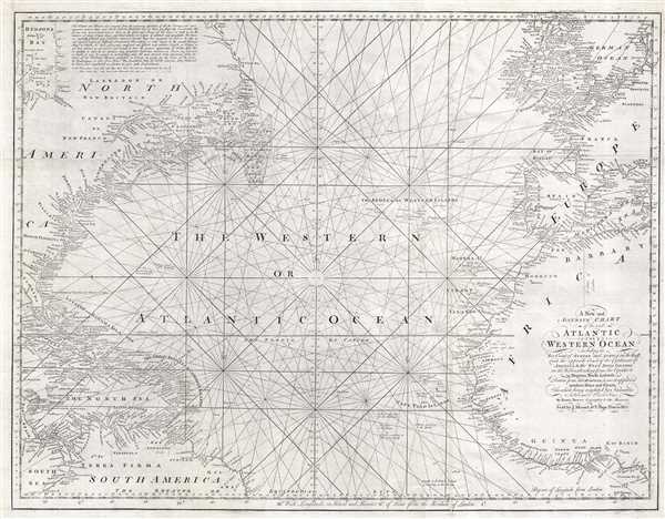
A New and Accurate Chart of the vast Atlantic or Western Ocean, including the Sea Coast of Europe and Africa on the East, and the opposite Coast of the Continent of America, and the West India Islands on the West; extending form the Equator to 59 Degrees North Latitude.
sold
- Digital Map Information
- Suitable for large format printing
- Full resolution TIFF file
- ICC color profile embedded
- Delivered instantly via download link
A rare 1778 nautical chart of the northern Atlantic Ocean by then English cartographer Emmanuel Bowen. The map covers from, roughly, the Arctic Circle to the Equator and from western Florida and Cuba to Sardinia and Denmark. Inland ... (more details)
Early map of Japanese Taiwan issued shortly following the 1895 occupation
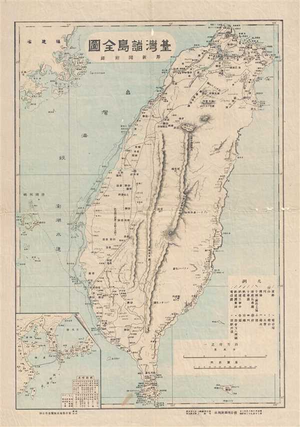
Full Map of Taiwan's Various Islands, Capital News Appendix / 台灣諸島全圖, 都新聞附錄 / Tái Wān Zhū Dǎo Quán Tú, Dū Xīn Wén Fù Lù
sold
- Digital Map Information
- Suitable for large format printing
- File Size: 4.37 MB
- File Type: ZIP / TIFF
- ICC color profile embedded
- Delivered instantly via download link
An attractive and historically important early map of Taiwan or Formosa drawn shortly after the island was sized by Japanese forces at the beginning of the First Sino-Japanese War (August 1, 1894 – April 17, 1895). After occupying ... (more details)
Early map of Japanese Taiwan issued shortly following the 1895 occupation

New Map of Great Japan and Taiwan, Penghu Archipelago / 大日本台灣新圖, 澎湖[]列嵨 / Dà Rì Běn Tái Wān Xīn Tú, Pēnghú Liè Dǎo
sold
- Digital Map Information
- Suitable for large format printing
- File Size: 5.72 MB
- File Type: ZIP / TIFF
- ICC color profile embedded
- Delivered instantly via download link
An attractive and historically important early map of Taiwan or Formosa drawn shortly after the island was sized by Japanese forces at the beginning of the First Sino-Japanese War (August 1, 1894 – April 17, 1895). After occupying ... (more details)
Important early map illustrating First Nations lands and featuring a distended Lake Michigan.
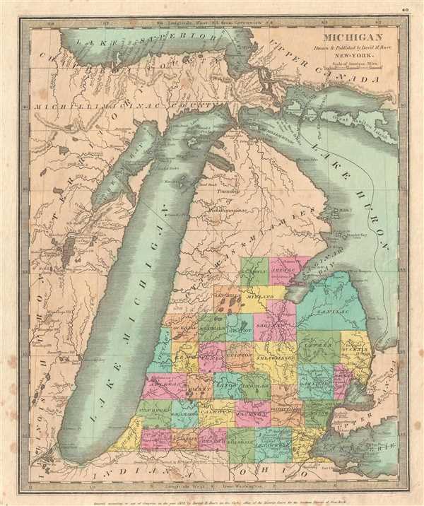
Michigan Drawn & Published by David H. Burr.
sold
- Digital Map Information
- Suitable for large format printing
- Full resolution TIFF file
- ICC color profile embedded
- Delivered instantly via download link
A very attractive and rare 1835 first edition example of Burr's map of Michigan, including Lake Michigan in full. Burr's map covers from the southern shores of Lake Superior to the Indiana / Ohio border and from Chicago to Lake St. ... (more details)
Dramatic art deco era aviation poster of Africa drawn by Dohet for Sabena Airlines.

Sabena Belgian Airlines.
sold
- Digital Map Information
- Suitable for large format printing
- Full resolution TIFF file
- ICC color profile embedded
- Delivered instantly via download link
A very attractive c. 1950 Claude Dohet art deco aviation map of Africa and Europe advertising Sabena Airlines, the Belgian national airline. This highly decorative pictorial map highlights Sabena Belgian Airlines routes in Africa and Europe using a gold reflective ink. The map itself recalls Belgium's cartographic heritage with its Renaissance style cartouche (evocative of Mercator and Ortelius), depictions of 18th century sailing ships, and elaborate compass rose. It is further elaborated by pictorial illustrations of European and Congolese people, and a dramatic illustration of the city of Kano (Nigeria) at its height. (more details)
The first map to depict Manhattan as an Island and depict a beaver.

Nova Belgica et Anglia Nova.
sold
- Digital Map Information
- Suitable for large format printing
- DPI: 300
- File Size: 14 MB
- File Type: ZIP / TIFF
- ICC color profile embedded
- Delivered instantly via download link
A beautiful old color example of one of the most important maps in the history of America, Blaeu's c.1635 Nova Belgica et Anglia Nova . Oriented to the west, this map covers the American coast from Virginia, past New York and Long ... (more details)
Uncommon map of the South Carolina Coastline
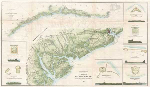
Coast of South Carolina from Charleston to Hilton Head. Sketch E Showing the Progress of the Survey in Section No. V.
sold
- Digital Map Information
- Suitable for large format printing
- Full resolution TIFF file
- ICC color profile embedded
- Delivered instantly via download link
This is an appealing 1862 U.S. Coast Survey nautical chart or map of the coast of South Carolina from Charleston to Hilton Head. Essentially two maps on the same sheet, the top map features a triangulation chart of the coast of ... (more details)
Uncommon map of the Napa and Petaluma Rivers in California.

Petaluma and Napa Creeks California.
sold
- Digital Map Information
- Suitable for large format printing
- File Size: 15.09 MB
- File Type: ZIP / TIFF
- ICC color profile embedded
- Delivered instantly via download link
This is an uncommon 1861 U.S. Coast Survey nautical chart or map of the Petaluma River and the Napa River in California. Essentially two maps on the same sheet, the left hand side of the sheet features a chart of the Petaluma ... (more details)
Vaux's plan of the southwest corner entrance to New York City's Central Park (columbus Circle).
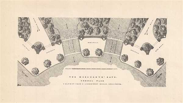
The Merchant's Gate. General Plan.
sold
- Digital Map Information
- Suitable for large format printing
- Full resolution TIFF file
- ICC color profile embedded
- Delivered instantly via download link
This is a c.1860 plan of the Merchant’s Gate in the southwest corner of New York City’s Central Park. It depicts the architect’s plan of the most heavily used entrance of Central Park. Notes the planned ornamentation ... (more details)
Early view of what would become New York City's Central Park.

View from Mount Prospect (Central Park,) Looking East.
sold
- Digital Map Information
- Suitable for large format printing
- Full resolution TIFF file
- ICC color profile embedded
- Delivered instantly via download link
This is an unusual c.1860 view looking east from Mount Prospect, Central Park, New York City. It depicts the view of Central Park and the city beyond from Mount Prospect, which would later be incorporated into Central Park ... (more details)