
A scarce and influential map illustrating the political situation around the Great Lakes and in Canada early in the American Revolutionary War.
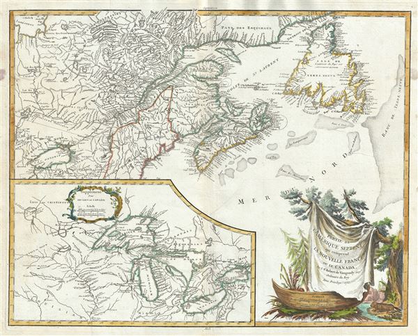
Partie De L'Amerique Septent. Qui Comprend La Nouvelle France ou Le Canada.
sold
- Digital Map Information
- Suitable for large format printing
- Full resolution TIFF file
- ICC color profile embedded
- Delivered instantly via download link
A fine example of Robert de Vaugondy's 1755 map of former French dominions in Canada and in the vicinity of the Great Lakes at the outset of the American Revolutionary War. Essentially two maps on a single sheet. The primary map covers the Gulf of St. Lawrence, ... (more details)
Map of Greece during the declining Ottoman Empire.

Turquie Europeenne.
sold
- Digital Map Information
- Suitable for large format printing
- Full resolution TIFF file
- ICC color profile embedded
- Delivered instantly via download link
This is a beautiful map of Greece from De Vaugondy's 1752 Atlas Universal. Depicts the whole of Greece from Bosnia and Croatia east to through Bulgaria and Romania to the Black Sea and south through Macedonia, Albania and the Pelopenesus to the Isle of Candia or ... (more details)
An important map illustrating the Mississippi Valley during the French and Indian War.

Carte de la Louisiane et Pays Voisins Pour servir a l'Histoire des Etablissemens Europeens.
sold
- Digital Map Information
- Suitable for large format printing
- DPI: 300
- File Size: 3.85 MB
- File Type: ZIP / TIFF
- ICC color profile embedded
- Delivered instantly via download link
This is an important 1760 map of the United States by the French cartographer Jacques-Nicholas Bellin. Centered on the Mississippi Valley, Bellin's map covers from the Riviere de Nord (Rio Grande) eastward to Lake Ontario and from Lake Huron to the Gulf of ... (more details)
Beautiful map of the City of Cartagena, Colombia.
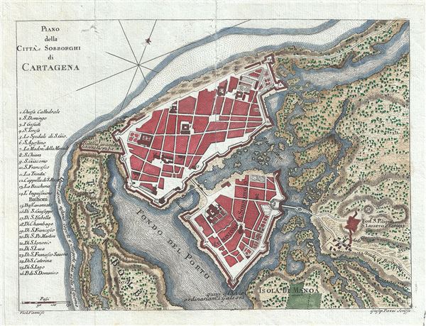
Plano della Citta, e Sobborghi de Cartagena.
sold
- Digital Map Information
- Suitable for large format printing
- Full resolution TIFF file
- ICC color profile embedded
- Delivered instantly via download link
This is an attractive 1763 plan of the city of Cartagena, Colombia by Violante Vanni. It covers the fortified city of Cartagena, located on the northern coast of Colombia. The map is exceptionally detailed and includes a numbered key along the left border ... (more details)
Scarce Map of Cispata Bay, Cordoba, Colombia.

Plan de la Baye de Zisapata a la Coste de Terre ferme.
sold
- Digital Map Information
- Suitable for large format printing
- Full resolution TIFF file
- ICC color profile embedded
- Delivered instantly via download link
This is an attractive 1764 Map of the Cispata Bay, Columbia by Jacques Nicolas Bellin. Oriented with north in the east, the map covers the Cispata Bay located near San Antero in Cordoba on the Colombian Caribbean Coast. Part of the Morrosquillo Gulf, ... (more details)
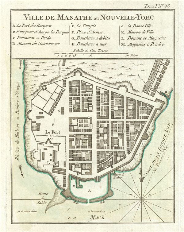
Ville De Manathe ou Nouvelle-Yorc.Â
sold
- Digital Map Information
- Suitable for large format printing
- Full resolution TIFF file
- ICC color profile embedded
- Delivered instantly via download link
This is a beautiful example of J. N. Bellin's important 1764 map of New York City. The map depicts what is today the Financial District at the southern tip of Manhattan between the Hudson River and the 'Canal de la Longue Isle' or east River. ... (more details)
Scarce nautical chart of the coast of Myanmar.

Carte de la Cote de Pegou et de Celle de Martaban.
sold
- Digital Map Information
- Suitable for large format printing
- Full resolution TIFF file
- ICC color profile embedded
- Delivered instantly via download link
This is a scarce 1775 nautical chart or maritime map of the coast of Burma or Pegu or Myanmar. Composed by Jean-Baptiste d'Apres de Mannevillette, this map covers the Gulf of Martaban and the coast of Myanmar from the Ayeyarwady region east as ... (more details)
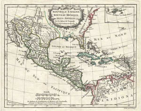
Nouvelle Espagne, Nouvelle Mexique, Isles Antiles.
sold
- Digital Map Information
- Suitable for large format printing
- DPI: 300
- File Size: 4.73 MB
- File Type: ZIP / TIFF
- ICC color profile embedded
- Delivered instantly via download link
This is an uncommon 1778 map of Mexico, the Gulf Coast, Florida and West Indies by Robert de Vaugondy. Centered on the Gulf Coast, it covers from Baja California to Florida and the Lesser Antilles, and from the Chesapeake Bay south as far as ... (more details)
Speculative 18th century map of Africa.
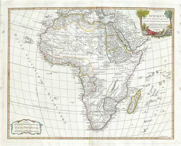
L'Afrique dressee, sur les relations les plus recentes, et assujettie aux observations astronomiques.
sold
- Digital Map Information
- Suitable for large format printing
- Full resolution TIFF file
- ICC color profile embedded
- Delivered instantly via download link
This is an exceptional 1783 map of Africa by Robert de Vaugondy. Following on the work of Nicolas Sanson, Vaugondy's map of Africa covers the entire continent in considerable detail. The late 18th century saw little in the way of African ... (more details)
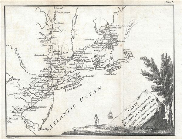
Carte Pour Servir Au Journal de Mr. Le Mquis. de Chastellux.
sold
- Digital Map Information
- Suitable for large format printing
- Full resolution TIFF file
- ICC color profile embedded
- Delivered instantly via download link
This is a scarce 1786 Revolutionary War era map of northeast United States by Dezoteux depicting the travels of Marquis de Chastellux. Centered on Long Island and Newport, the map covers the northern colonies from the Delaware Bay and Cape ... (more details)

La Judee Depuis le Retour de la Captivite, et particulierement sous Herode Le Grand et ses Enfans.
sold
- Digital Map Information
- Suitable for large format printing
- Full resolution TIFF file
- ICC color profile embedded
- Delivered instantly via download link
This is a scarce 1786 map of Israel, Palestine or the Holy Land by Robert de Vaugondy. It covers from the ancient city of Sidon in modern day Lebanon south as far as Rinocolure and Raphia (Gaza). Includes the modern day countries of ... (more details)
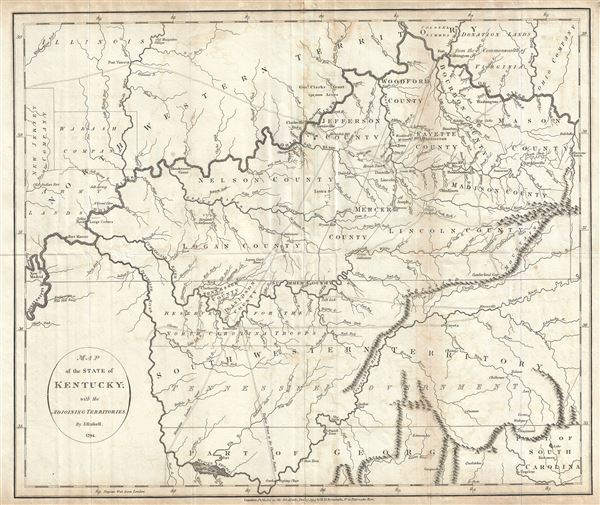
Map of the State of Kentucky; with the Adjoining Territories.
sold
- Digital Map Information
- Suitable for large format printing
- DPI: 300
- File Size: 8.68 MB
- File Type: ZIP / TIFF
- ICC color profile embedded
- Delivered instantly via download link
This is an unusual and scarce 1794 map of Kentucky by John Russell. This early map covers all of Kentucky, the northern parts of Georgia, most of Tennessee (here called South Western Territory) and parts of Georgia, Indiana and Ohio ... (more details)
Early map identifying the mythical cities of gold, Quivira and Teguayo.
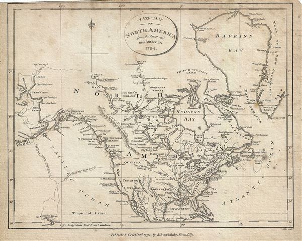
A New Map of North America from the latest and best Authorities.
sold
- Digital Map Information
- Suitable for large format printing
- Full resolution TIFF file
- ICC color profile embedded
- Delivered instantly via download link
This is an appealing 1794 map of North America by John Stockdale. It covers from Baffin's Bay south to Cuba and Mexico and from the Bering (Bhering) Strait east to Greenland. It offers fine detail throughout, noting several rivers, ... (more details)
Features the short-lived State of Franklin or Frankland.
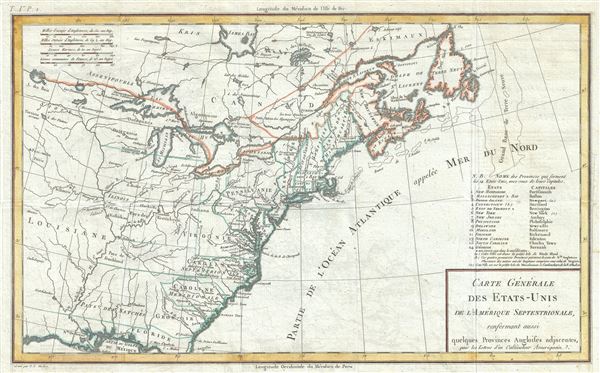
Carte Generale des Etats-Unis de l'Amerique Septentrionale, renfermant aussi quelques Provinces Angloises adjacentes.
sold
- Digital Map Information
- Suitable for large format printing
- Full resolution TIFF file
- ICC color profile embedded
- Delivered instantly via download link
This is a fascinating 1797 map of the United States by Pierre Tardieu. The map centers on the Great Lakes covering from the Lake of the Woods (Lake des Bois) eastward to Newfoundland and the Atlantic Ocean, and from James Bay ... (more details)

Arabia, Egypt, Abyssinia, Red Sea etc.
sold
- Digital Map Information
- Suitable for large format printing
- Full resolution TIFF file
- ICC color profile embedded
- Delivered instantly via download link
This is an exceptionally fine example of John Thomson's 1814 map of Arabia, Egypt, and Abyssinia. Centered on the Arabian Peninsula, Thomson's map covers from the eastern Mediterranean to the Horn of Africa, and from the ... (more details)
Map of North America with a view of the Niagara Falls.
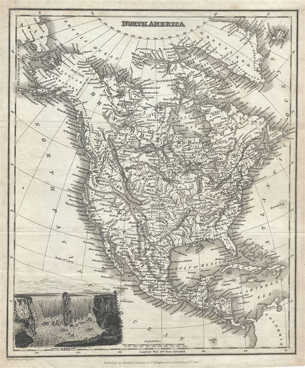
North America.
sold
- Digital Map Information
- Suitable for large format printing
- Full resolution TIFF file
- ICC color profile embedded
- Delivered instantly via download link
This is a nice 1834 map of North America by Blackie, Fullarton and Company. The map covers the entire North American continent from the Arctic Circle to the Isthmus of Panama, embracing all of Central America, Mexico, the ... (more details)
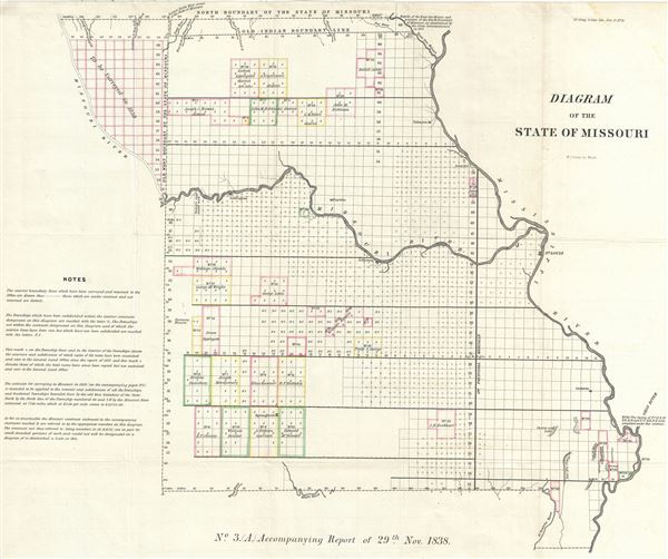
Diagram of the State of Missouri.
sold
- Digital Map Information
- Suitable for large format printing
- File Size: 297.6 MB
- File Type: ZIP / TIFF
- ICC color profile embedded
- Delivered instantly via download link
This is an impressive example of the 1838 public survey map of Missouri W. J. Stone. It covers the entire state of Missouri from the Mississippi River to the Missouri River. The map was prepared to illustrate the ... (more details)
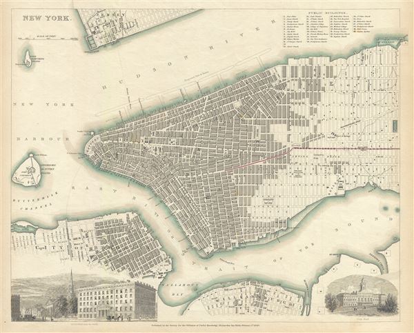
New York.
sold
- Digital Map Information
- Suitable for large format printing
- DPI: 300
- File Size: 6.89 MB
- File Type: ZIP / TIFF
- ICC color profile embedded
- Delivered instantly via download link
This is a fine 1840 first edition example of the Society for the Diffusion of Useful Knowledge's city plan or map of New York City. The map coves southern Manhattan from the Battery northwards to 42nd street as ... (more details)
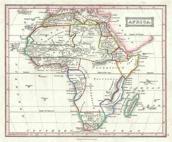
Africa.
sold
- Digital Map Information
- Suitable for large format printing
- Full resolution TIFF file
- ICC color profile embedded
- Delivered instantly via download link
This is a lovely example of the Thomas Ewing's 1845 map of Africa. It covers the entire continent from the Mediterranean Sea to the Indian Ocean and the South Atlantic, including the island of Madagascar. ... (more details)
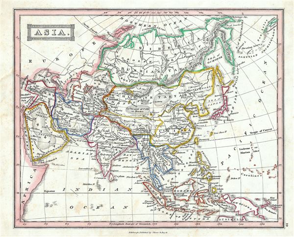
Asia.
$150.00
Acquire
- Digital Map Information
- Suitable for large format printing
- Full resolution TIFF file
- ICC color profile embedded
- Delivered instantly via download link
This is a beautiful example of Thomas Ewing's 1845 map of Asia. The map covers the entire Asian continent from the Arctic Ocean to the Indian Ocean and from the Mediterranean Sea to the North Pacific ... (more details)