
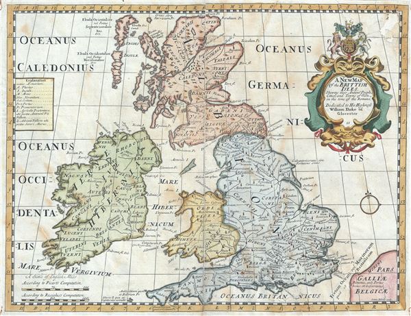
A New Map of the Brittish Isles, Shewing their Antient People, Cities, and Towns of Note, in the time of the Romans.
sold
- Digital Map Information
- Suitable for large format printing
- Full resolution TIFF file
- ICC color profile embedded
- Delivered instantly via download link
This is a beautiful 1712 map of the British Isles during the ancient Roman times by Edward Wells of Oxford. It covers all of modern day England, Wales, Scotland and Ireland. The map is highly detailed and notes the ancient cities and towns as they existed in ... (more details)

Map of Boston 1862.
sold
- Digital Map Information
- Suitable for large format printing
- Full resolution TIFF file
- ICC color profile embedded
- Delivered instantly via download link
This is a charming 1862 map or plan of the city of Boston, Massachusetts, by the famous Boston lithographer Louis Prang. Covering the entire city of Boston, Prang's meticulously detailed map illustrates streets, piers, parks, bridges, buildings, railways, ... (more details)

Rio Das Mortes Brazil.
sold
- Digital Map Information
- Suitable for large format printing
- Full resolution TIFF file
- ICC color profile embedded
- Delivered instantly via download link
This is a fine 1955 U.S. Air Force aeronautical chart or map of the Rio das Mortes, the river that flows through the state of Mato Grosso in Brazil. It covers parts of the Brazilian states of Mato Grosso, Goias and Tocantins. The map is highly detailed ... (more details)

Hibernia Guide Map of Portland Oregon.
sold
- Digital Map Information
- Suitable for large format printing
- Full resolution TIFF file
- ICC color profile embedded
- Delivered instantly via download link
This is a scarce 1926 map of the city of Portland, Oregon issued by the Hibernia Commercial and Saving Bank. It covers the city of Portland in its entirety from the Columbia River south to the Riverview Cemetery and from Lincoln Park east to 102nd ... (more details)

Metropolitan Los Angeles.
sold
- Digital Map Information
- Suitable for large format printing
- File Size: 24.54 MB
- File Type: ZIP / TIFF
- ICC color profile embedded
- Delivered instantly via download link
This is a fine c.1945 map of the city of Los Angeles, California issued by the Automobile Club of Southern California. It covers Metropolitan Los Angeles from San Fernando south to the Pacific Ocean and from Canoga Park east to El Monte. The map ... (more details)
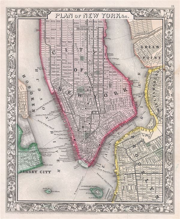
Plan of New York etc.
sold
- Digital Map Information
- Suitable for large format printing
- File Size: 6.46 MB
- File Type: ZIP / TIFF
- ICC color profile embedded
- Delivered instantly via download link
This is a beautiful example of S. A. Mitchell Junior's 1866 map of New York City. The map depicts southern Manhattan, below 45th street, along with parts of Brooklyn, Williamsburg, Greenpoint, Hoboken, and Jersey City. Mitchell offers wonderful ... (more details)

Johnson's Map of New York and the Adjacent Cities.
sold
- Digital Map Information
- Suitable for large format printing
- File Size: 18.31 MB
- File Type: ZIP / TIFF
- ICC color profile embedded
- Delivered instantly via download link
A fine hand colored map of New York City and Brooklyn dating to 1865. It covers the island of Manhattan and the borough of Brooklyn as well as parts of Jersey City and Hoboken. Johnson's plan is heavily based upon the third state of J. H. ... (more details)
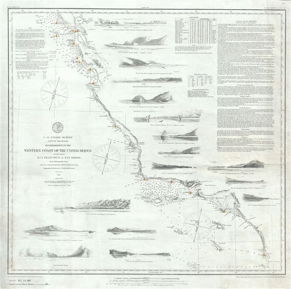
Reconnaissance of the Western Coast of the United States (Lower Sheet) San Francisco to San Diego.
sold
- Digital Map Information
- Suitable for large format printing
- Full resolution TIFF file
- ICC color profile embedded
- Delivered instantly via download link
This is one of the most attractive and desirable of the original U.S. Coast Survey charts of the California coast. Printed in 1887, this chart coves the western coast of the United States from San Diego and the Mexican border north as far ... (more details)
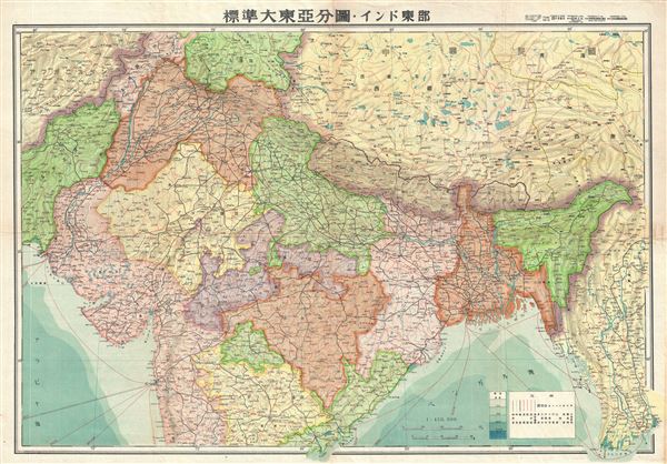
Northern India.
sold
- Digital Map Information
- Suitable for large format printing
- Full resolution TIFF file
- ICC color profile embedded
- Delivered instantly via download link
This is a beautiful 1943 or Showa 18 map of northern India issued by the Japanese during World War II. It covers all of northern India, Pakistan and Afghanistan. The map offers superb detail regarding topographic and political features ... (more details)
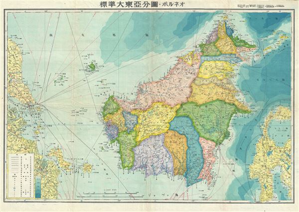
Borneo.
sold
- Digital Map Information
- Suitable for large format printing
- File Size: 7.85 MB
- File Type: ZIP / TIFF
- ICC color profile embedded
- Delivered instantly via download link
This is a stunning Japanese map of Borneo dating to World War II. It covers the entirety of Borneo, the largest Asian Island with color coding according to district. Offers superb detail regarding both topographical and political ... (more details)
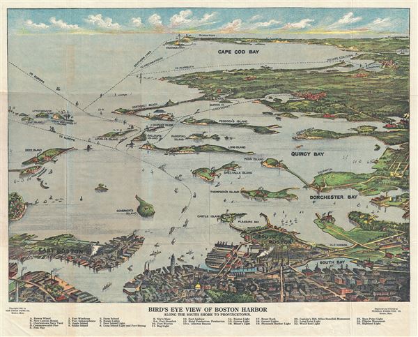
Birds Eye View of Boston Harbor Along the South Shore to Provincetown.
sold
- Digital Map Information
- Suitable for large format printing
- File Size: 15.97 MB
- File Type: ZIP / TIFF
- ICC color profile embedded
- Delivered instantly via download link
This is a remarkable 1920 chromolithograph map and view of the Boston Harbor from Boston to Provincetown. It covers all of Cape Cod Bay, Quincy Bay and Dorchester Bay with the communities of Boston, east Boston, south Boston, ... (more details)
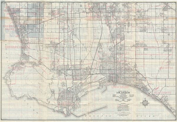
Southern Section of Los Angeles Including the Cities of Compton, Gardena, Hermosa Beach, Long Beach, Manhattan Beach, Redondo Beach, Palos Verdes Estates, Seal Beach, Signal Hill, Torrance and the communities of Artesia, Bellflower, Clearwater, Hynes, Lawndale, Lomita, Los Alamitos, Norwalk, San Pedro, Walteria, Wilmington.
sold
- Digital Map Information
- Suitable for large format printing
- Full resolution TIFF file
- ICC color profile embedded
- Delivered instantly via download link
This is a fine c.1943 map of the southern section of Los Angeles, California issued by the Automobile Club of Southern California. It covers from Forster Road in Norwalk south to Warner Avenue and Bolsa Bay and from Denni ... (more details)
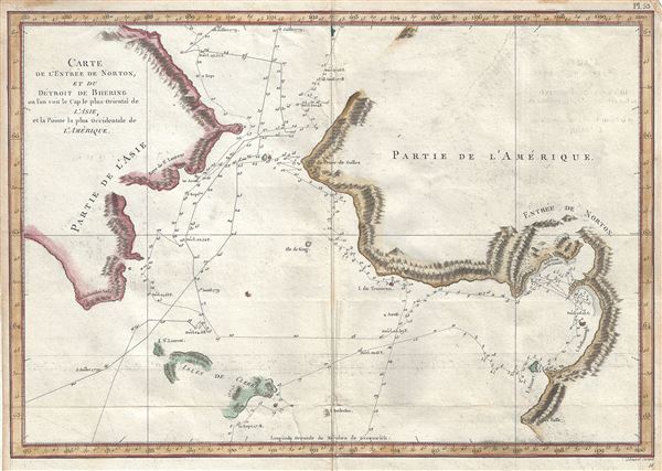
Carte de l'Entrée de Norton, et du Detroit de Bhering ou Von vou le Cap le plus oriental de l'Asie, et la Pointe la plus occidentale de l'Amerique.
sold
- Digital Map Information
- Suitable for large format printing
- Full resolution TIFF file
- ICC color profile embedded
- Delivered instantly via download link
This is a scarce and important 1785 map of the Pacific Northwest, Alaska and the Bering Strait depicting the two expeditions of Captain Cook. It covers the Bering Strait from the Chukchi Sea north of Cape Prince of Wales ... (more details)
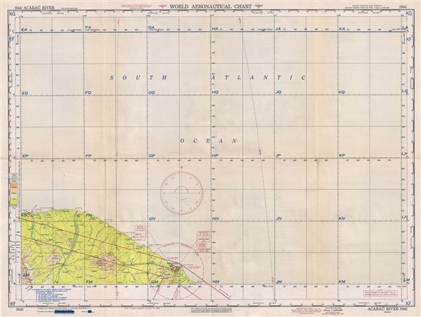
Acarau River Brazil.
sold
- Digital Map Information
- Suitable for large format printing
- Full resolution TIFF file
- ICC color profile embedded
- Delivered instantly via download link
This is a fine 1951 U.S. Air Force aeronautical chart or map of the Acarau River in the State of Ceara, Brazil. It covers the northeastern part of Brazil from Camocim to Aquiraz and inland as far as Ibiapina. The map is ... (more details)
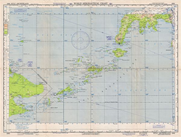
Sulu Archipelago North Borneo-Philippines.
sold
- Digital Map Information
- Suitable for large format printing
- Full resolution TIFF file
- ICC color profile embedded
- Delivered instantly via download link
This is a scarce 1952 U.S. Air Force aeronautical chart or map of the Sulu Archipelago in southwestern Philippines. It covers the archipelago forming the southern limit of the Sulu Sea and the northern limit of the ... (more details)
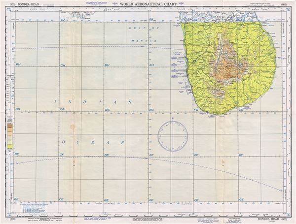
Dondra Head Ceylon.
sold
- Digital Map Information
- Suitable for large format printing
- Full resolution TIFF file
- ICC color profile embedded
- Delivered instantly via download link
This is a fine 1953 U.S. Air Force aeronautical chart or map of southern Sri Lanka. Focusing on Dondra Head, the southernmost tip of Sri Lanka, the map covers from the Puttalam Lagoon south to Dondra Head. ... (more details)
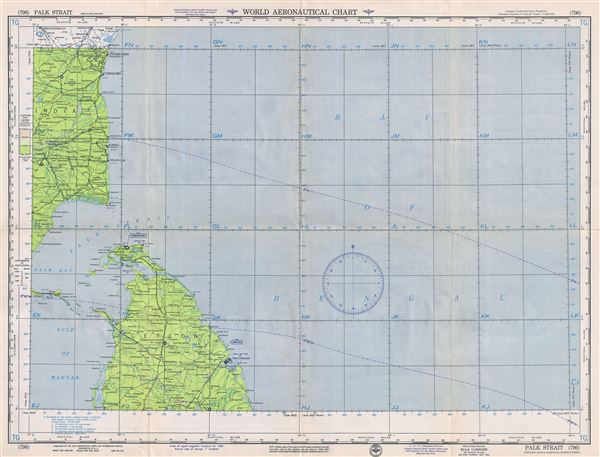
Palk Strait Ceylon-India-Karikal-Pondichery.
sold
- Digital Map Information
- Suitable for large format printing
- Full resolution TIFF file
- ICC color profile embedded
- Delivered instantly via download link
A fine 1954 U.S. Air Force aeronautical chart or map of the Palk Strait, between southern India and Sri Lanka. The chart covers from Thiruvannamalai in Tamil Nadu, India to Puttalam in Sri Lanka. The ... (more details)

Mindanao Sea Philippines Islands.
sold
- Digital Map Information
- Suitable for large format printing
- Full resolution TIFF file
- ICC color profile embedded
- Delivered instantly via download link
This is a scarce 1958 U.S. Air Force aeronautical chart or map of the Mindanao Sea in the Philippines. The map covers parts of the Visayan Islands and the Mindanao Island from Caluya Island and the ... (more details)
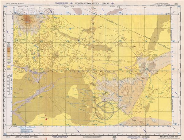
Mount Koussi Anglo-Egyptian Sudan-French Equatorial Africa-Libya.
sold
- Digital Map Information
- Suitable for large format printing
- Full resolution TIFF file
- ICC color profile embedded
- Delivered instantly via download link
This is a scarce 1955 U.S. Air Force aeronautical chart or map of Mount Koussi or Emi Koussi in the central Sahara in northern Chad. It covers from the high pyroclastic shield volcano of Emi ... (more details)
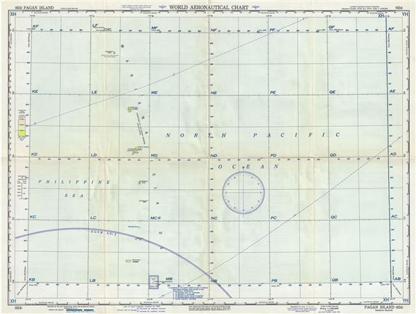
Pagan Island Mariana Islands.
sold
- Digital Map Information
- Suitable for large format printing
- Full resolution TIFF file
- ICC color profile embedded
- Delivered instantly via download link
This is a scarce 1951 U.S. Air Force aeronautical chart or map of Pagan Island, part of the Mariana Islands in the Pacific Ocean. It covers from Maug Islands to Farallon de Medinilla in ... (more details)